Love road travel, but hate traffic? Is your ideal road one that you can’t see the end of, that goes through endless spaces surrounded by nature? Then the Dalton Highway should be your next destination! Mind you, this isn’t about taking the romantic Route 66, nor is it simply about crossing a state on four wheels.
To travel the Dalton in Alaska requires good preparation, both of yourself and of the car with which you intend to reach the deep north. In this article I will try to summarize the main features of what is one of the most isolated roads in North America.
Contents
- The Dalton Highway: history and route length
- Dalton Highway Map
- How to get to the Dalton Highway
- Best time to Drive the Dalton Highway
- How Long Does it Take to Drive the Dalton Highway?
- Why Is the Dalton Highway so Dangerous? Useful Tips
- On the Dalton Pass
- Where to sleep along the Dalton Highway
- Organized tours along the Dalton Highway
The Dalton Highway: history and route length
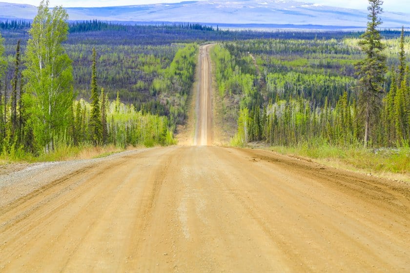
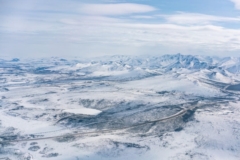
The Dalton Highway doesn’t pass through any major cities and doesn’t end anywhere, forcing those who travel it to turn around once they reach the end. There are no monuments to photograph and no activities or entertainment to partake in. Calling it ‘Highway’ is a gamble, being a dirt track for much of the way. So the question arises, why would you waste a few days of your life on the Dalton Highway? You’ll find the motivation within yourself if you’re constantly looking for a journey that challenges you, where you can test your skills and get up in the morning to meet the unknown.
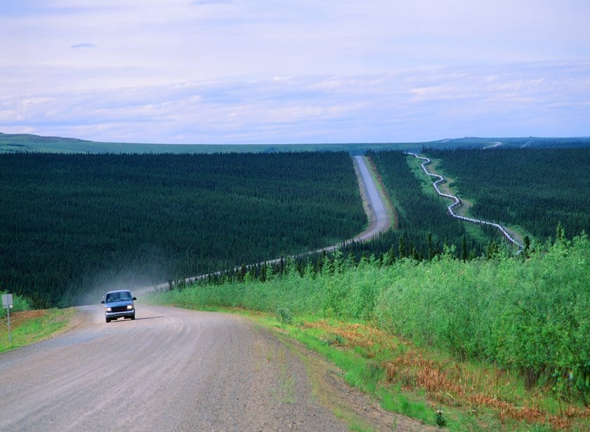
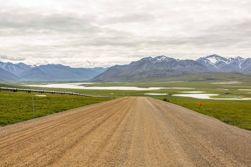
We’re talking about a 411-mile road that connects the Alaskan road network (specifically the Elliot Highway) with the Deadhorse industrial site in Prudhoe Bay, just a stone’s throw from the Arctic Ocean. The reason for the existence of this track that plows through the northern wilderness is oil.
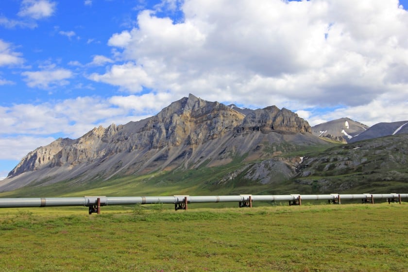
In 1968, during the energy crisis in the US, black gold was discovered in Prudhoe Bay, far away and disconnected from any American city. To tap into this manna that would have solved many problems, a pipeline was needed, in particular an 800-mile pipeline that had to be built in a hurry, in one of the areas where Alaska’s climate made everything more complicated.
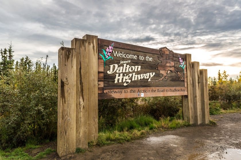
The road parallel to the pipeline was initially named Haul Road, because it was used to transport the precious booty discovered in the far north. It took its current name in 1981, dedicated to James B. Dalton: an Alaskan Arctic engineering expert involved in the explorations. In the same year, the road was opened to public traffic in its first section, while access was allowed up to Deadhorse only in 1994. This also means that the pipeline will be your main travel companion the whole time, running perpetually parallel to the road.
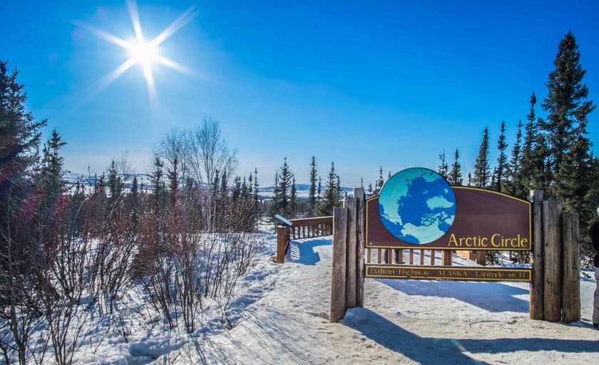
Today, more and more travelers are challenging themselves by crossing these lands, perhaps taking the opportunity to venture out into nature to walk, hunt or fish. Crossing the Arctic Circle is an achievement in itself, rewarded in summer by the chance to see the midnight sun.
Dalton Highway Map
How to get to the Dalton Highway
I have already pointed out that the Dalton Highway is one of the most isolated roads in the world: this means that there are not many alternatives for starting out on it. There is only one starting point: Livengood. Not a metropolis with airports, stations and highways, but a village that struggles to even be called such. The 2000 census gave 29 residents, divided into 13 homes. In fact, this handful of houses has only the merit of being exactly where the Dalton Highway branches off from the Elliot Highway (the road connecting Fairbanks to Manley Hot Springs).
So the real question is, how can you get to Livengood? The only option is to already be in possession of a car, which you can rent in at least three different places, depending on how much time you have available.
- Rental in Fairbanks. If your days are numbered, reach Fairbanks by plane or train from Anchorage. From Fairbanks you’ll have to travel 79 miles (consider about 2 hours) on the Elliot Highway to get to Livengood.
- Rent in Anchorage. If your plane lands in Anchorage and you’re not in a hurry, instead of boarding a train to Fairbanks, you can rent your car here. There are 360 miles between the two cities and you have to consider driving over 6 hours on the scenic Parks Highway. In this case, however, the best way to do it is undoubtedly to make an intermediate stop at the Denali National Park, staying at least one night in the vicinity of the park.
- Rent in Canada, in Seattle or Juneau. If you are a real fan of endless road travel, the Great North offers one of the best itineraries you could wish for. You must have plenty of days to spare, but you won’t regret it, and best of all, you’ll have a great option of intermediate stops, both Canadian and Alaskan. Seattle and Vancouver (only 120 miles from each other) are the two best served airports, but you might find good flights to other Canadian destinations as well. From Vancouver you have to travel more than 660 miles to reach Dawson Creek, not the one of the TV series but the town from where the famous Alaska Highway starts, crossing Western Canada and Eastern Alaska and reaching Fairbanks. Other Canadian airports closer to Dawson Creek are Kamloops (560 miles), Calgary (520 miles) or Edmonton (360 miles). From Dawson Creek to Fairbanks you have to allow almost 30 hours for the drive, but you can count on numerous stopover options along the way and split the itinerary into the number of days you prefer. Adding about ten hours, you can take a detour into southeastern Alaska, to Juneau (also consider flying into Juneau and renting a car here instead of in Canada). Finally, to cut the trip in half, there is also an airport along the Alaska Highway route in Whitehorse, just a 10-hour drive from Fairbanks.
Please note: some car rentals prohibit driving on the Dalton Highway, so check the rental conditions! Read also our tips on how to rent a car to know the conditions and the necessary documentation, and also for some advice on portals where to book.
Best time to Drive the Dalton Highway
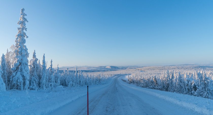
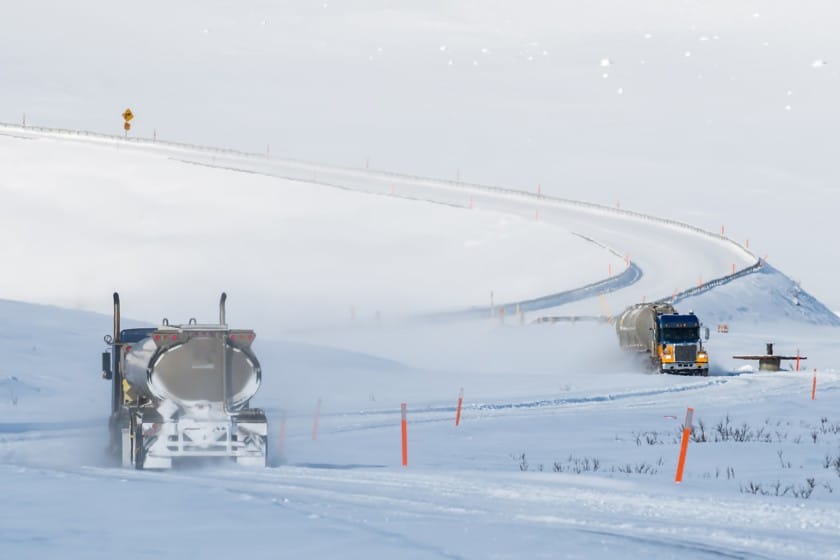
Winter in the far north of Alaska, where the terrain is composed of permafrost, is not a season in which it is pleasant to take a road trip, especially on a dirt road. Temperatures can drop below -59° and it’s quite normal to be below -4° anyway.
This implies snow and ice everywhere and the situation then becomes much more dangerous than it is in the summer. Even if you are a seasoned traveler, therefore, my advice is to undertake this trip in full summer.
How Long Does it Take to Drive the Dalton Highway?
Duration varies. It all depends on how many hours you’re able to drive each day, how many stops you plan to make, and how much you’ll be enthralled by the boundless landscapes, getting out of the vehicle to take pictures or simply look at the horizon for any number of consecutive minutes. And all, if there are no hiccups due to bad weather or road conditions.
These are the approximate travel times from Fairbanks, not including stops:
- Yukon River: 3 hours
- Arctic Circle: 5 hours
- Coldfoot: 6 hours
- Atigun Pass: 8 hours
- Deadhorse: 13-14 hours
My advice is to devote at least 4 days to the round trip, in order not to be in a hurry and to enjoy every detail of the trip.
Why Is the Dalton Highway so Dangerous? Useful Tips
Be prepared to be self-sufficient in everything and equip your car to be self-sufficient as well. There are only two gas stations between Fairbanks and Deadhorse, a distance of almost 500 miles (here are the coordinates for both: Yukon River Camp and Coldfoot Fuel Pump). Running out of gas or water, getting a flat tire, and not having the possibility to repair or change it, can be very unpleasant situations. Along the route between Fairbanks and Deadhorse there are no medical services, so it’s a good idea to bring a first aid kit, there are no banks or ATMs so it’s a good idea to bring cash, there are no stores where you can buy food or other goods: so leave with everything you need for the days you will be away.
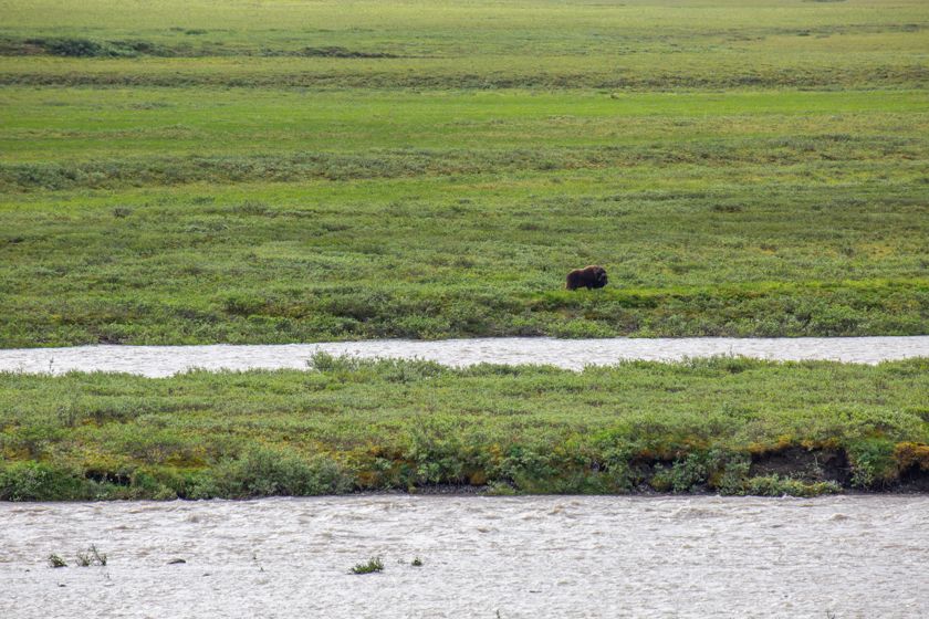
Consider also that for much of the journey phone and internet will be unusable. One tip? Use the radio! Truckers and workers on the road use radio channel 19. If you get yourself a short-range radio, you’ll be able to communicate with them in an emergency. The main snags on the route are weather (rain bombs are common in the summer, which can flood the road and make travel dangerous), fires, and wildlife.
On the Dalton Pass
Along the way, everyone chooses where to stop based on the scenarios that appeal to them the most. Below is a list of the main points of interest that I have made in order to break up the long journey. Distances are measured from the beginning of the Dalton Highway, near Livengood.
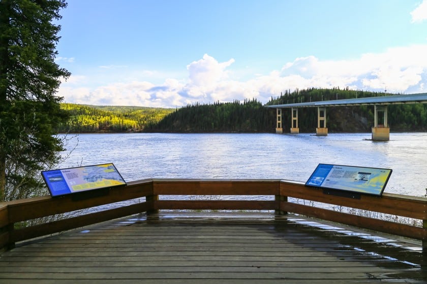
- Yukon River Bridge (56 miles): The Yukon River is the first stop on the trip. Here during the summer, some volunteers keep a log cabin open (usually from 9 a.m. to 6 p.m.), which serves as an information base for visitors. Alaska’s longest river is worth a look here, on one of the few bridges that cross it. The first of two gas pumps is located there.
- Mile 60: at mile 60 is the site of the first camping area (there are 6 in total) where you can stay overnight along the Dalton. Even if you don’t stay overnight here, consider a stop: there is an artesian well that provides drinking water.
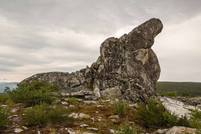
- Finger Mountain Wayside (98 miles): besides being a good panoramic point, here a big rock looks like a finger sticking out of the ground. Definitely one of the most photographed points of Dalton.
- Arctic Circle (115 miles): even if the parallel line is imaginary, here a sign indicates its passage. If you come here at lunch or dinner time, the picnic area is ideal for a longer stop. Not far away, on the hill, is the second camping area, but there is no drinking water.
- Gobblers Knob (131 miles): On sunny summer nights, get out of the car and climb the hill looking east to see the midnight sun.
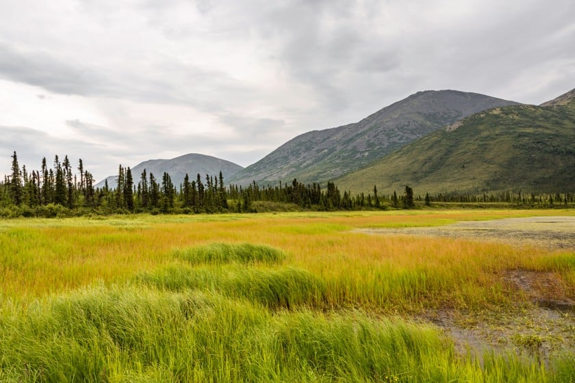
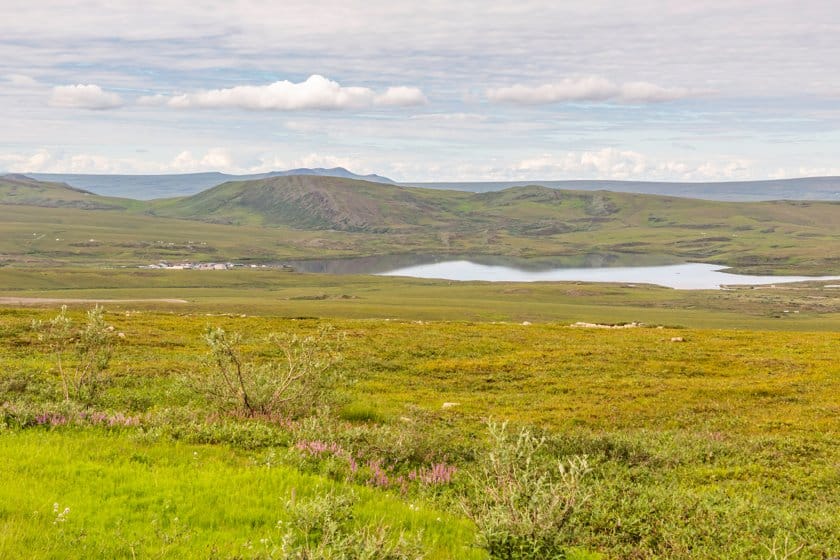
- Grayling Lake Wayside (150 miles): The shallow lake visible today is the remnant of the ancient glacier that formed this valley. Grazing elk and other animals are easy to see in these shallow waters.
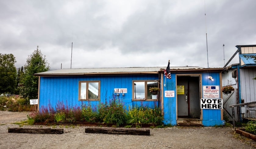
- Coldfoot (175 miles): the small town of Coldfoot once stood here, which began as a base for prospectors during the gold rush. In 1902 it had two farms, two stores, a post office, a gambling hall and seven saloons. Today, the Arctic Interagency Visitor Center is open from late May to mid-September, where you can stop by and learn about the Arctic lands. The third camping area and second gas station are located there.
- Marion Creek Campground (180 miles): fourth camping area along the route, it has a source of drinking water. A walk of about 1.8 miles leads to a beautiful waterfall with an 18 feet drop.
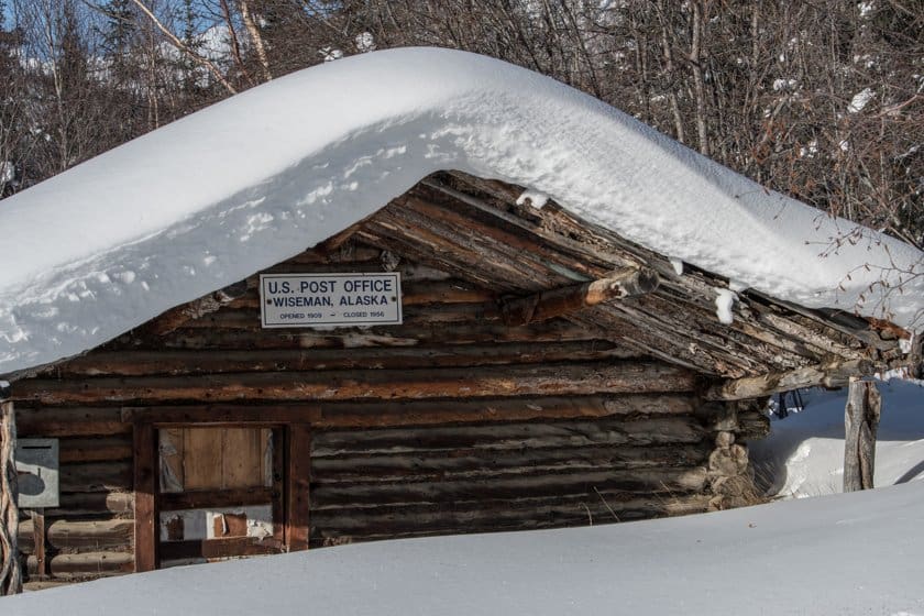
- Wiseman (189 miles): just after the Middle Fork Koyukuk Bridge, you can deviate from the route and follow the signs that will take you to the ancient village of Wiseman 3 miles away. Even today some people live here, basing their survival on hunting. Visitors are usually gladly expected.
- Sukakpak Mountain (204 miles): this is one of the most impressive mountains you can photograph in Alaska. Although it is only 4390 feet high, its peculiar shape does not leave you indifferent.
- Atigun Pass (244 miles): this mountain pass, at an altitude of 4665 feet, allows you to cross the Brooks Range.
- Galbraith Lake (275 miles): this lake is all that remains of the immense glacier that in past centuries occupied the entire valley of Atigun. From here, to the east, the Arctic National Wildlife Refuge opens up. At 4 miles on a secondary road, you will find the fifth camping area
- Toolik Lake (284 miles): this lake is home to a research station of the University of Fairbanks. It is not possible to access the station.
- Happy Valley (334 miles): this is a great place to take a long layover. There is easy access to the Sagavanirktok River and camping opportunities.
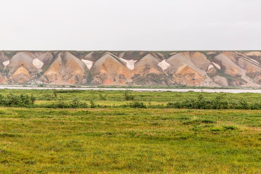
- Franklin Bluffs (424 miles): the iron-rich soil caused these colorful, very interesting bluffs to form along the river.

Where to sleep along the Dalton Highway
As you might have guessed, it’s not easy to find places to stay overnight along the Dalton Highway. Most travelers choose to camp. You can camp at 5 spots along the route, which I described in the previous paragraph. The two best are the one at Mile 60 and the one at Marion Creek, as they have a source of drinking water and waste containers.
It is possible to sleep in a bed in 3 places along the route, besides Deadhorse. The lodges are located respectively: near the bridge over the Yukon (Yukon River Camp), in Coldfoot (Coldfoot Camp), and in Wiseman (Arctic Getaway).
On the other hand, you will have a considerable choice regarding the city of Fairbanks which, as we have seen, is practically an almost obligatory support point to undertake an itinerary along the Dalton Highway. You can check the available hotels by clicking on the link below.
Find accommodation in Fairbanks
Organized tours along the Dalton Highway
If you don’t want to spend too much time worrying about the preparation of the trip you can rely on a tour operator. At the link below you will find an organized tour that allows you to travel along a part of the Dalton Highway by minibus, with the guided commentary of the driver.