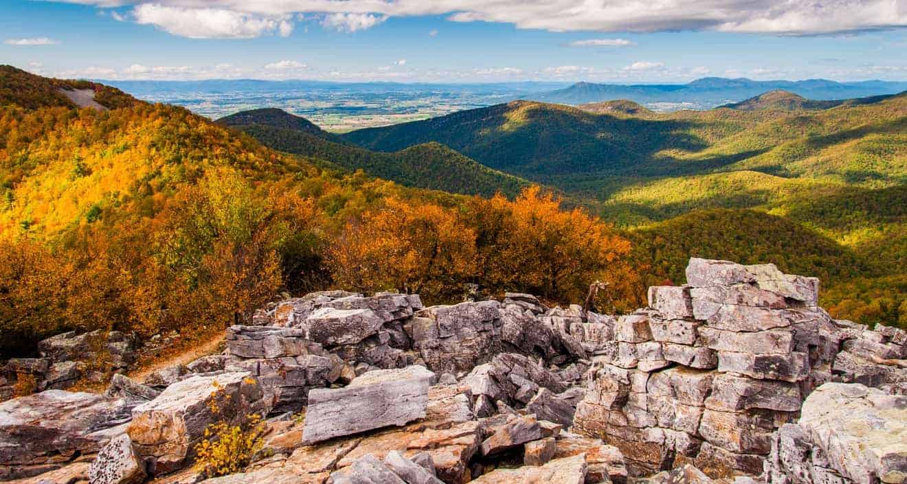
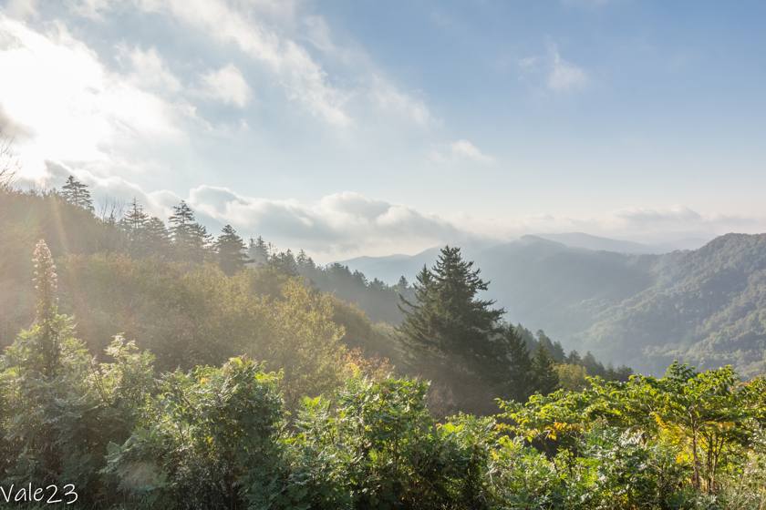
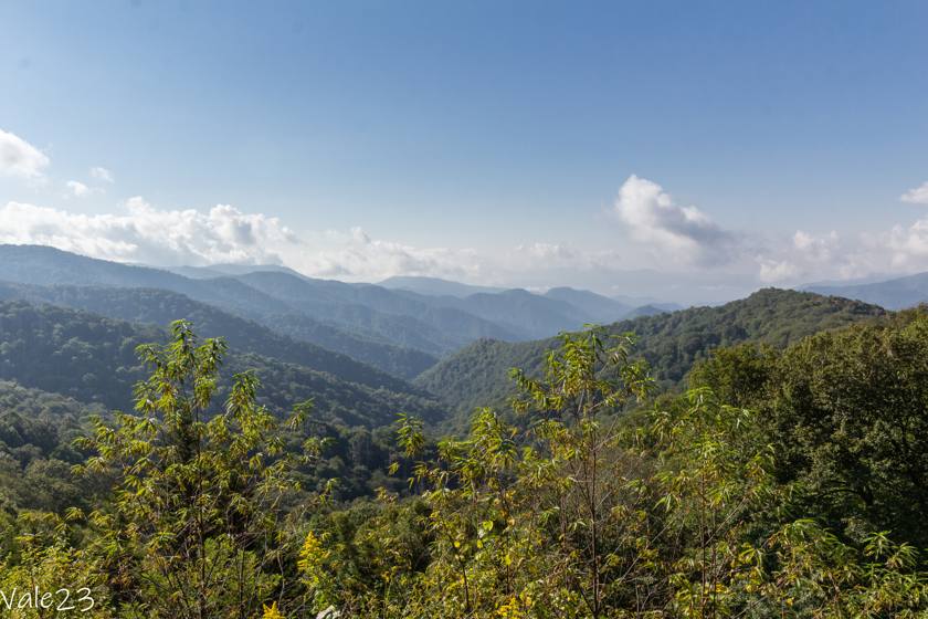
The Great Smoky Mountains National Park, between Tennessee and North Carolina, is the most visited national park in the United States, with more than 10 million visitors each year. The Grand Canyon, which is in second place, has about half that number. Its name is attributed to the constant presence of a bluish haze around the mountain peaks, which gives them a blue hue and makes it look as if everything is shrouded in smoke.
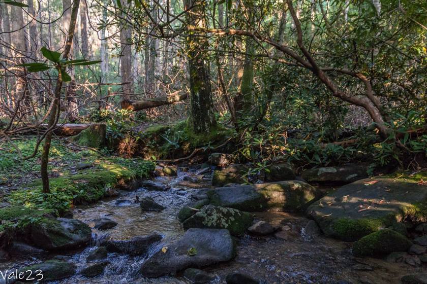
With 800 miles of trails, it is a hiker’s paradise. There are easy trails to do with children as well as the most challenging ones and everything in between. Here you can immerse yourself in nature as you discover waterfalls, streams, green valleys, and fragrant forests.
But this has not always been a protected area. Before the establishment of the national park in 1934, several farming communities lived here and had schools, churches, and timber farms; in fact, it is possible to visit the settlements and timber farms of the 1800s.
The Great Smoky Mountains is a complete park that has something to offer everyone, history and nature lovers alike. Let’s find out more about the attractions and how to plan a visit.
Contents
- How to get there
- Ho many days in Great Smoky Mountains?
- Best Time to Visit the Park
- Admission, hours, and the Visitor Center
- Things to Do in the Great Smoky Mountains
- Secondary areas of the Great Smoky Mountains National Park
- Places to stay in Great Smoky Mountains
- Places to eat in Great Smoky Mountains
- Safety Tips
How to get there
The Great Smoky Mountains National Park has two main entrances: one in Cherokee, North Carolina, and one in Gatlinburg, Tennessee.
- From Atlanta, take I-85 N. At exit 113 and at the junction take I-985 N toward Gainesville. After about 25 miles, the road changes names and becomes US-23 N; you continue for 93 miles more and enter North Carolina. In Dillsboro, take the interchange to US-441 N for about 5 miles. Then turn right onto Tsalagi Road, and you will arrive in Cherokee. Turn left onto Tsali Boulevard, and continue for 3 miles until you reach the Oconaluftee Visitor Center. Travel time is about 3 hours.
- From Nashville, take I-40 toward Knoxville/Huntsville, and continue for more than 186 miles to exit 407. From here, take TN-66 S towards Gatlinburg. In Sevierville, then take US-441 on the right, and continue for 11 miles to Gatlinburg. To enter the park directly, once you get here take the Gatlinburg Bypass, so you can avoid downtown. After a little more than 3 miles you will arrive at the Sugarlands Visitor Center. Travel time is about 4 hours.
- If you are coming from the east, for example from Charlotte, take I-277 N, and follow the signs for NC-16. After 2 miles, turn left to get on I-85 toward Gastonia, and take exit 17B for N. Chester/US321. Continue to exit 43, where you will take I-40 toward Asheville. At exit 27, take US-74 toward Clyde, and then exit at 103. At this point, take US-19 to Cherokee. Travel time is just over 3 hours.
You may find traffic around the cities, particularly on weekends.
Which itinerary does it fit in?
Here are two itineraries that the Great Smoky Mountains National Park could fit into:
- Journey to the U.S. South. On this itinerary, you’ll explore American history, from the Civil War to Civil Rights, as well as rock n’ roll’s most iconic sites. Some of the stops include Atlanta, Memphis, New Orleans, and Nashville. You will enter the park between Nashville/Chattanooga and Atlanta.
- East Coast Itinerary. Follow in the footsteps of the Founding Fathers. The stops on this trip include Washington DC, Norfolk and its naval base, the Blue Ridge Parkway, and the wide beaches of North Carolina (the Outer Banks being among the most popular). To enter the Great Smoky Mountains, you will take a detour between Roanoke and Charlotte.
Ho many days in Great Smoky Mountains?
Compared to other parks, the Great Smoky Mountains National Park is not that huge. The two nearest cities, Gatlinburg, Tennessee and Cherokee, North Carolina, are just 57 miles apart, a distance that takes 1 hour by car (without stops). Cades Cove, the most traveled area, is 27 miles from Gatlinburg, and 58 miles from Cherokee. It would seem that a few hours would be enough time to visit the park.
In reality, you will have to factor in some traffic delays, combined with a 35 mph speed limit. Also, the park is much more to explore than you might expect. There are beautiful scenic roads and the major points of interest along hiking trails, so you will have to walk a bit to reach them.
To see the main attractions, you should devote a full day or, better said, two half days. For example, you can arrive in the early afternoon, and leave after lunch the next day. If, on the other hand, you want to do a lot of hiking, I recommend spending a couple of nights here.
Here is an example of an itinerary for two half days in the Great Smoky Mountains.
Day 1:
- Cades Cove Parkway and Trail to Elijah Oliver Place (1.2 miles)
- Roaring Fork Motor Trail, Noah Bud Ogle Cabin, Rainbow Falls Trail (5.6 miles)
Day 2:
- Newfound Gap Road, Clingmans Dome, Chimney Tops Trail (4.5 miles)
- Mingus Mill and Oconaluftee River Trail (3.1 miles)
Best Time to Visit the Park

As we have seen, the Great Smoky Mountains National Park is by far the most visited park in the United States, and, as a result, it can get crowded. If possible, avoid weekends and national holidays. Another good idea is to visit the most popular areas, such as Cades Cove and Newfound Gap, early in the morning or in the late afternoon. Keep in mind that most tourists visit the park between 10:00 a.m. and 6:00 p.m.
As for the weather:
- In the winter it can snow in areas at higher elevations. Some secondary roads, such as Clingmans Dome Road, are closed during the winter.
- Spring weather is very variable. Some days can be pleasant in the high 60s but it can still get cold some days and there is even sporadic snowfall.
- Summer is not only the season with the highest temperatures and humidity but also the time of year with the most visitors. Afternoon thunderstorms are fairly common.
- In the fall, days are typically sunny and nights are cool and the temperature varies greatly between night and day. It can also snow as early as November.
The best time to visit the park is during the spring or fall. In spring you can see the blossoms that fill the forests and valleys with pastel colors. In autumn, you will be dazzled by the warm hues of the leaves.
Admission, hours, and the Visitor Center
The park is open year-round, and admission is always free.
There are 4 Visitor Centers:
- Sugarlands Visitor Center, for those arriving from Gatlinburg. This visitor center has a 20-minute video to introduce visitors to the park.
- Oconaluftee Visitor Center is the main tourist office. It serves travelers arriving from Cherokee and the Blue Ridge Parkway.
- Cades Cove Visitor Center is located near some historic buildings.
- Clingmans Dome Visitor Contact Station is open from April to November.
With the exception of the Clingmans Dome, all the other visitor centers are open every day except Dec. 25. The visitor centers are generally open from 9:00 a.m. to 5:00 p.m., with extended hours in the summer. In December they close at 4:30 p.m. Check online for detailed monthly schedules.
Before you go, download a map of the park, and a map of the trails. More detailed maps and guides can also be purchased at the Visitor Centers. I recommend buying the maps, which will help you identify points of interest along the scenic roads. Unfortunately, the free map provided at the Visitor Center is too basic.
There are convenience stores, picnic areas, and restrooms in the park, but no gas stations. Before entering, refuel at Cherokee, Townsend, or Gatlinburg.
Things to Do in the Great Smoky Mountains
Elkmont Historic District
The Elkmont Historic District, located 10 miles from Gatlinburg, Tennessee, is a historic area that now houses the park’s main campground.
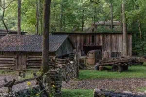
Although inhabited since prehistoric times, there is no evidence of any actual settlements until the arrival of European settlers in the early 1800s. The small village developed around the timber industry, from logging to transportation. The two main entrepreneurs in this industry were Levi Trentham and J.B. Townsend, who founded the Little River Lumber Company and had a railroad built in the heart of the Smokies.
Elkmont became a large town with a school, post office, hotel, supermarket, and exclusive tourist clubs for wealthy families. By the 1920s, the area was entirely deforested, so the Little River Lumber Company dismantled the railroad and moved its operations elsewhere.

With the establishment of the national park in 1934, the now-abandoned area was converted into the base camp of the Civilian Conservation Corps (CCC), which demolished all structures to reuse the wood. Meanwhile, the campground and accommodations for mass tourism date back to the 1950s-60s. Today, Elkmont is listed on the National Historic Register, and its most significant buildings have been appropriately restored.
However, most of them can only be visited from the outside, and the only two that can be entered are The Appalachian Clubhouse and the Spence Cabin.
In addition to visiting the historic area, you can also hike some trails, including:
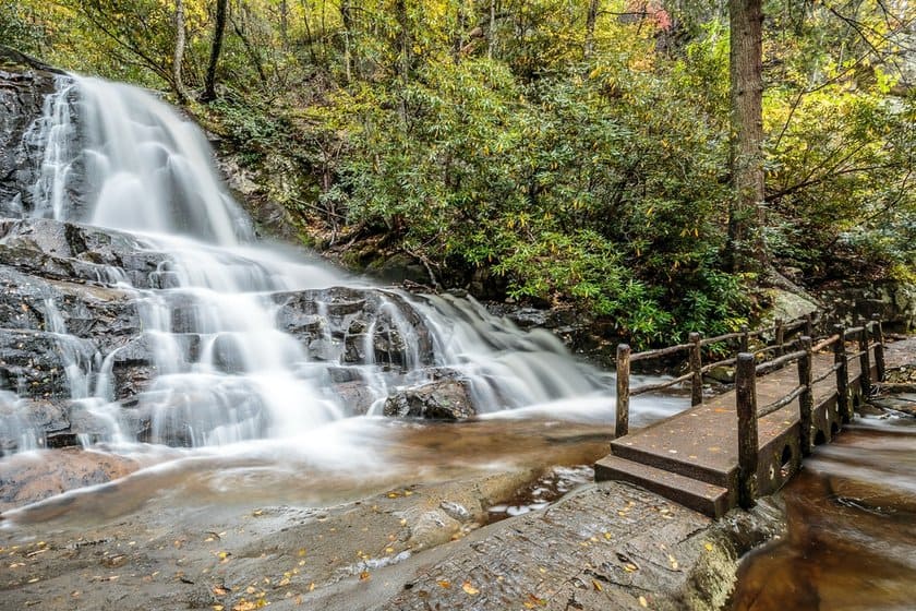
- Laurel Falls Trail is a 2.5-mile paved linear trail with 394 ft of elevation gain. Paved, it leads to the 79-feet-high Laurel Falls, named after the mountain laurel tree. The trailhead is halfway between the Sugarlands Visitor Center and Elkmont, along Fighting Creek Gap Road. As one of the most popular trails, it is very crowded, and the parking lot fills up quickly. If you can’t find a spot, about 0.2 miles ahead there are some places to park along the road.
- Elkmont Nature Trail is a beautiful 0.8-mile walk with a 95-ft elevation gain that is perfect for families. There are some information panels along the trail that give explanations of the local flora.
- Little River Trail, is a longer trail, about 12 miles long, that runs along Little River and ends at a camping area. But you don’t have to walk it all the way; in fact, most visitors only go as far as the Little Huskey Branch Falls. To get there, you will have to walk 4.7 miles with 384 ft of elevation gain. You will also see some uninhabited wooden houses, and with some luck, you may spot some otters. The trailhead is near Spence Cabin.
Cades Cove
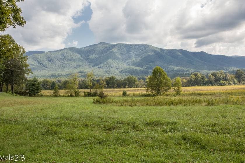
This green valley in the foothills of the Appalachian Mountains in Tennessee is the most famous and popular area of the park. In Cades Cove, you can drive the scenic 18-mile road, make stops to hike to numerous points of interest or see settlements from the 1800s. There are also many opportunities to spot wildlife, from deer to coyotes to brown bears, as well as smaller animals such as skunks, raccoons, and groundhogs.
In spite of its small size, Cades Cove is very rich in attractions and hiking trails, and to visit everything you’ll have to put in 2 to 4 hours, depending on how many hiking trails you want to take. Expect heavy delays; the road is very busy.

The one-way Cades Cove Road is open from dawn to dusk and can be traveled by car, motorcycle, bicycle, and on foot. Between June and September, on Wednesdays the road is vehicle-free, meaning it is accessible only to bikes and pedestrians. This initiative, launched in 2020, is part of a larger plan to improve the experience of the park. If you would like to rent a bike, please contact the store next to the campground.
These are the main points of interest and hiking trails along the parkway (following the trail):
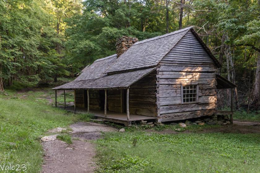
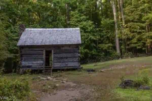
- John Oliver Place was the first house inhabited by European settlers. John and Lucretia Oliver settled in this wooden house around 1820. No mill existed at that time, and the wheat was ground manually. The house can be reached by taking a short 0.3-miles walk from the parking lot.
- The Methodist Church and Missionary Baptist Church are two wooden churches from the early 1900s. The former has two entrance doors, since, at the time, it was believed that men and women had to enter the church separately.
- Elijah Oliver Place Trail is a 1.2-mile linear trail with 98 ft of elevation gain. Elijah Oliver, the son of John and Lucretia Oliver, was a deacon of the Baptist Church and built a house on a farm for his family in this area. The wooden house had a guest room where travelers could find shelter for the night. The farm was self-sufficient, complete with a barn, chicken coop, and smokehouse.
- Abrams Falls Trail is a 5.6-mile linear trail with 656 ft of elevation gain. It follows the course of Abrams Creek to the waterfalls of the same name. Although they are only 20 ft tall, they are very powerful, so much so that swimming in the pool below is not recommended.
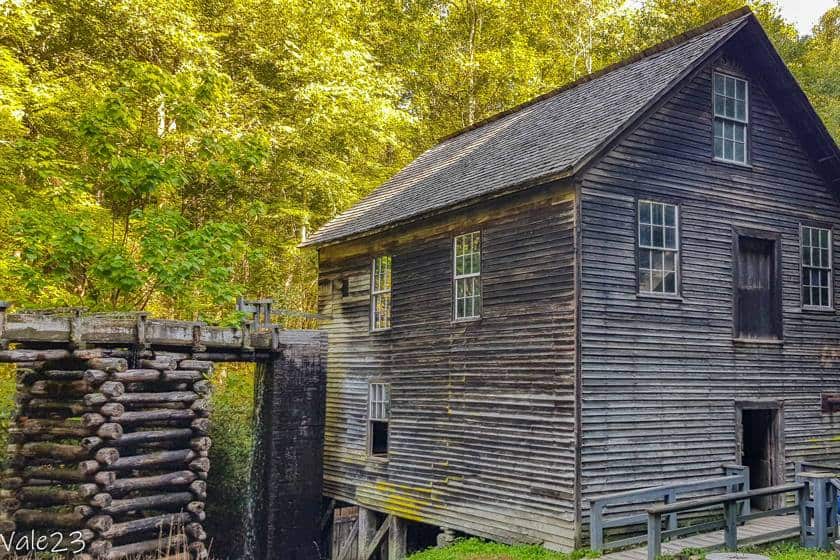
- Visitor Center. Several historic buildings are located in the area around the tourist office. These include the 1870 water mill, which is still in operation. Volunteers show visitors how it works. Stop by to see the other buildings as well, which include a wooden house, a smokehouse, and the curious Drive Through Barn, a barn with a large opening in the center for vehicles to pass through.
- Dan Lawson Cabin is an 1856 wooden farmhouse that also served as a post office.
- Tipton Place, the Tipton family farmhouse. The two-story house was built around 1870 by Colonel Hamp Tipton, a Civil War veteran. The farm had a barn, bee hives, and a blacksmith shop. The barn was built so that a vehicle could drive through it to load and unload grain more conveniently. Today visitors can see a replica of the barn.
- Carter Shields Cabin, another wooden house from the 1800s, is very picturesque in the spring when the meadow is filled with flowers.
Roaring Fork Motor Nature Trail
The Roaring Fork Motor Nature Trail is a one-way road that forms a loop that begins and ends in Gatlinburg in the western part of the park. The 10-mile road meanders through dense forest, crossing waterfalls, streams, and old settlements, with some scenic views of the mountains and the park’s two most famous waterfalls.
To reach it, turn left from the center of town onto the Historic Nature Trail, where the Space Needle is. The road is closed in winter, and the speed limit is just 10 mph. Calculate at least two hours to complete it while stopping to take a few photos, more if you hike many trails along the way.


Here are what the main attractions are (following the trail):
- Noah “Bud” Ogle Cabin and Trail is a 1-mile loop trail with 22 feet of elevation gain. It leads to the Noah Bud Ogle Cabin, built around 1880. The house consists of two sections, joined by a chimney, a typical structure in the area known as a saddlebag house. The trail then continues counterclockwise, crossing a couple of streams until it reaches the mill. Renovated in the 1960s, it has a turbine driven by a 20-feet channel set horizontally.
- Rainbow Falls Trail is a linear trail 5.6 miles long, with an elevation gain of 1640 ft. It leads to the falls, with an 82-feet drop, making them the tallest in the park. To see the rainbow, the namesake of the falls, visit them on a summer afternoon. During winter, spectacular ice stalactites form around the jet stream.
- Grotto Falls Trail is a 2.6-mile linear trail with 545 ft of elevation gain. The 25-ft falls are called “grotto” because there is a cave behind the jet of water, which you can enter. From the cave, you can admire the falls from an unusual vantage point.
- Alex Cole Cabin is a small cabin measuring just 20 x 16 feet. Alex Cole worked for the Little River Lumber Company, but he was also one of the first to understand the tourist potential of the area. He even became a tour guide. The house was originally located near Newfound Gap but was moved here in the 1970s.
- Ephraim Bales Cabin is a house consisting of two separate buildings joined by a covered patio. Ephraim Bales lived here with his wife and 9 children from 1890 until the 1930s when the government purchased the land to create the national park.
- Alfred Reagan Tub Mill is another mill with a tubular structure. This type of mill was popular in the Smokies because it was better suited to the land than the classic wheel mill. The tube used the natural current of streams and could also be placed in very narrow places.
- Ely’s Mill is a delightful craft and food store in a late 19th-century mill. Don’t be startled by the rusting cars outside, which may give you the impression that it’s abandoned. Go inside to buy excellent homemade honey.
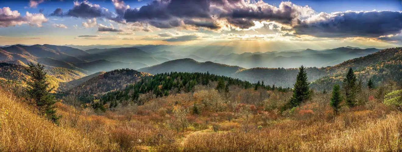
Newfound Gap Road
The scenic Newfound Gap Road runs from the Sugarlands Visitor Center to Cherokee, crossing the Tennessee-North Carolina border. It is 53 miles long, and, at an average elevation of 1,500 feet, offers incredible views of the Appalachian Mountains and coniferous forests. Travel time is about 1 hour without stops, but if you add in secondary roads and hiking trails, I would say consider half a day. Bring a sweatshirt because here it can be up to 10 degrees lower than in other parts of the park


Here are the main points of interest, from west to east:
- Carlos Campbell Overlook has views of Bull Head and, further in the distance, Balsam Point. Some information panels explain the different types of local flora.
- Chimney Tops Overlook is a scenic point overlooking the twin peaks of the same name.
- Chimney Tops Trail is about 1.55 miles from the beginning to the overlook point. It is 4.5 miles long and has an elevation gain of 1312 ft, mostly concentrated in the last mile. The trail partly follows the course of the Road Prong and then veers to the right and begins to climb over rocks, with views that become increasingly wider. For safety reasons, the last section, the one leading to the top, is closed to the public. The trail then ends with a small observation point below the Chimney Tops. Despite the significant elevation gain, it is one of the most traveled trails in the Great Smoky Mountains, and the small parking lot fills up quickly. If you can’t find a spot, try further along the side of the road, or in the parking lot just beyond the tunnel. If you are coming from Cherokee, try looking for parking at the Cove Hardwood Forest Parking, 1 mile east of the trailhead.
- Morton Overlook is a 1500-feet viewpoint on the Tennessee-North Carolina border.
- Newfound Gap Overlook is the most famous viewpoint, with a lookout that gives even more expansive views. The well known Appalachian Trail, the 3500-mile super trail connecting Georgia and Maine, also passes through here. You can travel a small portion of it, going west to as far as Indian Gap, or east to Sweet Heifer Creek. In either case, the route is about 3 miles long with an elevation gain of 820 ft.
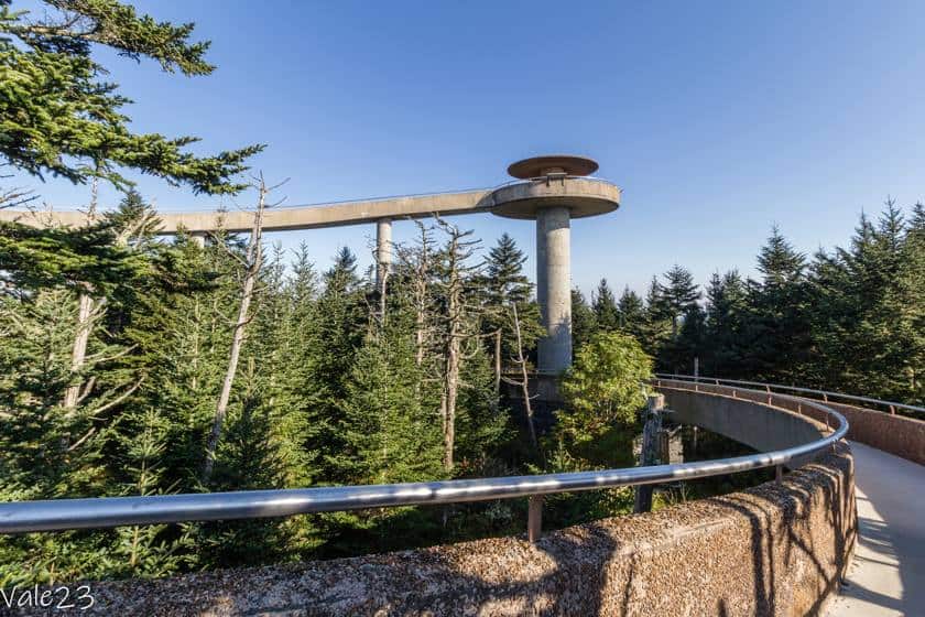
- Clingmans Dome Road and Trail. From Newfound Gap, take the 6.8-mile road on the right (closed in winter), and continue until the end of the road. A linear, 1.2-mile-long trail with 328 ft of elevation gain begins from the parking lot, ending with an ugly concrete viewing platform. Clingmans Dome, at 6640 feet, is in fact the highest point in the Smokies, and the circular platform provides a 360-degree view, above the clouds. This is the most spectacular view in the entire park.
- Smokemont Nature Trail is a 0.6-mile loop trail with an elevation gain of 164 ft. It is a beautiful walk in the forest that is recommended for the whole family. The trailhead is at the campground, but the parking spots in this area are reserved for campers. You can park your car in the small parking lot to the left of the bridge you will cross to enter the area. Turn right after the bridge and you will arrive at Smokemont Riding Stables, a company that offers horseback riding tours.
Oconaluftee

The Oconaluftee Archeological District is the main entrance to Great Smoky Mountains National Park for travelers arriving from North Carolina and the Blue Ridge Parkway, the 750-mile scenic highway that runs along the crest of the Appalachian Mountains and connects North Carolina and Virginia.
The area, which was originally inhabited by Cherokee Indians, saw its first European settlements in the late 1700s when John Jacob Mingus settled here with his family. Like Elkmont, the Oconaluftee Valley was also heavily logged by timber companies. This ended only with the establishment of the national park. The Visitor Center was built in 1940 as a temporary structure but remained unchanged for more than 70 years until it was renovated in 2011.
The main attraction in the area is the Montana Farm Museum, a reproduction of a typical 19th-century farm. Most of the buildings were brought here from other locations so that visitors can get a realistic idea of what life was like in those days. There is a log house, a barn, storage warehouses, a chicken coop, a blacksmith shop, a cellar, and other minor structures.


Other points of interest in this area:
- Mingus Mill and Mingus Trail. The mill, which is still in operation, dates back to 1886 and was built using the canal system. Inside, volunteers explain its operation with hands-on demonstrations, and flour can also be purchased. The mill is open from 9:00 a.m. to 5:00 p.m., between March and November, and is located a few minutes from the trailhead. The trail then continues for another 2.8 miles (one way) along the course of Mingus Creek, with an elevation gain of 1509 ft. NOTE: As of today (March 2024), the mill is closed for renovation. Any updates can be found on the relevant page of the official website.
- Oconaluftee River Trail is the only trail in the park where you can take dogs, but you must keep them on a leash. The trail is three miles long and leveled and it connects the Visitor Center to Cherokee. It begins at the Montana Farm Museum and follows the course of the Oconaluftee River, which, in fact, means “near the river.” It is a relaxing trail among horse chestnuts, maples, limes, and sycamores, and in spring it is filled with fragrant flowers.
- Mingo Falls is actually on the Indian reservation outside the Great Smoky Mountains. From Cherokee, cross the river and take Acquoni Road on the left and continue for about 5.6 miles. The falls drop 118 ft and you can reach them by walking 0.3 miles from the parking lot. The trail is short but steep, with a 98-ft decline and 160 steps to overcome right at the start. Pets are welcome on this, but they must stay on a leash.
Secondary areas of the Great Smoky Mountains National Park
Cataloochee
The Cataloochee Valley in North Carolina is an isolated and quiet valley, the most remote and least visited area in the Great Smoky Mountains National Park. However, in the past, it was one of the largest and most prosperous settlements, with a population of 1,200 people. It was primarily a farming and fishing community.
To reach it, you will have to exit the park in Cherokee and take US-19 to Dellwood. From there, turn left onto 276- Jonathan Creek Road, and then take Cove Creek Road for about 11 miles. The total distance is 37 miles, and it takes 1 hour and 15 minutes.
Once there, you will see some of the historic buildings dating back to the early 1900s, including:
- Hiram Caldwell House
- Beech Grove School
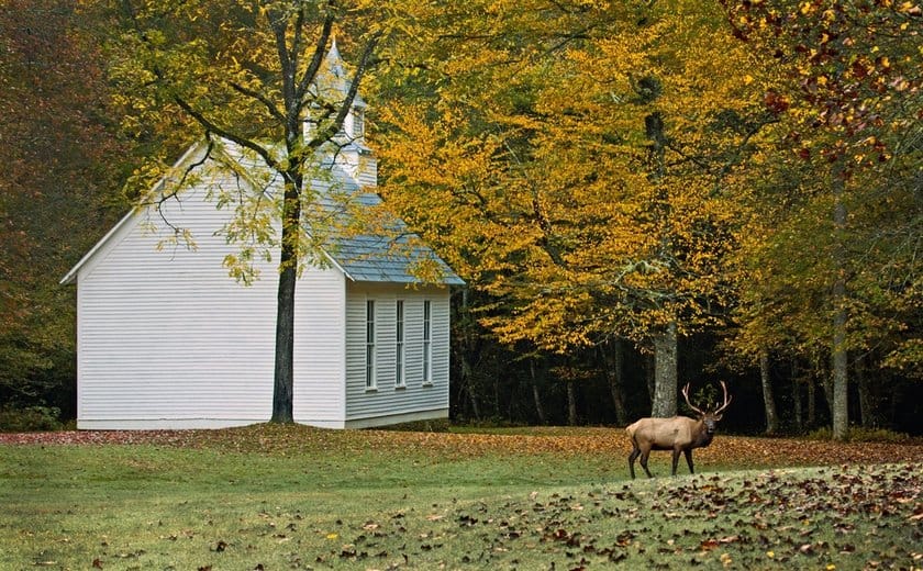
- Palmer Chapel Methodist Church
- Palmer Place
A small elk (American deer) herd often grazes in the valley, especially in the early morning and late afternoon.
Deep Creek
Deep Creek is located in North Carolina, near Bryson City. It is the southernmost area of the park and is known for creeks and waterfalls. Exit the Great Smoky Mountains at Cherokee and take US-19 south. Near the Hideaway Campground, take Shuler Road, and then Galbraith Creek Road on the right to the large parking lot. The distance from Cherokee to Deep Creek is 10 miles.
The Deep Creek Trail, also known as the “Three Falls Trail,” is a 5-mile loop trail with an elevation gain of 896 ft. As you may have guessed from the name, the trail leads to three beautiful waterfalls: Toms Branch Falls, Indian Creek Falls, and Juney Whank Falls.
Places to stay in Great Smoky Mountains

The only places where you can spend the night within the Great Smoky Mountains are the campgrounds. However, there are some towns on the edge of the park where you can stay overnight without having to go far from the park.
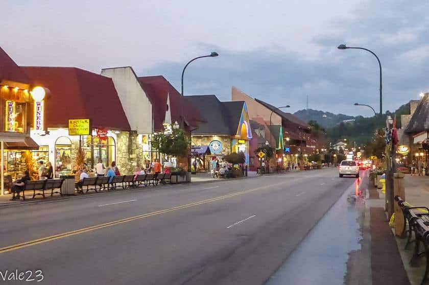
Gatlinburg, Tennessee, is a tourist town with a main street full of stores, restaurants, and attractions such as miniature golf and the 5D movie theater. There are several hotels of well known hotel chains, for example, the Econo Lodge Inn & Suites or the Country Inn & Suites.
All accommodations in Gatlinburg
If you prefer a more thematic experience, try the Dancing Bear Lodge in Townsend, where you’ll sleep in rustic furnished wooden cottages.
All accommodations in Townsend
Cherokee is in North Carolina, at the eastern end of the park. It is on the Indian reservation and is administered by one of only three federally recognized Cherokee tribes. You can choose to stay at a hotel chain, for example, the Super 8 by Wyndham, but you can also try the Chestnut Tree Inn, run by the Cherokee.
Places to eat in Great Smoky Mountains

In Gatlinburg and Cherokee, you’ll find a variety of restaurants, including some big chains like Bubba Gump Shrimp Co. and fast food chains.
In Gatlinburg, try Delauder ‘s BBQ, No Way Jose’s (Mexican), or even Cherokee Grill. I also recommend Tennessee Jed’s, open only for breakfast and lunch, serving pies, hamburgers, and hot dogs.


Also in Gatlinburg, be sure to stop by Ole Smoky Moonshine, a store of the famous moonshine whiskey brand. Moonshine was the illegal whiskey distilled during Prohibition, and it is named moonshine because it was made in secret, in the fields in the “moonlight.” Because it was made in a hurry, it was not aged, which gives it a particularly pungent aroma as well as a high alcohol volume. Today, of course, it is legal, but the company still maintains the tradition of bottling it in canning jars.
In Cherokee, there is BJ’s Diner, which serves burgers. Alternatively, head to Harrah’s Cherokee Casino to sample the excellent steaks at Ruth’s Chris Steak House. If you want a breakfast of champions, head to Peter’s Pancakes & Waffles, where you can choose from sweet or savory options.
Safety Tips
Before embarking on scenic back roads, such as the Roaring Fork Motor Nature Trail, go on the official website to check for any road closures or construction. The roads are very busy, and the speed limits are low. Stick to the limits and be mindful that there are many pedestrians and cyclists. If possible, avoid driving in the dark, since wild animals start to come out at dusk and often cross the roads.
Since this is a mountainous environment with many streams and waterfalls, trails can be wet and slippery. Wear hiking shoes with good traction, and bring a rain jacket in case of sudden rains.
If you spot wildlife, observe animals from a safe distance and do not feed them or try to attract their attention. Animals that become too accustomed to the presence of humans can become aggressive. Pets are not allowed along most of the trails.