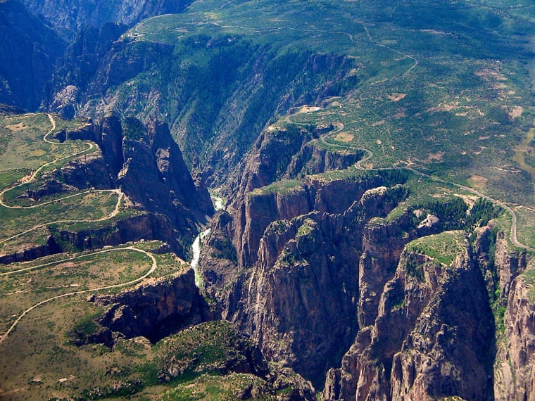
The Black Canyon of the Gunnison National Park is a Colorado park that is decidedly less popular than its California cousins like Yosemite or Death Valley, but no less spectacular.
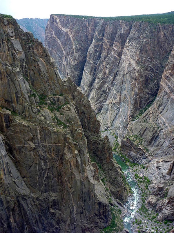
The name comes from the feature that makes it unique. The deepest areas of the canyon in fact, receive only about 30 minutes of light per day. Carved out by the Gunnison River over the course of two million years, this wonderful park may seem arid and desolate, but it is full of wild animals such as bears, coyotes and reindeer that live quietly and almost undisturbed thanks to the small number of visitors compared to other American national parks. Under 200,000 tourists a year come here, compared to the Grand Canyon‘s nearly five million visitors.

It is a gem waiting to be discovered, to be included by right in the top 10 of Colorado, and almost unknown to many travelers. Yet it offers spectacular scenery.
Contents
Directions, entrances and road closures
The Black Canyon of the Gunnison National Park is about five hours from Denver and four and a half hours from Colorado Springs. There are three entrances:
- South Rim: open to cars daily from April to mid-November; closes from Gunnison Point onward in winter
- North Rim: open only from mid-April to mid-November
- East Portal: Open only from mid-April to mid-November
If you don’t have an annual parks pass (recommended during a road trip), the cost per vehicle is $30. I would recommend that you start your visit at the South Rim so that you can also stop at the ranger station (always open) to ask about recommended routes and scenic roads.
How to Visit the Black Canyon of the Gunnison

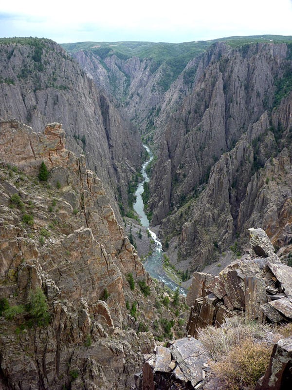
The best way to visit the park is to drive through it from South Rim Road and stop occasionally at the overlooks. This will give you an idea of the size of the canyon and a chance to take short walks into nature. Here you can find the park map, and here are the recommended trails.
Black Canyon of the Gunnison Drive
South Rim Road (Rim Drive Rd on maps)
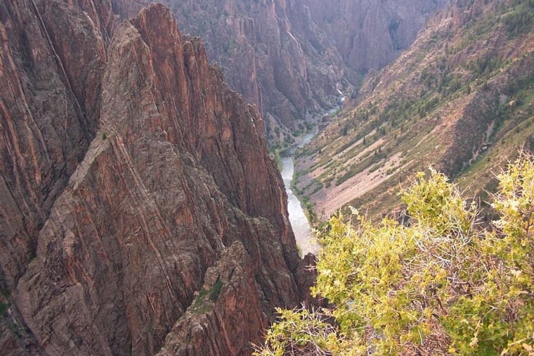
South Rim Drive is 6.5 miles long and stretches from Tomichi Point to High Point and includes 12 scenic overlooks. Starting from the visitor center, consider stopping at Gunnison Point (near the visitor center), Chasm View and the Painted Wall. The Painted Wall is unique because of the striped rock face that creates a wonderful play of shapes. The paths to reach the observation points are all very easy but not recommended for those who suffer from vertigo: the canyon is very deep and you can approach even without fences. You can try it, but always with due care.


The other lookout points along the road: Pulpit Rock, Cross Fissures View, Rock Point, Devil’s Lookout, Cedar Point, Dragon Point, Sunset View, High Point, Warner Point. Here the road ends and you can turn around and head back.
North Rim Road
This option is ideal if you are coming from the north, such as Wyoming, or from the east, such as Utah. It is less visited and gives access to six observation points along five miles. In summer you can stop at the North Rim Ranger Station to ask for information, but it is not always open.
Recommended Viewpoints: Chasm View, Narrows View and Kneeling Camel View
East Portal Road
This road is very steep (16% grade) and full of switchbacks, but ideal if your goal is to go inside the canyon and reach the Gunnison River. East Portal Road is accessed from South Rim Road, just past the park entrance. It’s not as scenic as the other two, but it’s short (less than 2.5 miles), so it’s worth it if you have time.
Black Canyon of the Gunnison Hikes

If you are planning to visit the Black Canyon with longer and more challenging hikes than just the trails to the scenic spots, here are a few to consider.
- The Rim Rock Nature Trail (South Rim, about 0.9 miles, moderate) is fairly flat and follows the canyon rim offering views of the river and cliffs. The starting point is at Campground Loop C and ends at the South Rim visitor center.
- For a more challenging, but still short hike, the Oak Flat Loop Trail (South Rim, just over 2 miles, difficult) is for you. Named after an oak grove you’ll encounter on the hike, it features very steep parts. Being a loop, it starts and ends near the visitor center.
Other trails on the South Rim are: Cedar Point Nature Trail (about 2.5 miles, easy) and Warner Point Nature Trail (about 1 1/2 miles, moderate).
The North Rim has two longer and more challenging trails, the North Vista Trail (6,8 miles to Green Mountain, difficult) and the Deadhorse Trail (5 miles, moderate) and a shorter but moderate trail, the Chasm View Nature Trail (about 2.5 miles). You can find all the information about Black Canyon trails here.
Where to Stay near Black Canyon of the Gunnison
Unless you are looking for a campground, staying inside the park is not possible, so you will have to look in the neighboring towns. The closest solution is Montrose which is 20 minutes by car, while at about 1 hour and a half ,you will find Grand Junction, a larger town with more available accommodations, as well as an excellent base to visit Colorado National Monument.
Accommodations around the Black Canyon
Photo gallery

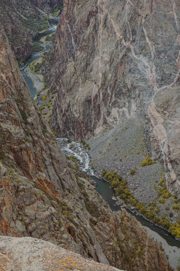
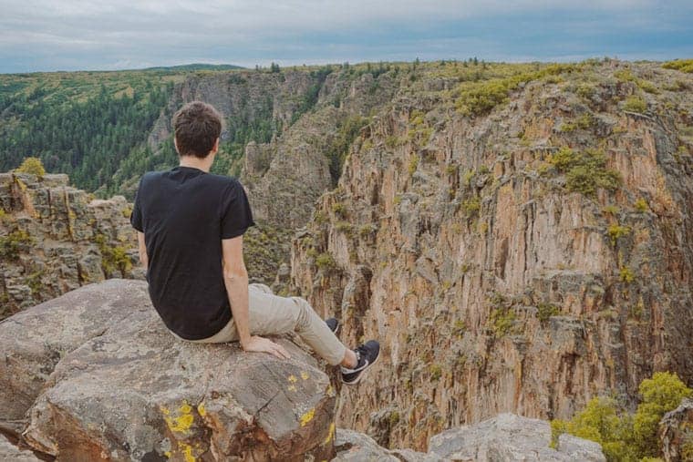

Photo Credit: Giorgio Nardini