Six times the size of Yellowstone National Park, at 20,460 square miles Wrangell St. Elias National Park is the largest national park in the United States.
Mountains and volcanoes, forests and glaciers that occupy this large slice of Alaska are still largely untouched and have been protected as a UNESCO World Heritage Site since 1979. Only two roads allow you to enter the park and there are trails that go deep into the wilderness, but even the most experienced trekkers must take many precautions before entering the heart of the Wrangell-St.Elias.
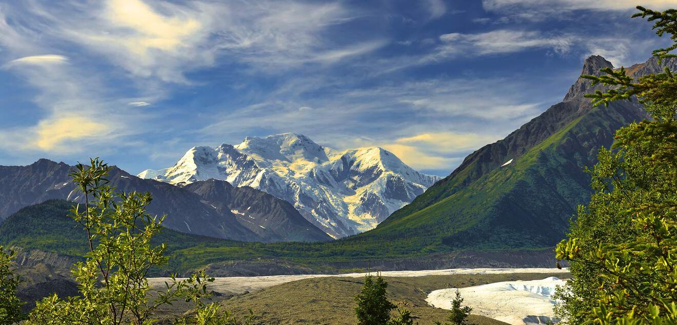
Here stands Alaska’s second highest peak after McKinley: Mount St. Elias, which reaches 18,008 feet and marks one of the borders with Canada. But it is not a solo mountain. The mountain ranges that cross the park, Wrangell Mountains and Chugach Mountains, are full of peaks over 10,000 and often 13,000 feet, with another peak over 16000: Mount Bona (16,420 feet).
Few can tackle the climb to these impassable peaks, but even at low altitudes the park is capable of filling a visitor with awe. A native settlement, an old mining road, and a paddle on a rushing stream will make your trip to the gigantic and wild Wrangell St. Elias National Park an unforgettable one.
Contents
How to get there
On its eastern side, the reserve marks the border with Canada, where it continues into the protected area of Kluane National Park and Reserve. There are several access points and it is therefore possible to reach the park by different means, depending on which area you choose to visit.
- By plane. The small Gulkana airport is near the eastern boundary of the park. Valdez Airport is also not far away. However, it makes little sense to get to the park’s border by plane. Given the good road connection to Anchorage, it makes more sense to land in the big city and travel from there by bus or rental car. It’s different if you intend to reach the innermost part of Wrangell-St. Elias by plane: in this case use the McCarthy runway.
- By bus. Glennallen and McCarthy are connected to Anchorage by bus services. On this page, you will find details of the companies that operate the service.
- By Car. If you’ve picked up a rental car, you’ll have no trouble reaching the park’s boundaries. Coming from Anchorage, just follow the Glenn Highway (use this itinerary) to Glennallen and from there continue on the Richardson Highway south to Copper Center, Chitina and McCarthy, or north to Chistochina, Slana and Nabesna. If you are coming from Fairbanks, however, the Richardson Highway will take you directly to the eastern end of the reserve. Because of its proximity to the Canadian border, this is one of the areas of Alaska that fits well into an on-the-road itinerary that includes parts of Canada. The Glenn Highway, which leads to the park from the northeast, connects directly to the Alaska Highway, which heads from the Canadian Yukon to Fairbanks.
Best to Visit Wrangell St. Elias

Such a vast area has very varied climatic conditions, especially considering the great differences in altitude. It goes without saying that between the sea coast and 16,400 feet, there is a big difference in temperature in any season. Leaving aside the mountain peaks, for which it is a good idea to check weather conditions in real time, I will write about the central area of the park, that of the Copper river basin and its tributaries, where the only two roads stretch out and which is therefore the area most visited by tourists.
The best period is summer. In the months between May and September, temperatures are acceptable. The hottest months, July and August, have on average maximum temperatures of 65° and lows of 50°. Winter is not as harsh as in other parts of the state: the coldest month, January, usually has daily highs of 33° or 35° and nighttime lows of 26-25°. Although temperatures are not extremely cold, the fall and winter months have the most precipitation, both rainy (especially October) and snowy.
Being an environment already quite inaccessible in itself, it is therefore highly inadvisable to visit this reserve in winter, especially as services in this period are very scarce and access roads are left without much maintenance. The general advice is however to keep an eye on the page dedicated to the current conditions of the park on the official website and ask the rangers for advice on the situation once you are there.
How to arrange a visit
Wrangell-St. Elias can be visited in a day or in a week; you can see a portion of it from the air on a scenic flight or you can trek for several days, camping in the wilderness. It’s hard to say which is the best way to see an area larger than Switzerland. However, considering that much of the reserve can only be visited by very experienced and knowledgeable people, I will focus on the areas that are accessible to everyone.
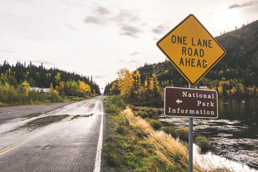
The two roads that enter the park are not paved and are only kept clear in the summer months. The same goes for hiking trails: they are not maintained in winter and can therefore be dangerous. In any case, always refer to one of the visitor centers, where rangers and park employees will explain the conditions of the various areas to enjoy the hike without risk.
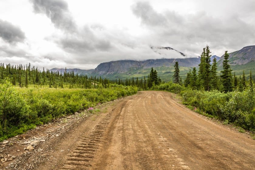
If you have a rental car, our advice is to venture on one of the two roads, or should we say trails, that penetrate the territory of the reserve: the Nabesna Road and McCarthy Road.
Entrance to the park is totally free and you can access it at any time, subject to the weather conditions in the area.
Visitor Centers
Before venturing into the park, and perhaps even when you are already inside, it is good to find out about the environment you are in. At the Wrangell-St. Elias, there is no shortage of visitor centers, where rangers are always available to answer any questions. Below, you will find details and schedules, but to be sure of the exact timings, it is advisable to check the official website, always updated on this page.
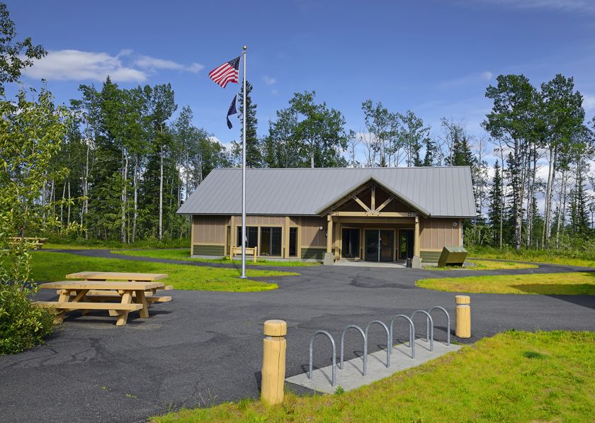
- Copper Visitor Center. The main visitor center is at Copper Center, on the western edge of the reserve, along the Richardson Highway. Here you can see an explanatory film and an ecology exhibit, there’s a bookstore and a cultural center, but mostly you can talk to rangers. The center is open May through September, daily from 9 a.m. to 5 p.m.
- Kennecott Visitor Center. If you drive all the way down McCarthy Road, you can also pay a visit to this visitor center located in the heart of the park. There’s no shortage of exhibits and films here either, but it’s essential for learning about the area’s mining past. It’s also a great place to acquire detailed information about routes to take in the surrounding area. The center is open from May to September, daily from 9 am to 11:30 am and from 1:30 pm to 4:30 pm.
- Chitina Ranger Station. At the mouth of McCarthy Road is the Chitina Settlement, where you can meet the rangers at their work station. A video and photo exhibit welcomes visitors, and rangers are on hand to help you make the best arrangements for your visit. The station is open May through September, from 9 a.m. to 5 p.m.
- Slana Ranger Station. Also at the entrance to Nabesna Road, you will come across a small settlement, Slana, with a ranger station. If you plan to visit the northern area of the park, you can refer to this station, which is also equipped with all kinds of services and information that may be useful to you. It is open from May to September every day from 9 a.m. to 5 p.m.
- Yakutat District Office. The less accessible part of the park, the southeastern part that is a reference for Yakutat, also has its own district office. If you visit this area, you will undoubtedly refer to this office, but it does not have set hours, as it is not an actual visitor center.
Kennecott and McCarthy Road
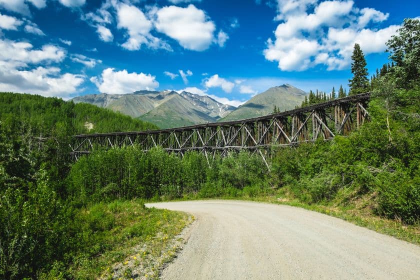
Copper is the reason we have a human settlement in the middle of this nature reserve today. The Kennecott Mines needed a transportation system, and in 1909 a railroad was built to take the mined cargo away. In 1938, when large-scale mining ended, most of the rails were removed to reuse the iron and the rail line was transformed into what is now McCarthy Road: a narrow, winding road, with the occasional sleeper peeking out treacherously from the dirt.
The McCarthy Road is about 60 miles long and leads from Chitina to the mining outpost of McCarthy/Kennecott. Reaching Chitina is easy: just take the Edgerton Highway, which starts from the Richardson Highway at Willow Creek and drive all the way (about 1 hour). Here, it is a good idea to stop at the ranger station to get updates on the conditions because if the weather has not been kind, this road can be really rough and dangerous to drive on.
Despite being less than 60 miles long, in fact, it takes about 3 hours to reach your destination. Also, bear in mind that there are no gas stations along the way, not even in Chitina. The last gas station is in Kenny Lake, along the Edgerton.
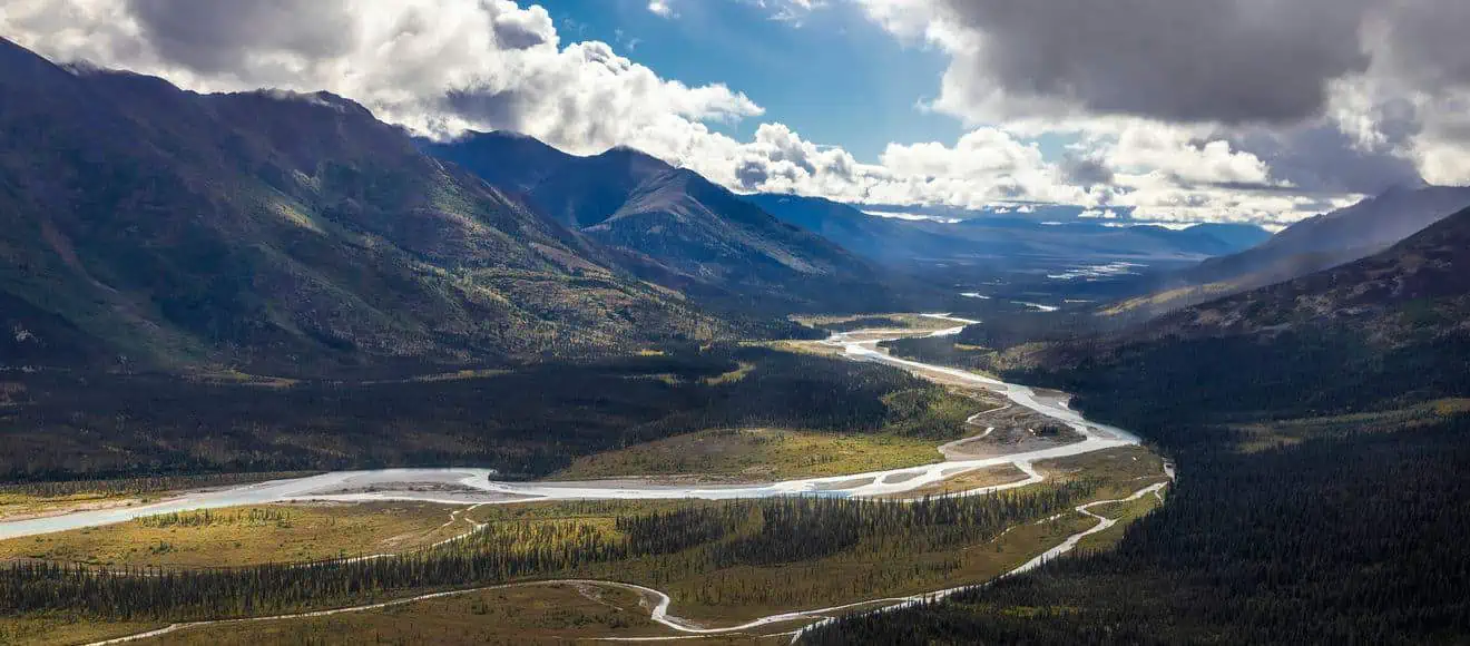
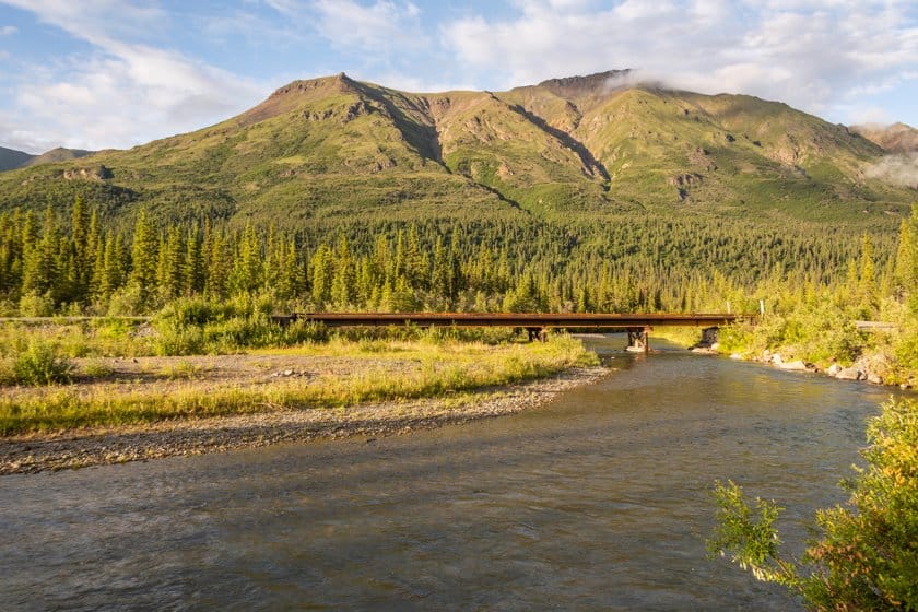
Chitina is the first point of interest on the road. Once a busy town, being the main port of call for freight trains heading from Kennecott to Cordova, it is now the gateway to the nature park. You can find dining outlets, accommodations and stores there. Leaving Chitina behind, you travel parallel to the river of the same name. The Chitina River is a tributary of the Copper, but it has a greater water flow than the latter, reaching in some places to measure more than 0.9 miles from bank to bank.
Once you’ve overcome the difficulties of the road, while admiring volcanic rocks and raging torrents, you reach McCarthy, or rather the parking lot in front of the Kennicott River. From here, it is one mile to get to the town, which can be covered on foot or by shuttles. McCarthy was the place where the miners had fun and that’s why there were more bars and brothels than houses. Today there are restaurants, stores and the McCarthy-Kennicott Historical Museum: a collection focused on the mining period and the life of the miners.


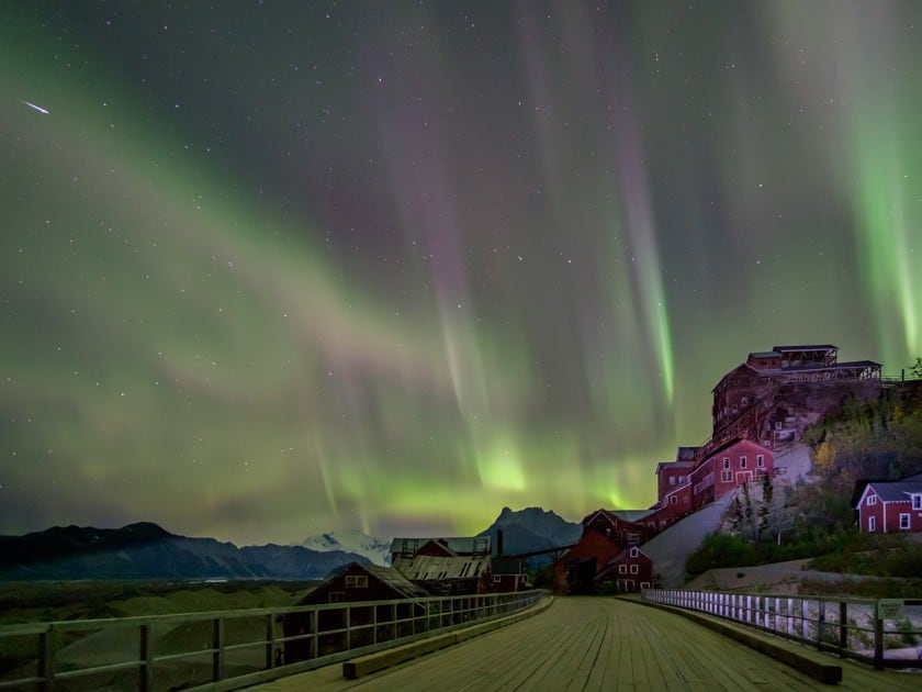
Kennecott Mines looks like a ghost town. They can be reached from McCarthy by shuttle bus and you can visit the inside of the mine on organized tours. The mine is called Kennecott because the mining company misspelled the name of the explorer Kennicott.
Nabesna Road
The Nabesna Road leads to the town of the same name, starting out from Slana, and following the course of the Copper River in its initial part. It was built to connect the Nabesna gold mine, which was active from 1925 to 1945. Unlike Kennecott’s copper mine, this one cannot be visited and the area is dangerous: the waters of this area are contaminated by mining residues.
The Nabesna Road is about 42 miles long and it takes about 1h 30m to drive it all. There are no gas stations in Slana or along the route: the closest are in Chistochina (28 miles south of Slana) and Mentasta (17 miles north of Slana). It is good to refer to the ranger station in Slana to inquire about the road conditions. The final part, after miles 28, is often too rough to be driven, even with an off-road vehicle.
The stretch that begins at mile 7, between the Rufus Creek and the Copper River, is very interesting. This is a marshy area where it is easy to meet grazing elk. At mile 16.5, there are also two camping areas, with picnic tables, ideal for a break. Here we are in the ideal position to admire some of the most beautiful peaks of the park: Mount Wrangell, Mount Sanford and Tanada Peak. At mile 29 and mile 31, the Trail Creek and the Lost Creek branch off respectively: trails that allow you to walk along the creek.
Yakutat and Hubbard Glacier
The southeastern part of the park is the most difficult to reach and therefore the least visited by tourists. This does not mean that it is not worth being included in an itinerary to discover this majestic protected reserve. Yakutat is the town to start an excursion from.
This coastal area is famous for its migratory birds and whales, both humpback and gray whales, which can be easily observed in the sea in front of it. Every year, between May and June, the Yakutat Tern Festival takes place here, which is a must for bird watchers.
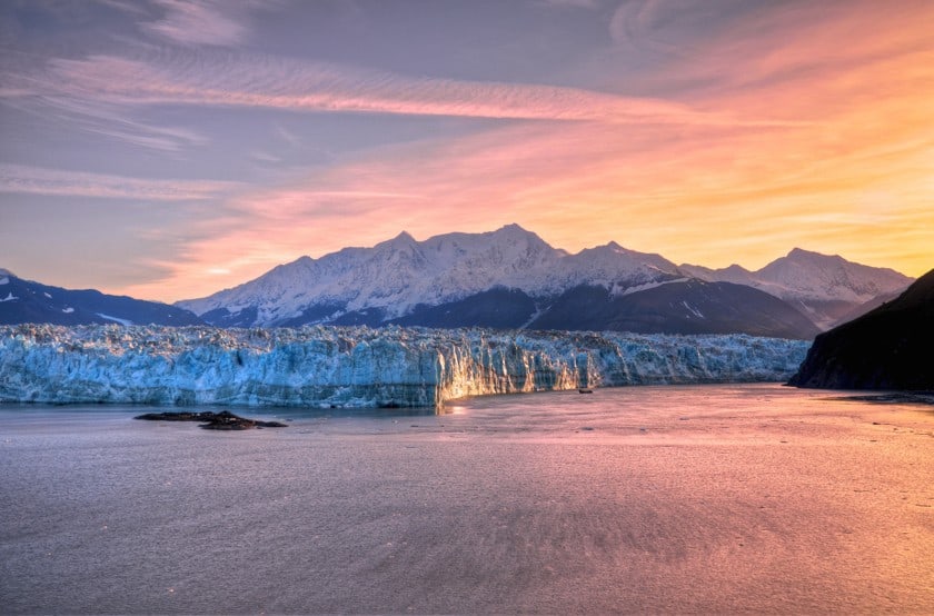
Yakutat is the starting point for kayaking and trekking trips, fishing trips and excursions armed with a camera in search of rare birds. One of the area’s biggest attractions, however, is the Hubbard Glacier. Thirty-five percent of the Wrangell-St. Elias’s area is covered by glaciers, but they are not all the same.

Hubbard Glacier (75 miles long and 6.8 miles wide) is the only one that is advancing rather than retreating, due to global warming. Higher temperatures, leading to more evaporation, resulting in more precipitation in some areas. One of these is the St. Elias Mountains, where the rain turns to snow at high altitudes and constantly feeds the ice sheet below.
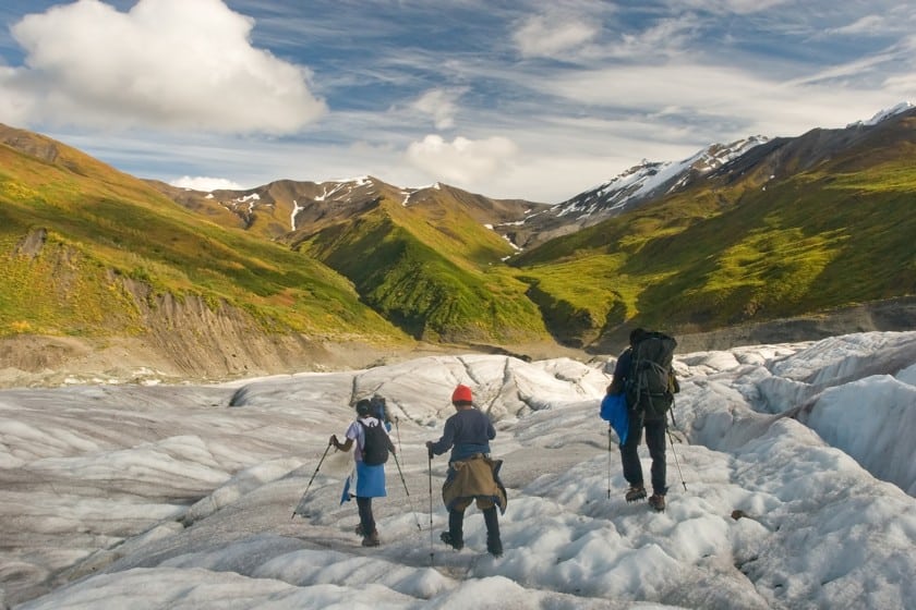
From Yakutat, there are visits to the Hubbard Glacier both by boat, following the coastline in the terminal part, and by plane to fly over it. There are also tourist flights on other glaciers of the park, but to explore them by land you must rely on local guides and rangers.
The park trails
Compared to other national parks, Wrangell-St. Elias is wilder, especially in the interior, due in part to the vastness of its terrain. This makes it more difficult to maintain all the trails through its forests and up the high mountain peaks.
Moreover, don’t forget that bears are the masters of these forests: in order not to run risks, always check with the rangers before going on an excursion. If it is the first time you visit this area, the advice is to trek only on the paths closest to the park boundary or to the two roads that cross it, so as not to run into any danger.
- Trails near Copper Center. Near the western boundary of the preserve, there are several short hikes possible. The Boreal Forest Trail and the Copper River Bluff Trail are two short trails, each less than 0.6 miles long, that provide views of the Wrangell Mountains and the Copper River, respectively. You can find descriptions of these and other trails in the area on this page.
- Trails near McCarthy Road. If you visit the park, you’ll likely reach Kennecott and thus have the opportunity to take a nature hike in this area. Root Glacier / Erie Mine Trail is a fairly easy trail that starts in Kennecott and follows the glacier. The hikes are more strenuous, also from Kennecott, on the Jumbo Mine Trail and the Bonanza Mine Trail, but they are definitely scenic. You can find information on these and other trails in the area on this page.
- Trails near Nabesna Road. Several trails also branch off from Nabesna Road, allowing you to explore the northern area of the park. The Caribou Creek Trail is fairly accessible and offers breathtaking views. More strenuous, but definitely scenic is the Skookum Volcano Trail. If you’re looking for an old abandoned mine, you can instead take on the Rambler Mine Trail. On this page you will find information on these and other trails in the area.
Lodging in Wrangell St. Elias National Park
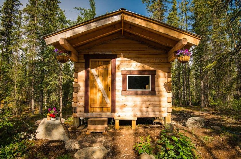
Staying overnight inside the park is nearly impossible. One of the few accommodations is the Blackburn Cabins in McCarthy: rustic lodgings in log cabins, with shared bathrooms and the ability to cook and use bicycles to get around the area. It is much easier to find accommodation around the natural area.
West area (between Glennallen and Copper Center):


- Antler’s Rest Bed and Breakfast. Near Glennallen, this wilderness property is perfect for those who want to savor the park lifestyle while staying within walking distance of civilization.
- Copperville B&B. Between Glennallen and Copper Center, we come across this simple yet comfortable accommodation, perfect for setting off on the hiking trails of this area.
- Sawing Logzz Bed and Breakfast. Close to Copper Center, it is in a great location for venturing into the park. The delightful log cabins are fully equipped and in addition to a hearty continental breakfast, you’ll be able to take advantage of the barbecue to make summer dinners unique.
- Klutina Kate’s B&B. Another charming B&B in Copper Center, located in an excellent position for accessing the trails and services of the area.
North area (between Chistochina and Slana):


- Gakona Lodge. Breakfast, bar and restaurant: this lodge is equipped with all facilities and is well located for the various park entrances.
- Hart D Ranch. Old-fashioned furnishings and farm animals characterize this lodging, just a short walk from the park entrance in Slana. An ideal place to stay if you plan to take on the Nabesna Road.
- Fox’s Den Cabin. Accommodation in a cabin, located in an area completely surrounded by nature along the Nabesna Road.