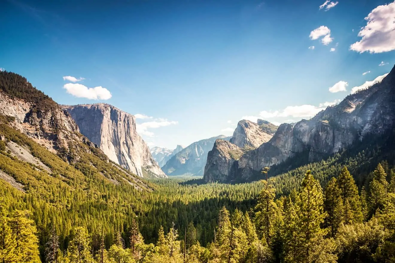
Covering an area of just over 1158 mi², Yosemite National Park is really hard to visit exhaustively, especially if you’re short of time and haven’t made up your mind yet. Just in the Yosemite Valley, there are a dozen or so trails scattered throughout the area. But which one is the right one for you?
Not all of us have the same physical fitness required for some very long and tiring hikes, and we do not all know which view is the most beautiful to see or how much you have to sweat to get there! It would be nice to be able to park your car and know exactly where to go, without wasting an ounce of precious time needed for road trips! Therefore, here is an article that will help you choose the Yosemite Valley hiking trails that are best for you.
Contents
- Bridalveil Fall Trail
- Lower Yosemite Fall Trail
- Cook’s Meadow Loop
- Mirror Lake Trail
- Snow Creek Trail
- Yosemite Valley Loop Trail
- Vernal Fall and Nevada Fall Trails
- Four Mile Trail
- Half Dome
- Map of Hiking Trails in Yosemite
- Do’s and Don’ts on the Trail: General Information and Advice
- Yosemite Valley Hiking Tours
Bridalveil Fall Trail
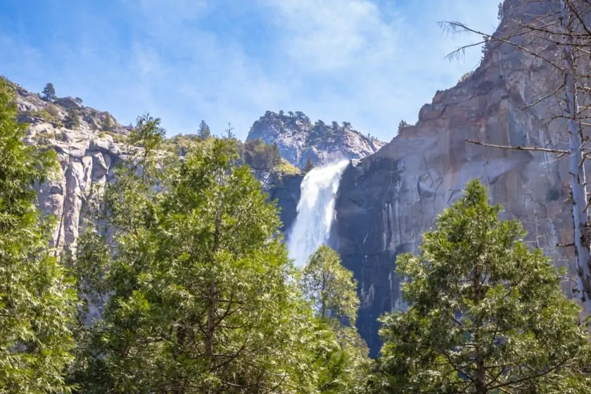
- Length: 0.5 mile
- Elevation: 80 ft
- Difficulty: Easy
- Duration: 20 minutes
Starting from the Bridalveil Fall Parking Area (accessible from the Wawona Road, as you can see from this map), after a short and agile walk, you will reach the beautiful Bridalveil Falls. The best time to see them thundering at full force is in spring and early summer.
Lower Yosemite Fall Trail
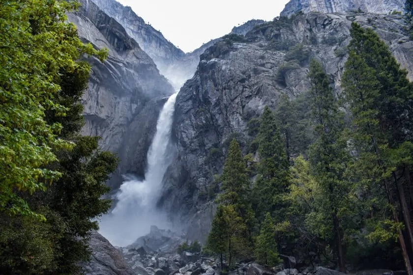
- Length: 1 mile
- Elevation: 50 ft
- Difficulty: Easy
- Duration: 30 minutes
This easy trail is a loop that you’ll finish in half an hour; it’s called Lower Yosemite Fall Trailhead (trailhead at shuttle bus stop #6, not far from Yosemite Village) and will take you below another famous Yosemite waterfall. The best time to visit the waterfall is in the spring. If you go in the summer you may find the waterfall dried up or it may be very small. For more information about this waterfall and how to walk the trail read my article on Yosemite Falls.
Cook’s Meadow Loop
- Length: 1 mile
- Elevation: None
- Difficulty: Easy
- Duration: 30 minutes
Start this trail at shuttle stop #5 or #9 near the Yosemite Valley Visitor Center. It is a loop and, on this trail, you will be near some beautiful views of Yosemite Falls, Half Dome, Glacier Point, and Sentinel Rock.
Mirror Lake Trail
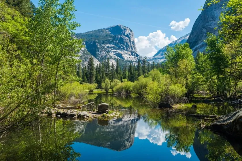
- Distance: 2 miles
- Elevation: 100 ft
- Difficulty: Moderate
- Time: 1 hour
You’ll start walking near shuttle stop #17 (near Curry Village parking lot), and it is here that the Mirror Lake Trail begins. It is a flat but slightly longer route than the previous ones. You’ll arrive at the shores of Mirror Lake, which you can also walk around (keep in mind it’ll add a couple of hours to the hike), but you can also settle for the wonderful views you’ll enjoy from the shore.
Snow Creek Trail
- Distance: 9.4 miles
- Elevation: 2,700 ft
- Difficulty: Difficult
- Time: 6-7 hours
If you have walked the Mirror Lake Trailhead and want to keep going, you can continue your hike along the Snow Creek Trail, in the heart of Tenaya Canyon, where you will have the opportunity to enjoy the many impressive views of the park’s large granite formation (Half Dome, Quarter Domes, Clouds Rest).
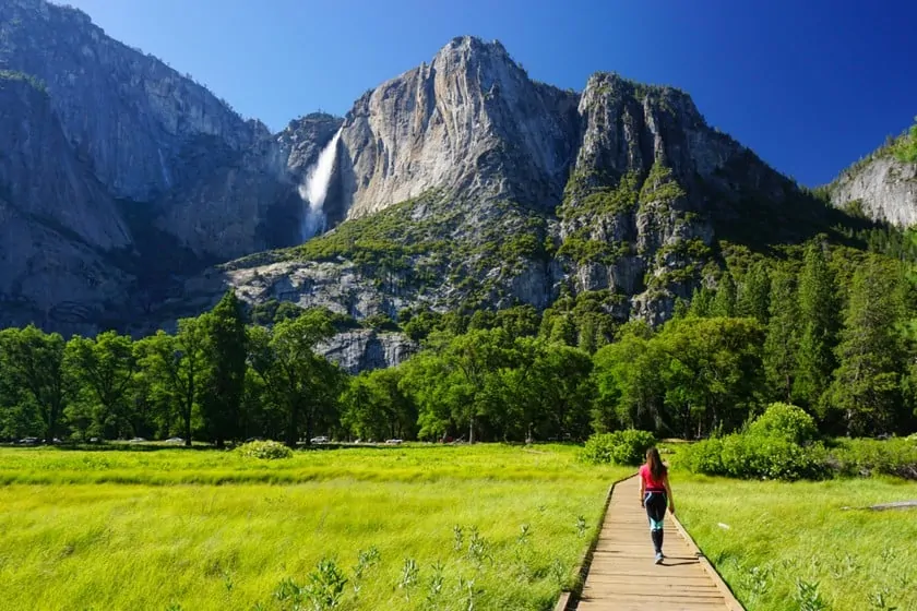
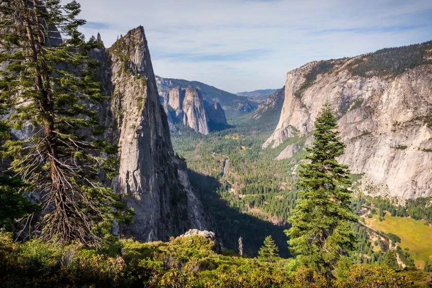
Yosemite Valley Loop Trail
- Distance: 11.5 miles
- Elevation: None
- Difficulty: Medium
- Time: 5-7 hours
You’ll start walking at shuttle stop #6 (Lower Yosemite Fall), where you’ll take a solo, medium-length hike along the Merced River, which features some of the most fascinating viewpoints this area of the park has to offer. There are many small trails to follow that split from the main one – bring your map so you don’t get lost. There is a chance to cut the length of the trail in half if you head back about halfway.
Vernal Fall and Nevada Fall Trails
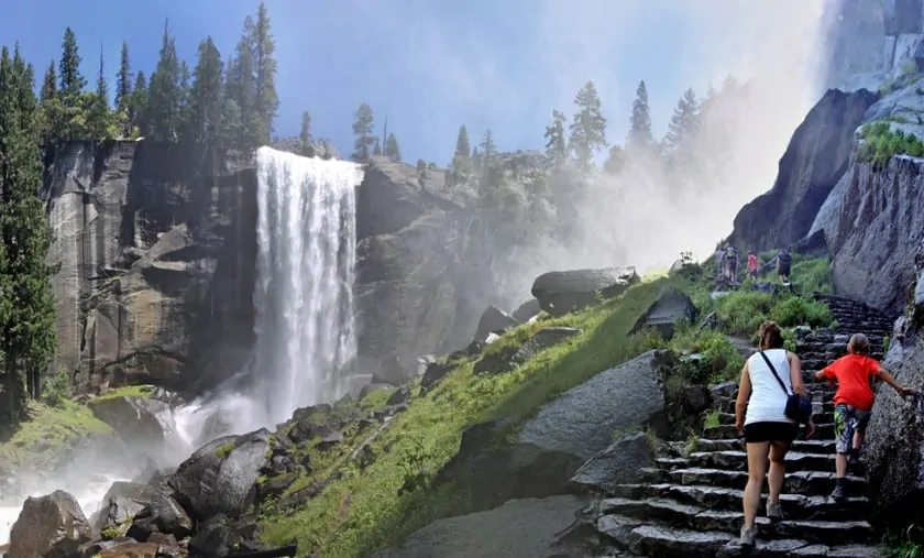
Vernal Fall Footbridge
- Distance: 1.6 miles
- Elevation: 400 ft
- Difficulty: Medium
- Time: 1-1.5 hours
If you want to get to the top of the Vernal Fall
- Distance: 2.4 miles via Mist Trail
- Elevation: 1000 ft
- Difficulty: Difficult
- Time: 3 hours
If you want to continue on the path towards Nevada Fall
- Distance: 5.4 miles via Mist Trail
- Elevation: 2000 ft
- Difficulty: Difficult
- Time: 5-6 hours
Vernal Fall and Nevada Fall are two breathtaking waterfalls. Departing from shuttle bus stop #16 (Happy Isles, a 10-minute drive from the visitor center on Southdrive Road), depending on your preparation and time, you can choose from three “difficulty levels”. Consider that the climb to Nevada Fall along the Mist Trail is very long, and the elevation reaches 2000 ft. You can also stop at the base of Vernal Fall and go back. Even the view from there is not disappointing.
If you wish, you can also take a guided hike. You can find all the info at the link below:
Yosemite Mist Trail and Vernal Fall Hike
Four Mile Trail
- Distance: 4.8 miles
- Elevation: 3,200 ft
- Difficulty: Difficult
- Time: 6-8 hours
Do you want to get to the top of the famous Glacier Point and see an incredible view from there? This hike is for those who are not content simply to visit Yosemite, but who want to get the full experience. Begin the arduous Four Mile Trailhead on Southside Drive in Yosemite Valley. The start of the trail is well marked. Attention! This trail is only accessible from May until the end of the summer.
Half Dome
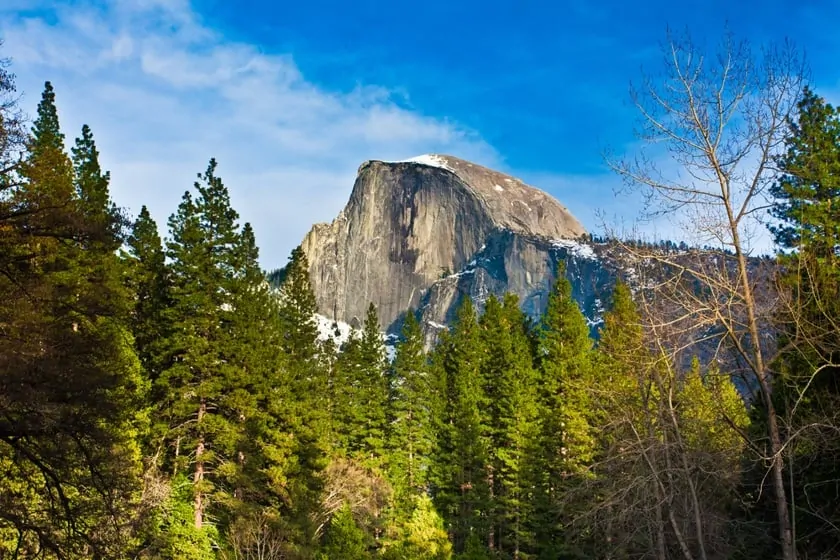
- Distance: 14 – 16.4 miles
- Elevation: 4800 ft
- Difficulty: Very difficult
- Time: 10-12 hours
Half Dome deserves an article all to itself; it is the forbidden dream of all daring hikers, but it requires a lot of attention and preparation, as well as a special permit for the final part of the hike, where it is necessary to use cables for the ascent. For more detailed information, please refer to this article.
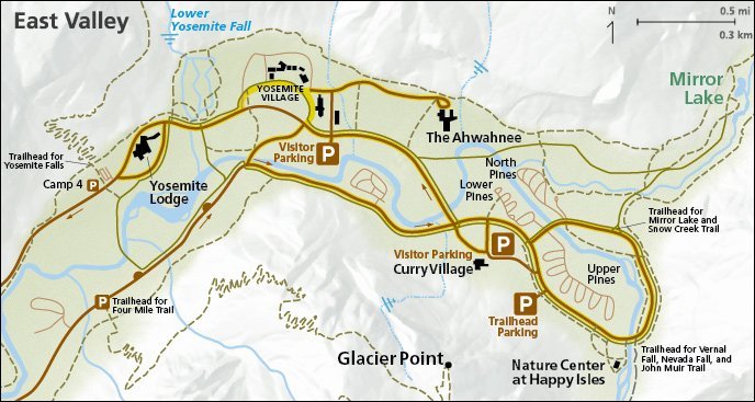
Map of Hiking Trails in Yosemite
To help you get your bearings, here is a map with all the access points of the paths mentioned so far.
Do’s and Don’ts on the Trail: General Information and Advice
- Stay on the marked trails, respecting the environment and wildlife;
- If you are wondering about the conditions of the trails in the Yosemite valley, please contact the rangers of the visitor center;
- Use clothing suitable for hiking in the mountains;
- Bring your own water and food, adapted to your needs and the type of hike;
- Use bicycles only on cycle paths;
- Always take your trash back with you if you can’t find trash bins;
- Smoking is forbidden on the hike. Smoke only in areas where it is permitted.
Yosemite Valley Hiking Tours
If you want to minimize time and the stress of planning in the Yosemite Valley, you can take advantage of the many Yosemite tours available. You’ll find a variety of tours departing from San Francisco or directly from the park.