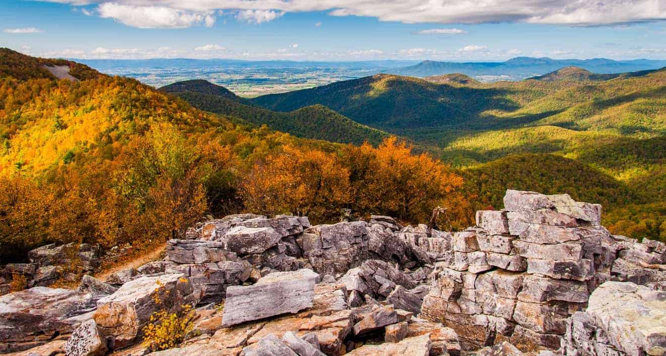
Perhaps a few of you have heard of Pinnacles National Park. In fact, this small park in the mountains is not as famous as Yosemite, Sequoia and other national parks in California, but for this very reason it is perfect for those who want to dive into a hidden corner of the Golden State without risking finding the “busy” nature trails.

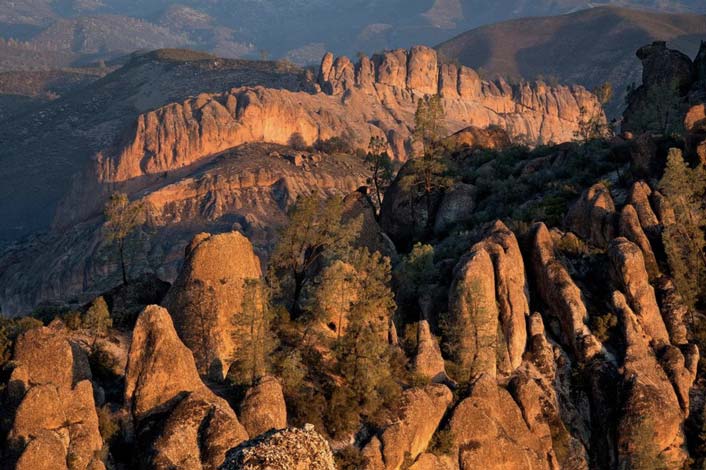
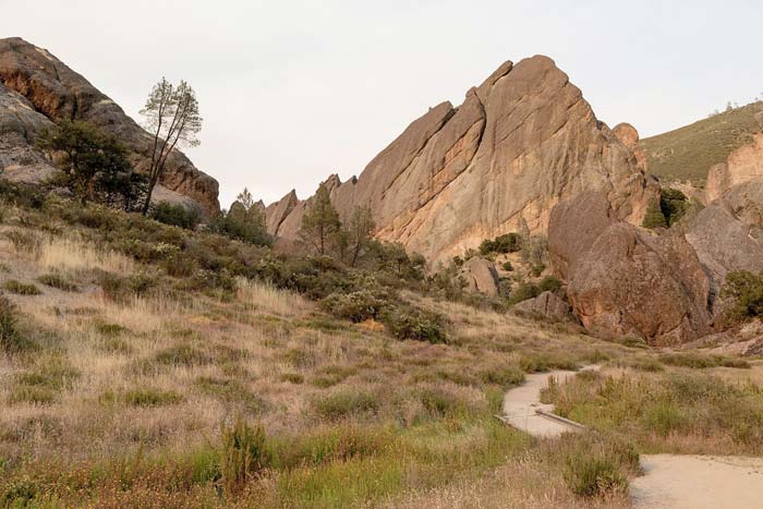
In addition to the relative peace and quiet that can be found when visiting Pinnacles National Park, you have the opportunity to see a unique landscape typical of these area. Along the various paths available you can lose yourself in a natural labyrinth of caves, tunnels, pinnacles and rocky spires of volcanic origin.
You can also find rare and shy animals such as bats and condors, as well as some shrubs, plants and flowers typical of chaparral. The vegetation is similar to that of the Mediterranean maquis and is typical of this Californian area, with its short and bushy plants.
In this article, I want to give you some more specific information on how to get to Pinnacles National Park in California and its hiking trails and views.
Contents
How to Get to Pinnacles National Park: East and West Entrance
Pinnacles National Park has two entrances, one on the west side of the park and another on the eastern side. Keep in mind that the two sides of the park are not joined by the same street, so you’ll have to choose one.
- East Side: The Pinnacles Visitor Center is the main entrance to the park. To get there, turn off of the pleasant and green Highway 25, which passes through the golden hills dotted with vineyards, farms, and the gorgeous wineries of Paicines and San Benito. The entrance to CA-146 W (Pinnacles Highway) is well marked by classic brown signs. After a couple of miles, you will arrive at the Pinnacles Visitor Center. This access is open 24 hours a day. In general, I recommend that you access the park via this entrance.
- West Side: On the western side of the park, instead of a visitor center, there is the Pinnacles Visitor Contact Station, open only from 7:30 am to 8:00 pm. You can reach this entrance to the park by getting on CA-146 E in Soledad, a nondescript town on Highway 101, one of the roads leading from Los Angeles to San Francisco. You have to drive on this road for 10 miles before reaching the barrier, and another 2.5 miles to reach the last available parking slot before the trails.
It can happen that travelers, to reach San Francisco from Los Angeles or vice versa, are forced to forego the much more scenic Pacific Coast Highway, which is sometimes closed for construction, and instead cross the US-101. Therefore, there is more reason to take a short detour to Pinnacles National Park and to enjoy exploring it.
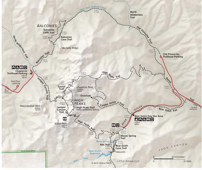
Pinnacles National Park Trails
The best way to visit Pinnacles National Park is on foot. It does not have the typical scenic drive to drive to see the best viewpoints. So wear comfortable clothes and hiking shoes, bring plenty of water and hit the trails.
East Side
Balconies Cave / Balconies Cliff

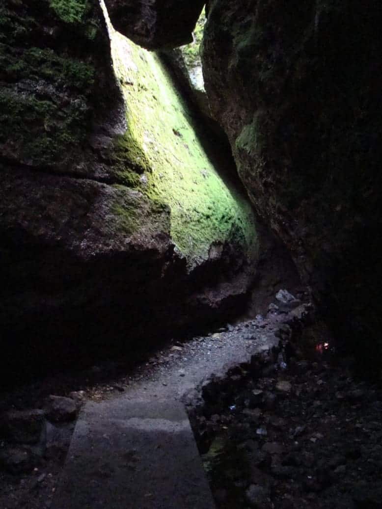
An excursion that presents many of the typical attractions of this park. The trail begins at the Old Pinnacles Trailhead Parking Lot, runs along the giant cliff with its beautifully orange Machete Ridge and then enters the Balconies Cave, at the junction with the Balconies Cliff Trail. A torch is necessary to find your way inside the caves, since some passages are not illuminated by sunlight. If you are claustrophobic, you should avoid this hike!
At the end of the trail, you can either go back the way you came or by taking the Balconies Cliffs Trail. This other route requires more effort, because the trail has a greater elevation gain, but you can enjoy some wonderful views of the rock formations that hug the trail. In this case, you should also add at least 2.4 miles to the total distance.
- Distance: 2-5 miles
- Difficulty: Moderate
High Peaks / Condor Gulch Loop
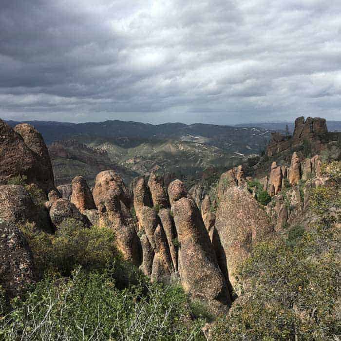
This trail – starting from the Bear Gulch Day Use Area Parking Lot – is very demanding, but those who have the perseverance, determination and preparation to do it will see some exceptional views of Pinnacles National Park, as for most of the hike you walk on the ridge, enjoying breathtaking views. The High Peaks Trail itself has a considerable elevation gain (1969 ft) with passages not recommended for those who are afraid of heights, but along a route, you can see peculiar pinnacles that are really worth all the effort there is to do. The return route is along the Condor Gulch Trail. In particular, the view from the overlook of the same name is notable. If you are lucky, you can also see the California condors circling high on the pinnacles.
- Distance: 5.4 miles
- Difficulty: Difficult
Moses Springs Trail / Bear Gulch Cave
In Pinnacles National Park, there is also a large colony of bats, normally found inside the Bear Gulch Cave. For obvious reasons, to ensure the safety of the animals, this cave is closed for a few months during the year (click here to see the period of closure). From the parking lot of the Bear Gulch Day Use Area it is possible to go on an easy trail, the Moses Spring Trail, which takes you through these caves (called talus caves) and remarkable rock formations and ends at a small lake.
- Distance: 2.2 miles
- Difficulty: Easy / Moderate

West Side
Balconies Cave
If you like the idea of visiting the Balconies Cave but can’t get to the East Side, you can also do it from the West Side of Pinnacle National Park, and more precisely from Chaparral Trailhead Parking Lot, practically the only one available on this side of the park. In this case, however, there is no loop. You’ll have to retrace your steps to get back to your car, unless you want to extend the hike further by taking the Balcony Cliff Trail.
After a stretch through the chaparral shrubs, the trail passes under the impressive Machete Ridge and goes through unusual passages between small caves, bottlenecks and tunnels formed by bizarrely shaped monolithic rocks.
- Distance: 2.4 miles
- Difficulty: Easy / Moderate

Pinnacles National Park Map
Where to Stay When Visiting Pinnacles National Park
If you like camping, keep in mind that there is a campground (it has a swimming pool) is located on the east side of the park. Since there are no hotels within the park, you will need to look in the nearby towns:
- King City (East side): Accommodations
- Hollister (East side): Accommodations
- Soledad (West side): Accommodations