Las Vegas is a kaleidoscopic city. The lights and colors are the main visual effects in an eccentric and somewhat disturbing context of tacky architecture. Let’s face it, it is impossible not to feel a constant flow of contrasting sensations, of amazement, dizziness and amusement. After all, it is difficult not to be captivated by the charm of this city even for a short time.
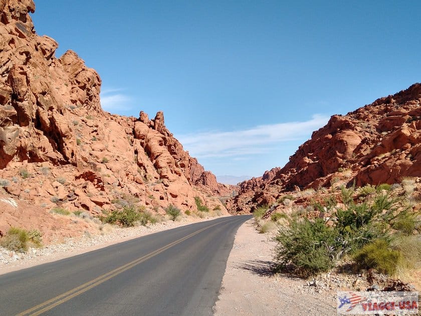
However, after a few hours, you can feel the itch to get back on the road to discover another kind of exhibition of colors that is much more fascinating, that of the Mojave Desert. No more than 55 miles from Las Vegas (Nevada), you can visit Valley of Fire, a state park that, with its rock formations with an incredible color palette, with red, white, yellow, gray and pink, that will make you forget the sparkling sea of artificial lights of Las Vegas.
This park can also be visited as part of a road trip while traveling from Las Vegas to Bryce Canyon or, more simply, to Zion, which is also closer. If you have a little bit more time on your hands, plan at least 2-3 hours in the park. You’ll discover a hidden gem of Nevada and may falling in love with it! So here’s what to do in the Valley of Fire.
Contents
- Where is Valley of Fire and How to Get There
- Valley of Fire State Park Entrance Fee and General Info
- Valley of Fire Scenic Drive: Two Stunning Byways Not to be Missed
- Valley of Fire Hikes: Best Trails
- How Much Time Should I Spend in the Valley of Fire?
- Lodging Near Valley of Fire: Where to Stay?
- Valley of Fire Tours
Where is Valley of Fire and How to Get There
 As we have already mentioned, this beautiful valley full of spectacular trails and Native American artifacts, is not far from Las Vegas.
- Coming from Las Vegas, you will have to take Interstate 15 N and drive north for 32 miles, until exit 75. Then you will drive another 20 miles down the road towards Valley of Fire/Lake Mead to West Entrance Station. At that point you will begin to see the beautiful red rocks scattered across the desert. The journey time is about 1 hour.
- You can also follow a scenic route within the Lake Mead Recreational Area, leaving Las Vegas via the NV-147 to the NV-167 (Northshore Drive) to the East Entrance Station. In this case the travel time is approximately 1 hour and 40 minutes for a distance of approximately 68 miles.
- Coming from St. George, just follow Interstate 15 southbound to Exit 93. Then take the NV-169 S/N along the Moapa Valley in the direction of Lake Mead, then after Overton turn right at the signs for the Valley of Fire. The East Entrance Station is just a few miles further. The distance is 93 miles, the journey time is about 1 hour and 40 minutes.
Valley of Fire State Park Entrance Fee and General Info
The price of admission to the park is $15 per car ($10 for NV vehicles). Remember it’s a State Park, so you won’t be able to use America the Beautiful Park Pass. If you are planning on camping, please note that it is possible to stay overnight in the authorized areas at the price of $25 per night ($20 for NV vehicles) + $10 per night for connections.
The Valley of Fire is characterized by a desert climate, so it is definitely not advisable to venture along the paths during the hottest hours of the day, especially during the summer months. I advise you to bring a lot of water and to bring suitable clothing for hiking. It is also strictly forbidden to stray from the marked paths and to climb up the rocks. You can go to the visitor center for anything you may need.
Valley of Fire Scenic Drive: Two Stunning Byways Not to be Missed
 There are basically two scenic byways within the park, which divide it exactly into two areas, the Valley of Fire Highway (which cuts it horizontally) and Mouse’s Tank Road (which cuts it vertically).
Valley of Fire Highway
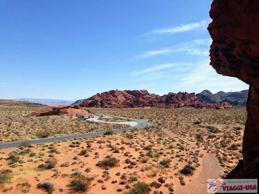
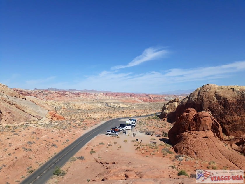
Let’s suppose you are coming from Las Vegas. Even just driving from west to east along the Valley of Fire Highway (which is the main road of the park) you can see up-close to some wonderful natural monuments and observation points that can be reached also by going on very short trails located near the main road. These are the things to see in order, which you can fin with the help of the map that you will be given at the entrance of the park:
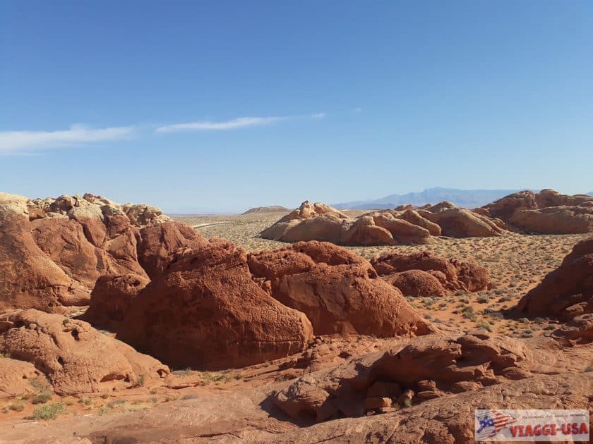
- The Beehives, striped and full of holes and with bizarre shapes. It will be the attraction you will find along the way, but it will exemplify a very common geological peculiarity in the park.
- Scenic Loop Road: On the left – 2.5 miles after the West Entrance and 1.8 miles before the fork with Mouse’s Tank Road – you will find a detour to the Atlatl Campground. The road is a very short scenic road that you can traverse in no time, stopping at two main attractions:
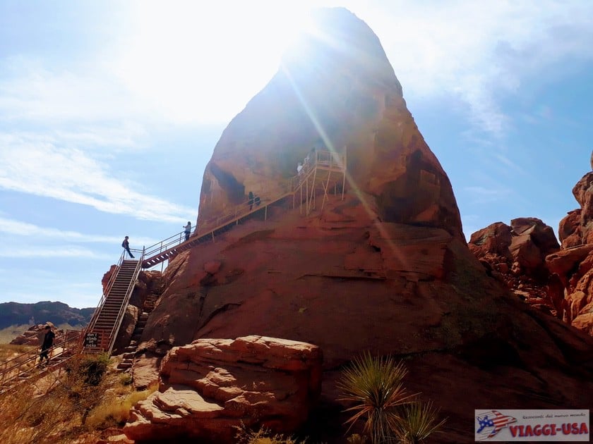
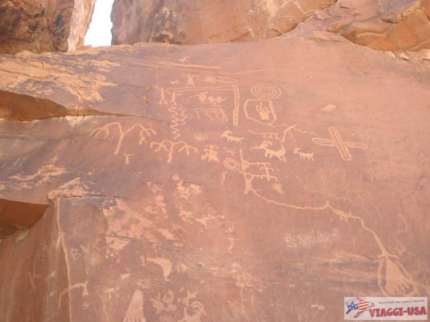
- Atlatl Rock: At the top of an iron staircase next to the parking lot you will find some petroglyphs, artistic inscriptions of Native Americans who resided this area.
- Arch Rock: A small arch of red rock on top of a red massif at the edge of the road.
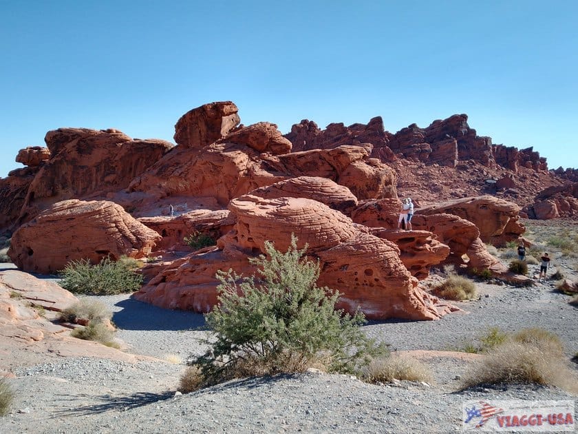
- The Seven Sisters, an imposing group of 7 rocks surrounded by desert sand. They are so spectacular that when we visited them, some Americans were having a wedding reception in the shade below of one of the sisters! You’ll find the parking lot 0.6 miles after the junction with Mouse’s Tank Road.
- The Cabins, ancient rock shelters built in the thirties for those who had to spend the night in the desert. Nearby there is a picnic area that you can easily reach by turning off the Valley of Fire Highway 1.2 miles after the Seven Sisters.
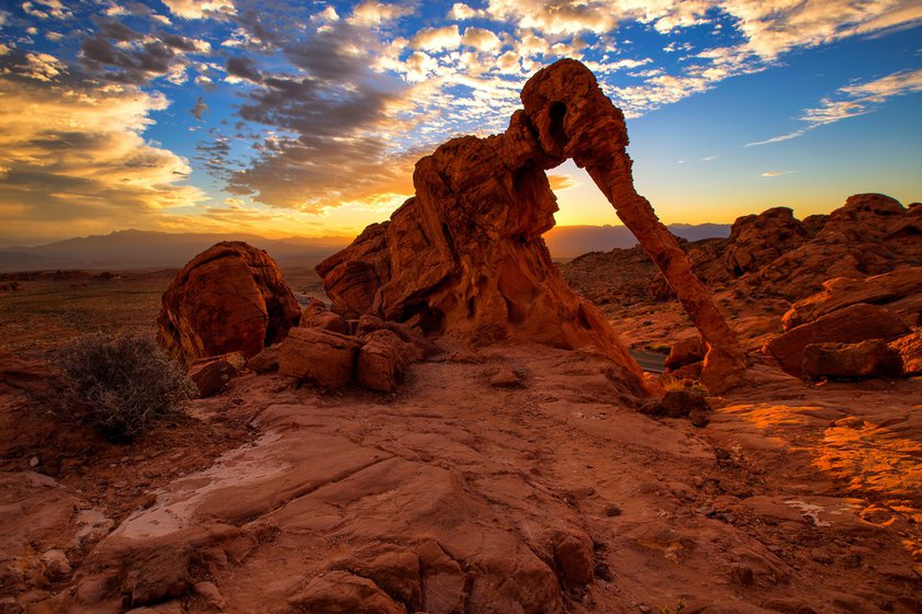
- Elephant Rock, one of the park’s landmarks, is located at the eastern end of the highway, right at the East Entrance toll booth. It is a rather unusual shaped rock, which may remind you of an elephant. Although it is close to the road there is also a specific trail that offers a better view of this rock formation.
Mouse’s Tank Road
 Shortly after the junction with Atlatl Campground, on the left you will see a sign for the visitor center, and it is precisely by taking this route that you will find yourself at the junction with Mouse’s Tank Road, the other scenic road in the park that you must see. Along this route you will find some panoramic viewpoints (I’ll list them below) and most importantly, the starting points of various trails, so I suggest you read the next paragraph.
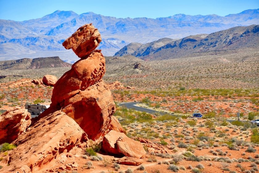
- Balanced Rock, the imposing rock formations are balanced in a very complicated way. You can also see them from the road, but you can also take a trail that begins at the visitor center parking lot to get a little closer.
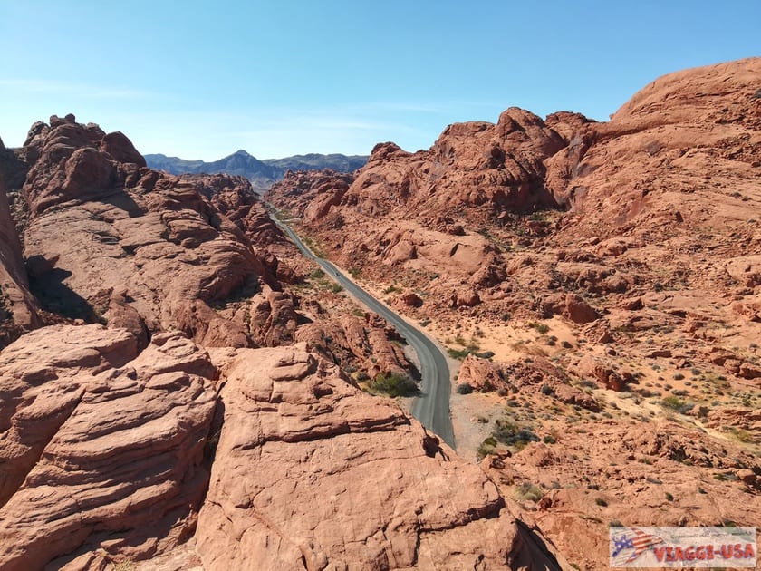
- Rainbow Vista: The first part of the road is remarkable, because goes uphill weaving narrowly between the reddish rocks. Unless you want to take the Mouse’s Tank Trail, as a first stop I suggest you to stop at Rainbow Vista, a viewpoint with a parking lot that offers the possibility to see all around a truly exceptional palette of colors. If you are careful, climb up the rock that runs along the road to get a 360-degree perspective still more beautiful.
- Fire Canyon Road: A few feet from the Rainbow Vista parking lot, turn right for a quick detour to Fire Canyon. You will soon arrive at a remarkable vantage point that highlights the contrast between the red hues of the Fire Canyon and the white of the Silica Dome. Star Trek lovers come here on pilgrimage because this is where Captain Kirk died.
Valley of Fire Hikes: Best Trails
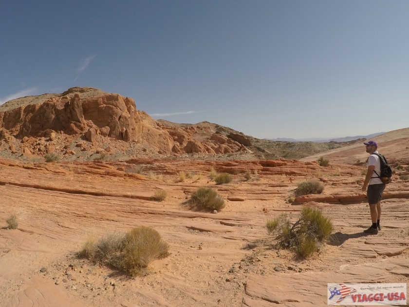 If you want to spend a little more time walking among the red rocks of the Valley of Fire, here are three quite simple trails that are highly recommended. We remind you to protect yourself from the heat. To give you an idea of climate, think of the famous, red-hot Death Valley!
Mouse’s Tank
- Length: 0.7 miles (Round trip)
- Elevation: 56 ft
- Duration: 20-30 minutes
- Difficulty: Easy
Shortly after the visitor center, along the road of the same name, you will find where the Mouse’s Tank Trail starts, which is also known as Petroglyph Canyon Trail. Along the quick trail that leads into this secret and fascinating natural basin you will find some examples of petroglyphs, ancient rock carvings of Native Americans.
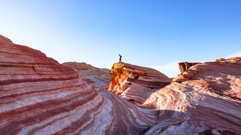
Fire Wave Trail
- Length: 1.5 miles (Round trip)
- Elevation: 246 ft
- Duration: 30 minutes
- Difficulty: Easy
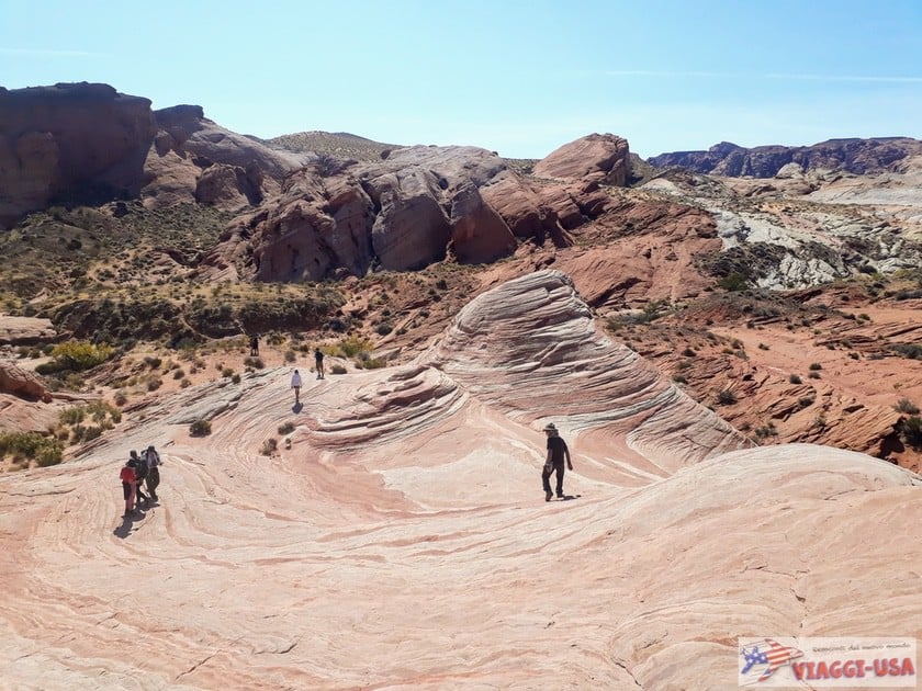
The Fire Wave Trail is one of the most famous trails. It is a simple trail that leads to one of the best-known natural wonders of the park, the Fire Wave, an expanse of smooth sandstone characterized by wavy red and white stripes. When we were walking along the final part of the trail, on smooth rock, we also met a couple of bighorn sheep. From above you can also see the last segment of the Pink Pastel Canyon, which you can take as an alternative way to end the route (see Seven Wonders Loop). The Fire Wave Trail starts along Mouse’s Tank Road, at parking lot 3.

White Domes Loop
- Length: 1.1 miles (Loop)
- Elevation: 174 ft
- Duration: 30-40 minutes
- Difficulty: Easy-Moderate
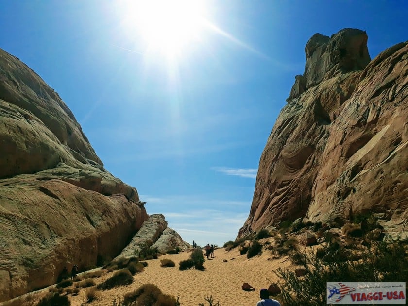
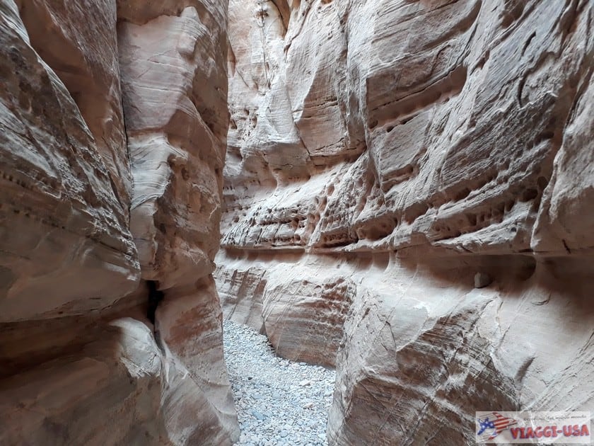
You’ll reach the trailhead along the entire Mouse’s Tank Road to the end, where there is a large parking lot with restrooms. From the level of the road you start to descend between the white rock walls until you reach a larger space from which you can admire the white domes typical of this area of the park. The second part of the trail starts with a beautiful slot canyon and as you continue you will see views and unusually shaped rocks until you reach the parking lot. The White Domes area was used as a film set for a famous 1966 western film (The Professionals), and there are still some remnants halfway along the trail.


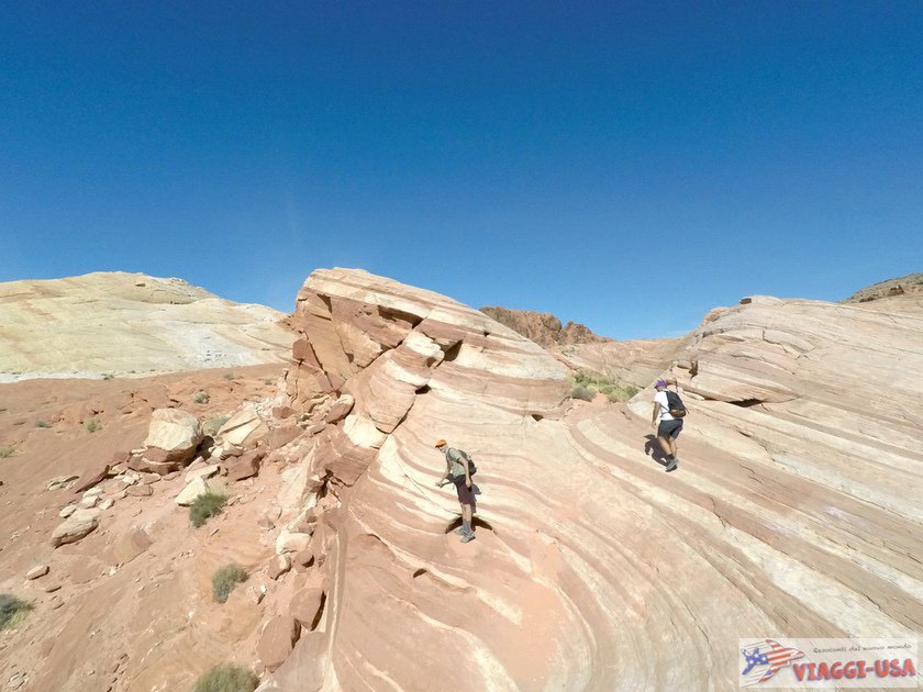
Seven Wonders Loop
- Length: 1.86 miles (Loop)
- Elevation: 213 ft
- Duration: About 1 hour
- Difficulty: Moderate
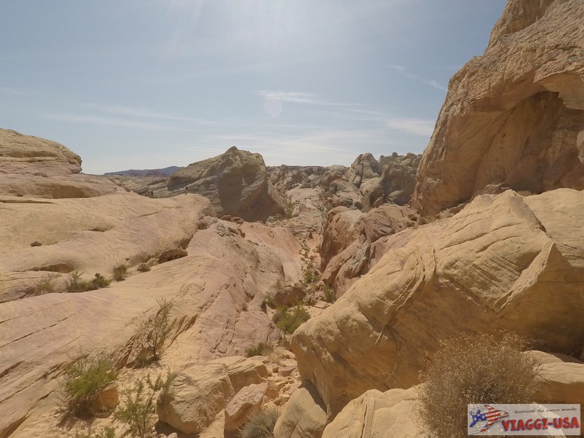
This trail is a gem that few people know about, especially because it is not included in the maps offered by the park rangers. It is basically an alternative way to reach Fire Wave, following a loop trail starting from the P3 parking lot. Instead of starting the Fire Wave Trail on the other side of the road, you will have to descend along the path that starts directly from the parking lot in the opposite direction. The path is not marked but it is quite easy to follow. Along the trail you will find some unique multicolored rock shapes, such as the “skull” Fire Cave, the Thunderstorm Arch and the bizarre and colorful Crazy Hill (click on the relevant links to see the location on Google Maps).
On the trail you’ll arrive at a fork (here’s the point on Google Maps) and you’ll have to go left, because if you go right you’ll rejoin the White Domes Loop (where the remains of the film set are located) via the impressive Kaolin Wash (which may be worth a short detour, in any case!). If you follow the path correctly, you’ll find yourself crossing Mouse’s Tank Road at some point. Across the road is the entrance to Pastel Pink Canyon, a short but stunning pink canyon. If you follow the path you will arrive practically under Fire Wave. From there just follow the trail back to the parking lot.
Other Paths for Those Who Have More Time
- Old Arrowhead Trail is a 6.8 mile-long trail that runs parallel to the main road. You can start it after a few miles from the west entrance, just before you see the Beehives parking lot;
- Prospect Trail is one of the most difficult trails in the park, not so much because of the length of the trail (4.6 miles), but because the elevation exceeds 656 ft between the rocks, which wouldn’t be too long if it wasn’t so hot. The trail starts from the Valley of Fire Highway (see here) and rejoins the White Domes Loop, which we talked about earlier.
How Much Time Should I Spend in the Valley of Fire?
 As it was already mentioned at the beginning of the article, it depends on what kind of stop the Valley of Fire is for you.
- If you are passing by on your way to the next stop and need to get there as soon as possible, you can also simply take the two scenic roads with a few stops at the “roadside attractions” indicated above and also take the short side roads (Scenic Loop Road in Atlatl and Fire Canyon Road). This will take you about 1 hour.
- If you have a couple of hours, in addition to the drive I suggest you to do at least two trails. One is the Mouse’s Tank Trail and then you may choose between the Fire Wave Trail and the White Domes Loop.
- If you have 3 or more hours, enjoy the drive stopping at the various recommended landmarks and go along Mouse’s Tank Trail, Fire Wave Trail and White Domes Loop. If you have more time left, take the Seven Wonders Loop.
Lodging Near Valley of Fire: Where to Stay?

The accommodations you select certainly depend on your itinerary, but Las Vegas is a rather logical place to look, whether you have to start your tour of the parks or you’re near the end of it, with the Valley of Fire as the final stop. The number of hotels in Las Vegas is infinite, so please take a look at our tips below.
Tips for where to stay in Las Vegas
If you are going to Zion or the other parks of Utah, the most logical solution is St. George, in Utah. Take a look at the links below to read our guide for accommodations.
If you are looking for accommodations in the immediate vicinity of the park, I suggest you consider one of the two small towns, either Overton or Mesquite, where there is definitely more choices of hotels. Try searching the links below:
Valley of Fire Tours
As we have said before, the most common way to visit Valley of Fire is coming from Las Vegas, due to its proximity. In addition to a self-guided tour, there are various organized tours and guided tours to choose from. There is a variety of tours and prices. You can find the information at the link below: