Zabriskie Point is one of the most emblematic places in the Southwest, yet not everyone who travels to the West Coast knows where it is or how to get there. Well, since Zabriskie Point is one of the panoramas that has stayed in my mind since I visited California, I decided to write an in-depth article dedicated to one of the most unforgettable wonders of Death Valley: Zabriskie Point!
Contents
Where is Zabriske Point?
As I already said, Zabriskie Point is located in Death Valley, one of California‘s best known national parks. To visit it, you’ll need to travel to Death Valley, use the map they’ll give you at the park’s entrance and drive to the viewpoint. Zabriskie Point is located just 4.5 miles from the Furnace Creek Visitor Center, one of the rare oases in this fiery desert and an important landmark for visiting most of the natural attractions in Death Valley.
Zabriskie Point Map
How Do You Get There?
 You will have heard about the unbearably high temperatures that characterize Death Valley, with lows above 86° F in July! (you can read more in our article on the weather in Death Valley) … don’t panic, you don’t have to worry, there’s no need to walk much! Zabriskie Point can be reached easily by car. Just below the observation point, there is a parking lot where you can leave your vehicle. You will take a short walk (only 5 minutes, but still under the scorching sun) uphill, and you will find yourself in front of the incredible landscape.
If you’re coming from Furnace Creek:
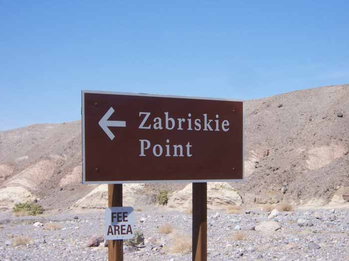
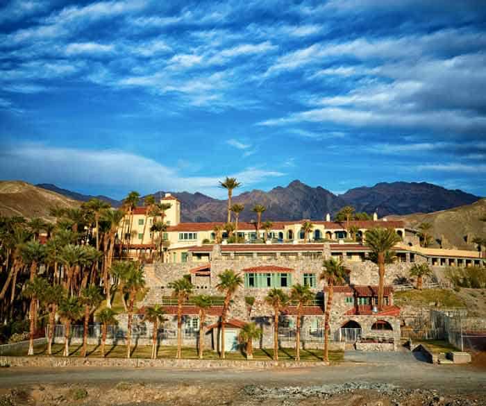
- As you leave the green oasis behind you, head south on CA-190 E. At the first fork in the road, just go straight ahead. After a while, you will see a hotel on your left, The Inn at Death Valley. Continue on the same road for about 4 miles until you reach a brown sign that will show you where to go. You will immediately see both the parking lot and the uphill path to the observation point.
If you’re coming from Las Vegas
- There are at least two routes to this part of Death Valley from Las Vegas. Which one is the fastest? You have to take US-95 N to Amargosa Valley. From here continue until Death Valley Junction, where the road to Death Valley National Park is indicated, the aforementioned CA-190, which you will have to take in the opposite direction to Furnace Creek. From Death Valley Junction, it takes about 25 minutes to reach Zabriskie Point.
- From Las Vegas, you can also reach Death Valley Junction via another road, NV-160 W, which passes through the small town of Pahrump, where you will still find hotel-casinos you thought you had left behind in Las Vegas. I suggest you refuel here, because gas is a bit cheaper and there aren’t many gas stations in Death Valley. Also, this road is perhaps a little more scenic than the other. After Pahrump you will see a sign for Death Valley, where you will turn left and follow the road to Death Valley Junction. From here, you know the way!
What Can You Expect?
 First of all, I reiterate that you should not expect a mild climate. I have already mentioned to you the high temperatures that characterize this area. In order not to be overcome by the heat, you must limit the time you stay out of the car (considering the short walk, I personally recommend no more than 15-20 minutes), especially in the summer months. Always bring water and appropriate clothing.
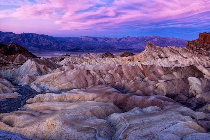
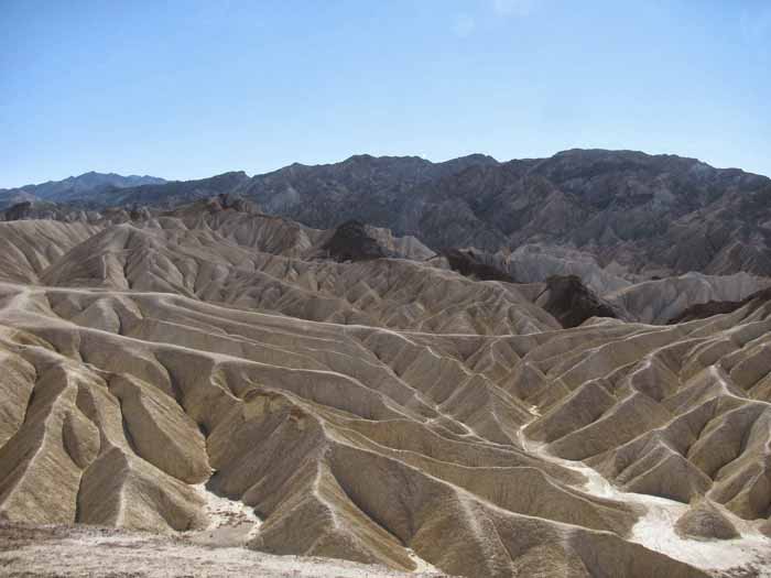
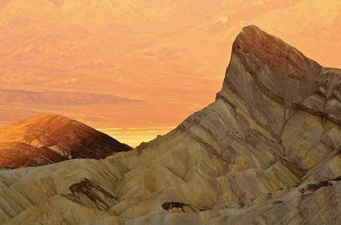
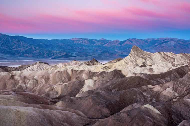
To better understand what to expect from the remarkable Zabriskie Point, just skip directly to the photo gallery, which displays the geological peculiarity of the landscape. As soon as you climb to the top of the hill to the overlook, you can see a desert expanse streaked with rock gullies formed by gravel, saline sediments and volcanic ash residue.
An ancient geological history…
 But how did this strange, alien landscape form? Let’s go back a few million years, when the whole area of Zabriskie Point (later called Furnace Creek) was covered by a lake. Salt deposits, borate minerals, gravel deposits from the surrounding mountains and volcanic remnants accumulated on the lakebed.
The geological changes subsequently caused the lake to dry up. As a consequence, these strange gullies have emerged and the erosion caused by the elements has given the gullies the shapes we observe in the present day. The dark yellow patina that covers them is an effect created by the lava that has submerged them during the numerous eruptions that occurred over the millennia. The highest peak is called Manly Beacon.
Movies and Music: Zabriskie Point in Pop Culture

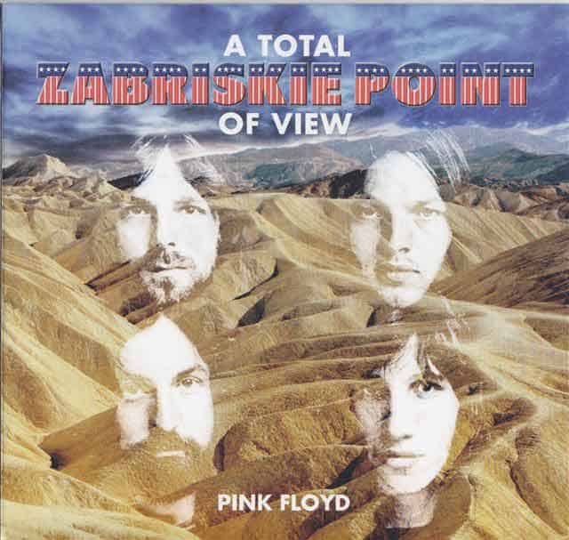
The scenery of Zabriskie Point has inspired many writers, artists, directors and musicians, and not all of them were American. French philosopher Michael Foucault was right to say that the vision of Zabriskie Point was the most important experience in his life. The most striking example of art inspired by Zabriskie Point is Michelangelo Antonioni‘s controversial feature film entitled Zabriskie Point, a film that tells the story of the fleeting love story between Mark and Daria, set during the student protests in California in the 1970s. The soundtrack also includes some Pink Floyd songs, of which one plays in the background during the famous final scene in slow-motion (see photo in the gallery) called Come In Number 51, Your Time Is Up.

In addition to this important cinematographic work, the arid territory of Zabriskie Point was used as a setting for some scenes of the film Spartacus (1959) and for the film Robinson Crusoe on Mars (1964), in which Zabriskie Point was used to represent the surface of Mars. Finally, the photograph for the cover of U2‘s The Joshua Tree album was taken at Zabriskie Point.

What Are Other Attractions Nearby?
You don’t enter the fiery Valley of Death just to visit Zabriskie Point! The other wonders of the national park are all quite close by:
- Dante’s View: The beautiful viewpoint is 20 miles south of Zabriskie Point. Simply continue on the CA 190 and turn onto Dantes View Road
- Badwater Road: You will have to get back on the CA 190 and drive to the hotel called The Inn mentioned above. From there take Badwater Road, where you will find Badwater Basin, Golden Canyon and the scenic road leading to Artist’s Palette viewpoint.
- Mesquite Flats: The scenic sand dunes of Death Valley are a little further away. You’ll have to travel about 27 miles northwest to reach this part of Death Valley.
To identify where the other Death Valley attractions are located, read our article on the 7 Wonders of Death Valley.
Tips for an Overnight Stay
My advice is to see Zabriskie Point at sunset: Even if the overlook will be full of photographers, this is perhaps the best time to enjoy the view. Consequently, it may be worth lodging inside the park, so you can eventually enjoy the sunrise, which is no less spectacular than the sunset.
For information on hotels in and around Death Valley, read the article below:
Tips on where to stay in Death Valley
Photo Gallery