When you drive the route between Yellowstone and Mount Rushmore (or vice versa), you’ll be surprised at the beautiful mountain landscapes you’ll drive through. This is the Bighorn National Forest, a region particularly loved for the beauty and variety of its landscape, which includes prairies, crystal clear lakes, glacier-carved valleys, alpine meadows, impressive waterfalls and mountains with imposing rock faces (the Bighorn Mountains). Yet despite its beauty, it is often treated as a mere stopover between Cody and Rapid City (or other nearby towns).
So let’s find out what to do in the Bighorn National Forest, both for those who have the opportunity to visit it in depth, and for those who, due to struggling with the timing of their on-the-road itinerary, have to make do with just crossing it. In fact, you should know that there are 3 ways to cross the park and each of them is incredibly scenic!
Contents
Bighorn National Forest: general information and location
The Bighorn Mountains are part of the great Rocky Mountain range and are located in north-central Wyoming, roughly halfway (about 3 hours 30 mins away by the shortest route) between Yellowstone National Park and Mount Rushmore in the Black Hills.
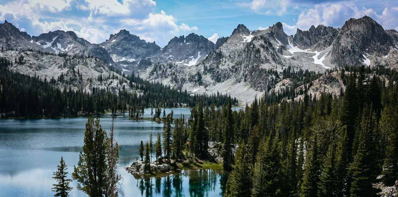
The mighty Bighorn massifs, whose highest peak reaches 13000 feet (Cloud Peak), are federally protected as the Bighorn National Forest, an immense area of 2800 square miles that includes 1200 miles of trails, 3 scenic byways (scenic roads recognized by the U.S. government), 30 camping areas and also the more remote Cloud Peak Wilderness, a pristine area that includes the highest peak of the mountain range.
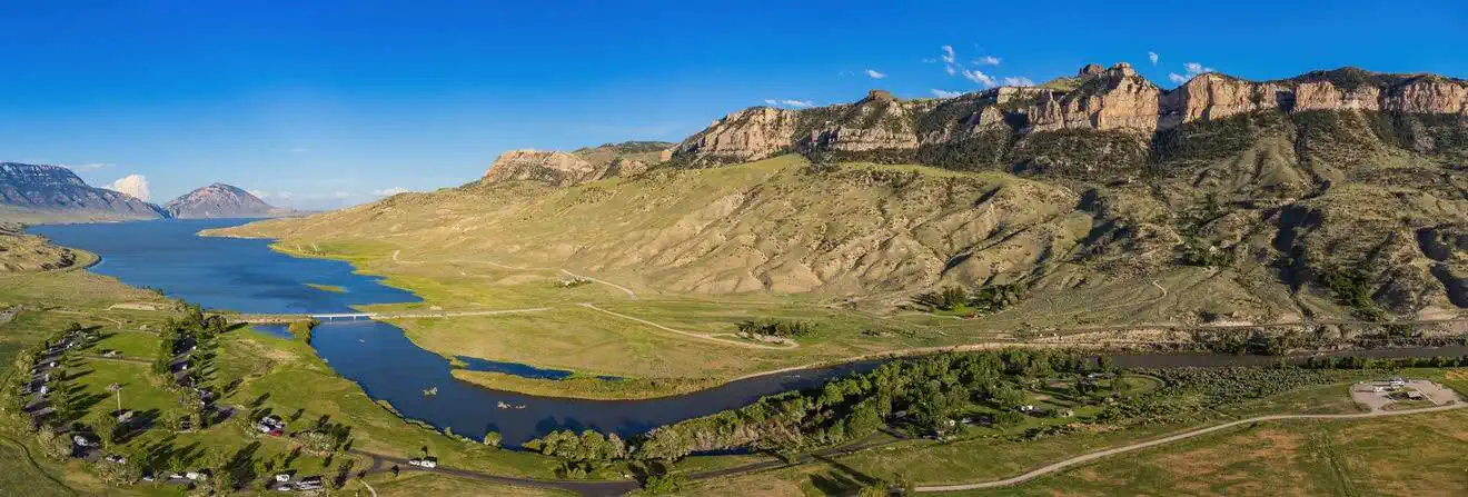
This wilderness area does not include the nearby Bighorn Canyon, which is regulated by the NPS (National Parks System) as Bighorn Canyon National Recreation Area.
How to get there and include it in your itinerary

Admission is free and it is accessed by 3 roads that cross northern Wyoming and become Scenic Byways. Here they are from south to north:
- Highway 16, which becomes Cloud Peak Skyway, coming from Ten Sleep (west) or Buffalo (east)
- Highway 14, which becomes the Bighorn Scenic Byway, coming from Shell (west) or Dayton (east)
- Highway 14/A, which becomes the Medicine Wheel Passage Scenic Byway, coming from Lovell (west)
We talk about the distances of each town from Bighorn National Forest below in this article’s section on where to stay.
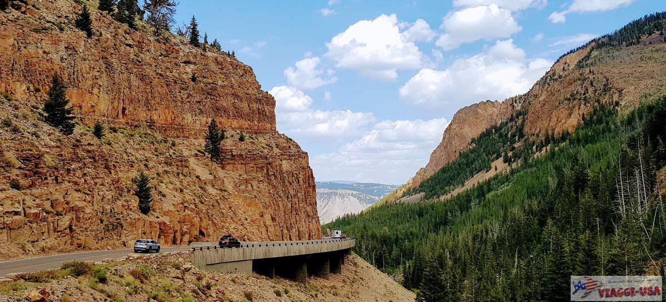
You will probably cross the national forest coming from Cody in the direction of Rapid City, after having visited Yellowstone with the aim of reaching Mount Rushmore (of course the same applies in the opposite direction). As already mentioned, it is useful to know that “just crossing” the Bighorn National Forest using this itinerary will mean you choose 1 of the 3 scenic byways in the park, making you forego the beauty offered by the other 2. That is, unless you plan to stay in the area for one night, devoting more time to the park, its scenic byways, and its countless trails.
So let’s look at what there is to see in this area, whether it’s worth dedicating more time to it, and provide useful information to help you choose which scenic byway to take depending on the itinerary.
Panoramic roads
Cloud Peak Skyway
- Length: 46 miles
- Open: all year round
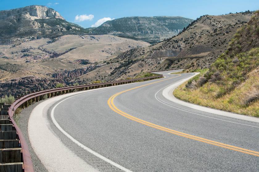
Near the section between Ten Sleep and Buffalo, Highway 16 becomes the Cloud Peak Skyway, crossing the southern section of the Bighorn Mountains and offering breathtaking views of snow-capped peaks. About halfway, there is the scenic Powder River Pass, which at 8,000 feet marks the highest point in the park that can be reached by car. Given the altitude, snowfall is not uncommon, and they can occur, albeit more rarely, even in July and August, so it is a good idea to check the weather forecast before leaving.


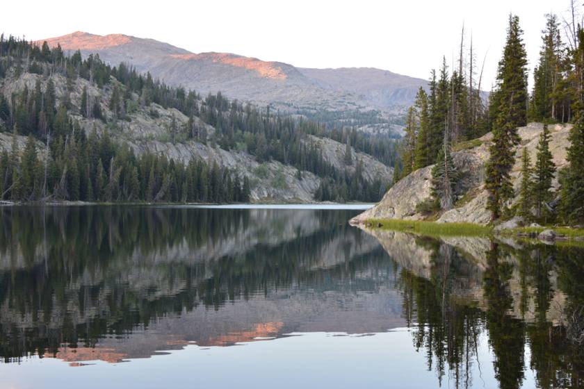
Other points of interest you cross on the Cloud Peak Skyway are Meadowlark Lake, a beautiful alpine lake where you will find campsites, picnic areas and hotels, and Ten Sleep Canyon, whose towering rock walls are a true climber’s paradise. It was in this canyon that an English nobleman lost his life in 1889, and the Leigh Creek Monument was erected in his memory, which can be seen from afar from the road (reaching the top of the mountain would require a rather challenging hike).
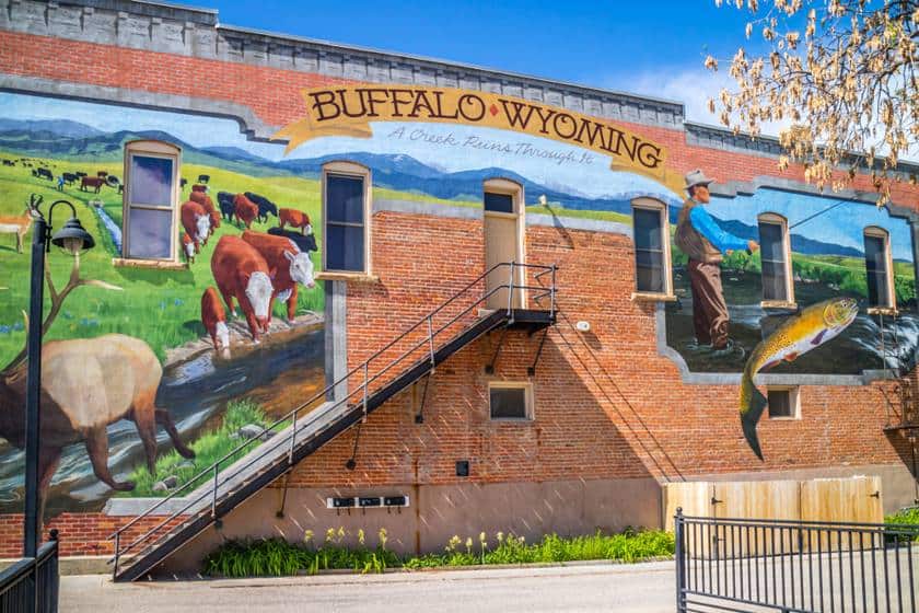
The road also crosses 2 towns in full Old West style: Ten Sleep, a small village where time seems to have stood still, with its family ranches and some historic buildings (for example the Ten Sleep Mercantile, the city general store built in 1905), and Buffalo, with its main street in classic Old West style, its museums and the many stories it has to tell to its visitors (Calamity Jane, Butch Cassidy, Sundance Kid, Buffalo Bill Cody and even Teddy Roosevelt passed through here).
Bighorn Scenic Byway
- Length: 58 miles
- Open: all year round
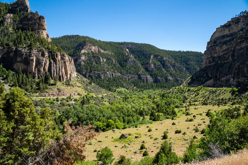
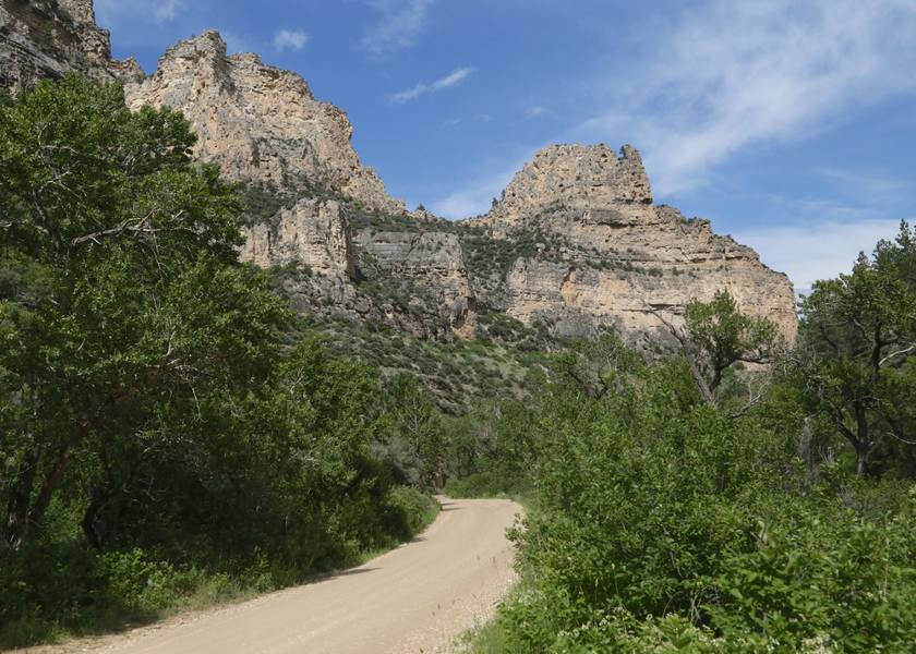
Highway 14 becomes the Bighorn Scenic Byway on the section between Shell and Sheridan and provides spectacular views of the valley from the many laybys at the side of the road. The road crosses Shell Canyon and offers great views of some particularly impressive massifs such as Copman’s Tomb, Pyramid Peak, Sunlight Mesa and Elephant Head Rock.
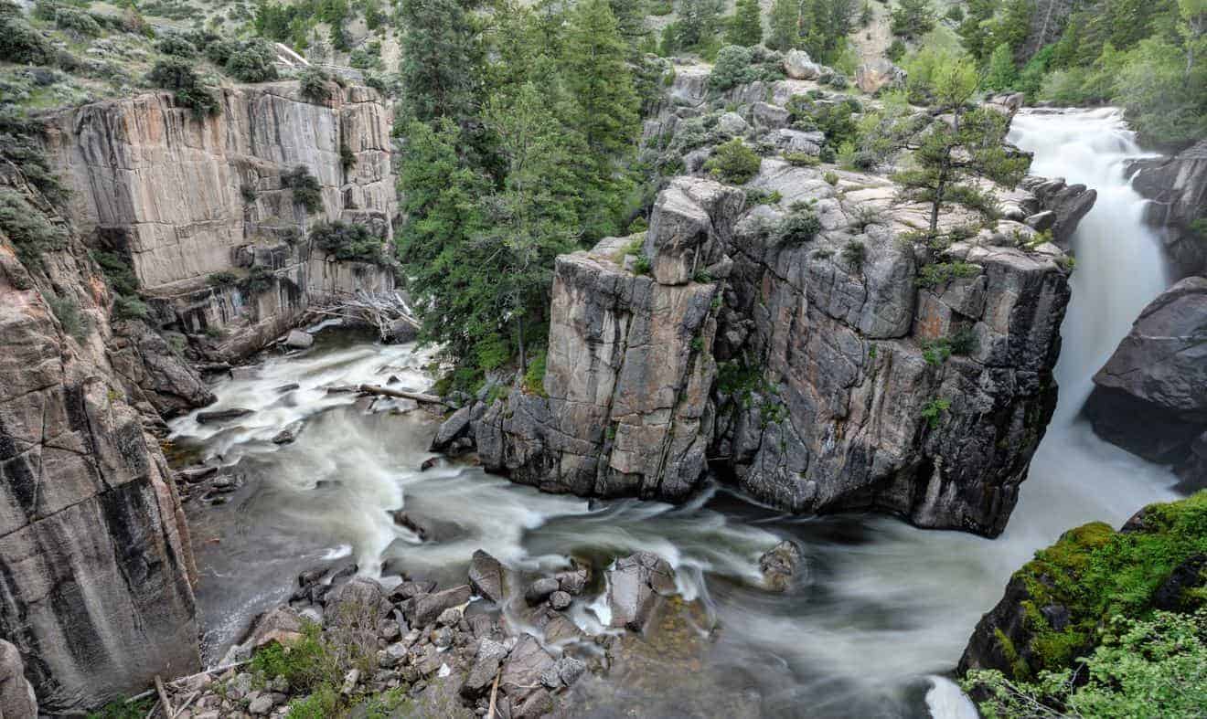
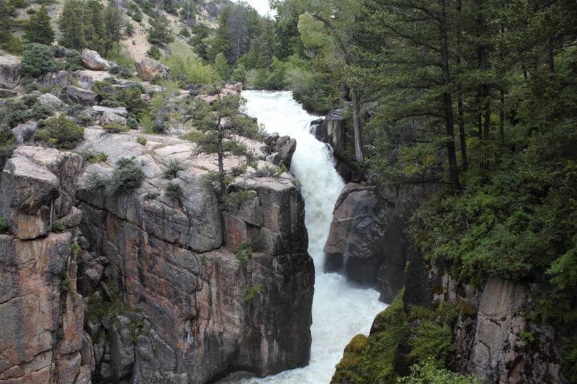
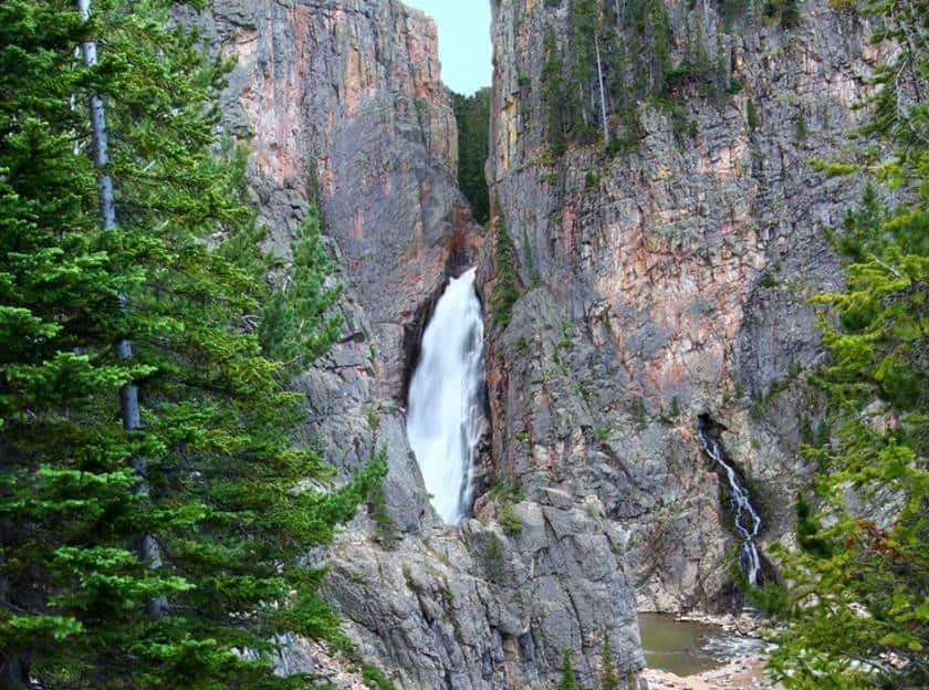
The most fascinating and well-known point on this road is the Shell Falls Interpretive Site, a short trail with information panels that leads to the impressive Shell Falls. There is also a visitor center at the parking lot; the site is open from mid-May to mid-September from 8 a.m. to 5:30 p.m.

As you continue on the road, you will find several laybys or rest areas to stop and admire the view: the best are Sand Turn Interpretive Site and Hogback Interpretive Site. The most interesting town you’ll pass through on the Scenic Byway is Sheridan, which boasts one of the most elegant and lively Old West style main streets in the state, as well as several museums and historical sites in the surrounding area.
Medicine Wheel Passage Scenic Byway
- Length: 27 miles
- Open: from Memorial Day to mid-November
Unlike the other 2 scenic byways, this one doesn’t cross the park from one end to the other but from the western border, near the town of Lovell, to Burgess Junction. This is the point where the Medicine Wheel Passage Scenic Byway (Highway 14A) connects to the Bighorn Scenic Byway (so you can cross the park by driving all of the Medicine and a portion of the Bighorn).
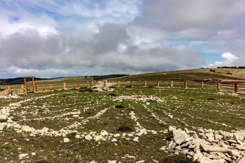
This is the steepest of the 3 roads and is named after an important historical site that it leads to, the Bighorn Medicine Wheel, one of the few Native American monuments that has survived intact to this day. It is a series of stones arranged in such a way as to form a wheel with 28 spokes and a circumference of 75 meters, which is said to have been used to forecast the weather. You can find information on how to reach the site in the next section dedicated to the trails.

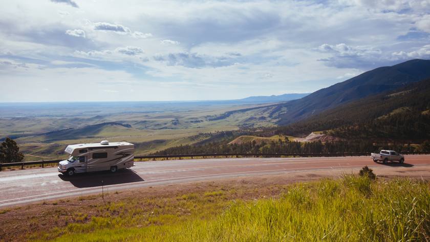
If you take this road from the west, coming from Lovell, you’ll notice how it begins to climb steeply into the mountains; the Medicine Wheel Passage Scenic Byway reaches a 10% gradient, climbing about 1100 feet in the space of 10 miles. If you’re in an RV or with a tow vehicle it may not be the best option of the three scenic byways.
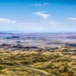
Along the way, you’ll find a few laybys to stop and admire the view, the best of which are Observation Point, which marks the highest point on the Scenic Byway (2874 feet), and Bighorn Basin Overlook, which provides a remarkable view of the Bighorn Basin, a vast arid valley over which the massifs of the Bighorn Mountains stand imperious.
If you have time to explore the area, it may interest you to know that there is also an old section of road, called Old 14-A, that leads to the Five Springs Campground. Here, following a short trail (1800 feet round trip and 130 feet of elevation gain), you can reach the waterfalls of the same name, the Five Springs Falls. The entrance is located 22 miles from Lovell, at these coordinates.

In addition to the sights you’ll encounter along the way, there’s another reason why the Medicine Wheel Passage Scenic Byway is worth the drive: this scenic byway will allow you to easily include a detour from your itinerary, to the remarkable Devil’s Canyon Overlook over Bighorn Canyon.
Bighorn National Forest Trails
Mountain enthusiasts could spend days on end in the Bighorn National Forest without getting bored. The number of trails available is staggering, I’ve selected 2 for each entry route. In the map above you will find all trailheads indicated. Bear in mind that you will have to take dirt tracks to reach many of the trails in the park; although they are usually well maintained, always pay attention, also because of the policy of US car rental companies regarding unpaved roads.
Trails on the Cloud Peak Skyway
- James T. Saban Lookout (0.6 miles round trip with a 190 feet elevation gain): a short hike to an old fire lookout tower with a beautiful view. Turn off the road here onto dirt road 429 and drive a little over 1.2 miles.
- Mirror Lake and Lost Twin Lakes Trail (11 miles round trip with 2000 m elevation gain): A long hike that takes you to some of the hidden gems of the Cloud Peak Wilderness: the alpine Mirror Lake and the more remote Lost Twin Lakes. If you want, you can also just walk to the first lake, thus limiting your route (5.7 miles round trip with an elevation gain of 1000 feet). The trailhead is at the West Tensleep Lake Campground parking lot; to get there, you’ll need to turn at this point onto Deer Haven Lodge Road and follow a dirt road for about 7.5 miles.
Trails on the Bighorn Scenic Byway
- Steamboat Point Trail (1.6 miles round trip, with a difference in altitude of 600 feet): a trail that leads to the suggestive Steamboat Rock, which, as the name says, is shaped like a steamship. Access is directly on the road at this point.
- Tongue River Canyon (4.7 miles round trip, with a difference in altitude of 760 feet): A walk in a beautiful valley in the canyon carved by the Tongue River. To take the trail you will have to detour from the town of Dayton and take the 92, following it for about 5 miles until you reach the Tongue Canyon Campground.
Trails on the Medicine Wheel Passage Scenic Byway
- Medicine Wheel Trail (2.8 miles round trip, with an elevation gain of 190 feet): this is the trail that leads to the famous native monument. The walk is quite easy and, in addition to the monument, it offers beautiful views of the valley below. To reach the trailhead you’ll have to take Forest Service Road 12 at this point, a dirt road about 1.8 miles long.
- Porcupine Falls Trail (0.8 miles round trip, with an elevation gain of 350 feet): a short and easy trail that leads to a beautiful mountain waterfall. Turn at this point onto Forest Service Road 13 and continue for about 6 miles to the entrance.
Where to stay
You’ll be able to find plenty of accommodations in the small towns and villages on the edge of the National Forest. Here are a number of useful places in case you choose to simply drive through the park, or prefer to spend more time there. For convenience, I’ve grouped them by the specific access road so that you can focus on the ones that interest you. Many are small villages with few accommodations, others are small towns with more availability,1 for example Cody, Buffalo and Sheridan, which are usually the most popular. Distances are measured relative to the park boundary.
Towns west of the Bighorn National Forest
Highway 16 entrance
- Cody, 112 miles from the park border: our tips for sleeping in town
- Ten Sleep, 15 miles from the park boundary: all accommodations
- Worland, 41 miles from the park border: all accommodations
Highway 14 Entrance
- Cody, 75 miles from the border with the park: our advice for sleeping in the city
- Shell, 5 miles from the border with the park: all accommodations
- Greybull, 20 miles from the park border: all accommodations
Highway 14-A Entrance
- Cody, 72 miles from the border with the park: our tips for sleeping in town
- Lovell, 25 miles from the park border: all accommodations
Towns East of the Bighorn National Forest
Highway 16 Entrance
- Buffalo, 9 miles from the park border: all accommodations
- Gillette, 78 miles from the park border: all accommodations
Highway 14 Entrance
- Sheridan, 28 miles from the park border: all accommodations
- Dayton, 6 miles from the park border: all accommodations
- Ranchester, 12 miles from the park boundary: all accommodations