Sometimes, those who visit the Grand Canyon on their road trip may be a little disappointed by the large crowds of tourists that crowd the edge of the canyon. The famous national park in Arizona is not by chance one of the most famous of all the United States and attracts many travelers and nature lovers from all over the world.
It follows that the likelihood of having the Grand Canyon South Rim all to yourself (or almost) becomes a difficult dream to realize. Maybe only in low season or by starting the scenic drive not much later than dawn.
But there is another, equally fascinating way to see the Grand Canyon without having to listen to the noise of cars, the chatter, the screams and the irksome clicking of cameras. I am talking about visiting the Grand Canyon North Rim, the section of the park less frequented by tourists.
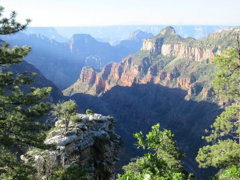
As a result, this ridge of the Grand Canyon is “relatively” untouched and gives a more intimate contact with the prodigious grandeur of nature shaped by the Colorado River. Of course, the views rival those of the South Rim (difficult to say which is better); North Rim is a natural landscape of unquestionable beauty and gives a new perspective on some parts of the valley.
Let’s get to know the Grand Canyon North Rim: there are many things to see and do in this area. How to visit it? Here are some frequently asked questions.
Contents
Driving Directions: How to Get There?

As we already mentioned in our article Grand Canyon South or North Rim – unless you fly there – you can’t visit both sides of the Grand Canyon in a single day. It’s a 4-hour drive from one rim to the other.
The Grand Canyon North Rim is in fact located in Kaibab Plateau, 2 hours and 40 minutes from Page, a strategic town from which it is advisable to leave to visit the park. Jacob Lake, Fredonia and Kanab are other alternatives in the area.
Page AZ to North Rim
To get from Page to the North Rim, you will first take US-89A, the scenic drive that runs along the Vermilion Cliffs and passes Marble Canyon and Lees Ferry, which is considered to be the starting point of the Grand Canyon.
At Jacob Lake you must then take SR-67, following the signs for the Grand Canyon. It’s very easy. From here, you then drive the last stretch of road (about 1 hour) along the beautiful forests of the plateau, before reaching the North Rim.
Las Vegas to North Rim
If you are coming from the west (Las Vegas), after St. George take the 89-A at Fredonia and continue to Jacob Lake.
When does the North Rim of the Grand Canyon Open?

On a sad note… the North Rim, unlike the South Rim, is not open all year round. Here are some dates: from May 15th to October 15th the park is always open, including accommodations, restaurants, campsites (for which a permit is required) and shops.
Starting on October 15 the park remains open only for “day to dusk” daily visits (on October 15, the lodge closes, on October 30, the campsite closes), and the North Rim closes completely on November 30, or at the first snowfall severe enough to block the traffic on the SR-67.
As we had already written in our article about visiting national parks in the winter, from November to May it is not possible to enter the park with your own vehicle, but you can get a permit to camp inside the park and hike.
Cost and tickets
If you have paid admission to visit the South Rim ($30) you can also enter the North Rim and vice versa. If you have the annual national parks pass, you will be able to pass easily, as the park is included in the list.
Things to do in North Rim: hikes, best views and scenic drive
In this section, we want to give you some advice on how to plan out your visit to the North Rim. In particular, we will point out the best trails, scenic roads, and viewpoints. I remind you that in the article about the Grand Canyon trails we have already pointed out some possible options, which we will include here with others.
North Rim Map
Bright Angel Point trail
The most famous overlook is also the easiest to reach. You can get there by following the short (but quite steep) paved path that winds along the ridge crest and leads to a magnificent view of the canyon. The trail is located behind the Grand Canyon Lodge, but you can start directly from the Visitor Center Parking Lot (0.9 miles round trip, about 30 minutes).
North Kaibab Trail
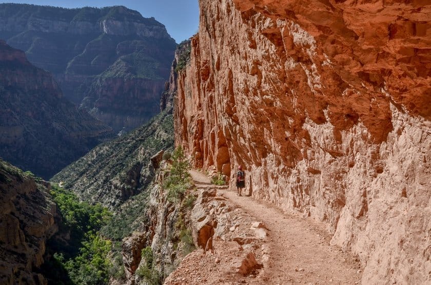
Here is another trail that is just as well known but definitely more challenging. This is the famous hike from the top of the ridge to the Colorado River and then up to the top of the southern ridge along the South Kaibab Trail (for those who would dare go…). In order to calculate the timing of the descent to the river, it is necessary for hikers to evaluate their own training and experience.
The distance one way is about 13.7 miles, which obviously doubles when you have to go back up (the elevation gain is about 6800 feet). Usually, this trail is spread over two days, and you can spend the night at the Phantom Ranch or at the campsite near the river.
If you don’t have the time or preparation to make it all the way to the Colorado River, here is a list of the intermediate points you can get to along the trail and eventually turn back:
- Coconino Overlook- 0.7 miles
- Supai Tunnel – 2 miles
- Roaring Springs – 4.7 miles
- Cottonwood Camp – 6.9 miles
- Ribbon Falls – 8.4 miles
- Phantom Ranch – 13.9 miles
- Bright Angel Campground – 14.5 miles
The trailhead is at the parking lot located 2 miles from the Visitor Center on SR-67.
Widforss Trail
The Widforss Trail runs along the western part of the North Rim, and has beautiful views of the canyon along a pleasant flat trail, mostly shaded by forest trees. The entire trail is 9.1 miles long (elevation gain is 1036 feet), but you can walk just part of it and still enjoy excellent views.
In order to reach the trail, you have to walk along a short stretch of a dirt road (about 0.3 miles, until the first parking lot). If you are coming from the visitor center, you will find the dirt road on the left after 2.8 miles.
Uncle Jim Trail
If you are interested in a hike that is popular among hikers (and mule deer!), you can take the 4.7 mile long Uncle Jim Trail loop (elevation gain 731 feet), which you take at the North Kaibab Trail Parking Lot.
While the latter descends into the canyon, the Uncle Jim Trail cuts through the woods and takes you to an overlook.
Route on the Cape Royal Road
Along Cape Royal Road there are some viewpoints that are really worth visiting. Before I list them, let me tell you how to get there.
Starting from the Visitor Center, head back to the road you came from and after 3 miles turn right. This is the Cape Royal Road, a 20-mile long road where I recommend the following stops:
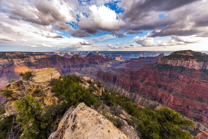
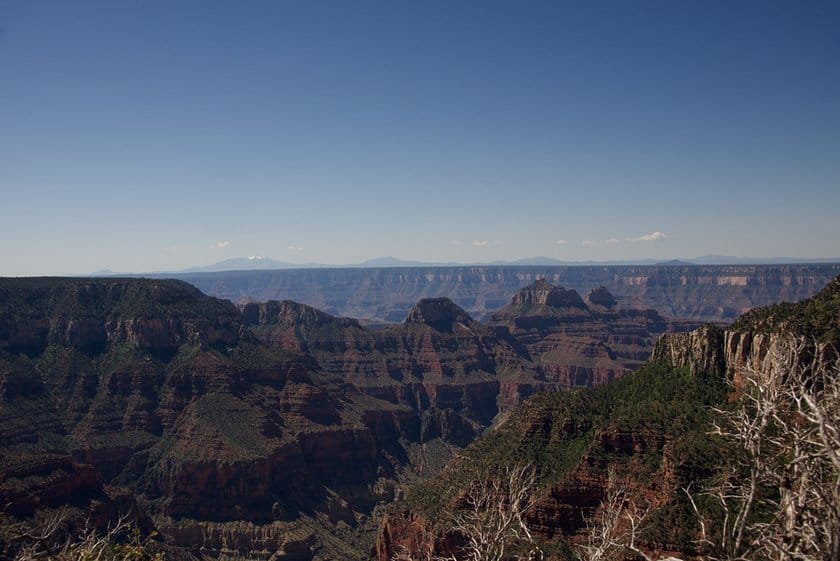
- Point Imperial: Drive on Cape Royal for 5 miles and then turn on Point Imperial Road, which ends at the observation point with the same name. The view is quite unusual, because it overlooks the northeastern part of the canyon. Since it is the highest observation point in the Grand Canyon, Point Imperial will allow you to also see Vermilion Cliffs and the Navajo Mountains.
- Roosevelt Point Overlook: As you return to the Cape Royal Road, it is worth stopping at this vantage point, which offers impressive views of the North Rim landscape.
- Walhalla Overlook: Another noteworthy viewpoint on this road. Besides overlooking the canyon (from where you can see a Colorado delta called Unkar) you can even see Walhalla Glades Pueblo, an archaeological site that preserves some ruins of a Native American village dating back 900 years.
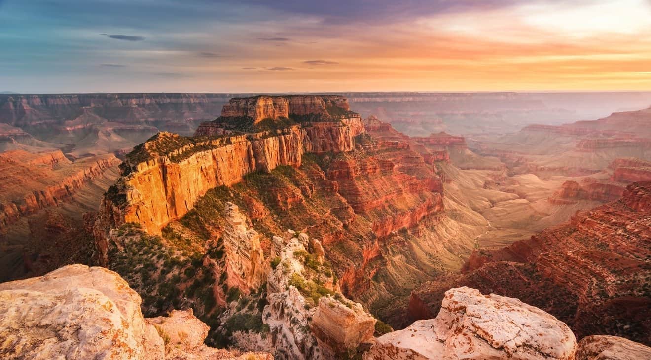
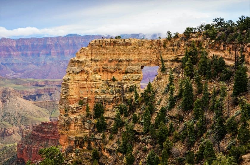
- Cape Royal: From here you can see, through a short path, first the Angel Window and then the impressive Wotans Throne (see cover photo), a peak which stands out in a wide panorama of the canyon. The trail is a total of 0.8 miles long (round trip) and takes about half an hour out and back to complete (elevation gain is 65 feet).
Helicopter Tours and Jeep Tours of the North Rim
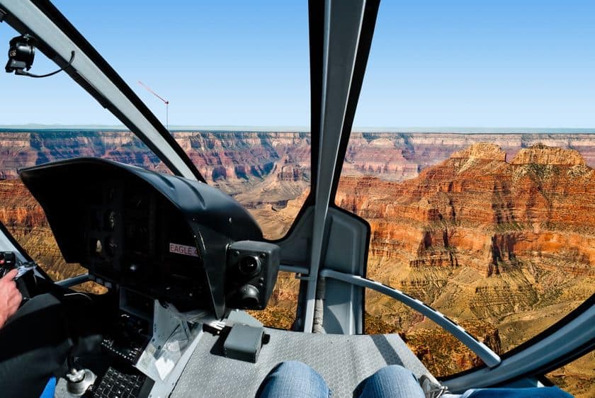
The only way to see both sides of the canyon is to go on an air tour. Here are two very interesting and very exclusive options by Papillon which offers very professional helicopter flights over the Grand Canyon.
Helicopter Flight from the South Rim
If you’re already at the South Rim of the Grand Canyon and want to get to the North Rim, why not fly there? Here is a helicopter tour departing from Tusayan Airport that will take you over the northern edge as well as the southern edge, observing both from an unforgettable view. The flight lasts 25-30 minutes.
More information about the tour
Helicopter Tour from Las Vegas with 4×4 Jeep
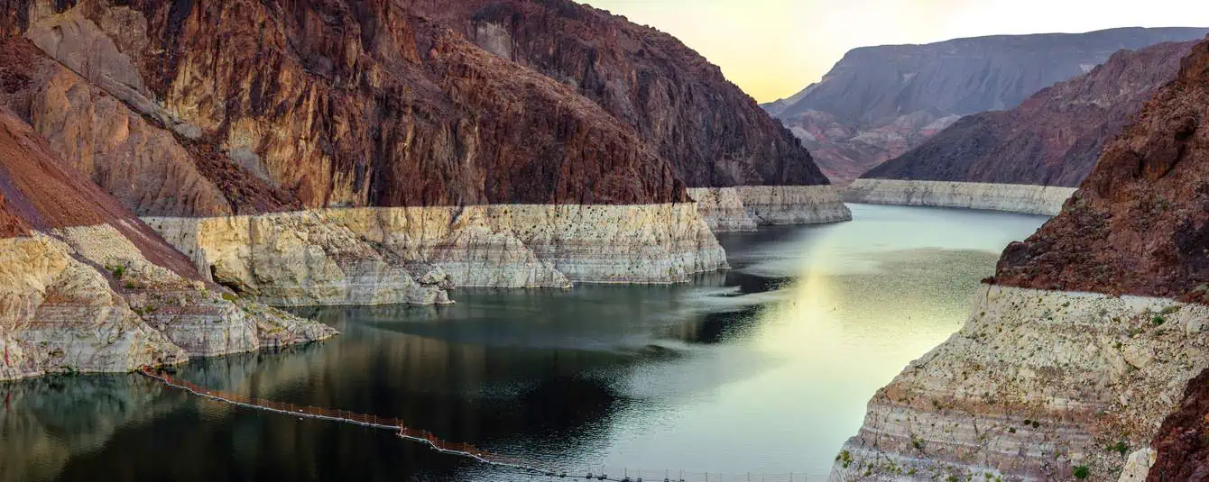
There is also a more complete tour, which includes a flight and jeep tour, but this one departs from Las Vegas. This tour will take you all day. The flight lasts 45 minutes and you will enjoy the view of Lake Mead, Hoover Dam, the Colorado River, and the Grand Canyon itself. You will land at Bar 10 Ranch, the starting point for a 4×4 trip along the most pristine roads in the area.
You will pass by Whitemore Canyon and Lake Mead Recreation Area, and then arrive at the canyon side itself. This is the highlight of the tour, as this area is not easily visited otherwise. On your way back you can enjoy a barbecue at the ranch you left from. The return flight will take you back to Boulder City, where the last transfer to your Las Vegas hotel awaits you.
More information about the tour
Where to stay in or nearby the Park
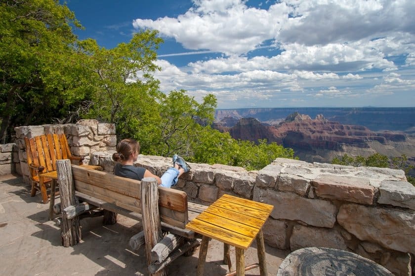
Despite the seasonal closure, you can stay inside the Grand Canyon (North Rim) in the only lodge inside the park, the Grand Canyon Lodge, where you can see incredible views from the spectacular panoramic ridge terrace. Book in advance, because the lodge fills up fast…
Check Grand Canyon Lodge availability
If you don’t want to stay overnight in the park, you can look for a room at the bed & breakfast in Jacob Lake, the Jacob Lake Inn, or book a room at the Cliff Dwellers Lodge, where you’ll find some strange rock formations typical of the Vermillion Cliffs area.
You will find a much greater selection in Page, 2 hours and 20 minutes away, and in Kanab, 1 hour 40 minutes away.
Our tips for sleeping in these towns: