We are in Gallup, New Mexico and we’re about to head to Goosenecks State Park in Utah. We have two options. The first would be to continue north to the sacred and surreal Shiprock, then turn west at Four Corners where Arizona, Colorado, New Mexico and Utah meet. Afterwards we would take Highway 41, Highway 162 and Highway 163.
The second option would be to first travel west along I-40W and continue north on I-40W, shortly after Lupton. Next, we could take Indian Route 12, which we have never traveled before, and then take Highway 191 and Highway 163. After giving it lots of thought, we choose the second option, in order to discover a small unknown portion of Arizona. Looking at the map, we realize that eventually Indian Route 12 crosses into New Mexico, practically along the state border, and then it re-enters the Grand Canyon State.
Contents
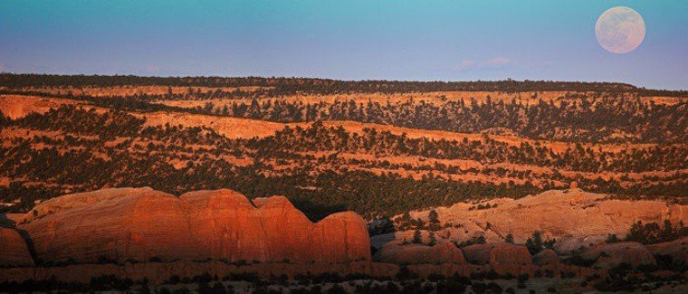
We are thrilled to travel on Indian Route 12 for the first time and the excitement builds as we get closer, because we don’t know what to expect from this road that connects to other main roads that take you to incredible places. On our way north through the Navajo Nation, we are given a warm welcome, since here in Arizona, the colors of the reliefs, hills, rock formations and cavities created by erosion are more vibrant.
We didn’t think we’d find so much to admire and photograph. Instead, we found out we must make frequent stops to take pictures. As we continue our journey north, the change in the landscape is even more dramatic. The small towns give way to an endless landscape accentuated by remarkable rock formations that stand out against the blue sky.
Main Points of Interest
As we travel north along Defiance Plateau, the road leads north to Oak Springs and a small community of farms. Then we come across Hunters Point, a wooded area stretching west from the plateau. Hunters Point is named after John Hunter, who was a superintendent of the southern Navajo jurisdiction. To get a better view of the area, stop at mile marker 16 on the eastern side of Indian Route 12.
St. Michael’s Mission

Then we make a brief stop at St. Michael’s, a mission founded in 1898 by Franciscan priests who used the stone building as their chapel and residence. St. Michael’s Indian School, founded by the Sisters of the Blessed Sacrament led by Mother Katherine Drexel, was inaugurated in 1900 with fifty Navajo students. Mother Drexel, who gave up a comfortable life as an heiress to take her vows. She was canonized as a saint in 2000 by Pope John Paul II.
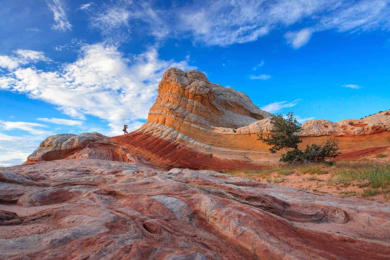
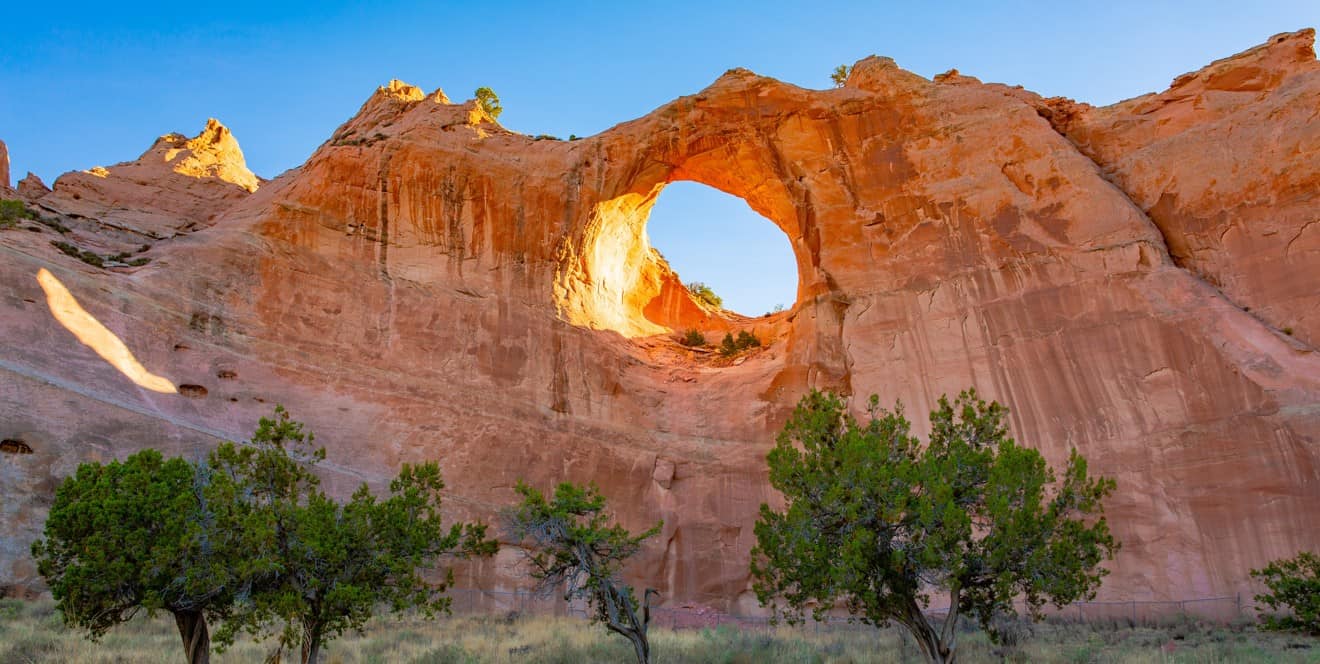
The stone school building has become a museum while St. Michael’s mission and school still serve the Navajo community. The town, also called St. Michaels, has accommodations, a few restaurants and there are scenic tours and tours of historical sites. On our right, we see monoliths, mesas, and high rock spikes that seem to have “beaks”. Then a little further on we begin to see more red rocks as we approach Window Rock. Actually, we had been waiting to find them, because this is the only place we knew about on Indian Route 12.

As we approach Window Rock, we know that we are about to see something special, and, in fact, about a mile north of the country, we see the sacred rock formation of the same name in all its splendor. It is a large circular “window” with a diameter of 46 ft, imposing and striking above a sandstone hill that is 197 ft high. If you really want to look for a flaw, it is that it’s located close to the fenced area where there are Navajo government buildings, while an open space that would have enhanced the view.
We enter the property slowly without meeting anyone to ask if we need a permit and even the offices seem to be closed. In the green space under the large hole in the rock, an imposing bronze statue of almost 16 ft tall catches our attention. It is a statue of a soldier that serves as a symbol to honor the legendary Navajo marines whose language was used as a strategic communication technique in battle during the Second World War.
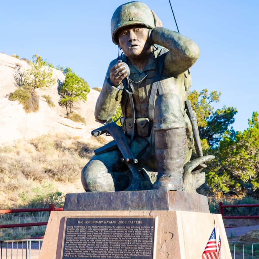
The memorial also includes a series of bayonets and a circular walkway over the rock. In addition to being a spectacular place, Window Rock is home to the Navajo Tribal Museum. It is possible to visit Anasazi ruins nearby either on foot or on horseback with a guide. Simply contact the Navajo Nation Parks and Recreation in Window Rock to find out about places to go sightseeing in the area.
We continue driving, not knowing what the landscape will be like on the way to Goosenecks State Park and this uncertainty makes us want to keep our cameras out just in case we see something incredible. Fortunately, not many vehicles pass through this area and this is a point in our favor. We can stop or turn back every time we want to snap a picture.
The beauty of the rocky landscape is breathtaking, but if we continue like this, who knows when we will arrive at our destination. Let’s do some approximate calculations and plan the length of the stops. These places filled with “enchanting silence” contain a lot of history and often have a turbulent past.
Fort Defiance
A few miles north of Window Rock the lush green valley of Tséhootsooí (meadow among the rocks) many years ago was a peaceful refuge for the Navajo’s horses and sheep. Medicinal herbs grew in this sacred land and water flowed. Then in 1851, the land was confiscated from the Navajo for the establishment of Fort Defiance and used as a base to protect the settlers in the region.
Known by soldiers as “Hell’s Gate” presumably because of its remote location, the place was the scene of several battles and later became a prison camp for the Navajo before they were driven away from here to go to Bosque Redondo and Fort Sumner in New Mexico. Today it has become one of the main centers of the Navajo Nation. In fact, according to the 2000 census, 92.9% of the population are Navajo.
Canyon de Chelly
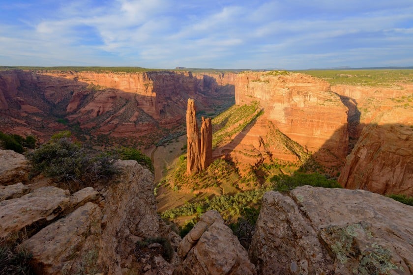
Then, as we keep heading north on Indian Route 12, we continue past Window Rock. Near Tsaile, we see “rock fingers” rise up towards the sky. As we admire these curious shapes, we realize that we never tire of gazing at this landscape. The landscape is bizarre, as if it were another world, but when we see a horse grazing in the distance and sheep around bushes, we snap back into reality.
In the distance, you can see a hogan, a characteristic Navajo dwelling, and then in Tsaile, it is possible to visit Diné College, the oldest and largest tribal college, or to stop at Tsaile Lake and Tsaile Creek which continues to flow through Muerto Canyon and Canyon de Chelly. And speaking of the latter, there is a sign on Indian Route 12 to turn west on Highway 64. We don’t think about it twice and take a detour on Highway 64 for about 18 miles.
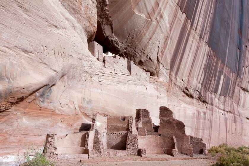
One of the advantages of Indian Route 12, besides being amazing in its own right, is the fact that other scenic roads branch off or continue from it. We know we are heading off course, but it seems right to do this, because we want to at least have a look. Who knows how long it’ll be until we come back here! Some overlooks along the north edge of the canyon are accessible by car and allow you to admire historical and archaeological sites and cliffs that are over 980 ft tall.
The first overlook on Highway 64 is Massacre Cave Overlook, because during a Spanish military expedition, 805 Navajo (women and children in particular) were killed when a cave collapsed. They had taken shelter there, since it was in one of the canyons that were their strongholds. From this overlook, you can see cliffs interspersed with green trees in some places. We like to be accompanied by remarkable cliffs, mesas and different rock formations that are typical of Arizona!
Read our article about Canyon de Chelly
We get back on Indian Route 12 and head north, we see the Lukachukai Mountains and continue our drive, which we declare to be a treasure trove. What seem to be peculiar large rocks from a distance often reveal themselves be beautiful, individual rock formations that transform the scenery as we drive by. This is pure natural beauty!
Round Rock
We reiterate that Indian Route 12 is like a long and beautiful tree from which beautiful branches grow. We arrive at Round Rock where a large monolith and a smaller one mark the end of Indian Route 12 and the beginning of Highway 191.
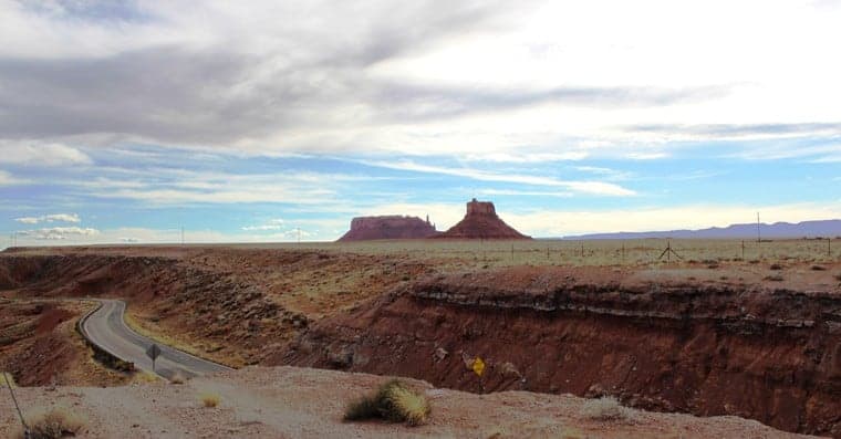
We imagined, or rather we hoped that the route had some pleasant surprises in store for us and it certainly did. But the journey is not over, because our destination is Goosenecks State Park. This means we must continue on Highway 191 and then take Highway 163.
On our way to Goosenecks, the scenery becomes more and more beautiful. Shortly after crossing the border with Utah, along the horizon line, we can see Monument Valley. It seems almost like a mirage, and as we continue south on Highway 163, it becomes more of a concrete reality.