Islands in San Francisco Bay
Out of all of the islands and islets surrounding San Francisco, many of them of little consequence to tourists, there is one that can be considered among the city’s most famous attractions along with the Golden Gate Bridge. I am talking about Alcatraz, the prison island that has inspired novels and movies. In addition to the famous penitentiary, however, there are also other fascinating islands. Let us examine the main islands around San Francisco, both those within the San Francisco Bay and those beyond the bay.
Contents
Map of the Islands in the San Francisco Bay
Alcatraz Island
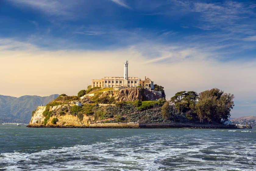
Alcatraz Island, just over a mile from San Francisco, was converted into a federal prison in 1934. The island was chosen because of the strong currents and cold temperature of the bay water that made escaping very difficult for inmates. The impossibility of escaping and the notoriety of some of its inmates (e.g. Al Capone) were behind the fame of this prison that inspired novels and movies. In 1963, the penitentiary was closed and now it is a tourist attraction. Visitors can book special tours to go to the island. For more information read our guide on visiting Alcatraz.
Angel Island

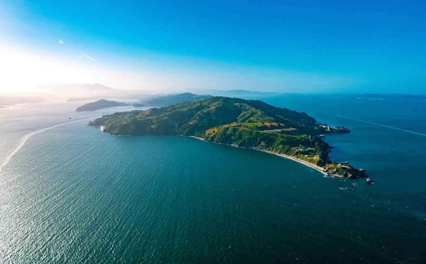
This is one of the largest islands in the San Francisco Bay. Rich in natural beauty, Angel Island has trails that lead to splendid views of the ocean, especially from the summit of Mount Livermore, the highest vantage point on the entire island, but also allow visitors to come in contact with numerous historical sites that mark how important this island has been to American history, from missile bases, to World War II military facilities, to the Angel Island Immigration Museum, the western counterpart of Ellis Island of New York City.

The amount of sights on the island have led to the establishment of Angel Island State Park, a state park also recognized as a California Historical Landmark. The island can be reached by taking the Golden Gate Ferry from San Francisco, near the Ferry Building, or by taking the Tiburon/Angel Island Ferry from Tiburon, a peninsula north of San Francisco.
Yerba Buena Island and Treasure Island

These are 2 contiguous islands with a total area of 0.91 mi2 located about halfway between San Francisco and Oakland. Yerba Buena Island, the smaller one, is crossed by the San Francisco – Oakland Bay Bridge, the bridge that connects the two cities. From Yerba Buena Island you can take Treasure Island Road to Treasure Island, a man-made island built in 1937 for the 1939 Golden Gate International Exposition.
Both islands offer beautiful views of the bay and the Bay Bridge from different spots, such as Clipper Cove Beach or along roads that line the coast, for example Avenue of the Palms or the aforementioned Treasure Island Road. However, these are not destinations that draw many tourists. On Yerba Buena Island there is also the striking Yerba Buena Lighthouse, but it is located in an area owned by the Coast Guard (as is the entire area southeast of the Yerba Buena Tunnel) so it cannot be visited. Still, it can be easily spotted and photographed by taking the Alameda/Oakland Ferry.
Alameda Island

Located near Oakland, Alameda Island is home to the city of the same name (which actually extends a bit beyond the island boundaries) and is connected to the mainland by 6 bridges. The island is home to some beautiful scenic beaches, e.g., Robert W. Crown Memorial State Beach and Alameda Beach, and interesting museums such as USS Hornet – Sea, Air and Space Museum, Pacific Pinball Museum, and Alameda Museum.
Even though there are several bridges, none of them connect the island to San Francisco, so it will be necessary to take a ferry to reach the island.
Farallon Islands National Wildlife Refuge

The Farallon Islands form a small archipelago in the Gulf of the Farallones and because of their location, about 30 miles from the Golden Gate and 20 miles from Point Reyes, they are visible from the coast only on sunny days. The treacherous waters surrounding these islands have also earned them another nickname given to them by sailors: Devil’s Teeth Islands. The waters around the islands are within the Greater Farallones National Marine Sanctuary, a very large protected area that extends north to Point Arena, just below Mendocino.

The islands, which are closed to the public, are accessible only to researchers studying the ecosystem and in particular the whales and sharks that live around the islands. However, there is a way to take a closer look at the beautiful rock formations. You can take a whale-watching tour, which will also give you a chance to observe other marine life, such as dolphins and sharks.
Seal Rocks

More than islands, they are a small group of rock formations near Lands End, a beautiful park in San Francisco with stunning ocean views. The name Seal Rocks comes from the fact that sea lions often rest on these rocks.
Because of their relative proximity to the coast, these rocks can be easily observed from the mainland. The best spots to view them are Cliff House and Sutro Baths, which we have mentioned in our guide to Lands End. The Seal Rocks are in the Golden Gate National Recreation Area.