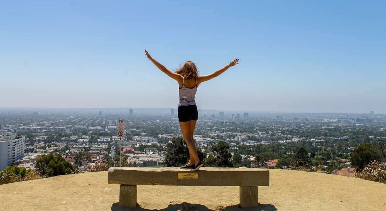
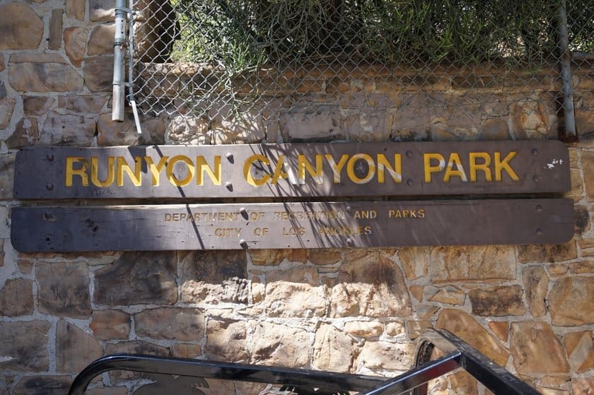
Runyon Canyon is a great park where you can take a walk and enjoy a view of the Los Angeles skyline. Did you know you can see Los Angeles from above by taking a short hike? Not far from the city, you can go to Runyon Canyon Park, a park that is popular among locals, since it is easy to get to and an ideal place to escape from the chaos of the city. Also, if you are jealous of those who live in Hollywood mansions, what could be better than looking down on them? Let’s discover the best Runyon Canyon hiking trails!
Contents
How to Get to Runyon Canyon Park: Entrances
Runyon Canyon Park is located near Los Angeles, just a 15-minute drive from downtown. Depending on which part of the city you’re driving from, you’ll be taking different roads. However, if you just put one of the park’s three entrances on your GPS, you’ll easily arrive at your destination. This small park has three entrances. One entrance is located on the north side of the park and two are on the south side. If you have enough time to walk through the whole park on foot, you can choose any one of the three entrances, but if your time is limited then you should determine which side of the park to prioritize and go to the right entrance.
- Mulholland Entrance: This is the entrance on the north side, located at the intersection of Mulholland Dr and Pyramid Pl. It is the best entrance to access the East Trail and the viewpoint that branches off from the northern section of the West Trail. This is also the starting point for the paved road that runs through the middle of the park to the Vista Entrance (not for private vehicles).
- Vista Entrance: This is the southwest entrance, located at the intersection of N Vista St and Runyon Canyon Rd. Start here if you plan to walk along the entire West Trail, or if you plan to do a loop around the park.
- Fuller Entrance: This is the southeast entrance, located at the end of N Fuller Ave. Use this entrance if you are short on time and want to go directly to Inspiration Point.
Plan Your to Visit Runyon Canyon Park
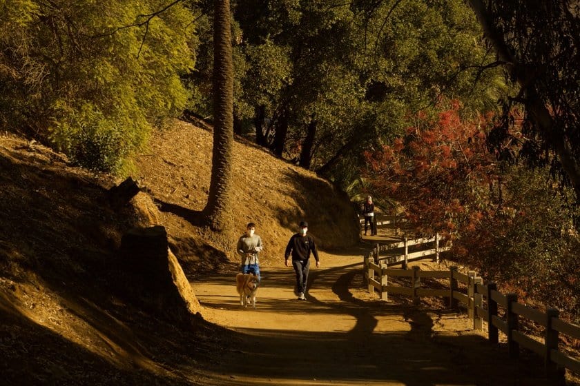
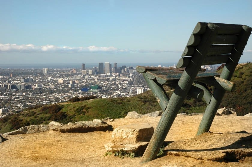
Runyon Canyon Park is a 65-hectare park, so it is very small compared to the bigger parks that we usually discuss in our articles. Here you can enter only by foot and you can go on several trails. Almost all of the trails are very easy and suitable even for those who are not used to hiking. The park is narrow and elongated and runs from north to south. It is composed of the canyon that gives it its name and the two mountain ridges that run on its sides. The main reason why this park is worth visiting is that it is located high above the city of Los Angeles and offers excellent scenic views of the City of Angels. Since it is so close to Hollywood, it’s not uncommon to see celebrities taking a walk in the park behind their home. Therefore, those in search of famous people might be pleasantly surprised.
Hours and Access
The park is open daily from dawn to dusk and access is free. However, during certain times of the year, some trails may be closed. To be on the safe side, you should always check the information section on the official website.
Runyon Canyon Hiking Trails and Viewpoints
A paved road (used primarily for fire trucks and ambulances to access the park in case of emergencies) runs through the center of the park, connecting the Mulholland (to the north) and Vista (to the southwest) Entrances. The West Trail, which runs along the entire west side of the park, starts at the Mulholland Entrance and merges into the paved road near the Vista Entrance. On the east side of the park, there is the East Trail, which starts in the center of the park (about halfway along the paved road) and runs through the southeast area until it reaches the Fuller Entrance, but it also branches off and goes to the Vista Entrance as well.
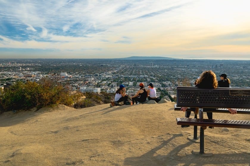
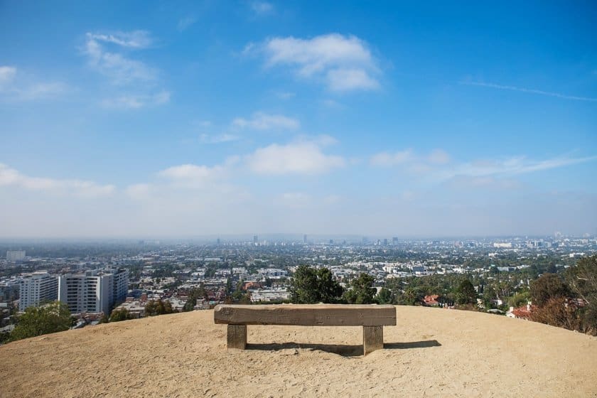
There are a few viewpoints on the West Trail. Two that are particularly scenic are the one where the Runyon Canyon Flag is located, about halfway along the trail, and the one at Indian Rock Peak located on the northern side, reached by taking a short detour. Since the viewpoints are on the western side of the park, they are ideal places to watch the sunset. On the East Trail, there is Cloud Rest as well as Inspiration Point. In both places, you can enjoy a beautiful view of the city of Los Angeles.
Recommended loops
If you are not in a rush, you can take the time to explore the park, but if your schedule is tight, you can still make a quick stop at Runyon Canyon Park. We would like to suggest four possible routes in the park.
- North Area Loop (0.8 miles). This loop is ideal for a short hike to a scenic viewpoint. Starting from the Mulholland Entrance, take the West Trail (the entrance is on your right) and continue for about 820 ft until you reach an intersection. To go to Indian Rock Peak, turn right. Go back to the intersection, turn right and take the West Trail to the next intersection. Turn left at the next junction and you’ll reach the paved road. Turn left and you’ll complete the loop, returning to the starting point.
- South Loop (1.86 miles). This loop is not difficult and at the same time allows you to reach two of the most beautiful scenic points of the park. If you have no time to do a longer loop, but enough to walk just under 2 miles, this is the best choice. Enter the park from the Fuller Entrance and keep walking the path in front of you. At a certain point, the path will curve to the right and after about 0.4 miles, you will arrive at Inspiration Point. From here, take the East Trail to Cloud Rest. Continue and when you reach the paved road, turn left to return to the starting point and finish the loop. Just before you get to the Vista Entrance, you will need to turn left onto the trail that will take you back towards the Fuller Entrance.
- Wide South Area Loop (2.6 miles). This loop runs along both ridges so you will see the views featured in the previous loop, but also along the western side of the park. Follow the directions for the previous loop to Cloud Rest. Once you reach the paved road, turn right in order to continue north. At the junction with the West Trail, turn left and walk along the entire ridge. When the trail meets the paved road, turn right and then left onto the next trail so you can head back toward the Fuller Entrance.
- Complete park loop (3.3 miles). For those who are not in a hurry, you will enjoy this trail. It allows you to explore the park in its entirety. Follow the directions for the previous loop to the junction with the West Trail. Turn right here and continue north to the Mulholland Entrance. Keep left to start heading back south. Take the small detour to the viewpoint, then walk along the entire West Trail to the paved road near the Vista Entrance and return to the Fuller Entrance by following the directions above.
Map of Runyon Canyon Park
Where to Stay near Runyon Canyon Park
Los Angeles is one of America’s largest cities and has several accommodations to choose from. In our article on where to stay in Los Angeles, we give you some tips to help you choose the best place to spend the night. If you want to be within walking distance of Runyon Canyon Park, look specifically in the West Hollywood area.