
For those like me who are fascinated by the landscapes of southern Utah, it was an obvious choice to refer to Moab as the “Promised Land”, an equally biblical name. In fact, the fingers on your hands are not enough to count the wonders that are hidden around this small town in southern Utah. We have described in detail its national parks (Arches and Canyonlands) and have written an overview of all the natural wonders found around Moab in an article on what to do in Moab.
But because the surprises never end around here, today I turn your attention to UT-128, a truly unforgettable scenic byway from Moab, also known as the Upper Colorado River Scenic Byway.
Contents
What Is the Best Time to Go? Why Is It Worth It?
When you look at a map, you’ll notice that UT-128 is a winding road that goes east of Moab towards the junction with I-70, where the interstate connects Utah to Colorado. This is a good alternative to US-191, a faster but certainly less scenic road.
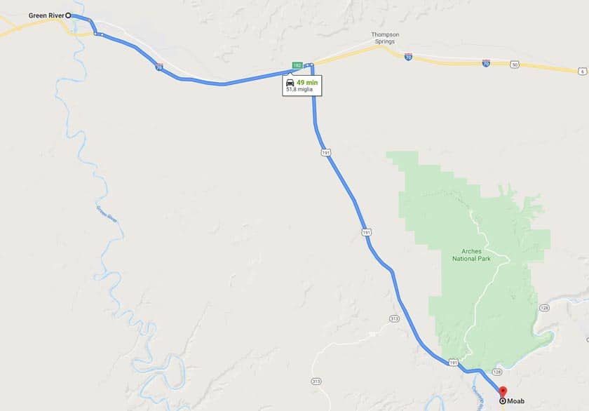
If you’re traveling from Colorado, then you know the way. If you plan to reach Moab from Bryce Canyon or Capitol Reef, you’ll need to take the scenic UT-12 Scenic Byway and UT-24 Scenic Byway, then after you pass Green River along I-70, at Crescent Junction, the GPS will tell you to get on US-191. While it is true that this is the fastest route from Bryce Canyon to Moab, it is also true that the fastest route is not always the best one to take. In order to take the most beautiful road, you will go straight at Crescent Junction for another 22 miles to Exit 204 towards Cisco. From there, the Upper Colorado River Scenic Byway begins.
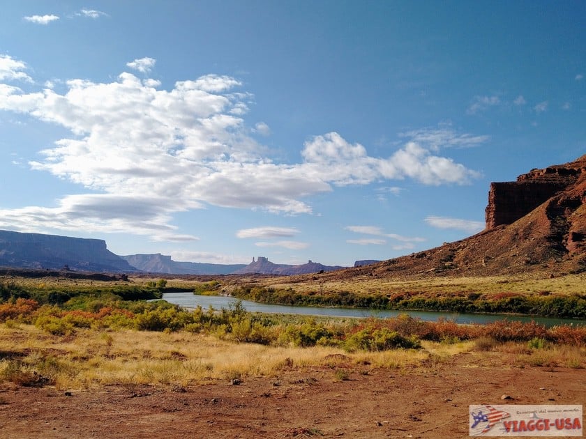
But why choose UT-128? I’ll go into great detail as I describe this road so that I may persuade you to go, but for now, you just need to know that – just as the name of the scenic road suggests – almost the entire route takes place along the Colorado River and it traverses an unforgettable landscape. It’s not something you would expect, starting in Moab (besides a short stretch on the Potash Road), you can’t easily drive along the river anymore, except for a short stretch on the Marble Canyon.
In addition, anyone who wants to go rafting on the Colorado River has the option to do so easily here without spending much, unlike other parts of the river.
Half-Day Tour: Rafting in Colorado
Distance and Travel Time
The distance between Moab and Cisco (the point where UT-128 starts) is 47 miles and without breaks, it takes 1 hour to drive. But I’ll tell you right now that if you decide to take this road, it is quite unlikely that you will resist the temptation to stop at one of the many points of interest along the way. Moreover, on this road, there are many incredible trails. For this reason, if you have some time at your disposal, it would be advisable to spend at least half a day exploring on UT-128.
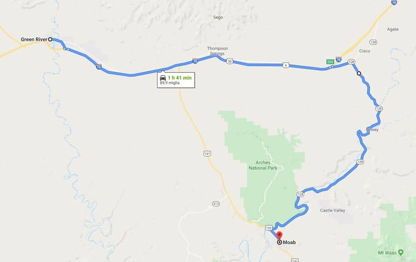
When making your choice, remember that from Green River to Moab via the US-191 it takes just 50 minutes to drive 52 miles. Instead, if you drive the entire UT-128, the distance between Green River and Moab becomes 95 miles, for a total of about 1 hour and 40 minutes of driving (without stops). For this reason, if you want to travel this route, you should plan your itinerary well.
Itinerary Map
The Most Beautiful Points of Interest on the Upper Colorado Scenic Byway

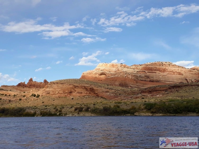
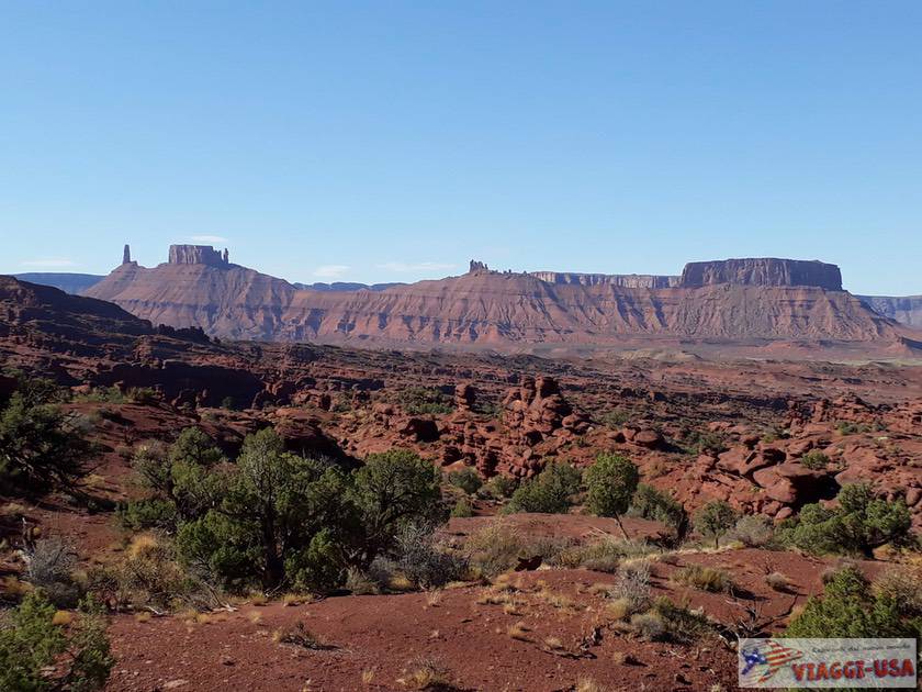
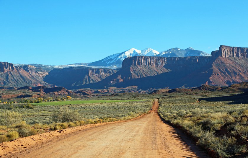
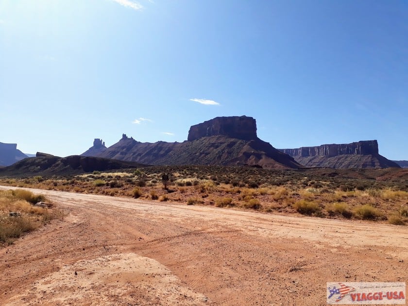
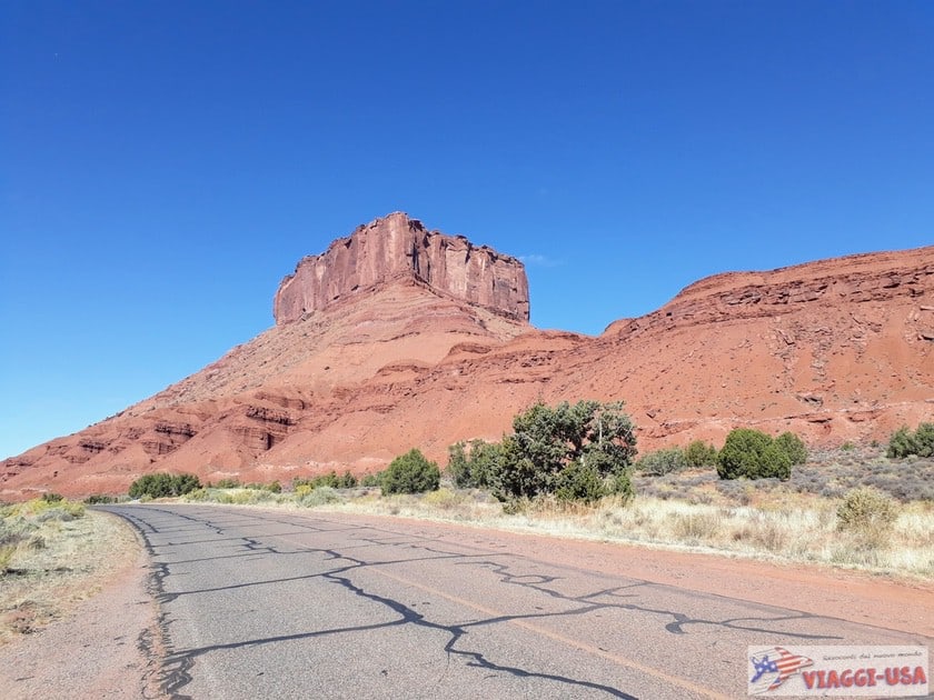
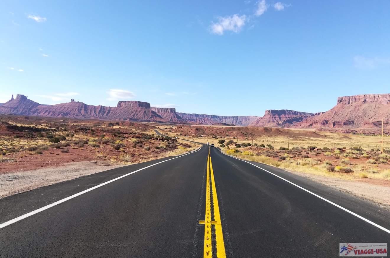
As I mentioned earlier, a large part of the scenic route runs along the Colorado River, one of the symbols of the Wild West that some have always dreamed of seeing. As you drive along UT-128, you will pass through two large, scenic valleys carved by the river, Professor Valley and Castle Valley, whose monumental rock formations will bear a striking resemblance to the landscape of the Monument Valley, more precisely to Forrest Gump Point. After Castle Valley, on the last stretch of the road leading to Moab, the valley narrows and becomes almost a gorge. The rock facades above the river will loom over you. The top of the escarpment on the north side of the river, although it is not visible from the road, is the location of Arches National Park.
So let’s start describing each point of interest, starting from the eastern end of the road at Cisco.
Cisco

If you followed my directions, by now you will have passed Green River and Crescent Junction have gotten off of I-70 taking Exit 204. After a few miles, you will immediately see the turn for Moab, but you will head straight towards Cisco. You will take the UT-128 later on the journey. After just 2.7 miles – when you see a series of rundown buildings, scraps of graffitied cars and a lot of scrap metal – you’ll realize you’ve arrived at your destination. In a desolate landscape, you’ll see what remains of a historic railway town in the Far West founded in 1870 and has been neglected due to the construction of the nearby highway and, more recently, vandalism.
Cisco is now a ghost town with cinematic charm (Thelma and Louise was shot here). It is abandoned, or maybe not completely abandoned, as a hilarious sign (“Oh nooo! Cisco ain’t abandoned”) on UT-128 will suggest. This sign is found just before the turn you’ll have to make to enter the town. Another piece of evidence that shows that the town is not dead but only dying is, Buzzards Belly, the shop you’ll find along the aforementioned street. It is the only business open in Cisco and absolutely worth a visit, not only to say hello to the nice owner, but also to have a coffee and browse through the shelves full of memorabilia, collectibles, junk and antiques (though the prices are on the expensive side!).
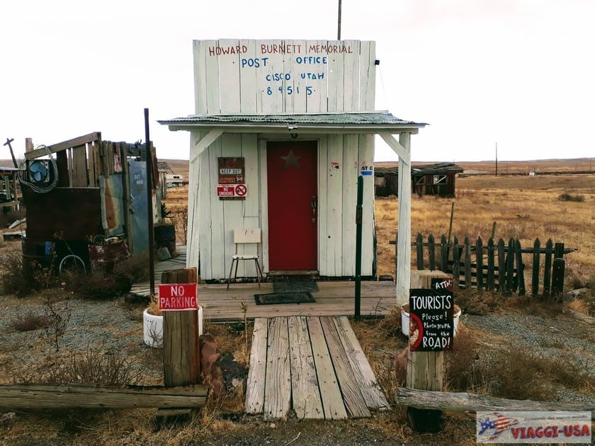
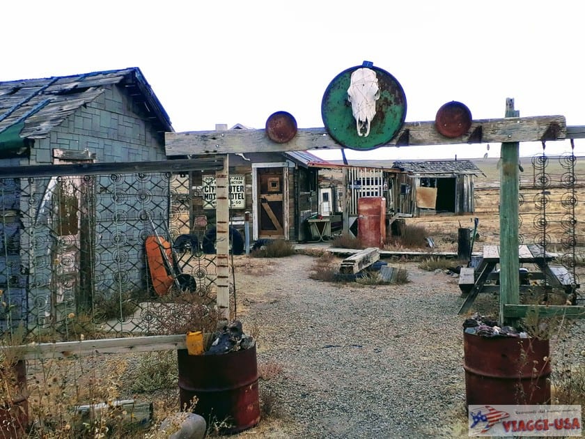
The owner of the store, which opened in 2019, explained to us that there is an artists’ residence in Cisco curated by Eileen Muza which aims to revitalize Cisco with a project called “Home of the Brave”. These artists are the only people living in Cisco, and you will notice it by driving around the shabby buildings, abandoned vintage cars and piles of wreckage. Although some of the signs along the road are not exactly hospitable, I suggest you to stop here and take a look at some details of the past of the town, before heading to Moab.
Dewey Bridge
The first stretch of road, from Cisco to Dewey, is the least interesting part of the trip and it happens to be the only section of UT-128 that doesn’t go along the Colorado River. At the point when the road runs parallel to the river, the beautiful views begin. 14 miles past Cisco, you will have the rare opportunity to cross the Colorado River by car on the Dewey Bridge.
When you are on the Dewey Bridge, look on your left. You will see what remains of the Dewey Suspension Bridge, a historic bridge dating back to 1916. At the time, it was the longest bridge in the United States west of the Mississippi River, stretching 502 ft across the river. In 2008, it was almost entirely destroyed by a fire caused by a child camping nearby. The Dewey Bridge Campground is located immediately after the bridge, on the right. I suggest you make a short stop here to dip your feet in the Colorado River. You can get close to the river by going all the way to the boat ramp at the campground.
Hittle Bottom Campground

After the wide and verdant Dewey Valley, with its ranches and cultivated fields, the basin narrows and becomes almost a gorge. You will drive right next to the Colorado River for a few miles, below the cliffs of the Dome Plateau, until, all of a sudden, the infinite horizon of Professor Valley and, already visible from a great distance, the rock formations of Castle Valley will come into view.
You’ll be tempted to stop and take a picture right away, which you can do at the Hittle Bottom Campground, a camping area on the river and in the shade of a huge rock spur. 1.7 miles after the campground, you will find another clearing where you can stop. On the right, you will see a strange rock formation, which may resemble a train. It’s called Locomotive Rock and behind it there is Hauer Ranch, whose buildings have maintained the style of the Far West, remind you of a past of cinematic splendor. Important westerns have been shot here. Today it is possible to follow in the footsteps of the cowboys by horseback riding with Moab Horses, which is located right on the ranch. Here are the coordinates. To reach it, you have to get off of UT-128 by taking the Fisher Tower Road towards the river.
Fisher Towers
Fisher Towers Road crosses the scenic byway about 2 miles after Hittle Bottom Campground. If you take a right, as I said earlier, you go towards the river, while if you take a left turn, you will arrive at the Fisher Towers Picnic Area following a dirt road. The view of Fisher Towers is by far the most beautiful view in Professor Valley. Even as you drive on UT-128, you will see them soaring to your left, but thanks to this short side road you will arrive practically under the towers.
Fisher Towers look just like the spires of a gothic cathedral or the towers of a castle, and because of their particular shape they have become the setting for many Hollywood movies, and last but not least, the recent Westworld TV series. The view from the picnic area parking lot is beautiful, but my advice is to take the popular trail from the parking lot to the base of the towers. Before you go, have a look at the map on the parking area informational signs, where you’ll find all the information and precautions to take along the way. In its entirety, the hike takes place on a 4.7-mile long round trip trail, with a significant elevation of 1821 ft. The first part – which also offers wonderful views of the surrounding valley and the adjacent Onion Creek – takes place on smooth rocks, then you enter a canyon and then continue the ascent on irregular rock steps that lead beyond the ridge.
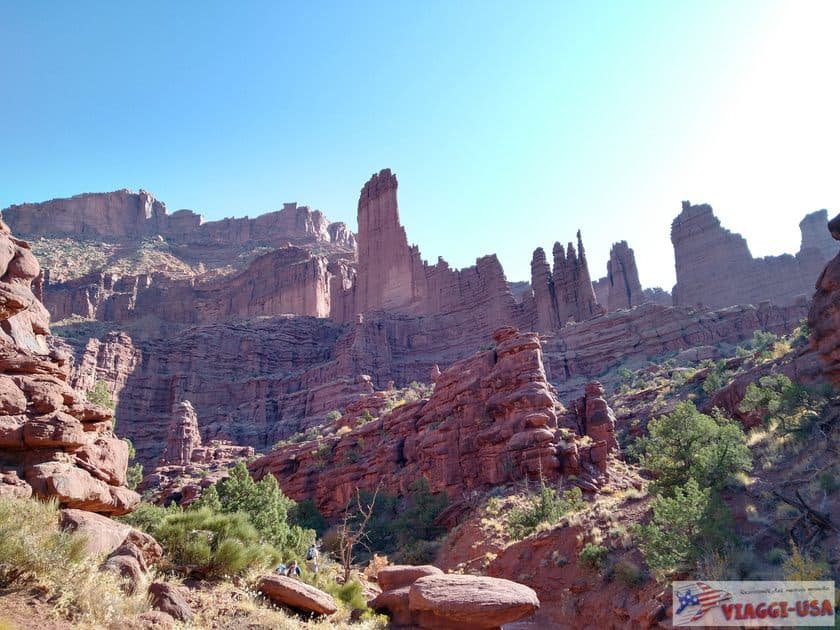
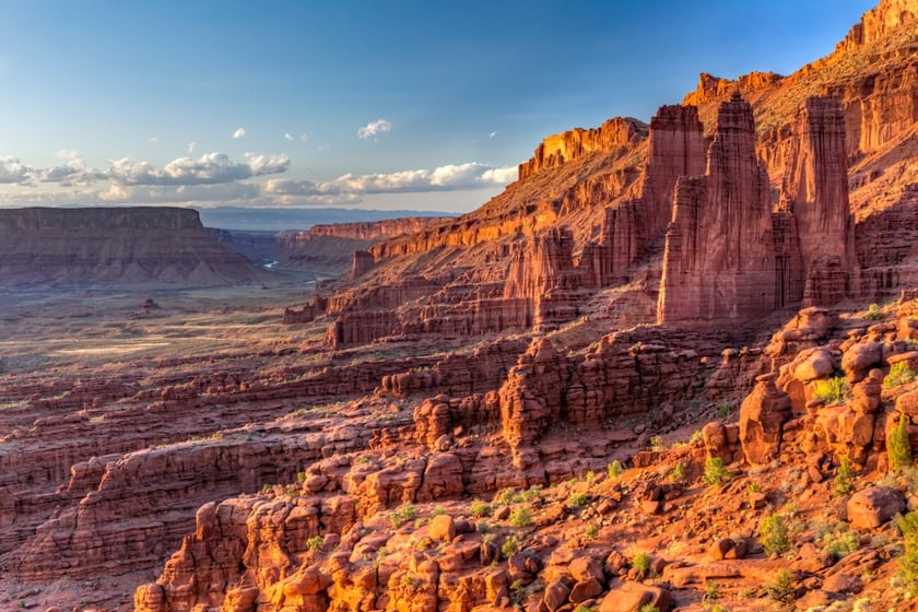


Not everyone decides to complete the trail, but I suggest that you get at least to the point that on the map is indicated as Ancient Art (click here for the location on Google Maps). You will be at the top of an incline and at the base of the towers, it’s the perfect point to get a good view from below 3 of the 4 spires (King Fisher, Cottonwood and Echo) and to see The Titan (the fourth and highest) tower in the second row. To get close to The Titan, you need to continue on the trail, which also includes a passage on an iron ladder. As you climb, take a look at the top of the spires. You’ll be likely to see climbers trying to reach the top!
Professor Valley Road
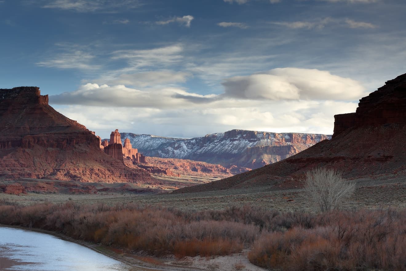
After the hike to the towers, return to UT-128. As you continue, you’ll see the outline of Castle Valley more and more clearly. The most recognizable rock formations have very curious shapes, hence the names The Rectory, The Convent, Sister Superior, Priest and Nuns and Castleton Tower, the main symbol of the valley. Behind this row of “ecclesiastical” rocks, the imposing Parriott Mesa emerges.
You can make as many stops as you want on the way to take the perfect picture, but you also have an alternative solution. Perhaps the ride will be a little more bumpy, but you should definitely still consider it. This alternative is to take the dirt road called Professor Valley Road. This is also a secondary road, and you’ll have to turn right 2.6 miles after the intersection of UT-128 and Fisher Valley Road. This dirt road is mainly used by those who want to reach the Professor Creek and Mary Jane Canyon Trail, a 7.6-mile trail that winds through a canyon along the river and leads to a waterfall. You can drive on Professor Valley Road to the parking lot of the trail to drive parallel to the ridge of Castle Valley.
Castle Valley

While Professor Valley is practically cut in two by the Upper Colorado Scenic Byway, Castle Valley requires a short detour to reach it, and if you’re impressed by the rock formations you saw in the distance, you’ll be tempted to drive the few miles straight into it.
After the Parriott Mesa, follow the signs for Castle Valley and turn right onto La Sal Valley Loop Road. After a short stretch of road through the red rocks, you will see a wide, green valley bordered by towering rock faces and framed to the southeast by the La Sal Mountains, while Round Mountain stands in the center.
Once you’re inside the valley, you may realize that your high expectations have not been met. Truth be told, Castle Valley is much more impressive when viewed in the distance on UT-128 than from the inside. However, I suggest you drive at least until you get under the Castleton Tower, because it’s a really scenic rock formation. With more time on your hands, you may choose to do one of the following activities:
- Castleton Tower Trail: Yes, you can reach the actual base of Castleton Tower and enjoy an impressive view of the two adjacent valleys. To do this trail you have to leave your car here and start walking uphill on a hike that is 2.7 miles round trip with an elevation of 1444 ft. The hike is of moderate difficulty, but less experienced hikers will have to pay attention to the final part, which is quite exposed.
- Fisher Valley Overlook: Drive along La Sal Loop Road for another 6.2 miles past the parking lot for the Castleton Tower Trail. At the junction with Gateway (Colorado) continue towards Gateway. Drive another 5.4 miles after the junction and you will arrive at Fisher Valley Overlook, which offers stunning views of the valley below and of the North Beaver Mesa. Then turn around and head towards UT-128.
Moab Museum of Film and Western Heritage
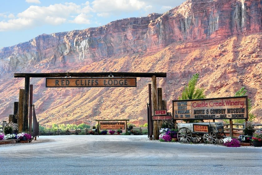
After you have ventured into Castle Valley, turn back on the same road to get on UT-128. Before driving to Moab, make a detour to the Moab Museum of Film and Western Heritage, just about one mile after the turn for Castle Valley. The museum is located inside the Red Cliffs Ranch, a historic property that also houses a winery, a good restaurant (The Coywboy Grill) and a beautiful lodge that is reflected in the Colorado River. This is one of the most sought after hotels in Moab.
The museum, which offers free admission, is a must for lovers of western films. It has a collection of artifacts from the many films shot in the Moab area for 100 years.
Grandstaff Canyon (formerly Negro Bill Canyon)
After visiting the Red Cliffs Ranch, you will leave Professor Valley and enter the last part of the road trip. As I have already anticipated, the last 15.5 miles of UT-128 wind through a gorge carved by the Colorado River. The road narrows between the walls of the gorge and follows the course of the river along a winding route full of remarkable landscapes. On either side of the road are other canyons and gorges. The most impressive confluence is here, where the Colorado River meets the Salt Wash.
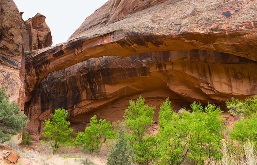
The most popular canyon in the Moab area, however, is Grandstaff Canyon, known until a few years ago as Negro Bill Canyon. The trailhead is right along the road, 4.3 miles after the Big Bend Campground. This magnificent well-marked trail begins near a parking lot and ventures inside a canyon that was once crossed by Williams Grandstaff, a black cowboy who brought cattle here (the name has been changed because it was considered racist). The hike is easy but it’s not to be taken lightly. At an elevation of just 384 ft, it’s 4.3 miles round trip inside a canyon where you find yourself walking both on rocks and sand. At the end of the trail, there is a 243 ft rocky arch, the Morning Glory Arch, considered one of the longest in the world. To see it at its best, get as close as possible. The arch is not far from the rock face, but when seen from below it is impressive.
Where to Stay
Along UT-128 you can find accommodations in the prestigious Castle Valley ranches to experience the cowboy experience. Here are some of them:
- Red Cliffs Lodge: I already mentioned this ranch in the article when I was talking about the Moab Museum of Film and Western Heritage. Out of all the places, I mention here the Red Cliffs Lodge, which is the closest to Moab, but this is not the highlight of the Ranch. Rather, it is the location. The incredible wooden suites overlook the Colorado River and offer exceptional views of the valley’s typical red escarpments. In addition, as I mentioned earlier, there is the museum, the winery with a tasting terrace overlooking the river, a western-style restaurant and a swimming pool… a scenic swimming pool.
- Castle Valley Inn: Unlike the Red Cliffs Lodge, the Castle Valley Inn is located in the heart of the valley and is a bed & breakfast in a green garden with a more familiar, less western feel. It is not on the river, but the view is still sensational. all around are fruit orchards (especially apple trees), and the red La Sal Mountains emerge in the background. The breakfast is superb, as is the layout of the rooms. Compared to the other place, the price to stay here is a bit cheaper and is average for Moab.
- Sun Outdoors Arches Gateway. This is a two-star accommodation located near Moab at the end of the road, surrounded by large rock formations and in an excellent location for visiting the nearby Arches National Park.
Alternatively, although hotels in Moab are quite expensive, there is no shortage of cheaper hotels in the area. You can find our advice at the link below.
Very thankful for this article that clearly help me plan my road trip on UT 128 the road I don’t want to miss!
Thanks for this great article which I skimmed but will further research. So for our boulder to Moab drive which we had planned to do in a day (leave boulder in morning and arrive Moab early evening hopefully at our hotel, we would take route 70 in boulder drive to Cisco and take Rt 128 all the way to Moab. For the sake of trying to plan, how long would that drive from boulder to Moab take (we would of course make stops and slight detours, as you suggest in this article.
Hi! Depending on how many and what stops you will make (for example: Fisher Towers would take at least an hour!) I think it will take you between 5 and 6 hours. Consider that there are many potential stops even on the utah hwy 24 from Boulder to Green River.
Great article!! Thanks for sharing. This is first and foremost on my list for 2023.