If you are on a road trip and plan to visit the parks of the West, you will discover that it’s complicated to drive along the Colorado River. You will have many opportunities to see it from above or from afar, but it is difficult to find a road that is easy to travel that also gives you the thrilling experience of driving along the most famous river of the West. Well, in the area surrounding Moab, Utah, there are three scenic roads that allow you to do so. The most famous is SR-128 (known as Upper Colorado River Scenic Byway), but there are also Kane Creek Road and SR-279, also known as Potash-Lower Colorado River Scenic Byway (or just Potash Road).
In this article, I would like to tell you about Potash Road and all the hikes along this road that can be accessed by leaving the car on the side of the road or taking short detours. I will not limit myself to describe only the first, quick, paved section that stretches about 17 miles along the river, but I will also tell you about the remaining 18 miles on a dirt road, which passes through red rock formations, and leads straight to the most remote areas, such as Dead Horse Point State Park and then Island in the Sky (one of the districts in Canyonlands), and climbs the sides of the canyon along the Shafer Trail, a route that may be challenging for some, but is absolutely spectacular.
Contents
Directions
First of all, allow me to make a couple of clarifications about the route you are going to take. Technically it’s a loop around Moab, but only a few people decide to drive it in its entirety, because it is a long road and most of it takes place on a dirt road with sections that are complicated for those who don’t have some off road driving experience.
From Moab
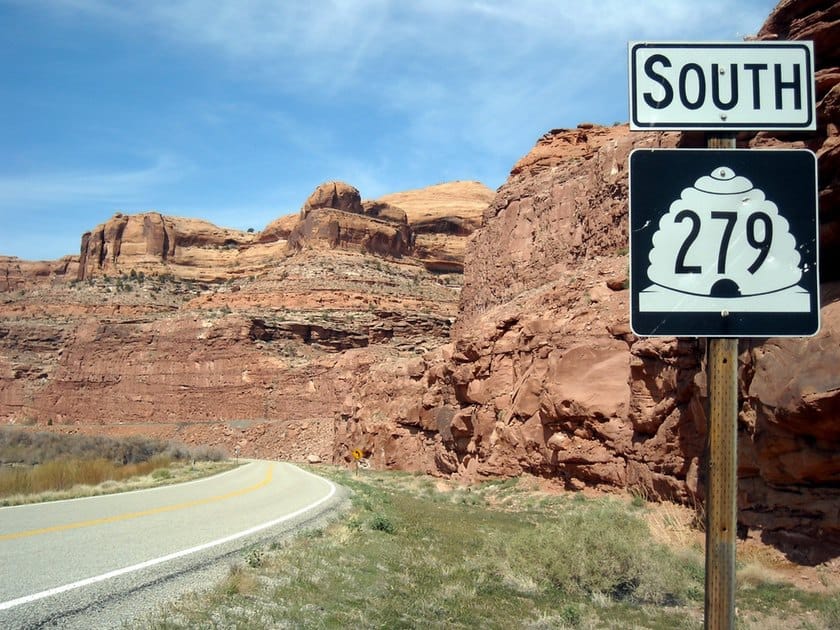
Coming from Moab, you will find the entrance to the Potash Road deviating from the US-191 road about 1.5 miles north of the bridge over the Colorado River, towards Arches National Park. Here is the exact point on Google Maps. From this point the paved road continues for 16 miles, up to the Potash Boat Ramp, after which the dirt road begins and will to take you to Canyonlands.
- If you are only going to drive on the paved road, you will have to go back on the same route as soon as you reach the Potash Boat Ramp. That’s 20 miles in total.
- If you want to do the whole loop, continue on the dirt road to Island in the Sky following the itinerary below and return to Moab via SR-313 and US-191. That’s 66 miles in total, of which 18 miles are on a dirt road. In this case, you will need to pay admission to Canyonlands National Park (national parks annual pass is accepted).
From Canyonlands
If you are in Island in the Sky and want to reach Moab via the Potash Road, just 919 ft after the park entrance (1 mile before the Visitor Center) you have to turn left. This is the exact point indicated on Google Maps. Shafer Canyon Road starts here and it is the most complicated stretch of road, because it is the one that will take you to the bottom of the canyon to the junction with Potash Road.
However, I do not recommend doing the loop in this direction because the descent on the hairpin bends is more daunting and potentially more dangerous than the ascent.
Route Map (Loop)
This one below on the map is the Potash Road loop. If you only want to take the paved road from Moab, you’ll have to go back when you reach the Potash Boat Ramp.
The Paved Road
The road trip starts in Moab. Turn onto SR-279 following the green sign for Potash. After about 2 miles you will notice that the road begins to run alongside the Colorado River, and this is where you will start to see the attractions found on this road.
Portal Overlook Trail and Wall Street

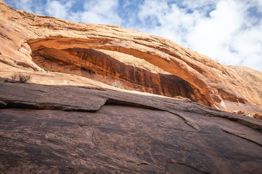
After 4 miles, on your right you will see a tree-lined area at the foot of a red rock cave. This is the Jaycee Park Campground, a small, very pleasant green space with views of the Colorado River and Moab.
From here, you will see the sign for the Portal Overlook Trail, a little-known trail that leads to the top of the cliff, where there is a vista point over the entire Moab Valley. After walking through the woods, you will start to climb up the hairpin bends and continue on steep sandstone slabs without protective barriers on the sides of the trail. The total distance (round trip) is about 3 miles. You can definitely consider hiking the whole trail, but only if you have a lot of time. There are much more beautiful trails ahead!
Shortly after Jaycee Park, a very high wall of smooth sandstone, called Wall Street, will come into view. This wall represents a real challenge for rock climbers. You will see many attempting to climb it as you drive, especially during the summer season.
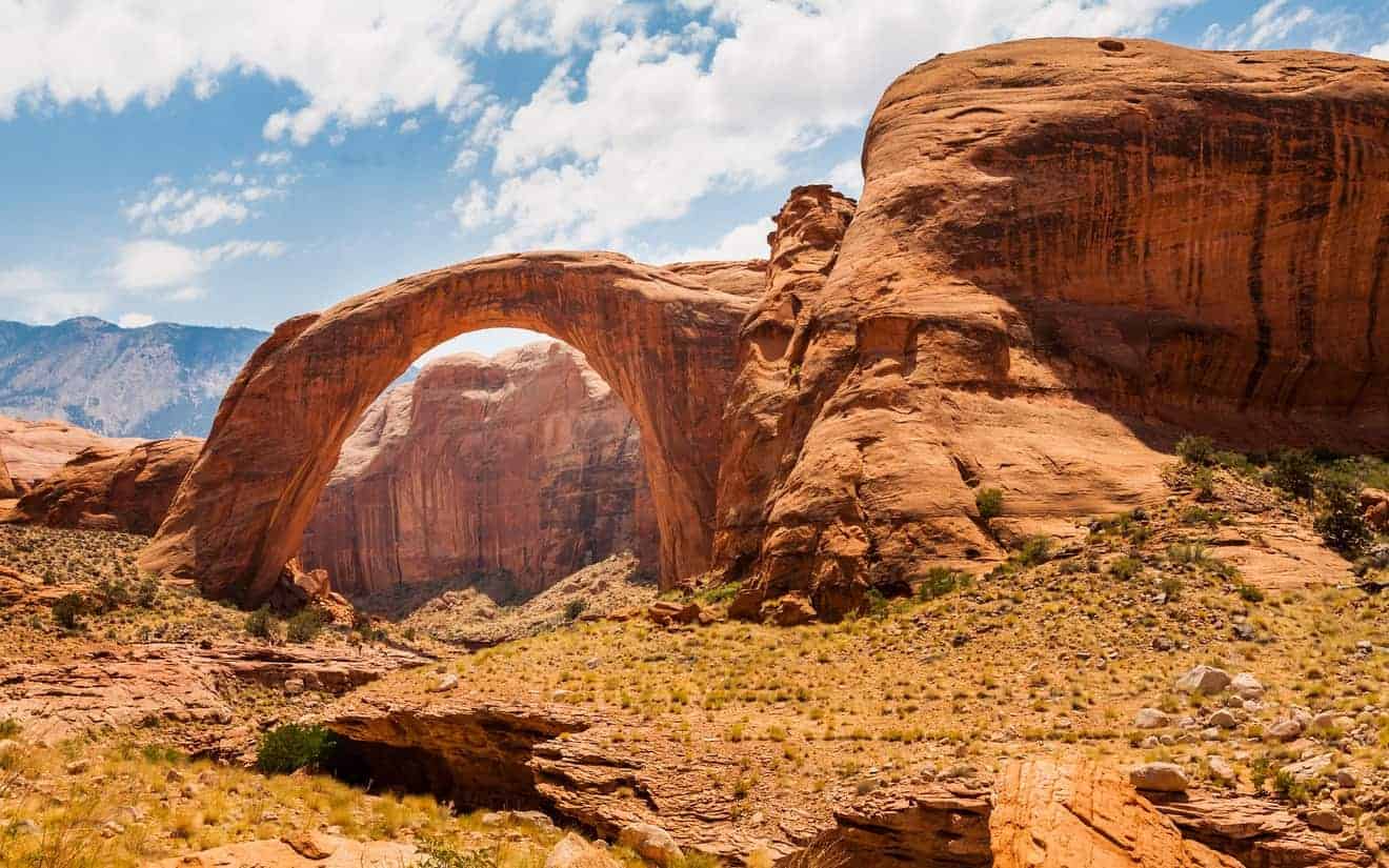
Longbow Arch and Dinosaur Tracks
Who said that the best rock arches are all in Arches National Park? There are several arches around Moab and along Potash Road, there are at least 3 that are worth mentioning. The first, but not the most beautiful, is the Longbow Arch. Here’s how to get there.
Shortly after Wall Street, you will see two signs for Spider Trail and Dinosaur Tracks. Follow the very short dirt road up the hill and leave your car in the parking lot. The path towards Longbow Arch begins past the restroom and climbs up the rock and then takes place on the river bed (drained, of course!), with passages on rock and sand that will slow you down a bit. I would like to point out that after a while you also need to use a walking stick during this complicated passage.
The trail is not well-marked and – as you will most likely hike it alone – you will have to follow the green signs, when available, to know where to go. Along the way you will also see dinosaur tracks (coordinates) and ancient petroglyphs (coordinates). After about 1 mile and at 41 ft of elevation, you will find the arch. Then return to your car following the same trail.
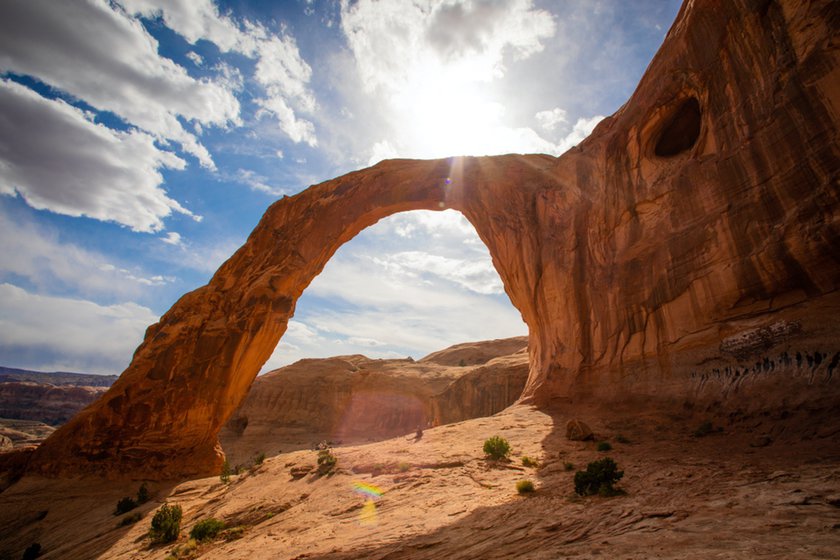
Corona Arch and Bowtie Arch
After the detour to Longbow Arch, the road follows a wide bend in the Colorado River. There is a trail 4 miles from the Spider Trail parking lot that leads to two arches, Corona Arch and Bowtie Arch, which are more scenic than Longbow Arch. Leave your car in the parking lot on the right and before you start the trail, take a look at the directions and advice printed on the sign near the trailhead.
This trail is clearly indicated, very enjoyable and not too tiring. You have to cross the train tracks, right where they enter into a canyon (take a picture. You don’t see a view like this every day!). Afterwards, you will need to help yourself with a ladder and a rope to overcome some more difficult points on the rock. The most exciting moment, however, is when you arrive at the majestic Corona Arch, which is actually halfway between the natural bridge and the natural arch that remains partially attached to the rock.
Just before Corona Arch, on the same trail, you will also see Bowtie Arch, which resembles a large hole in the rock. It can be a lot of fun to try to get as low as possible to get the perfect picture of the sky visible through the hole. Halfway between the arch and the parking lot, there is also a secondary path that leads to Pinto Arch. This arch is also very nice, however, it is at a higher elevation compared to the main trail and in some sections you must walk on smooth rocks.

Jug Handle Arch and Long Canyon Road
Past the Corona Arch parking lot, the road begins to skirt the train tracks which, as we will see, arrive at the site where the Intrepid Potash Company processes potash, a potassium compound (hence the name of the road). After 3.5 miles, you will see the Jug Handle Arch, well indicated on the right side of the road. Immediately after the arch, you will find the intersection with Long Canyon Road.
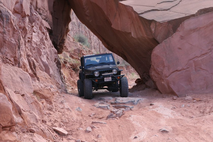
This incredible dirt road is unknown to most people, but if you have time and, most importantly, a 4×4 (or at the least a car with a raised body), it’s really worth it. Most of Long Canyon Road is without barriers and climbs uphill on the hairpin bends to the Pucker Pass, from where you can enjoy incredible views of the canyon and the whole area.
The dirt road is in good condition and it is wide enough for a car to drive in the opposite direction, but if you are not used to this kind of road, I suggest that you be very careful. The entire drive on this road in the canyon is wonderful, but the most exciting moment is when you pass under a huge boulder that has collapsed from the rock face.
It’s not a loop, so you’ll have to drive all 4.3 miles of this road in the opposite direction if you want to return to the Potash Road. It may be useful to know that when you get to the top of the canyon (Pucker Pass), the road continues on a mesa that leads to Dead Horse Point State Park. If you are in the mood for adventure and would like to reach the state park from an alternative road instead of the traditional one, look at the map below to find out how to do it.
Potash Boat Ramp
The paved part of Potash Road ends at the Potash Boat Ramp, a slipway used for tourist boat tours on the Colorado River. The area (under National Park Service protection) has a bathroom and picnic tables below some trees. Before turning back towards Moab or continuing on to Canyonlands, you can just park your car and walk to the banks of the Colorado River to enjoy a beautiful view of the rocky ridges reflected in the water.
The Dirt Road
After the ramp on the Colorado River, a completely different road trip experience begins. As I said before, for the sake of time and safety, not everyone will be able to drive on this dirt road. The road is in fact long, bumpy and, in the last part section, you must drive carefully. I can tell you that what I’m about to describe is the most exciting part of the Potash Road, because it’s at this point that you enter the most rugged part of the road, first, passing through the bottom of Dead Horse Point State Park and then through the heart of Shafer Canyon in Canyonlands.
Potash Evaporation Ponds

About 3 miles after the ramp, you will find yourself facing the potassium evaporation tanks, a surreal view to say the least. This multicolored, geometrically shaped lake appears out of nowhere behind a protective net, surrounded by a rocky landscape. When you see these pools, you will have the impression that you have landed on another planet. How do you explain the color of the water? As I mentioned earlier, the Intrepid Potash Company produces potassium chloride, which usually gives the evaporation ponds a natural reddish color. Here the water is treated with dyes (mainly dark blue, but also with other dyes) to accelerate the absorption of sunlight. In this way, the water evaporates faster and ensures a quicker collection of saline residues that will be taken to be treated.
As a result, the water has a peculiar appearance, and not everyone is happy with the operation. However, the dyes used by Intrepid Potash are carefully monitored so that their use complies with environmental guidelines. I recommend visiting this place! Do not get too close to the ponds. Potassium chloride is toxic.
Thelma & Louise Point
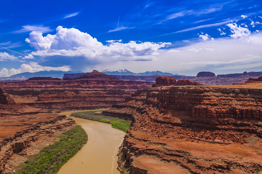
You will leave the colorful toxic pools of Intrepid Potash behind and continue driving for another 3 miles until you reach the most cinematic point on Potash Road. If you have been to Dead Horse Point State Park, from the top of the mesa you will have seen (and envied) cars driving on a road at the base of the canyon. Well, those cars are driving right down Potash Road, roughly at the spot immortalized in the final scene of Thelma & Louise.
The two protagonists throw themselves into the Colorado River with their car not from the edge of the Grand Canyon (as the script would have you believe) but from here, an excellent and exceptional viewpoint over the bend in the river and the surrounding area. From this point, you can also drive a little closer to the ravine by car away from the main road. You can arrive to this point and this point.
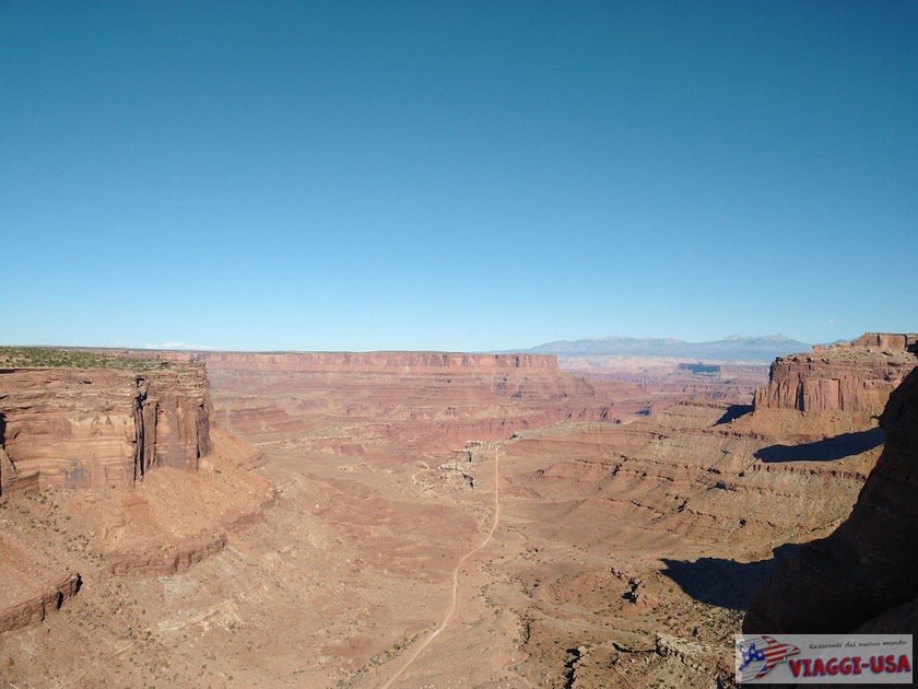
From Thelma & Louise Point you can’t really see the rocky ridge on the river that made Dead Horse Point State Park famous. In order to be directly in front of this point, you’ll need to continue on the Potash Road for another 1.6 miles. At this exact spot, you will find the Gooseneck Overlook. Set the coordinates on your GPS so you will be sure to get there.
South Fork Shafer Canyon

After the Gooseneck Overlook you have to be a bit careful, because the road no longer follows the river. Instead, it begins to descend. At South Fork Shafer Canyon, you will travel for a short distance on the bottom of a river. Here the road is very different, because you drive through the canyon and not on the mesa with an open view of the plateau. The driving experience is just as exciting, but it can also be more complex, with holes and rocky sections.
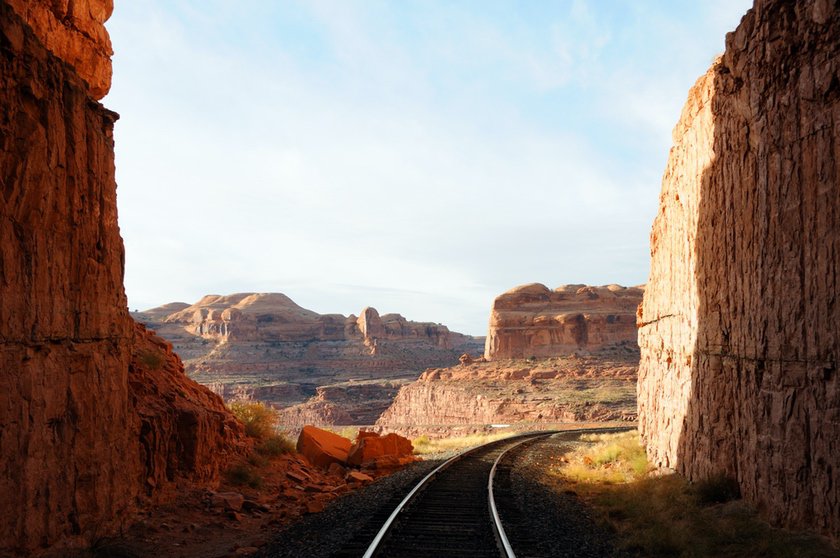
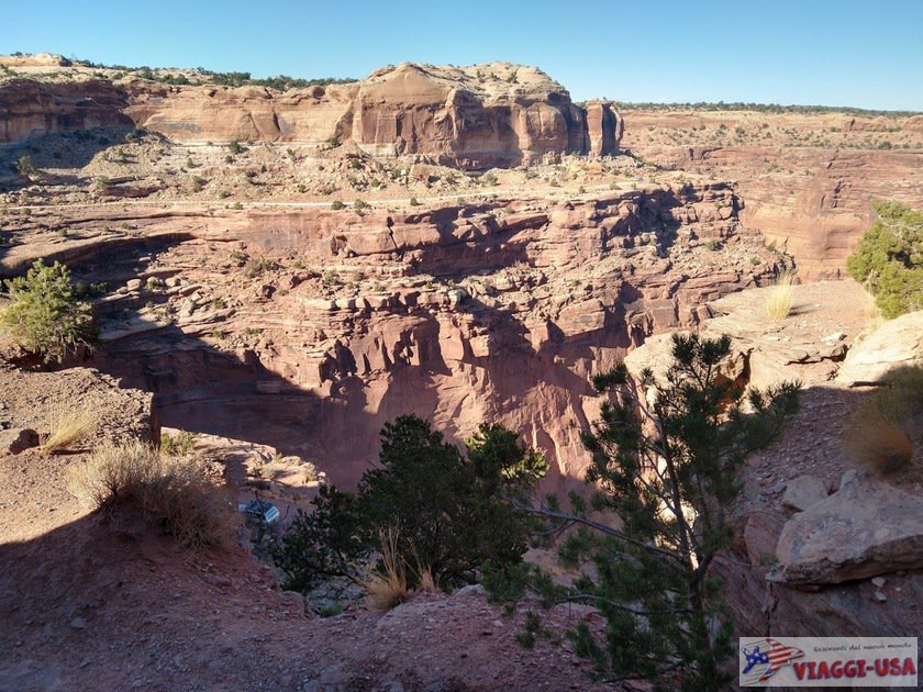
White Rim Road to Musselman Arch
After about 2.5 miles of driving along the bottom of the river, you will return to a much wider landscape. You have finally arrived at the bottom of the actual Shafer Canyon. You’re practically at the back end of the plateau of Island in the Sky, and those who overlook the Shafer Canyon Overlook in Canyonlands at that time may see you as a distant dot. Soon after, you’ll find a fork in the road that will lead you to Shafer Canyon Road, the road that will take you up to the top, where the park’s main road is located.
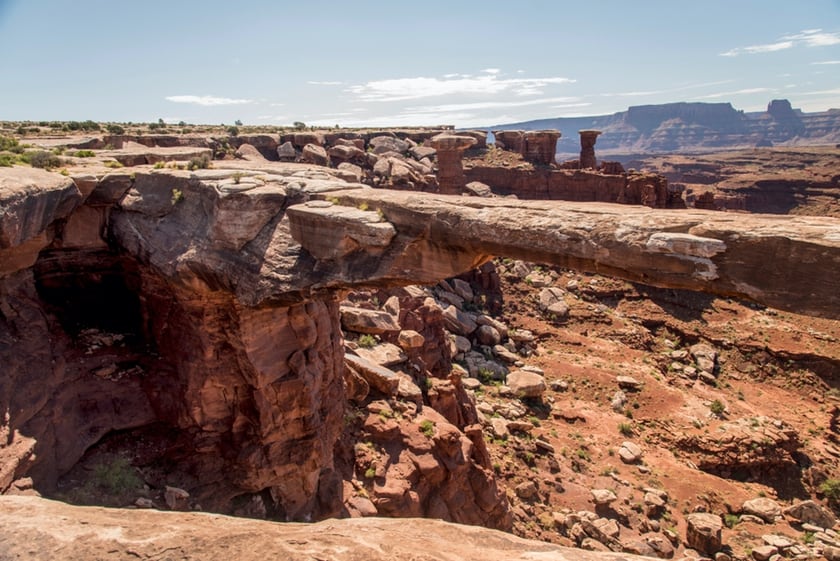
Be careful! At the fork you will have to go right towards the Visitor Center, because otherwise you will go on White Rim Road, a road that goes in a completely different direction. The only reason to drive a short stretch of White Rim Road is Musselman Arch, a natural bridge suspended on the edge of a ravine, on which you can also cross to test your courage. There are also rock formations around it that are reminiscent of the Goblin Valley. This arch bridge is located 3.3 miles from the junction between the Potash Road and the Shafer Canyon Road.
Unlike Shafer Canyon Road, the White Rim Road continues along the Colorado River. You have to pay attention, because there are points where there is no barrier between the road and the precipice, but the advantage is that you can reach other viewpoints to see Dead Horse Point State Park from the west. Click this link to find the coordinates for a nice viewpoint overlooking the Colorado River.
Potash Road to Shafer Trail
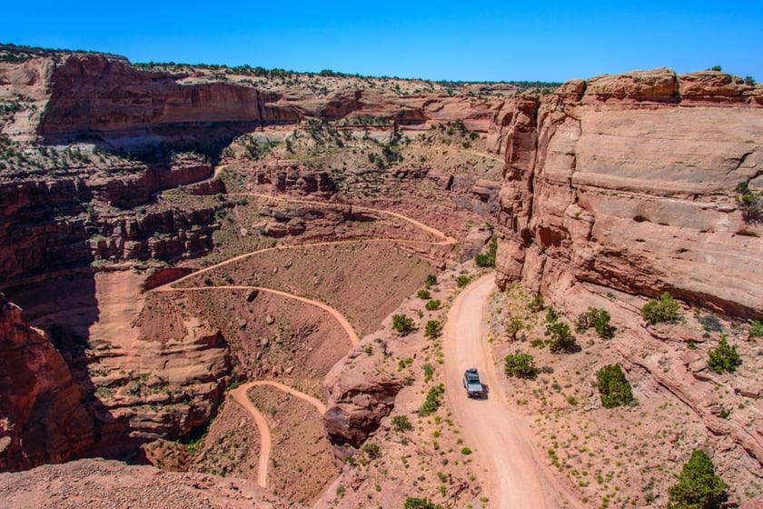
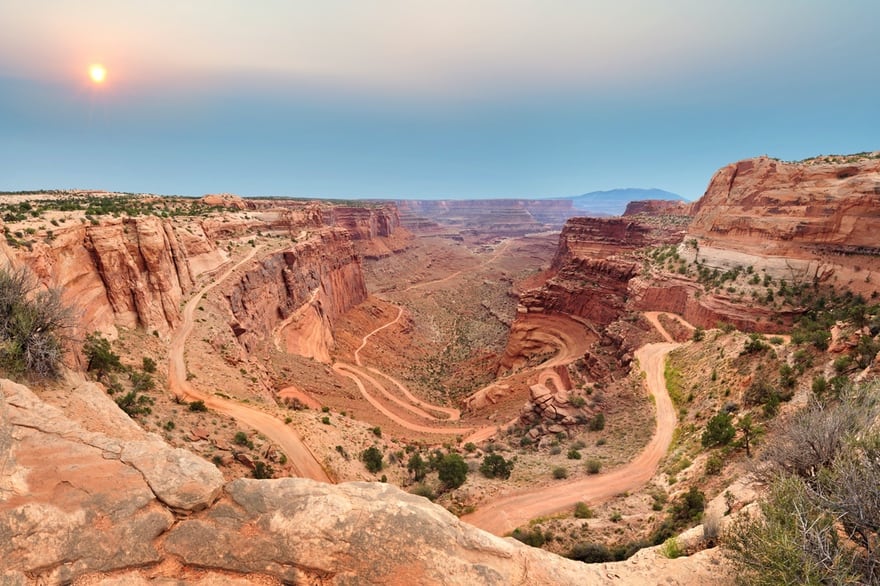
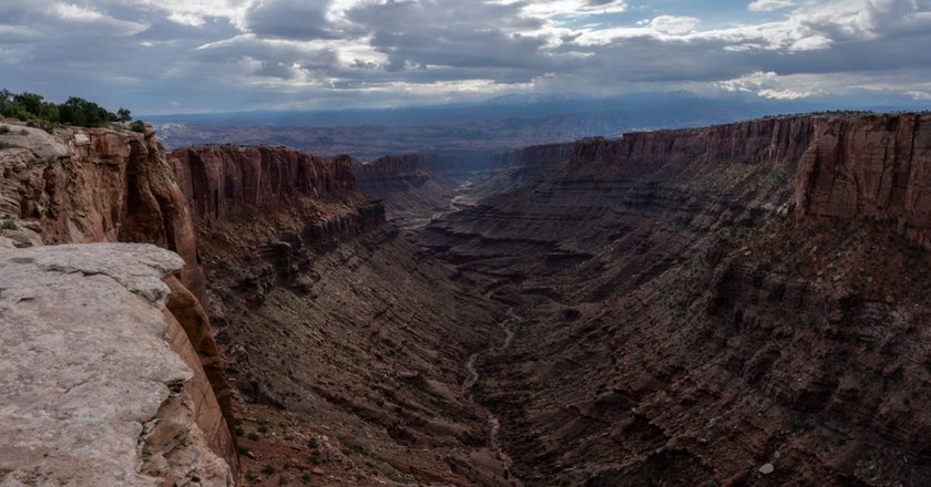
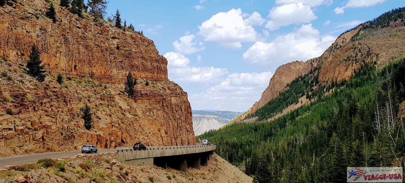
Now head back to the crossroads. From here the Shafer Canyon Road, also known as the Shafer Trail, begins to climb gradually, offering exceptional views over the entire valley. Things get complicated after about 1-2 miles on the dirt road, when the steep hairpin bends start climbing the western side of the canyon all the way to the top. This is certainly the most challenging part of the scenic route from Moab to Canyonlands. I advise everyone to take it uphill (i.e. coming from Moab), which is less daunting and difficult than the descent from Canyonlands.
After the hairpin bends, once you have reached a sufficient altitude, continue along the edge of the canyon for about 2 miles (see photo above), and you will reach the Island in the Sky Road. During the last part of the climb, when you find a wide enough clearing, stop to enjoy the view of the canyon. You will continue to be awestruck by the view as you go up.
This final stretch of road (from the bottom of the canyon to the park road), like those after the South Fork of Shafer Canyon, are the most obvious reason why it would be better to have a 4×4.
Island in the Sky (Canyonlands)
Now you have concluded the road trip on Potash Road and Shafer Canyon Road. You will continue on smooth paved roads and up ahead, views of Island in the Sky, the district of Canyonlands that is easiest to visit, await you. As I mentioned earlier, if you want see where you were until just before, go to Shafer Canyon Overlook and the Shafer Trail Overlook, which will show you the part of the hairpin bends.
Map of the Attractions
What Is the Best Car to Rent?
My recommendation will apply only if you are going to drive the section on the dirt road. If you have the possibility, drive a 4×4, because it will allow give you more stability as you drive on the most uneven spots of the road. However, if you have rented an SUV or a car with sufficient height above the ground, you can still venture out on Potash Road and Shafer Trail, but you must be careful and remember that the insurance included in the rental does not cover damage on dirt roads. Avoid taking the second part of this scenic road if you have a car that is lower to the ground or that does not belong to the categories mentioned.
Below you’ll find a video that gives you an overview of the entire route.
Organized Tour
Don’t have the right car, time, or enough courage to venture along this beautiful road? No worries: there’s the option of an organized tour that will allow you to have this experience. Click this link for more information.
Where to Stay
Whether you plan to do the whole loop or to just drive on the paved road and go on a few trails, the best choice for an overnight stay is always Moab. Below are some detailed recommendations for an overnight stay in Moab.

OK as a retired chemist I can tell you that Potassium Chloride is colorless or as most folks would say: white. There may be impurities in it at the Potash beds that give the impure material a red color, probably iron.
Also Potassium Chloride itself is not very toxic, doctors inject it on occasion and yopu may be told to increase you potassium intake if you blood potassium is low.
But you have produced a very good travel log.
BTW the main road into Canyonlands from 191 is closed right now (9/22) I assume for roadwork. There is supposed to be a detour from Monticello.
Okay! I’m definitely not a chemist so your corrections are very welcome, thank you!