Moab is a great starting point for anyone who wants to explore the impressive natural landscapes of Utah’s parks, including Canyonlands, Arches, and Capitol Reef and hidden gems like Goblin Valley and Castle Valley. But today we want to tell you about Dead Horse Point, a small and still relatively unknown State park that gives you an impressive bird’s-eye view of the reddish and jagged territory of the region. The view may remind the Grand Canyon, but the effect is completely different.
But let’s start at the beginning. Where exactly is Dead Horse Point State Park located? What to do? What can you expect to find there?
Contents
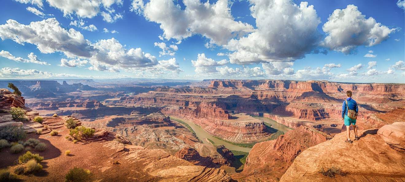
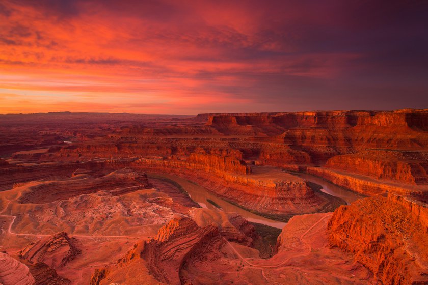
Dead Horse Point Overlook: What to Expect

Dead Horse Point is easy to find, especially if you’re on a tour of the parks in Utah, in the stretch between Canyonlands and Arches. Dead Horse Point is practically halfway between the two parks, and it’s perfect for those who are leaving Island in the Sky in the late afternoon and want to see an unforgettable sunset before returning to Moab.
The spectacular view at Dead Horse Point shows a bend in the Colorado River that may actually remind you of other similar views, such as the view of the bends in the San Juan River at Goosenecks State Park, but also of another natural wonder of the West, the cliff in Horseshoe Bend (Page, Arizona) shaped like a horse’s hoof also located on the Colorado River. The word “horse” is also in the name of the state park we are describing in this article, but for a different and perhaps more macabre and fascinating reason. We will tell you about it in a moment.
Directions
But how do you get to Dead Horse Point?
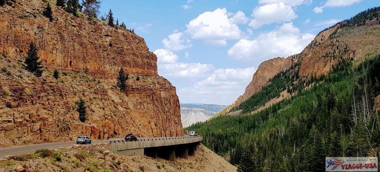
Coming from Moab, head north on US-191, passing both the Colorado River bridge and the turn for Arches National Park. After about 9 miles, turn left onto UT-313 W at Moab Giants Dinosaur Park. From here, the sign will point you in the direction of Canyonlands and Dead Horse Point. The road is remarkably beautiful, especially at the beginning, where the red cliffs looming over it, anticipating what you will soon see.
After 17 miles, you have to turn left and drive another 7.5 miles. After paying the entrance fee ($20 per car), you can stop at the Visitor center (located near the Basin Overlook, which offers beautiful views of the east side of the canyon) or continue by car for another mile or so to the actual Dead Horse Point.
Things to Do at Dead Horse Point State Park: Trails
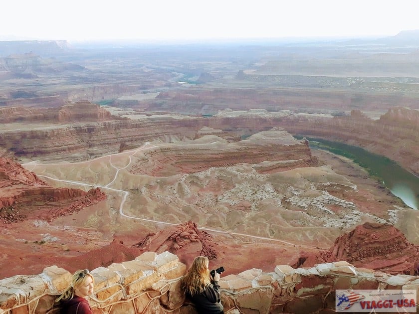
There are basically two ways to visit Dead Horse Point. The first – the simpler way – is a very short walk from the parking lot along the Dead Horse Point Trail, which leads to the main natural terrace from which you can see the beautiful view of the bend of the Colorado River in the immense red expanse of Canyonlands cut by the beautiful Potash Road. You can enjoy a wonderful panorama from this viewpoint that you can reach without having to exert much effort.
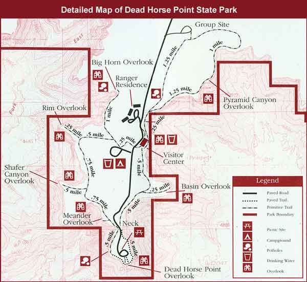
The second way to visit Dead Horse Point requires more time and determination. There are trails that depart from both the visitor center and the Dead Horse Point parking lot (there are also some bike trails) that wind along the ridge of the canyon, offering you a 360-degree view of the entire surrounding area. One of these is the West Rim Trail, which ventures for about 2.5 miles on the western side of the park, up to the Rim Overlook. From here, after enjoying the view, you can return to the visitor center, since the trail reaches the nearby camping area.
If you start from the visitor center, it takes about one mile to reach the Pyramid Canyon Overlook. Here too you can enjoy the mesmerizing beauty of the landscape, despite being on the opposite side of the meander on the Colorado River.
Marlboro Point: A Hidden Gem!

Most of the park’s viewpoints are located on the main “peninsula” of the mesa. Dead Horse Point Overlook is found on the southern tip of this mesa. However, not everyone knows Marlboro Point, precisely because it is located on another strip of land that is less frequented by tourists, especially because the road to get there is very curvy.
Dead Horse Point Overlook offers a beautiful view of Shafer Canyon, which is usually seen from west to east, from the top of Island in the Sky (Canyonlands). From Marlboro Point, on the other hand, you can look deep into the canyon from north to south, offering a very unique perspective. But what’s special about Marlboro Point is that before you look out over the desert expanse, you’ll also see a couple of towers and a butte jutting out over the ravine you’re standing on that greatly enrich the view.
- How to get there? Given that it’s important to have an adequate vehicle (definitely better if a 4×4), it must be said that there are several roads, all dirt roads, leading to Marlboro Point. I recommend the that you choose the one closest to the visitor center of the park. When you are driving on UT-313 W, you will make a turn at this point and take the dirt road. After 1 mile, turn left at the fork and continue on the main road for another 1.5 miles, until at least this point. If you feel up to it, you can also continue as close as possible to the arrival point, but bear in mind that the terrain is sandy and there are potholes and sections with rocks in the road. It can be rather bumpy, but it is mostly a flat route.
The Legend of Dead Horse Point

We have already given you tips on how to visit Dead Horse Point State Park, and now we want to tell you about the legend that gave the park its name.
It is said that a herd of mustangs lived wild and free in these parts. Some cowboys who were exploring the area along the trails overlooking the endless valley saw these splendid horses and decided to pursue them in order to capture them. The mustangs, who were desperately trying to get away, met their end at the edge of the meander. Rather than be harnessed by the cowboys, the horses decided to jump off the cliff, losing their lives and freedom to the river. This is the tragic origin of the name Dead Horse Point.
A no less fascinating – but perhaps less gloomy – legend has it that the horses were chased as far as the meander and there was no way out. The cowboys took away the best horses, while the other horses remained symbolically on that cliff without ever returning home.
Potash Road and Dead Horse Point in Film
This is the setting not only of the legend, but movies as well. Where do you think Tom Cruise was climbing in the first scene of Mission Impossible, if not on the sharp edge of the canyon in this state park? Here, at Dead Horse Point!
But the film Thelma and Louise immortalized this park in film. Did you know that Thelma and Louise‘s final scene – the dramatic car flight from the edge of the ravine – doesn’t take place at the Grand Canyon (as stated in the film) but on Potash Road, a scenic road that winds practically under Dead Horse Point? That’s the point. Potash Road is an impressive dirt road that starts in Moab and goes all the way to Island in the Sky (Canyonlands).
Dead Horse Point: Useful Information
Dead Horse Point Opening Hours and Fee
The park is open all year round from 6:00 am. to 10:00 am, while the visitor center is open from 9:00 am to 5:00 pm. As I mentioned earlier, the entrance costs $20, and because it is a state park and not a national park, it is not possible to use the national parks annual pass.
Where to Stay Near the Park
The best place to stay overnight near Dead Horse Point is undoubtedly Moab, called the “Adventure Capital of Utah” because of the beautiful natural heritage in the surrounding area. We loved the rustic Bighorn Lodge. You’ll also find more recommendations at the link below.
Helicopter Tours over Dead Horse Point, Canyonlands, and Arches
We recommend a nice helicopter tour in the Moab area, which may remind you of the helicopter tour of the Grand Canyon we talked about extensively in another article. The difference – in our opinion decisive – is that this air tour will take you to the red sandstone natural wonders of Utah, which is very different from the landscape of the Grand Canyon.
The helicopter tour (total duration: 1 hour) flies over the three districts of Canyonlands, the beautiful rock arches of Arches National Park, the aforementioned Dead Horse Point and many other emblematic places created by the Colorado River, as well as the point where it meets the Green River, a little further south of the park.