The fortunate town of Page in Arizona is a must-stop on any West Coast tour that wants to truly define itself: the number of natural attractions in its surroundings is so high that two full days wouldn’t be enough to visit them all. Lake Powell is undoubtedly one of them: we can confidently say that, along with Antelope Canyon and Horseshoe Bend, this artificially created reservoir with unforgettable colors is the symbol of Page.
But what, in turn, is the symbol of Lake Powell? It’s hard to answer, given the great number of unforgettable sceneries, starting with the mysterious and unreachable Reflection Canyon! However, when talking about Lake Powell, one cannot avoid mentioning the legendary and mysterious Rainbow Bridge, hidden in a remote area of the Glen Canyon National Recreation Area.
Contents
What is the Rainbow Bridge? Characteristics and History
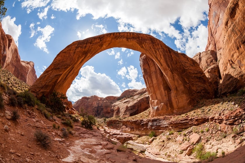
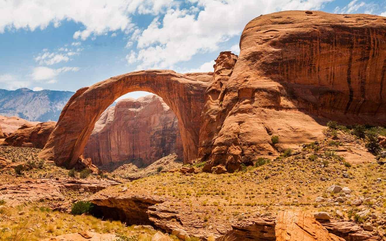
With its span of 275 feet and a height of 308 feet, Rainbow Bridge stands in the realm of the world’s largest natural bridges, competing with other natural wonders in the USA and Asia. From a geological perspective, we’re talking about a Navajo Sandstone bridge resting on a base of Kayenta Sandstone, carved over millions of years by weathering agents.
Originally, the river (Bridge Creek) that flowed along the bed of what is now known as Rainbow Bridge Canyon created a meander that cut through the plateau. Over the millennia, the river changed its course and, aided by wind action, carved and shaped the bridge. Today, we see it in its most glorious form, but in some future era, the same weathering agents will likely test its endurance and cause the structure to collapse.
Considered a sacred site by the native tribes of the area, the natural bridge was previously known by the Navajo name Nonnezoshe (“rainbow turned to stone”). Discovered in the 19th century by explorers and cowboys, the arch remained unknown to the public until 1909. The following year, President William Howard Taft proclaimed it a National Monument.
Location
The “unfortunate news” is that this exceptional natural monument is not exactly easy to reach. Rainbow Bridge is hidden in a remote meander in the southern Utah portion of Lake Powell, within the boundaries of the Navajo Nation. Despite being on native territory, the area where the bridge is located is an integral part of the Glen Canyon National Recreation Area and, as mentioned earlier, has been a separate National Monument for over a century (one of the smallest in the entire National Park Service), known as Rainbow Bridge National Monument.
How to Get to the Rainbow Bridge National Monument
Ci sono solo due modi di raggiungere il Rainbow Bridge: in barca e a piedi.
There are only two ways to reach Rainbow Bridge: by boat and on foot.
Rainbow Bridge National Monument Boat Tour
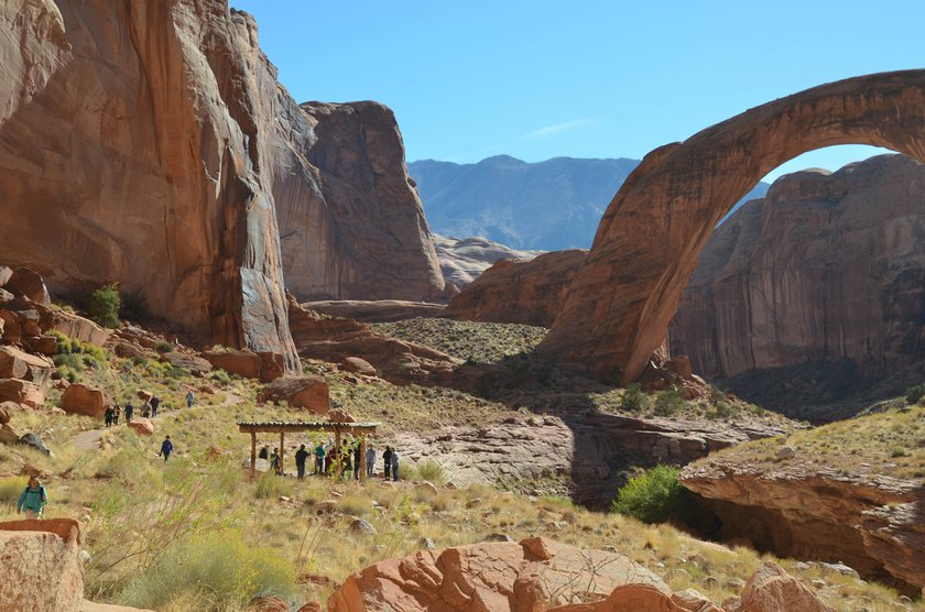
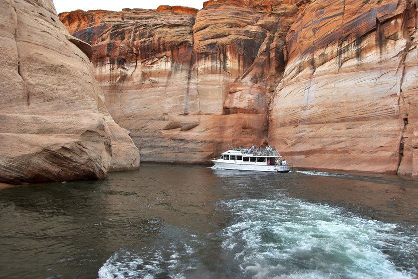
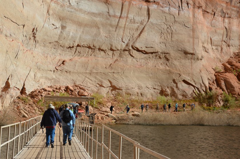
The most common way to reach the Bridge Canyon meander is through a guided boat tour. You’ll embark on a lengthy journey (approximately 50 miles!) aboard a vessel departing from Wahweap Marina, the main port of Lake Powell (also the most frequented by tourists due to its easy accessibility and proximity to Page). The boat will take you to the dock where a boardwalk leads to the canyon’s entrance. From there, a walk of less than a mile will bring you to the arch, allowing you to marvel at its magnificence. In total, you’ll need to walk approximately 2 miles round trip. CAUTION! During certain times of the year, the cruise may not be available due to the lowering of the lake’s water levels, making navigation to the meander impossible.
Book the Rainbow Bridge Boat Tour
If you don’t want to join the crowd and know how to operate a boat, it is possible to rent a motorboat at the marina during certain months of the year and independently reach the dock. Here is a link for more information.
Rainbow Bridge National Monument Hike
This section of the article should only be of interest to experienced hikers who have plenty of time available. There are two very long and challenging hikes that start from Navajo territory in Utah, far from Page, at the base of the nearby Navajo Mountain: one on the southern slope and one on the northeastern slope of the mountain. To reach the respective trailheads, a 4×4 vehicle is required as the routes involve driving on unpaved roads that are not always in good condition.
In both cases, in addition to the length and technical difficulty, it’s important to consider that the hike is entirely exposed to the sun. Moreover, in summer, there is a real risk of encountering a flash flood, and in winter, it is not advisable to venture onto the trail if the ground is wet. The best time to undertake these hikes is from March to mid-May, as well as the autumn months (October-November).
You will need two or three days to complete the round trip. In addition to wearing appropriate clothing and carrying plenty of supplies, you will need to plan for one or more nights of camping. Obtaining a permit from the Navajo is necessary for camping, and a permit is also required to hike on the trail.
Rainbow Bridge North Trail
- Trailhead: Coordinates
- Length (round trip): Approximately 31 miles
- Elevation gain: 5,577 feet
- Detailed description and directions: Official website
Rainbow Bridge South Trail
- Trailhead: Coordinates
- Length (round trip): Approximately 25 miles
- Elevation gain: 6,686 feet
- Detailed description and directions: Official website
Where to Stay
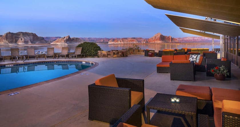
If you decide to visit Rainbow Bridge by boat from Wahweap Marina, you will likely need to spend at least one night in Page. You can find our recommendations on where to stay in Page at the link below.