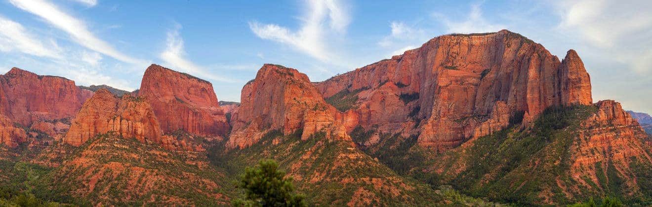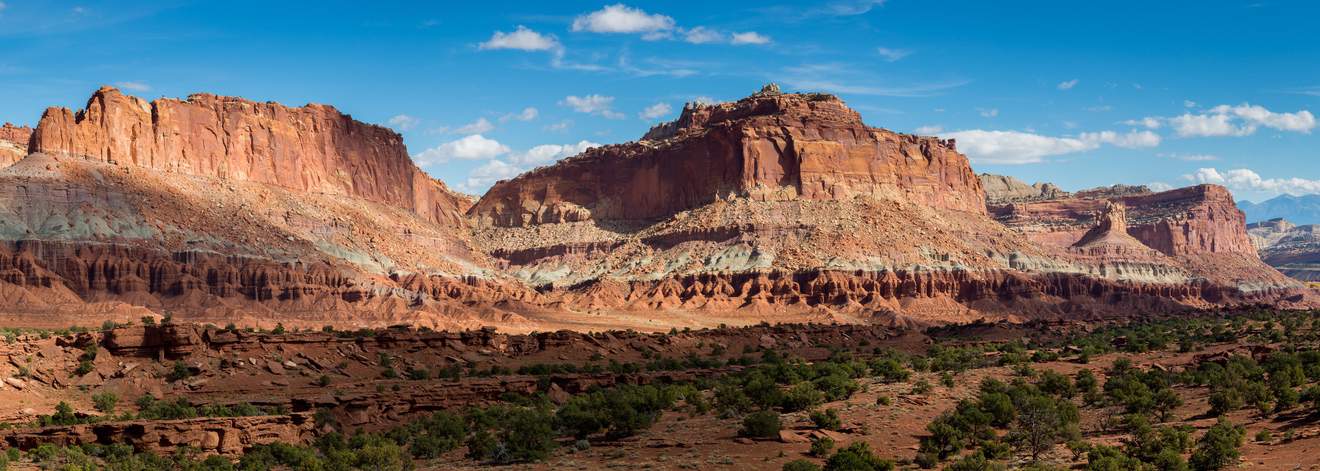
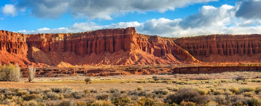
Not everyone knows that visiting Capitol Reef could be a fascinating and surprising experience, as it is one of Utah‘s most unjustly underrated and therefore, less frequented nature parks. Located in south-central Utah, right in the heart of the region of red rock formations and along the beautiful Utah State Route 24 Scenic Byway, Capitol Reef is the national park home to natural wonders in Waterpocket Fold, a monocline that stretches about 100 miles with intense colors and the most imaginative cliffs, domes, steep peaks, canyons, mesas, natural bridges, arches and more.
But visiting Capitol Reef entails more than venturing into a geological masterpiece, one of many in Utah. Another peculiar feature of the park is Fruita, an ancient Mormon settlement that, as its name suggests, is dotted with lush orchards from which anyone can pick apples, peaches or cherries. But let’s look at the details for planning a visit to Capitol Reef: things to do, hiking trails, scenic roads and best overlooks.
Contents
Where is Capitol Reef National Park? How to get there?
Capitol Reef is one of the so-called Utah Mighty Five, the name given to the five national parks of Utah, and as already mentioned, is located in the south-central region of the state. A point of reference for Capitol Reef is a pleasant town called Torrey, which is a few minute’s drive from the visitor center.
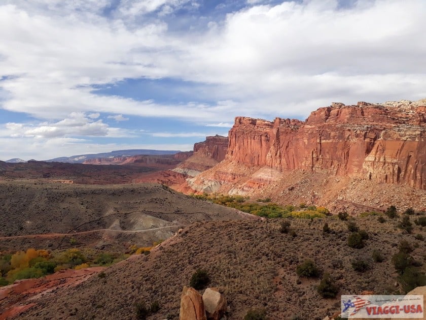
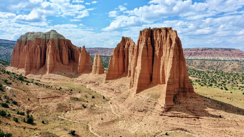
The name of the park comes from 2 natural features, the Capitol Dome monolith, which reminded the first explorers of the U.S. Capitol Building in Washington, D.C., and the immense geological barrier (“reef”) known as Waterpocket Fold, which spans the entire length of the park.
Along the barrier, Capitol Reef National Park is divided in the following 3 districts:
- Fruita: The most accessible area, where the visitor center and the historic district of Fruita are located.
- Waterpocket District: The remote area south of the park that offers spectacular views of Waterpocket Fold.
- Cathedral Valley: The isolated area north of the park, known for its striking “rock cathedrals”.
In this article, we will explore in detail the area of Fruita, which already offers many points of interest, and a brief paragraph to the other two more remote areas, equally remarkable, but more complicated to reach.
The park is located on Utah Highway 24, a scenic road that Viaggi-USA readers will be familiar with, and which we recommend to those traveling from Bryce Canyon to Moab, the reference city to visit Arches National Park and many other wonders of the red rock region of Utah.
Therefore, Capitol Reef is easy to reach, being, among other things, in a strategic position for those who visit this area, but it is often treated just as a quick stop, as if it were a secondary attraction. That is a real shame, because a visit to Capitol Reef is not a waste of time at all.
Admission Fee and Hours
Both the park and the camping area can be visited all year round and the visitor center opening from 8:30 a.m. to 4:30 p.m. (with extended hours from spring to fall). Like any national park, there is a fee for admission. The price per car is $20 and is included in the national parks pass.
How to Plan a Visit to Capitol Reef?
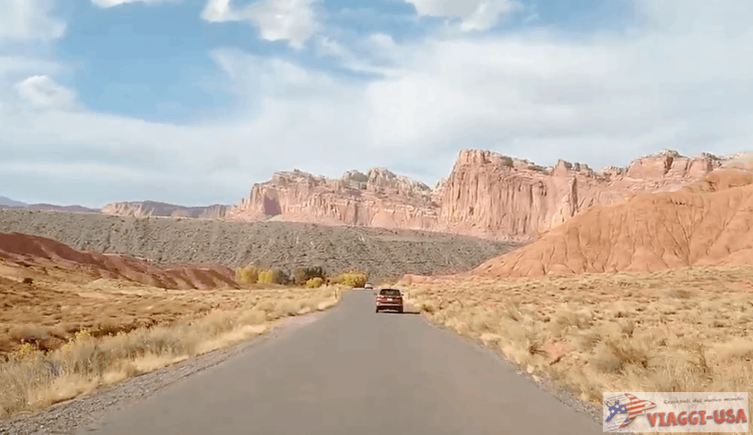
Capitol Reef accommodates the many needs of visitors. In fact, you can go on a nice drive, enjoying splendid panoramic views from the car or from the various viewpoints that wind along the Scenic Drive. There is no lack of scenic roads here. In the Fruita District alone there are two scenic roads.
Those who want to see the geological wonders of Capitol Reef up close can do so with little effort. There are many trails in the park that you should definitely consider.
Obviously, one way doesn’t exclude the other, on the contrary, as it often happens, combining a scenic drive with some nice walks is the best way to enjoy a national park. If you have little time, later in the article I will give you some advice on how to organize a visit lasting a few hours.
Scenic Roads
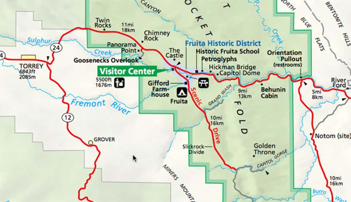
Capitol Reef can be a paradise for lovers of road trips and Scenic Byway. Here are the two scenic roads in the Fruita district, with all the points of interest you will find along the way:
Capitol Reef SR-24 Scenic Byway

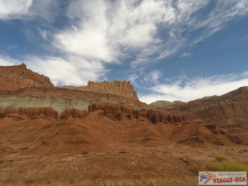
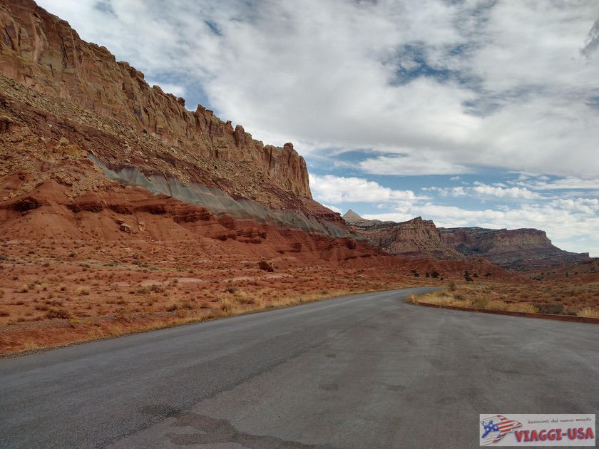
SR-24 is a beautiful scenic road that starts in the small town of Salina and ends in the Green River area, crossing a series of natural wonders including Capitol Reef. In fact, this is the only road of great distance to cross the monocline known as Waterpocket Fold, allowing you to visit the park with ease. For more complete information on the scenic route, you can read our guide on SR-24.
Carved deep in this extraordinary land barrier, the portion of SR-24 that crosses Capitol Reef is the main road of the park, on which you will find a series of viewpoints, the orchard area, the visitor center and the starting points of some trails.
- Start: At the entrance of Capitol Reef, impossible to miss.
- Length: the whole road is 81 miles long but the section that crosses Capitol Reef is about 16 miles long.
- Average Travel Time: Driving the entire length of SR-24 takes about 1.5 hours without stops. Capitol Reef can be crossed in 20 minutes, of course, it will take much longer, given the various activities to be done in the park.
Points of Interest
Along the road, you will find these points of interest (listed from west to east, coming from Torrey to be precise), but not all of them are marked, that’s why I marked them on the map above:
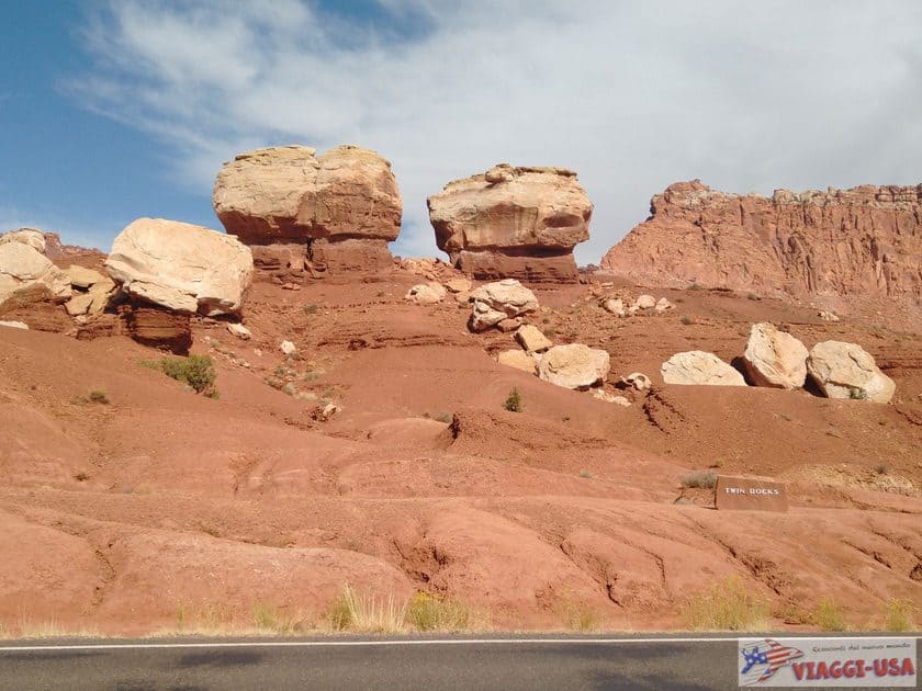
- Twin Rocks: Boulders that emerge from the earth like big mushrooms-like rocks.
- Chimney Rock: A rock “fireplace” emerging from a great red wall. Nearby you will also find the trail Chimney Rock Trail (Chimney Rock Trail).
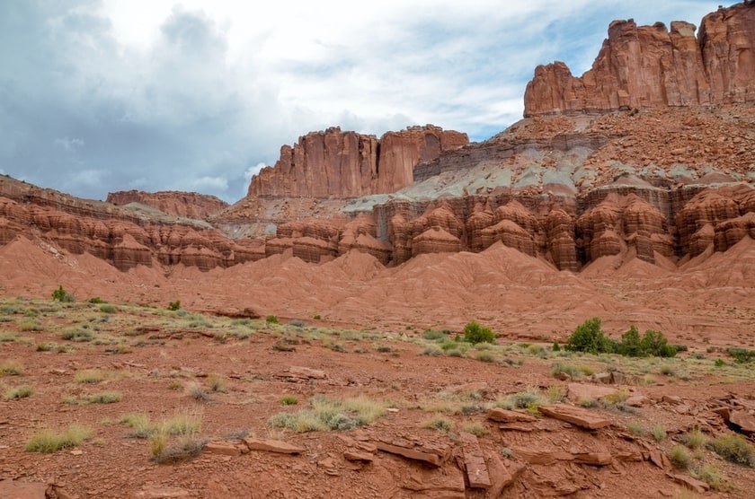
- Mummy Cliff: Large cliff with colorful rock layers, located in front of the turn for Panorama Point.
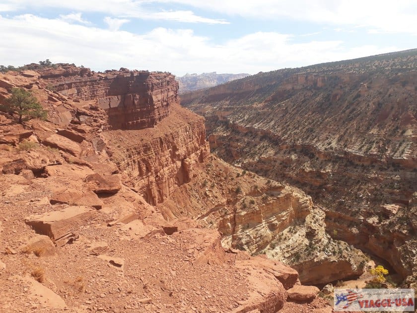
- Panorama Point: Ideal place to admire the rocky ridge of the Waterpocket Fold
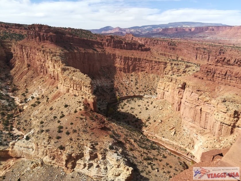
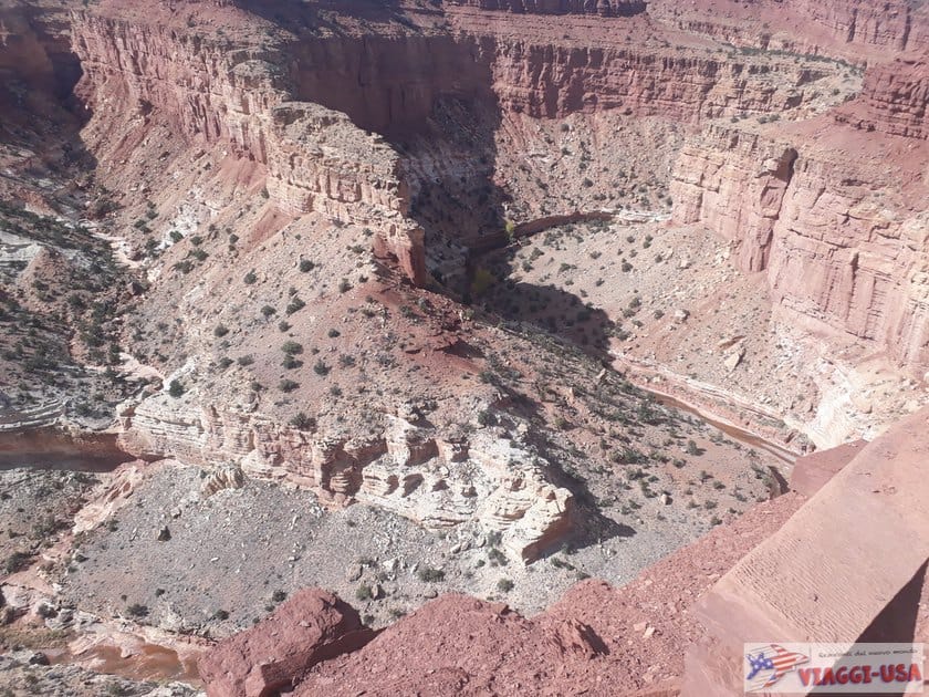
- Goosenecks Overlook: Continue past Panorama Point to another beautiful viewpoint overlooking the three curves of Sulphur Creek Canyon. Picture a larger version of Goosenecks State Park!
- Sunset Point: Heading from the parking lot towards the Goosenecks Overlook, there is a short trail of just over 1640 ft that will lead you to another viewpoint from which you can admire the Fremont River Gorge and as well as the Henry Mountains in the distance.
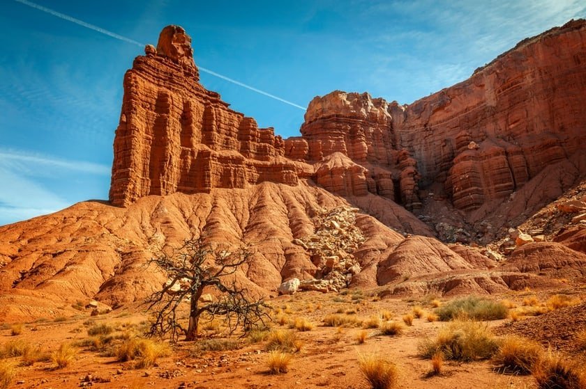
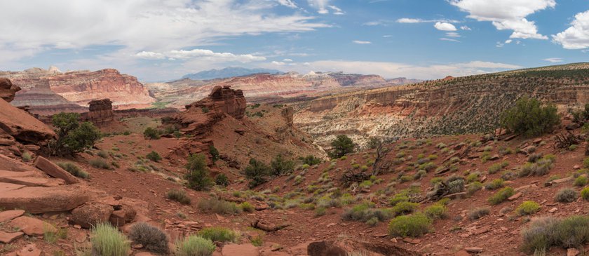
- The Castle: Taking the main road you’ll find this rock formation at the top on your left. You can admire it from a clearing on the right or even from the visitor center parking lot just up ahead.
- Capitol Reef Visitor Center: The visitor center referenced throughout the article. In addition to the classic information material here you can enjoy viewing a video about Capitol Reef, that explains its unique geological features.
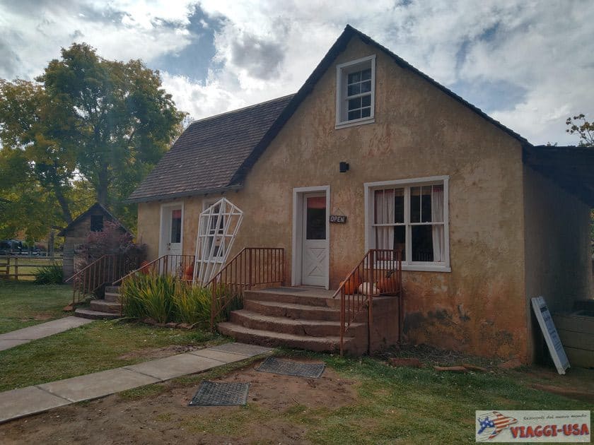
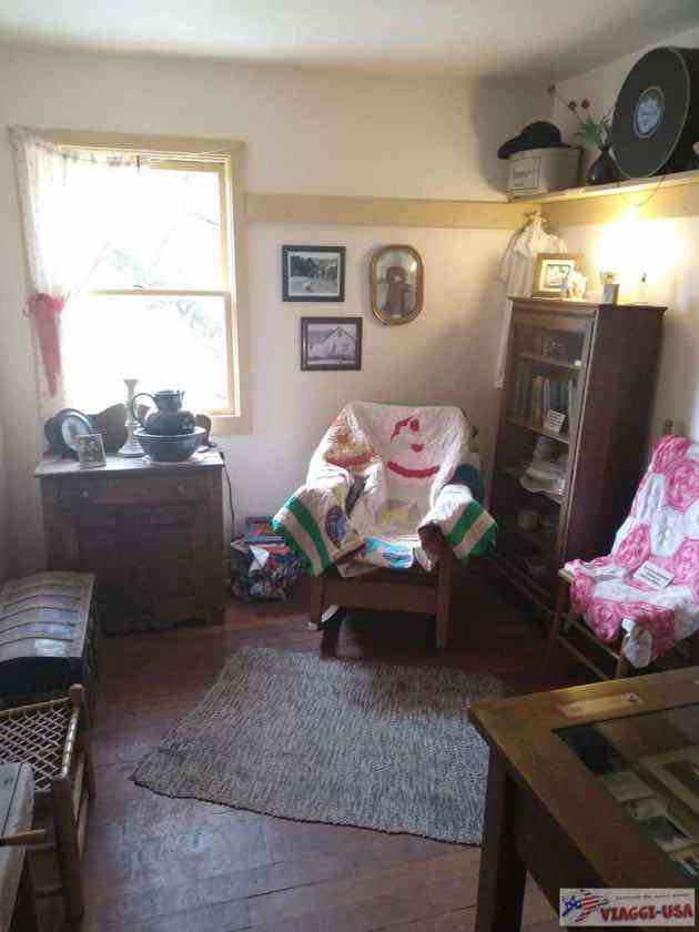
- Fruita Schoolhouse: The town’s old schoolhouse dates back to 1896, although the interior reflects how it should have looked in the 1930s. You will find it on the left about half a mile past the visitor center.
- Petroglyphs: Just outside the town, you will find a site with rock carvings of an ancient people who lived here 2000 years ago.
- Hickman Bridge Trailhead: About 0.6 miles further you will see the parking lot and the trailhead of another very popular trail in the park that leads to the beautiful rock arch Hickman Bridge. Nearby, on the opposite side of the road, you will also find one of the 2 starting points for the Cohab Canyon Trail (the other is in the historic village of Fruita, not far from the farm).
- Grand Wash Trailhead: Just over 2.5 miles further, you will notice a small clearing on the right where you can park your car and drive along Grand Wash, a nice road that branches off into a narrow canyon. There aren’t many parking spaces, so if you can’t find a parking space you can try the other trailhead near the Capitol Reef Scenic Drive, which I will talk about in the next paragraph.
- Behunin Cabin: Historical residence dating back to the 1880s where the Behunin family lived. Believe it or not, apparently, 15 people lived in this small house!
Capitol Reef Scenic Drive

Capitol Reef Scenic Drive, the other scenic road in Capitol Reef, takes you to the visitor center. Although the visitor center is clearly visible from SR-24, it is actually on Camp Ground Rd, which becomes Scenic Drive.
You start seeing the best views on this road beginning in the historic town of Fruita, and continuing for about 7 miles along the western side of Waterpocket Fold.
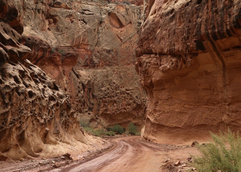
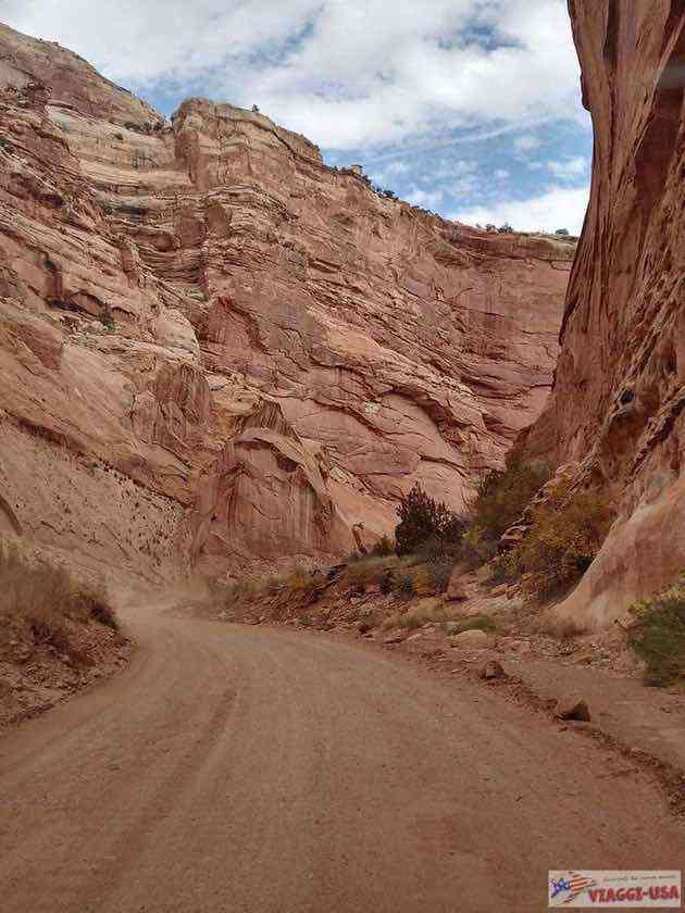
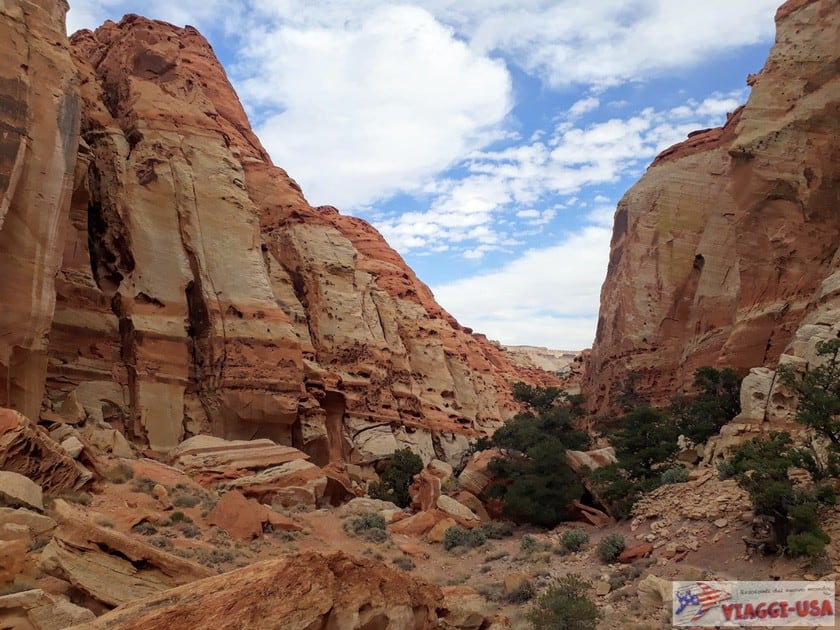
From the Scenic Drive (all paved) there are two secondary dirt roads (Grand Wash Rd and Capitol Gorge Rd) which lead to trails by the same names. For short stretches along these dirt roads you can enjoy a nice drive (especially in the case of the second one).
The landscape you’ll find closely resembles the rugged red rock headlands of SR-24, but with a much closer view. In fact, on some parts of the road (those on the dirt road) here in Capitol Reef, there is a rather rare opportunity, which is to drive inside the winding rock canyons, almost as if you were following the course of the rivers that have dug them over time.
- Start: At the visitor center, although officially Scenic Drive begins just before the cluster of historic houses.
- Length: 6.8 miles only counting the paved section; Grand Wash Rd is 1.2 miles long; Capitol Gorge Rd is 2.2 miles long.
- Average Travel Time: 1 hour and 20 minutes roundtrip. If you want to limit yourself to just the paved road, you can drive it in about 35 minutes (also roundtrip). Of course, you will have to plan for additional time for various stops.
Points of Interest
Along the Scenic Drive, you will find the following points of interest (listed from north to south, coming from the visitor center), indicated in the map above:

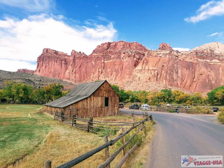
- Fruita Historic District: The old Mormon town, surrounded by orchards and red rock walls, seems to be a kind of unique oasis. A series of historic buildings await you here, including the iconic farm (where you must take a picture, as it tradition), the old schoolhouse and the Gifford House Store and Museum, where you can taste fresh local pie! In addition, you can walk among the over 2500 fruit trees, you can pick apples, peaches or cherries and for a small price, you can also take them with you, but eating them on the spot won’t cost you anything. Here also is the beginning of one of the park’s most beautiful trails called Cohab Canyon Trail.
- Grand Wash: After about 2 miles, take the first to get to Grand Wash, the bed of a dry river that can be covered for the first 1.2 miles by car. After that, you will have to continue on foot and enter a nice winding canyon (Grand Wash Trail). At the same spot, there is another very popular trail (also challenging) that leads to a beautiful natural arch called Cassidy Arch.
- Slickrock Divide: On Scenic Drive there are beautiful views you can see while driving, but there are not many viewpoints where you can stop and take pictures. In this small clearing, you can pull over and capture a beautiful view of the Waterpocket Fold.
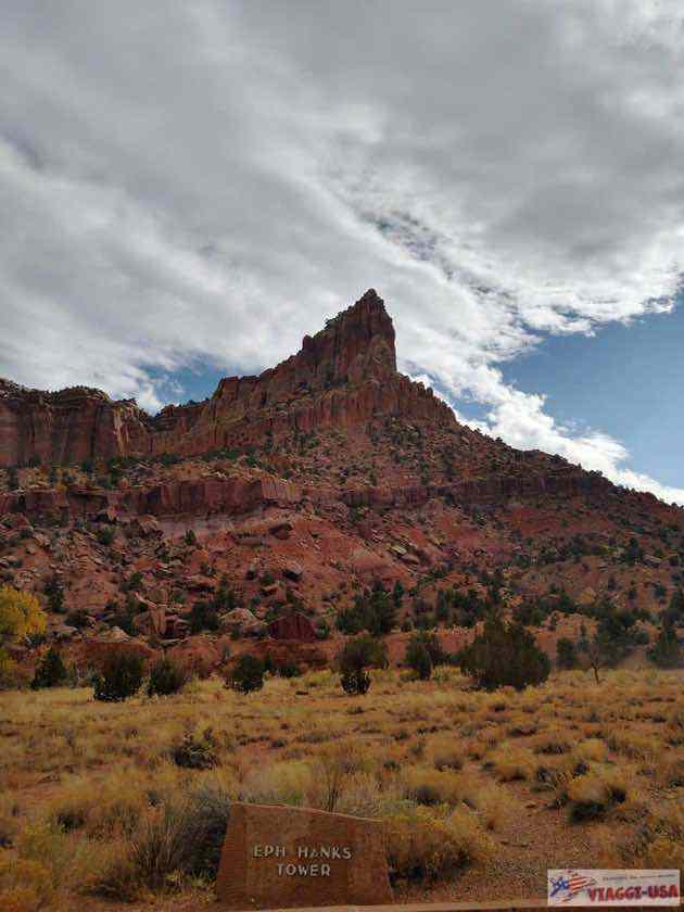
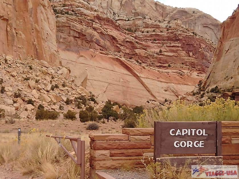
- Eph Hanks Tower: At the foot of this impressive rock formation is a parking lot with a picnic table marking the paved portion of the road. Here begins Capitol Gorge Road, a charming dirt road that ends at the entrance to the trail of the same name.
Capitol Reef National Park hikes
Along the two scenic roads, you will find trailheads for all trails. There are many excellent trails and it is not easy to choose. Here are my favorites:
Capitol Gorge Trail

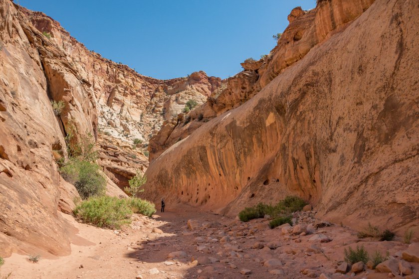
Probably the best path for those who have little time and do not want to strain themselves too much. You’ll cross a narrow canyon that is mostly in the shade where you’ll see some faded ancient petroglyphs but also some much more recent inscriptions of a list of names and dates engraved on the rock faces (Pioneer Register) that are evidence of the passage of many pioneers along this route. At the end of the trail, you will find the natural water tanks.
- Length: 2.4 miles (round trip)
- Elevation: 577 ft
- Difficulty: Easy
- Start: Capitol Gorge Trailhead, take Capitol Gorge Road at the end of Scenic Drive.
Grand Wash Trail

An easy walk in a drained river bed where you can meander into a canyon with a winding path, and in some sections, the cliffs come together leaving a thin space between them. The walk can be extended by adding the first stretch of Grand Wash Rd (starting from the Scenic Drive) but I don’t recommend it, since cars pass on this road and you risk breathing a lot of dust. The southern access of the trail serves as an entrance to another beautiful, albeit technical, trail that leads to the natural arch Cassidy Arch.
- Length: 4.4 miles (Round trip)
- Elevation: 400 ft
- Difficulty: easy
- Start: The northern access is on SR-24, 2.5 miles after the Hickman Bridge Trailhead. The south access is on Grand Wash Road, which is off of Scenic Drive.
Cohab Canyon Trail

As you are walking up from the picturesque orchards in Fruita, turn around and enjoy a beautiful view of the valley, admiring the majestic rocky ridge that frames the town, but the best is yet to come. After the ascent, you will cross a beautiful canyon that has striking multicolored rock faces that are stratified and perforated.

- Length: 3 miles (Round trip)
- Elevation: 794 ft
- Difficulty: Moderate
- Start: Fruita (Scenic Drive); near the parking lot of Hickman Bridge Trail, on SR-24.
Hickman Bridge
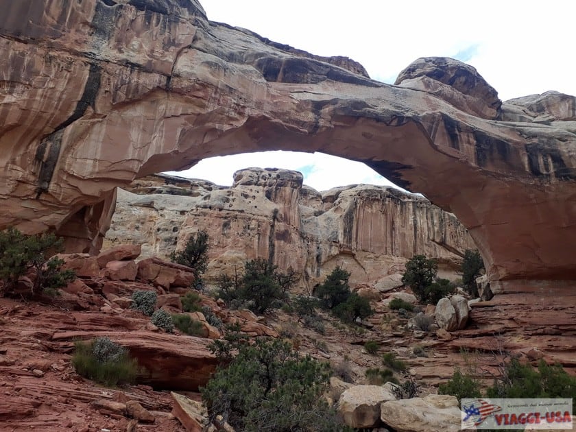
There are two main reasons to walk this trail. First, the beautiful during the ascent of the Capitol Dome and Pectols Pyramid monoliths and the satisfying finish, where you will see Hickman Bridge, a beautiful natural arch of considerable scope.
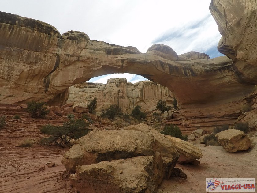

- Length: 1.7 miles (Round trip)
- Elevation: 426 ft
- Difficulty: Moderate
- Start: Hickman Bridge Trailhead, on SR-24.
Chimney Rock Loop

The Chimney Rock Loop trailhead is one of the first you’ll find when you drive into the park. The trail is challenging, long and exposed to the sun, but you will walk among the strangest rock formations of the Waterpocket Fold, pillars, colonnades and rock “fireplaces” that you will find there are perfect for a visit at sunset.
- Length: 3.3 miles (Round trip)
- Altitude difference: 794 ft
- Difficulty: Difficult
- Start: Chimney Rock Loop Trailhead on SR-24.
Golden Throne Trail

The trail begins in the same spot as the Capitol Gorge Trail. The route is fairly short though quite challenging. What makes it worth it is the view at the end of Golden Throne, an imposing, golden-white rock that may remind you of Yosemite Park‘s Half Dome.
- Length: 3.5 miles (Round trip)
- Elevation: 777.5 ft
- Difficulty: Difficult
- Start: Capitol Gorge Trailhead, take Capitol Gorge Road after reaching the end of Scenic Drive.
Remote Areas
These two remote areas of the park are certainly less accessible and require some caution, but what they offer can undoubtedly reward the effort. Before entering these two areas, keep in mind that you need to be prepared and inquire first at the visitor center about road conditions.
Waterpocket District

The scenic Notom-Bullfrog Road, only partially paved, runs for over 70 miles parallel to the east side of the Waterpocket Fold, entering the remote southern region of Capitol Reef, less frequented by tourists. To reach it, simply take SR-24 and after passing all the points of interest along Notom-Bullfrog Road, turn right following the Notom-Bullfrog Rd sign.
In addition to the remarkable views of the geological barrier, this road also provides access to many trails, such as Surprise Canyon, Headquarters Canyon and Strike Valley Overlook. Most of the roads in this area are unpaved, although they can typically accessible for standard cars, but a bit of bad weather is enough to make them impassable.
After about 40 miles, Notom-Bullfrog Road connects to the Burr Trail Road, another beautiful panoramic road that leads to the town of Boulder and that we have already talked about in our article on SR-12.
Cathedral Valley
In this valley known for its particular rock formations that resemble Gothic cathedrals, you can enjoy remarkable views in complete solitude. There are several ways to reach it and the most daring adventurers opt for the Hartnet Road, a dirt road with problematic conditions, such as fording a river and transit (for a short distance) from private property.
If you don’t feel like going against all these complications, luckily there are alternatives, the most affordable is to take SR-72 and, shortly after Fremont, take two dirt roads, first FR206 (Elkorn Road) and then FR022 (Polk Creek Road); you will cross the Fishlake National Forest to finally reach the Cathedral Valley.
A vehicle of a certain height above ground is recommended to visit this area, not necessarily a 4×4, although road conditions can vary greatly depending on weather conditions. Always remember to check with the park’s visitor center first.
How to Visit Capitol Reef in 2/3 hours?

Are you passing through Capitol Reef and still want to get the most out of one of the most mysterious parks among the Utah Mighty Five? Here are some tips to organize an itinerary for a visit lasting a few hours:
- Along SR-24, before arriving at the visitor center, enjoy two remarkable viewpoints: Panorama Point and Goosenecks Overlook.
- Head to Fruita, visiting the orchards and historic buildings (don’t forget that at the Gifford House a fresh pie awaits you!).
- Enjoy Scenic Drive, which runs south of the visitor center, so you can admire the beautiful nature in the Waterpocket Fold area.
- Choose a short hike:
- Hickman Bridge Trail (Difficulty: Moderate)
- Capitol Gorge Trail (Difficulty: Easy)
Are There Any Guided Tours of Capitol Reef?

There aren’t many Capitol Reef guided tours, but I’ll give you a combined itinerary of the parks in Utah that includes Capitol Reef: Utah Parks Tour: 6 days to Explore the Mighty Five!
Where to Stay in Capitol Reef: lodging tips
There are no hotels in Capitol Reef. There are just a few campsites available. You can still book a hotel in Torrey, a pleasant town on the outskirts of the park. Here are 3 recommended accommodations and a link to all the places available on Booking.com:

- Broken Spur Inn & Steakhouse Motel: Even if this is not the typical American motel, the Broken Spur has its own personality, as you can see from the Western style of the rooms, the possibility to sleep in Far West caravans (don’t worry about the inconvenience, they are equipped with beds, bathroom, fridge and even a microwave!), or the fantastic adjoining steakhouse, both for the food served and the cowboy atmosphere. To top it all off, there is a beautiful pool overlooking the reddish geological barrier of Capitol Reef.
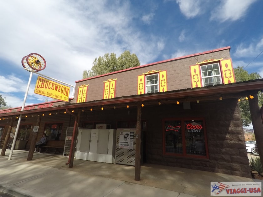
- Austin’s Chuckwagon Motel: This beautiful Far West saloon-style property overlooks Torrey’s main street and is a landmark in the town. Here you can sleep in family suites, standard rooms or separate bungalows, and you can also swim in the convenient outdoor pool. The adjoining shop/market is very useful, where you can stock up with the right supplies for each day’s excursions to the park.
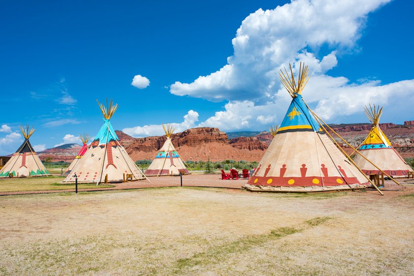
- Capitol Reef Resort: Located near the entrance of Capitol Reef National Park, this resort really has a lot of positive attributes. First of all the beautiful natural surroundings, which make you feel as if you were sleeping inside the park, but it doesn’t end there. You can book horseback riding excursions or 4×4 jeep tours and then relax swimming in heated outdoor pools, while you admire the stunning Waterpocket Fold. Also, this place stands out among the rest of the accommodation options, because in addition to standard rooms, suites and independent bungalows, you can choose to sleep in a caravan or Native American tent (don’t worry, these are also comfortable options).