It is common knowledge that moving from one place to another in America requires a bit of patience. You often find yourself traveling along very long and straight roads, and while it is true that the landscapes are very diverse, over time they all begin to look the same. Well, in the case of Yosemite Valley this is not the case.
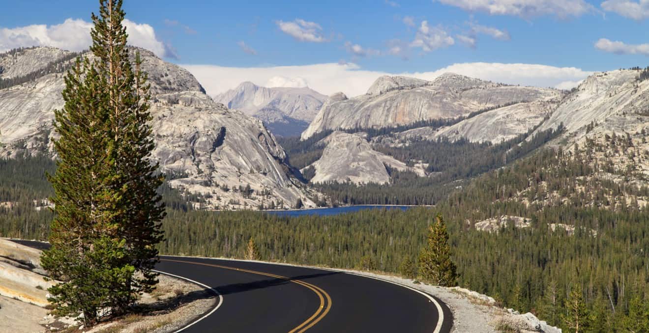
How would you feel if we told you that the road that leads you there – and that allows you to cross the incredible Yosemite National Park – is just as beautiful, so much so that you will be mesmerized? This road is not a dream; it exists, and it is called Tioga Road, the route that climbs up the Tioga Pass.
Contents
Tioga Road’s Opening and Closures
Before we begin to tell you what’s so special about Tioga Road, we want to point it out on the map and give some info about the opening and closing periods. It is very likely that you will find yourself on the Tioga Road for the very simple reason that the one and the only way to cross Yosemite going west is across the Tioga Pass, which is right along the Tioga Road.
So, whether you are coming from the west towards Yosemite, or you are leaving the park, you will find yourself driving on this road. Of course, if you’re coming from the San Francisco Bay Area and you’re planning to visit Yosemite and turn back, you won’t have a chance to drive along Tioga Road, but if you’re on an amazing road trip across the West, and you want to go to Nevada, you’ll have no choice but to go on Tioga Road.
What If Tioga Road is Closed?
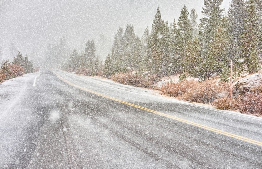
Last but not least, you have to pay a lot of attention to the closing dates. as for the opening dates, Tioga Pass, during the winter, is impassable due to snow (it’s a mountain road, don’t forget it!) and therefore closed to transit. Tioga Road is closed from November to May, however we recommend you to inform yourself on the park’s website, because in some particularly unfavorable years the road was closed until July (luckily it happens very rarely!).
Having the misfortune to find the Tioga Road closed brings with it a series of annoying inconveniences, often forcing to completely change travel plans. Since the Tioga Road is the only “convenient” road that allows you to cross the Sierra Nevada between Death Valley-Las Vegas and Yosemite-San Francisco, its closure forces to take a much longer route, bypassing the Sierra Nevada from the south, from Bakersfield (or more rarely from the north, from Lake Tahoe) whether you are coming from Las Vegas or from San Francisco.
Moreover, unless they have a lot of time on their hands, many people must choose between Sequoia National Park and Yosemite, because Sequoia is on the long journey between San Francisco and Death Valley. In case you have to take this alternative route, our Death Valley to Sequoia National Park itinerary may be useful.
How Long is Tioga Road?
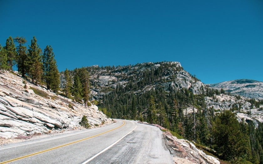
Tioga Road is a wonderful scenic byway 64 miles long connecting Big Oak Flat to Lee Vining. The name of the road, which you may not find that interesting but is useful to orient yourself, is California State Route 120 (or more simply Highway 120). The travel time without ever stopping (from Crane Flat Campground to Lee Vining) is about 1.5 hours, but it’s very difficult that you don’t make at least one stop!
In fact, along this road you will enjoy some breathtaking viewpoints, which could extend the trip up to 2-2.5 hours. To tell you about these attractions we decided to walk you through this drive, starting from Crane Flat Campground (the junction between Big Oak Flat Road and 120) and heading east.
What To See Along The Drive
The Giant Sequoias of Tuolumne Grove
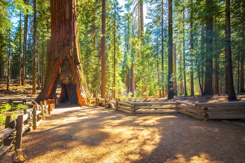
Right away, you’ll come across Tuolomne Grove, which is just a few miles long and worth stopping for a short walk. From this point there is a bit of walking, but do you really want to miss seeing giant sequoias? The most famous ones in the park are located in the Mariposa Grove area, which is a bit removed from the central valley. For this reason you may have to choose whether to go to Mariposa Grove or to decide against it due to lack of time. Well, nothing better than finding them on the road, or almost! Just park your car and get ready for an easy walk for a couple of miles to find yourself surrounded by these wonderful giants of nature.
The White Rocks of Olmsted Point
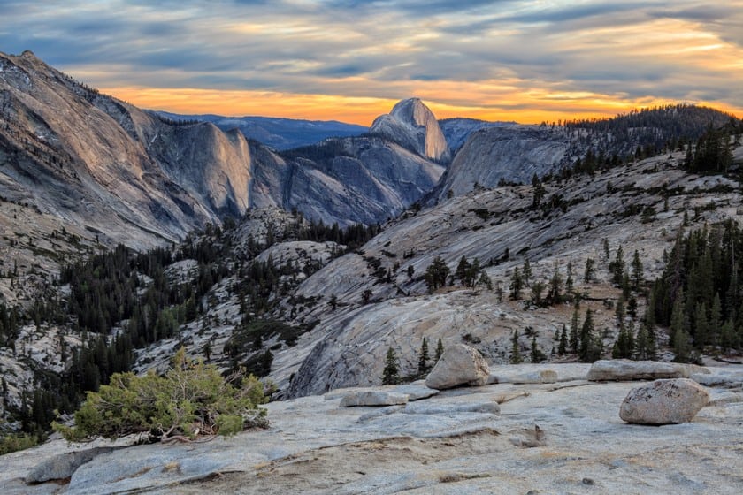
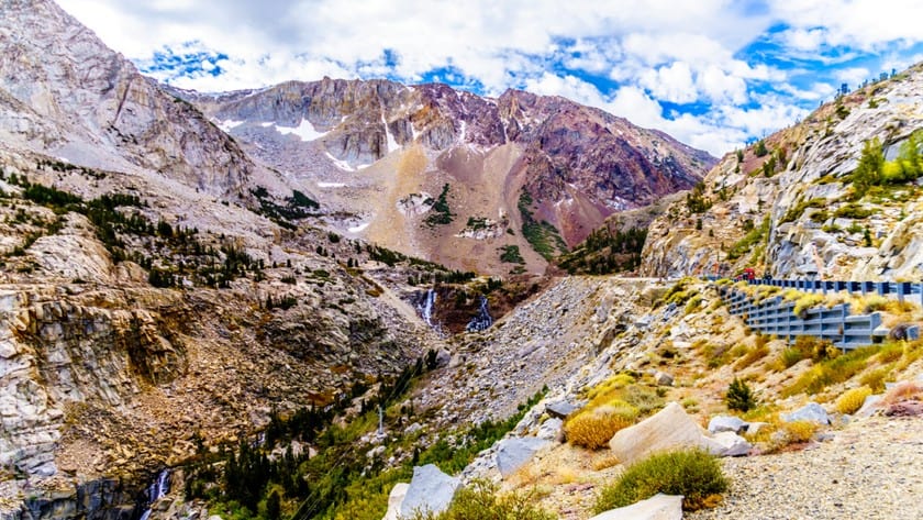
Hop back in your car and enjoy the ride. The road skirts lush forests rich in wildlife, and every now and there are clearings with spectacular views of the tall peaks that rise up on the horizon, such as Mount Clark, Tuolumne Peak, the mythical Half Dome and Cathedral Peak.
We recommend you to stop at Olmsted Point, which is well marked and has a parking lot right next to it. From the flat white rocks of Olmsted Point, braving the blistering winds, you can enjoy an exceptional view and if you venture along the trail, you can also see Half Dome.
The Crystal Clear Waters of Tenaya Lake
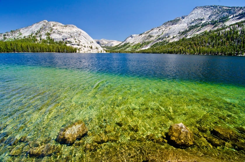
There are not many signs to help you find this amazing lake with crystal clear waters. Driving away from Olmsted Point, you will probably find on your right some cars parked on the edge of the road. These are tourists who have decided to cool off on the shores of Tenaya Lake, a beautiful lake at the foot of white mountains. Really a marvelous place often underrated by guides.
The Poetry of Tuolumne Meadows
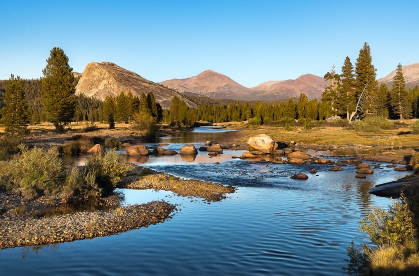
Get back in the car as fast as you can. You have yet to see the most beautiful part. When you will have covered about ¾ of the Tioga Road, you realize that the landscape is changing again. No more dense redwood forests, no more surreal white rock paths, instead you see a landscape of green, flat meadows, beautified by the elegant Tuolumne River waterway, which draws the eyes towards the sharp mountain peaks in the distance.
If you have some time, park your car and ask the visitor center staff for recommendations for hiking. From the shortest trails, such as Tuolumne Meadows: Soda Springs/Parsons Memorial Lodge (about an hour’s walk 1.5 miles away), to the most challenging ones. We want to point out the one leading to the Mono Pass, for experienced walkers (8 miles and 1000 feet of elevation for a total of 4-6 hours of walking). Here is a link where you can see all the trails.
Finally at the Tioga Pass Entrance: Whoa Nellie Deli and Mono Lake

After enjoying the poetic walks in the Tuolumne Meadows area, you will have to return to the “prose” of the road trip, but just for a little while, until you pass another beautiful body of water like Tioga lake, a few miles before Tioga Pass, which marks the end of Tioga Road.
But, just before arriving at Lee Vining, we suggest you to make another stop, which is rewarding for two reasons, for its beauty and food. A few feet before the junction before the city, you will see a Mobil gas station, on Vista Road. It a great place to view the last jewel of Tioga Road, Mono Lake, a mysterious lake with indescribable colors (we have already talked about it in this one of a kind West Coast roadtrip). When you’re done taking your pictures, go into the adjacent restaurant, the Whoa Nellie Deli and order a hamburger. You won’t regret it.
Where to stay in the area?
If you don’t know where to spend the night, and you are looking for a resort in Tioga Pass or just a motel, remember there is an article about where to stay near Yosemite National Park.