The immense Grand Staircase Escalante National Monument contains many attractions that are somewhat hidden, which can be visited for free. The Toadstool Hoodoos are one of them and make for a great stop between some of the area’s major natural attractions. If you’re planning a road trip between Utah and Arizona, you may be looking for a few interesting places to stop at along the way.
If you are in Page or Antelope Canyon and you’re heading to Kanab to visit Bryce Canyon or Zion National Park (or vice versa), it is likely that you’ll take Hwy 89. Right along this road there are a few trails that lead to the bizarre mushroom-shaped rock formations that are common in the geological area around the Paria and Wahweap Rivers.
It doesn’t take long to reach them and the Toadstool Hoodoos can be the perfect spot to take a break from driving all day, perhaps in addition to the Coral Pink Sand Dunes. Alternatively, if you’ve just spent the day at Lake Powell and Horseshoe Bend and are heading to Kanab for the night, stopping here on the way in the late afternoon might be another idea to consider.
Contents
Directions and Trailhead Map
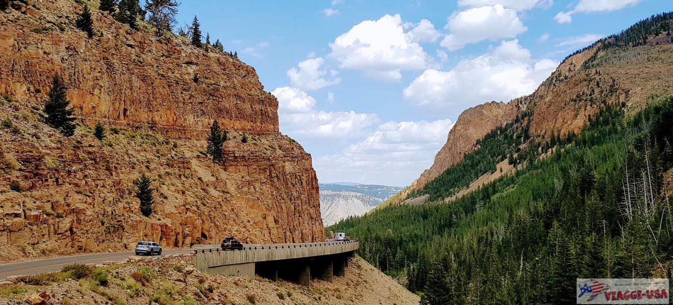
The Toadstool Hoodoos trailhead is along Highway 89, 28 miles from Page (about 30 min drive) and 43 miles from Kanab (about 45 min drive). The quickest and easiest way to get there is just to follow Highway 89 to the entrance of the path, whether you are coming from Page or from Kanab.
A much more scenic alternative that is only accessible by off-road vehicles as it is a very long dirt road, is the intriguing Cottonwood Canyon Road, which branches off from Hwy 89 to Cannonville, near Kodachrome Basin State Park and Bryce Canyon, and crosses the central area of Grand Staircase-Escalante National Monument.
If you have the right kind of car, after visiting Bryce Canyon, you may choose to take this scenic road to Hwy 89, then turn right and you will arrive at the trailhead in a matter of minutes.
What Are Toadstool Hoodoos?

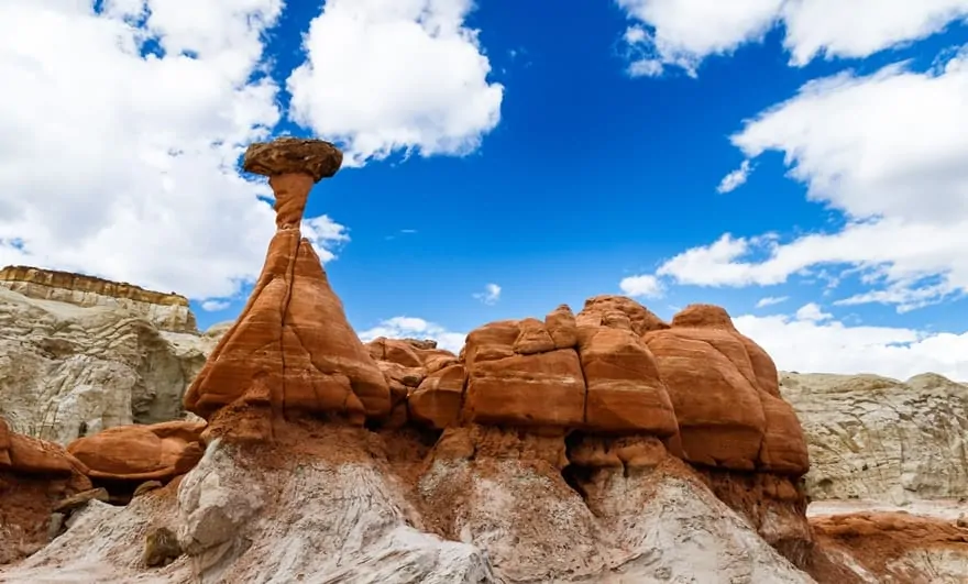
In Grand Staircase-Escalante and throughout the southwest USA hoodoos, also called fairy chimneys, are quite common. These are tapered rock formations that rise out of the ground and can be tall or short and of different colors and shapes.
The most famous examples of such chimney rocks are undoubtedly those found in Bryce Canyon and Cedar Breaks, but the number of hoodoos and vastness of the area where they rise is not necessarily the characteristic that makes them so interesting and peculiar
If you’ve heard of Goblin Valley, you will certainly have a clearer idea of those hoodoos, that rather than pinnacles, they look more like magical little characters (hence the name of the valley) or mushrooms. This is why the formations described in this article are called toadstools.
The hat on the top is what sets them apart from the more common chimney-like rocks in other areas, making them a truly bizarre attraction. The two different types of sandstone rock are worn down by the wind in a different way. As a result, a narrower stem is formed that is topped by a wider hat made of harder rock (and therefore more difficult to erode by the wind).
Not far from here we can also find the Wahweap Hoodoos, which are very similar but with different colors. The Wahweap Hoodoos are white with dark hats, unlike the Toadstools, that have reddish shades.
The Toadstool Hoodoos Hike

There is a very simple trail that allows you to reach the Toadstool Hoodoos in less than half an hour on foot. You can leave your car at the entrance of the trail along Hwy 89. More specifically, the trail is about 1 mile (less than 2 miles round trip) which is not difficult and is also practicable by children.
Just follow the little arrows placed along the trail, but it is not difficult to figure out where to go. Simply continue straight ahead along the path, which has no detours.
Sometimes you’ll find what may look like alternative paths. You’ll realize that they’re really just short paths that extend a few feet, which all lead to the final clearing where the hoodoos are concentrated. The complete trail continues to the left of the small rocky valley and leads to other rock formations, called Rimrocks. If you have little time, you can easily stop here, saving yourself a few thousand feet of walking.
There is also a second trail, that is not as popular as the previous one. To get to this trail, you can park your car 1.5 miles away from the previous trailhead. More precisely, the trail starts at the Paria Contact Station, but on the opposite side of Hwy 89.
The two most interesting rock formations that you can view on this trail are Skinny Hoodoo and Twisted Hoodoo. This trail is less than 1 mile long, so it is plausible to go on both trails, but if you have to choose one, then I recommend the main one, which allows you to reach the clearing where the most important hoodoos are concentrated.
Where to Stay in the Area

Near the Toadstool Hoodoos, The best place to stay is Big Water, where you can find a couple of accommodations to choose from. Because of its location, it might be a good place to spend a night or two, because from here you can easily get to various attractions such as the Coral Pink Sand Dunes near Kanab or Page and Lake Powell, but also other points of interest in Grand Staircase-Escalante National Monument.
However, it is very likely that you plan a quick stop at the Toadstool Hoodoos on a road trip from Kanab to Page or vice versa. Therefore, I suggest you to read our other articles about accommodations in Kanab and Page.