Stone spires and huge rock formations that rise above the landscape, beautiful to admire and perfect for climbing, are the main attractions of the City of Rocks National Reserve and Castle Rocks State Park, two of the best places to visit in Idaho. The latter is smaller but adjacent to the former. They are easily visited one after the other and are some of the best nature stops you can make in Idaho. So let’s find out more about them and what there is to see.
Contents
Location and Directions
The two parks, which almost border each other, are located in south-central Idaho, just a few miles from the Utah border and the Nevada border. Almo is a small town that can be used as a reference point when trying to reach the entrances to both parks. Take I-84, which connects Portland, Oregon to Salt Lake City, Utah, and crosses Idaho perpendicularly. Then take ID-77 (if you are coming from the north) or ID-81 (if you are coming from the south) and, between Albion and Malta, you will reach the beginning of Elba-Almo Road. Once you pass a town called Elba you will be almost at your destination.
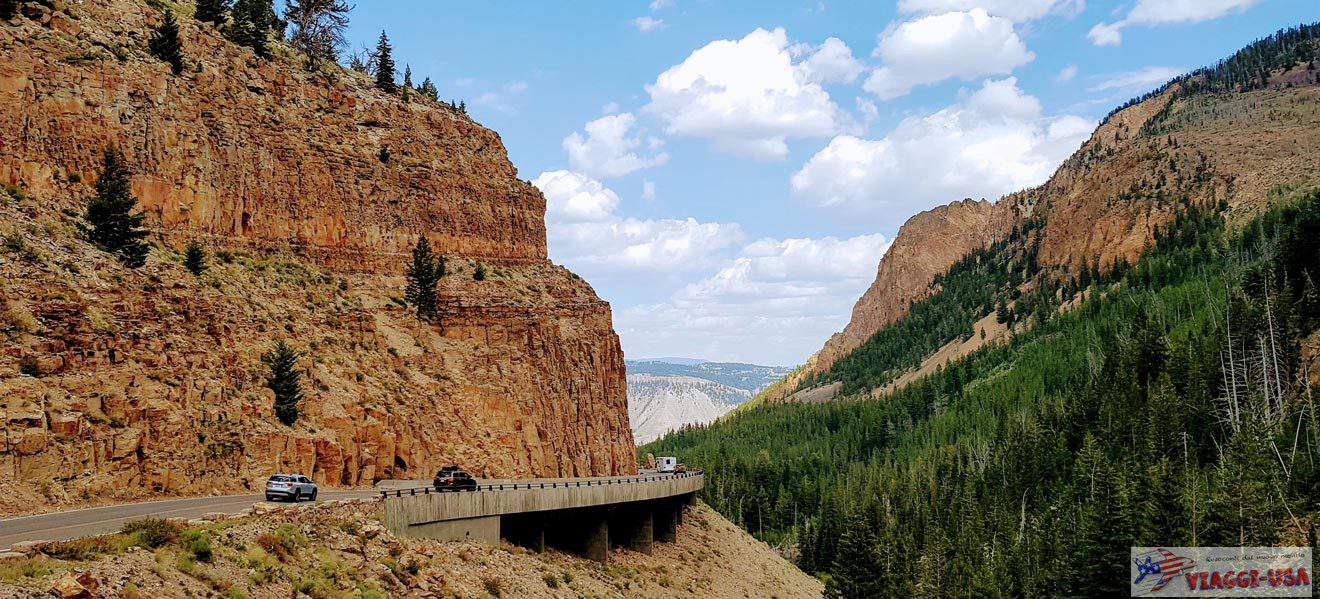
Given the location, City of Rocks and Castle Rocks are not only a key stop on a journey through Idaho, but can also be a good stop on an itinerary that includes multiple states, particularly Utah, Nevada, and Wyoming (although Wyoming is a bit further away). For example, if you enter Idaho from the south and want to visit the state’s most famous attractions, such as Mesa Falls, the Crater of the Moon, or Shoshone Falls, spending a day or two in these parts is an excellent idea.
Tickets and hours for the two parks
City of Rocks National Reserve does not have an admission fee and the Visitor Center is open daily from 8:00 a.m. to 4:30 p.m (in winter, the opening hours are reduced, and delays may occur here). Castle Rocks State Park charges $7 admission per vehicle, regardless of the number of passengers.
Since this is a state park and not a national park, the national parks annual pass cannot be used here. For Idahoans, there is a state parks passport that allows you to visit them all within a year for only $10 per vehicle. The Visitor Center is open Wednesday through Sunday from 8:00 a.m. to 4:30 p.m.
Visiting the City of Rocks National Reserve
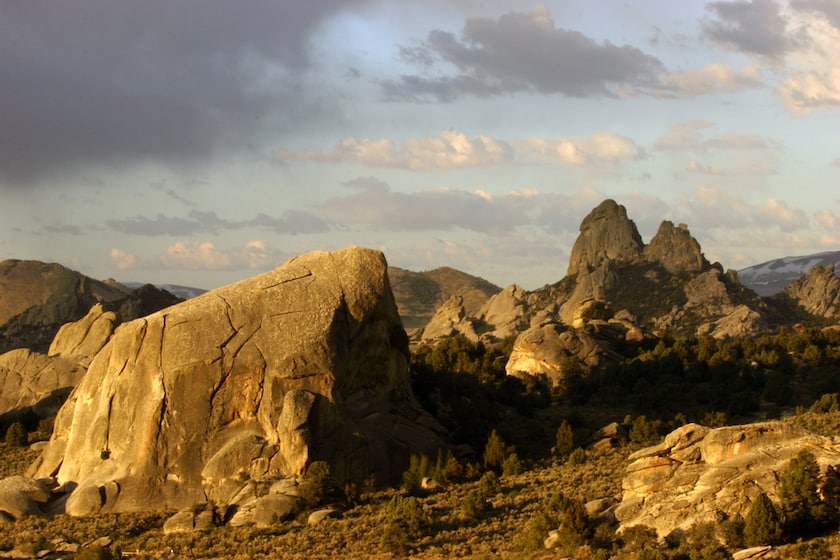
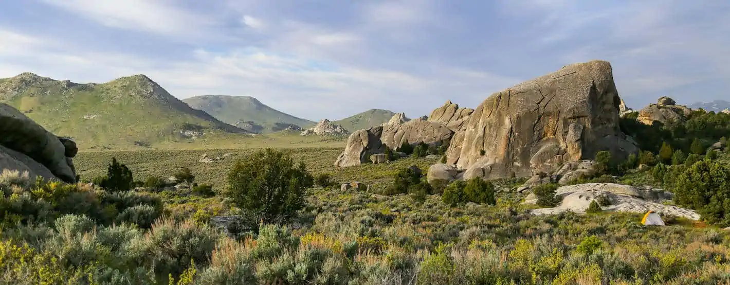
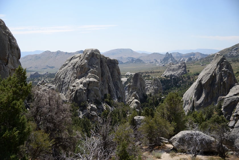
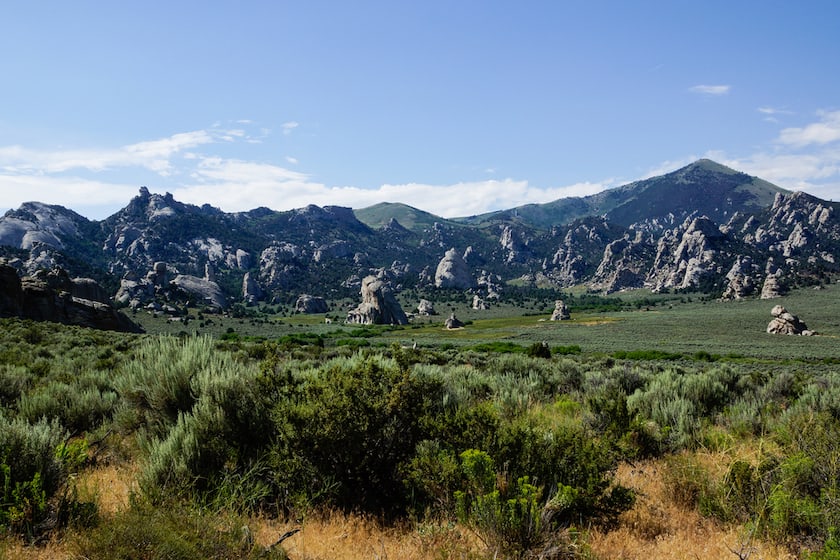
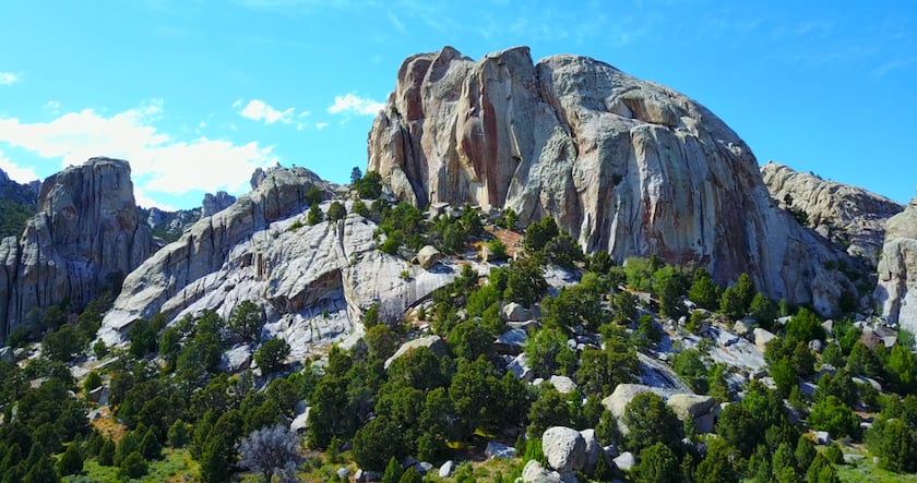
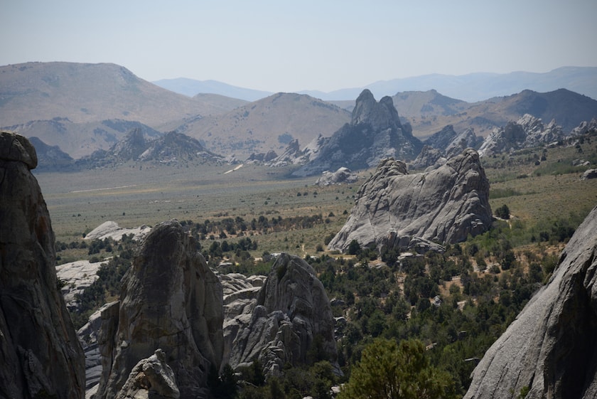
The City of Rocks is a climber’s paradise. The granite spires that reach up to 590 ft have made it famous and are frequented by those who enjoy rock climbing, but there are also easier ways to appreciate this place. In addition, the park has abundant flora and fauna, so there is much more to see besides the rocks.
Hiking: Trails in the City of Rocks
To visit the City of Rocks in greater depth, I recommend wearing comfortable shoes to walk on the trails that run through it, which is the best way to reach the most fascinating viewpoints and fully enjoy the beauty of this place. There are long and challenging trails that require hours of walking, but there are also shorter trails that are perfect for those who are visiting the park on a road trip and do not have much time.
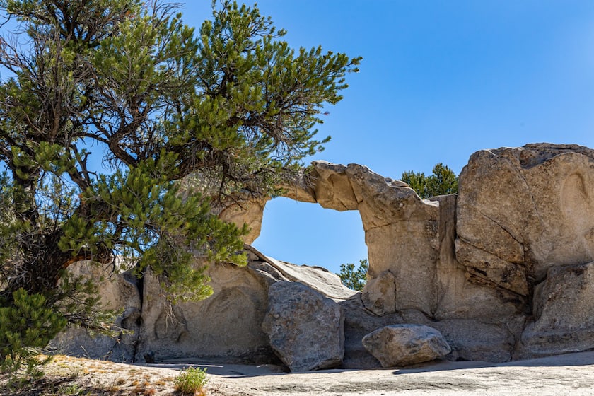
- Window Arch Trail (262 ft). The Window Arch is one of the most symbolic granite formations in the City of Rocks. It only takes a short walk to get there, starting behind campsite 37, so this is recommended for everyone.
- Bath Rock Trail (0.25 miles, 72 ft elevation gain). Bath Rock is a monolith that got its name because of the large pools of water on top of it. The trail loops around it and is not long. There are a few sections with stairs. Also, those who are more adventurous can try climbing to the top of the huge rock. Legend has it that taking a bath in Bath Rock restores youth.
- Geological Interpretive Trail (1 mile). If you are wondering how rocks get these shapes, the best way to find an answer to your questions is to walk this trail, where there are 12 posters that explain the history of the park and its monoliths and you will admire some interesting geological formations up close,
- Creekside Towers Trail (1.4 miles, 410 ft elevation gain). Although it is a bit longer than the previous one, this trail is still suitable for everyone, including families with children. The best time to come is in the spring when the water level in the creek is higher and the small waterfall seen from the trail is more spectacular. It is a great trail for those who want to see the plants and animals in addition to the granite towers.
- Castle Rocks – Backyard Boulders Trail (1.5 miles). A loop that leads to some of the most fascinating rocks in the area as well as some archaeological evidence, such as pictographs on the rocks. In the springtime, flowers abound and migratory birds arrive, while in the fall the foliage embellishes the trail.
- Stripe Rock Loop (2.8 miles, elevation gain 338 ft). Stripe Rock is one of the park’s most famous large rocks. Starting from the parking lot, take the trail and after a while, it generates a loop. When the loop ends, you will return to the parking lot.
- City of Rocks Loop (6.8 miles). If you have enough time on your hands, this is the loop trail that gives you the widest overview of the reserve. You get to see incredible rock formations, but also immerse yourself in the pine forest. There are several access points to the trail. We recommend the one at the Emery Creek picnic area.
Take a drive
There are three dirt roads that cross the City of Rocks National Reserve that allow you to reach some of the main points of interest and have a good overview of the reserve.
- The main one is City of Rocks Road, which runs east-west connecting Almo to Birch Creek Road – a road that you can take if you are traveling toward central Idaho or down south into Utah. If you travel this road you will pass several of the park’s most popular places.
- Twin Sisters Road, on the other hand, starts from City of Rocks Road in the center of City of Rocks and runs south, perpendicular, until it, too, connects to Birch Creek Road. Take this road if you intend to see the rocks named Twin Sisters.
- Logger Spring Road also starts from City of Rocks Road but it runs north. You will use this road to get to Finger Rock. Finally, there is the City of Rocks Backcountry Byway, a road with striking scenery that winds along the Albion Mountain Range and its towering granite spires that stand above the surrounding rural landscape. The route begins in Albion, on 77, skirts the Sawtooth National Forest, crosses Elba and Almo, and ends in Oakley.
Birdwatching and other activities in the reserve
If you spend more than a day at the reserve, in addition to hiking or other typical activities you can perhaps do some of the other activities that attract several tourists here each year. Rock climbing is a must because of the tall granite spires but there are also alternative activities if you are not a climber. First, there is birdwatching. Various species of birds abound in this park, and the migrations in the spring and fall draw more visitors.
On this page, you will also find the dates when excursions are scheduled. If you go, make sure you take your binoculars and camera. At City of Rocks, you can also do archery, as well as fishing and hunting in some areas of the reserve. These may be considered niche activities, but they are sought after by some visitors. Finally, you can also rent a mountain bike to explore the park’s trails more quickly than walking.
Guide to Castle Rocks State Park
Although it is much smaller in size than the nearby national reserve, Castle Rocks State Park is not to be underestimated in terms of its natural beauty and array of activities. As is often the case, state parks have more organized activities – that is, there are things to do and various overnight options for visitors.
The goal is to offer tourists, both local and foreign, an opportunity to take a multi-day vacation in the middle of nature, without ever getting bored. Warning: if you research the park online, do not confuse it with Castle Rock State Park, which is located in California. One “S” makes all the difference!
Hiking: Trails in Castle Rocks
There are no roads in the park, so the only way to fully enjoy nature is to venture out on foot along the trails. There is an intricate web of trails, so if you are used to finding your way around with a trail map, you can create your own loop. However, I suggest some options that I think may be ideal for those who are short on time and want to get to the major points of interest.
- Around the Rock Trail (1.1 miles, 150 ft). This short loop about a mile long starts from the picnic area located at the end of Big Cove Ranch Road, the road leading to the park. It takes about a half-hour to complete round trip and wraps around one of the park’s most famous large rocks.
- Castle Rocks Stine’s Creek (1.93 miles, 351 ft). This trail starts at the same picnic area as the previous trail, but it is not a loop. It takes you to other impressive stone spires as you walk along Stines Creek.
- Bracksiecks Pillar Loop (2.2 miles, 472 ft). This route does not start at the picnic area, but rather at an intermediate point on the road. It starts with a straight section and then loops back to the initial straight section. Over the course of the hike, which will take about an hour, you will see more spectacular rock formations.
- Castle Rocks Trail (5.9 miles, 994 ft). The trail starts at the same point as the previous one and is a fairly comprehensive loop of the park, and is an ideal way to see most of the rocky spires that make this area famous.
Other activities in the park
Not only hiking: there are several activities you can do in the park. One of the most popular things to do, as in the case of the City of Rocks National Reserve, is climbing. But you can also go mountain biking or horseback riding, birdwatching, or stargazing at night here.
The park organizes a large number of thematic events to give visitors as many choices as possible that range from fishing classes to nighttime stargazing walks. Check out this page on the official website to find out what events you can participate in during your stay.
Where to Stay
There are no accommodations in the City of Rocks, while at Castle of Rocks, on the other hand, there are some options. You can stay in either the campground or in lodges. On the City of Rocks website, you will find a list of places to stay overnight, but these are located in the nearby state park. If you intend to vacation here, perhaps about a week or so, then it may be best to stay overnight within the park. The same is true if you are camping and looking for a campground where you can rest for one or more nights.
However, if you are on a road trip and this is one of your stops, you may want to find other accommodations. Consider, for example, staying in Burley, where you can stay at either the Hampton Inn Burley or the Holiday Inn Express. If you are driving through Utah and are headed toward Salt Lake City, you can stay in Tremonton, for example, at the Western Inn.