Many will contend that anyone who goes on a tour of Utah without a quick stop in the small and unknown Kodachrome Basin State Park will be missing out. And we – who love to find small natural wonders hidden on U.S. maps, especially on the West Coast – are excited talk about it in-depth in this article, because we always hope that even just one of our readers, thanks to our articles, will visit an unforgettable place that that person otherwise would not even have suspected that it existed. We have done this before when we wrote about another nearby park, Cedar Breaks National Monument, and we won’t stop there!
We will now continue and answer some questions you may have. Where is Kodachrome Basin State Park? How can I include it in a West Coast trip? Could it be an intermediate stop between the classic national parks? What can I expect to experience while exploring for a few hours the short trails of this little gem in Utah?
Contents
Where is Kodachrome Basin State Park?
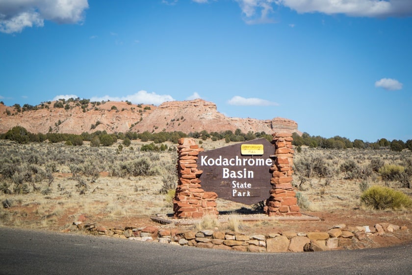 Kodachrome Basin State Park – which was named after Kodak Film Corp in 1948 – is located in South Central Utah, about 7 miles from Cannonville, and no more than half an hour from the entrance to the much better-known and popular Bryce Canyon National Park. The address is 2905 S. Kodachrome State Park Rd.
Since it is very likely you will visit Kodachrome in combination with Bryce Canyon (usually as an intermediate stop before Capitol Reef), here is how to reach this small state park coming from the north.
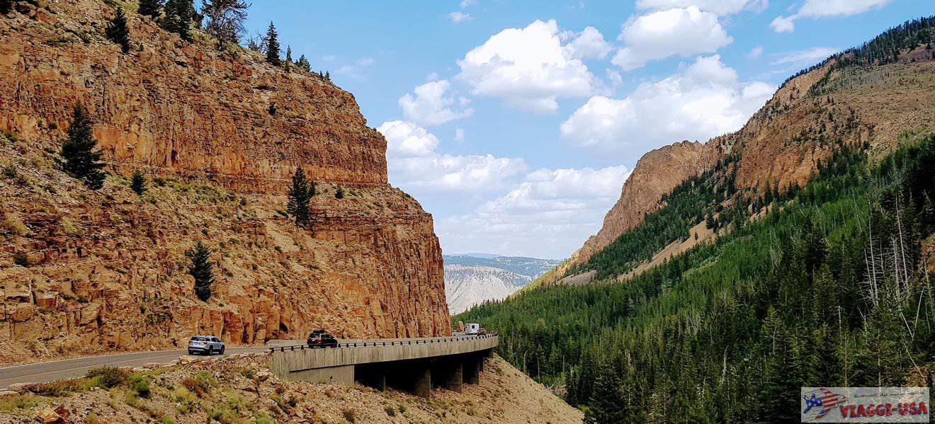
- When you leave Bryce Canyon and get on UT-63 heading north, you just have to turn right and take the beautiful Scenic Byway 12 and continue east. The landscape along this road will be similar to what you’ve enjoyed so far – green woods framed by bright red and white rocks. This road will take you first to the small town of Tropic (which we talked about in the article where to stay in Bryce Canyon) and then, after 5 miles, to the equally tiny Cannonville. By continuing on UT-12, you’ll reach Capitol Reef through Boulder and the Grand Staircase-Escalante National Monument. You have to go on Cannonville’s Main Street, which cuts the town in half, and then keep going. As soon as you pass the leave the town, you’ll find yourself on Kodachrome Road. Go over the bridge and continue for another 4 miles. On the left, you will find Kodachrome State Park Road, which will take you straight to the visitor center, where you will pay the entrance fee ($10 per vehicle, the national parks annual pass is not accepted here).

For those coming from the south, there is a road that, in fact, could be a really convenient way to reach Kodachrome Basin if you are coming from Page… but under the following conditions:
- Usually, to reach Bryce Canyon (and then the Kodachrome continuing southeast) from Page you take the comfortable and paved Highway 89 and in about 2 hours and 35 minutes, you will reach the park. But there is another way, the infamous Road 400, a panoramic dirt road that – you will exit Highway 89 and get on Road 400 about 10 miles after Big Water – crosses the whole area around the Paria River and comes out right at the entrance of the Kodachrome Basin State Park. The travel time from Page to Bryce via Road 400 (aka Cottonwood Canyon Road) is more or less the same as the travel time on Highway 89, but it’s half the mileage! As you can see, you will have to have a lot of patience and, above all, drive a suitable 4×4 vehicle in order to avoid any challenges when traveling this route when the ground is wet.
What to Expect from Kodachrome
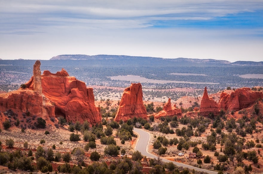
 Because of its proximity to Bryce Canyon, you can expect to see a similar landscape here in this colorful park. You will find towering pinnacles, monolithic spires, soaring “chimneys”, sandstone palaces towering over wide multicolored rock dunes (from red to yellow to white) and a great variety of strangely shaped boulders that starkly contrast the blue sky and change color depending on the time of day…. This landscape may remind one of another hidden gem known as Coal Mine Canyon in Arizona. So bring your Kodak cameras… the name of the park says it all!
In addition, because Kodachrome is so small and isolated, the number of tourists that visit it is low compared to other large parks in Utah. It goes without saying that, in this silent and solitary place, the hikes along the short and quick trails are definitely more fascinating.
Things to Do at Kodachrome Basin: Hiking Trails
 The best way to visit the Kodachrome is to choose a couple of quick trails and enjoy them in complete peace and tranquillity, letting yourself be inspired by the beauty of the landscapes and their magnificent colors. You can easily spend 2 hours visiting Kodachrome Basin State Park. Some of the roads you must take to reach the trailheads are dirt roads, but they are still passable, although they may become dangerous if it rains or snows. Inquire about the road conditions at the visitor center before venturing recklessly on the dirt roads.
Nature Trail
This short trail (0.5 miles) is located just before a camping area and has information panels. You can read an introduction to the flora, fauna and geology of the park. We could say that this trail is didactic!
Angel’s Palace Trail
 This is the park’s most popular trail and it’s is about 1.5 miles long. It reaches an elevation of just 147 ft, so it is a fairly easy hike. On the trail, you can see the typical red hoodoos of the area and there are also beautiful overlooks over the basin.
Eagle View Trail
 At the end of the paved road, where there is a small loop, just past the camping area in the northern section of the park, you can access a beautiful trail that, in less than a mile, reaches an overlook (498 ft elevation gain) where you can see a beautiful view over the entire area of the park … from a bird’s-eye view!
Shakespeare Arch – Sentinel Trail
 Shakespeare Arch, the only natural arch in the park, is located on the Sentinel Trail. To get to the trailhead, you will drive about 1.5 miles east of the visitor center. The trail is 1.7 miles long and passes under the majestic red rock arch. In addition, it has some beautiful views of the immense Grand Staircase-Escalante National Monument, which is adjacent to the Kodachrome.
Grand Parade Trail
The Grand Parade Trail runs along the base of the natural basin and crosses through the majority of the eastern region of the park. You can walk up the 1.5-mile trail and look around at the tall pinnacles. Along the trail, you can also see the access to two box canyons.
Panorama Trail
To explore the western side of the park, you can take the Panorama Trail, which is slightly more demanding, but it is full of unusual geological features along the way (the remarkable Secret Passage, Hat Shop, Ballerina Spire, see gallery). You can decide to walk this loop trail for about 3 or 6 miles depending on how much time you have available. The trailhead is just past the visitor center. In addition to hiking, you can also go on a horseback riding tour organized by Red Canyon Trail Rides on this trail.


For those who love natural arches…
 If you do not have time to visit Arches National Park and you are interested in seeing some natural arches, in addition to the aforementioned Shakespeare Arch, you can also add to your list the Grosvenor Arch, a beautiful double arch made of white rock that is just past the boundaries of the park in the north-western region of Grand Staircase-Escalante National Monument.
Grosvenor Arch can be reached by going east along (about 10 miles) Cottonwood Canyon Road, the dirt road that you can take at the fork with the Kodachrome State Park Road, leads to Page. From Grosvenor Arch Parking Lot (it is fairly well-marked and there are restrooms), you will take a short walk that will lead you directly under the beautiful natural arch.
Where to Stay Near the Park

In fact, because it is a small little-known park, Kodachrome Basin State Park could be a unique and wonderful location to go camping under the stars. Many visitors decide to stay overnight in one of the two campgrounds in the park, to enjoy the view the starry sky above the pinnacles and rock formations. Alternatively, you can decide to find accommodations in Tropic, Cannonville or Henrieville, or in one of the locations listed in the article “where to stay near Bryce Canyon“.