The beaches on the Pacific Ocean coast are not known as being places to go swimming. With the exception of the San Diego area and some specific areas of the coast, the water temperature is usually quite cold and the exposure to the wind can further complicate things. So what makes the beaches on this coast attractive? Well, if I had to give you one reason why it is worth it to visit the beaches of California and Oregon, it would be the scenic views with romantic coves and sandy beaches framed by cliffs.
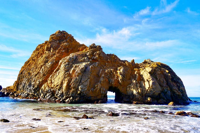
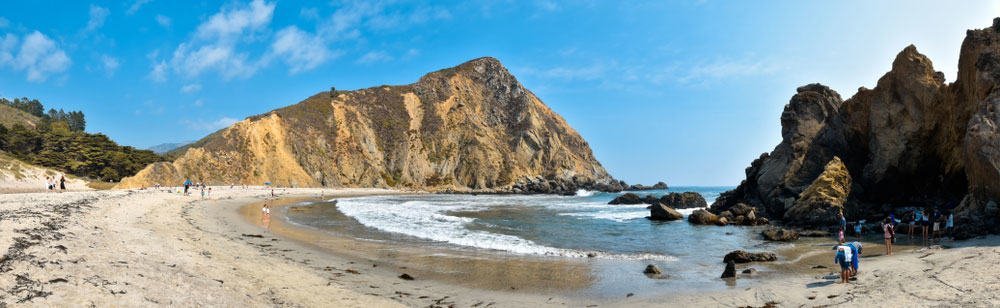
Out of all the beaches on the West Coast, Pfeiffer Beach stands out for various reasons, such as its enchanting location in the heart of the Big Sur, the unusual violet color of the sand due to the manganese garnet of the surrounding hills, the alluring rock formations on which powerful and thunderous waves break, and the imposing Keyhole Arch, that is remarkable when it “faces” the sun at sunset. Moreover, at sunset, the color of the sand transforms into different shades. In fact, because of this, it has even been renamed “Rainbow Beach”.
The majestic, romantic and isolated Pfeiffer Beach is especially recommended for those in search of pristine natural havens and can’t wait to put their photography skills to use in order to capture one of the most beautiful sunsets of their lives. Let me tell you more about Pfeiffer Beach and give you directions and tips.
Contents
Where is Pfeiffer Beach
First of all, it is important to note that we are not talking about the Pfeiffer Big Sur State Park, the nearby state park that has no connection with the aforementioned beach. Pfeiffer Beach, as I mentioned, is located in Big Sur, one of the most scenic areas of the famous Pacific Coast Highway or Highway 1.
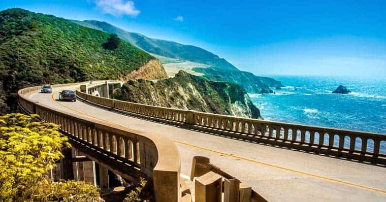
It is about 155 miles south of San Francisco and about 1 hour away from Monterey, the largest city in the area. About 16 miles away from Pfeiffer Beach, there is the Bixby Creek Bridge, another noteworthy attraction for those traveling in California and also one of the most scenic bridges that you will ever see.
How to Get to Pfeiffer Beach
Pfeiffer Beach can be reached by car or by taking its own shuttle service, but if you choose the latter option, you will need to arrive at the pick-up point with a car (or rental car).
By car
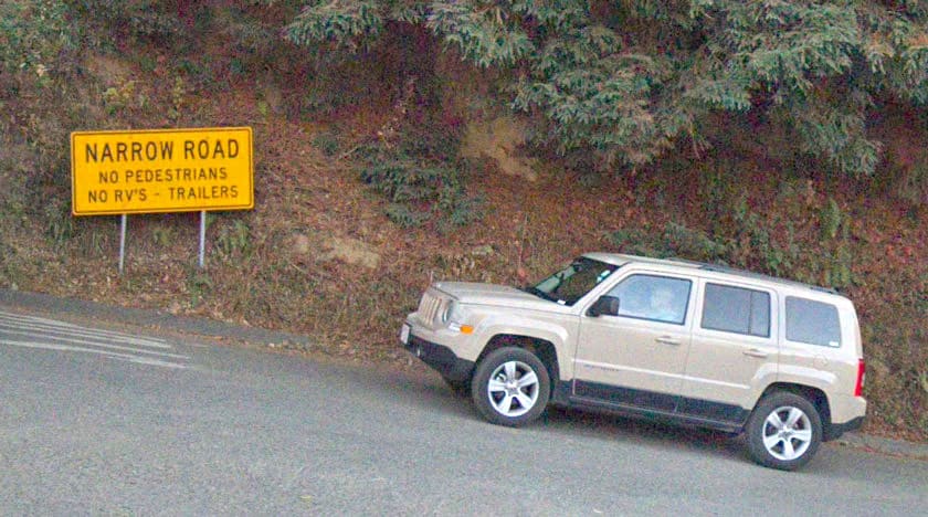
To get to Pfeiffer Beach you have to go there intentionally because it is not indicated by road signs, which probably contributed to the fact that it is not beaten by mass tourism. Along Highway 1, there is a small road called Sycamore Canyon Road, indicated by the yellow narrow road sign. Continue on Sycamore Canyon Road for about 2 miles and you will arrive at the entrance to the beach. To reach the access point, enter this address (Pfeiffer Beach Day Use Area) in the GPS, or follow these simple directions:
- For those coming from San Francisco or from the North: Pass the Big Sur Station, the visitor center, and turn right after about half a mile at the yellow narrow road sign. Be careful not to turn into the road just before Sycamore Canyon Road (Pfeiffer Ridge Road), which instead of going down to the beach, climbs up the hill to Buzzards Roost Viewpoint, a pleasant viewpoint that can be reached by following a path (we’ll talk about it later).
- For those coming from Los Angeles or from the South: Pass the small town where the Deli and the Chamber of Commerce are located and as you cross the Pfeiffer Canyon Bridge, get ready to turn left a few yards after the bridge.
By Car + Shuttle

You can also take the shuttle bus that leaves from the Big Sur Station (here is the address to enter into the GPS) and is open 7 days a week from 9am to 4pm. The cost is $5 per person plus another $10 to leave your car at the starting point of the shuttle (there is free parking for only 20 minutes).
You should consider using the shuttle in the following 2 cases:
- On weekends, especially during the summer, the concentration of tourists can be high, traffic can be intense and the parking lot may be full, forcing you to wait in line at the entrance until someone leaves Pfeiffer Beach and frees up a space. It’s first come first serve.
- It is the only way to get to the beach if you are traveling in an RV, since large vehicles are not allowed on Sycamore Canyon Road.
The downside of using the shuttle (besides not being cheap) is the fact that the shuttle to return to Big Sur Station departs before sunset, which will prevent you from enjoying Pfeiffer Beach at the peak time.
Tickets, Hours and Parking
Once you arrive at the access point (Pfeiffer Beach Day Use Area), you will have to pay the entrance fee, which costs $10 per vehicle, and then you can park your car. The beach is open from dawn to dusk. Please note that only cash is accepted so be prepared.
Pfeiffer Beach at Sunset
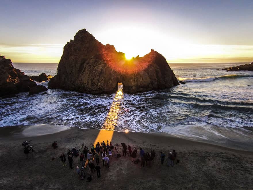
As I have already mentioned, the best time to enjoy this beach in all its splendor is at sunset, when the sun descends and reaches sea level, and shines through the Keyhole Arch creating a rare and beautiful phenomenon.
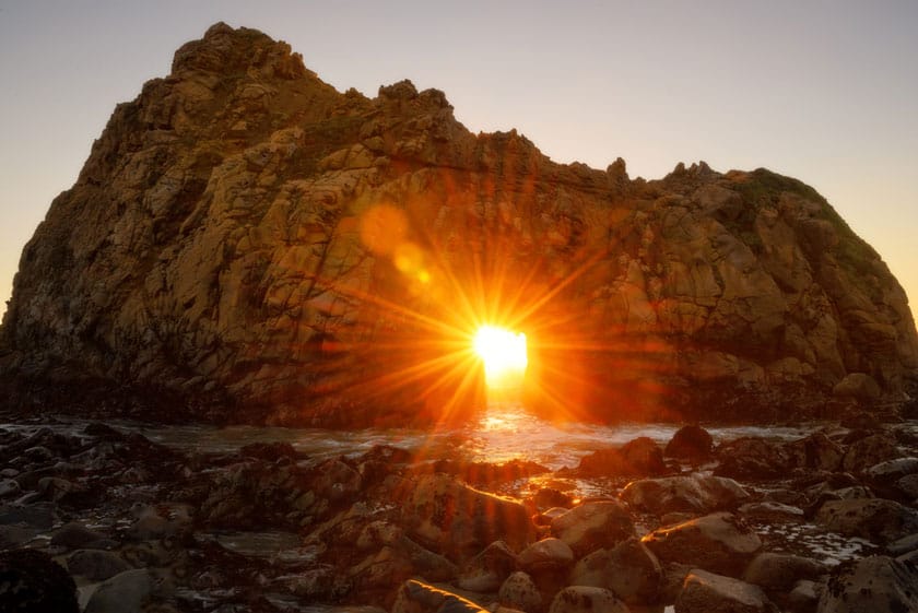
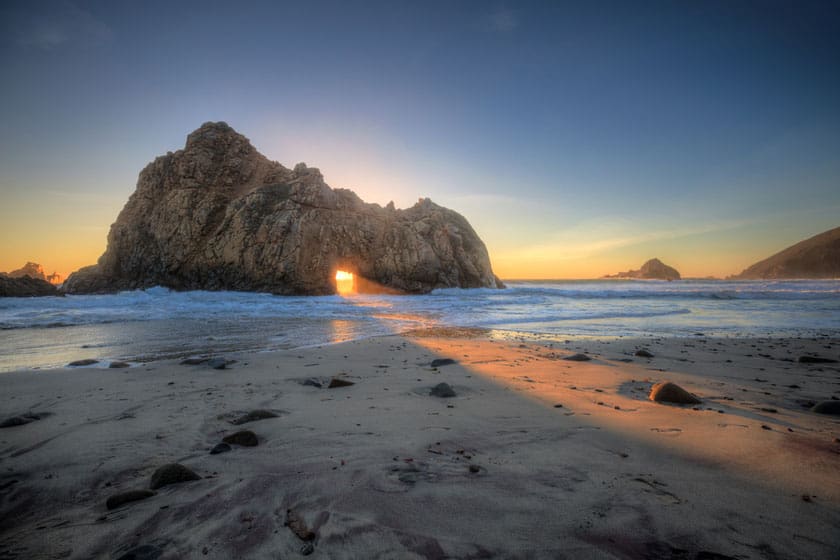
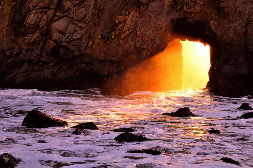
The best time during the year to enjoy this effect is around the winter solstice, between December and January, when the sun, the rock and the ocean align perfectly so that a reddish ray extends onto the beach. This lasts a few minutes and many photographers converge on the beach to try to capture it. Unfortunately, it is impossible to predict the exact dates on which the phenomenon occurs.
Can You Swim at Pfeiffer Beach?
As I mentioned above, Pfeiffer Beach is not best known for being a location for swimming. In fact, I would not recommend swimming here. It tends to be windy and swimming in the rough waters can be quite dangerous.
Nearby Attractions
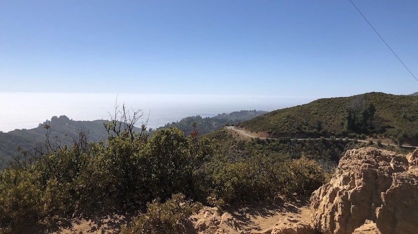
If you wish to read about all the attractions in the surrounding area, I refer you to our guide on Highway 1 and the article on Big Sur, where you will find the places of interest along the way. For those who love hiking, I recommend the nearby Buzzards Roost Viewpoint Trail. The trail, which is about 3 miles long, will lead you to a viewpoint where you can admire the ocean and the surrounding hills.
Where to Stay near Pfeiffer Beach
Presumably, if you plan to pass through here, you are traveling between Los Angeles and San Francisco (and you chose the best option, Pacific Coast Highway). In that case, you will find yourself deciding whether to break up the trip with 1 or 2 stops. To find the best solution according to your needs, I suggest you read my guide on where to stay between Los Angeles and San Francisco. To see all the accommodations available in the area (there are not many actually), you can click on the button below: