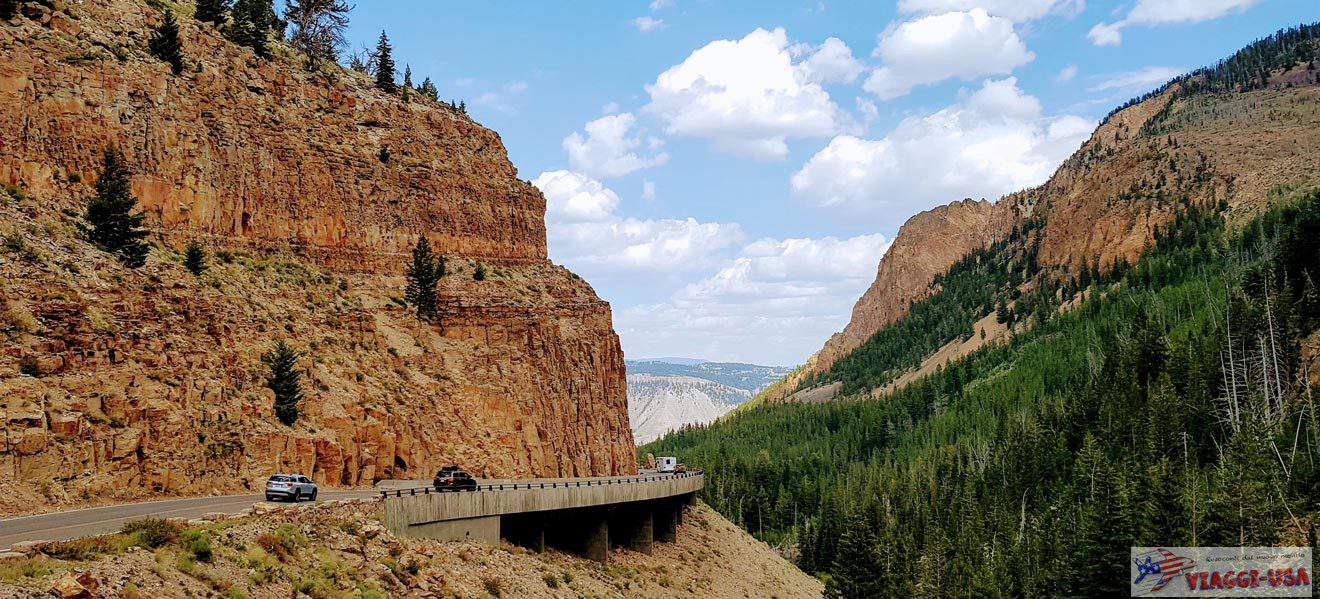
I would like to use my experience as the context to talk about Red Canyon in Utah, because the drive on this short stretch of road was an incredible experience that has stayed with me. During my first trip to the Southwest, I was on my way from Las Vegas to Bryce Canyon and I made a stop in St. George – where I first saw the typical red color rock formations in the Red Cliffs National Conservation Area and Snow Canyon – and, since I was in a bit of a hurry to go to Bryce Canyon, instead of taking the scenic SR-9, I continued my road trip on I-15, the interstate that crosses a landscape that is not even half as scenic, except for the Kolob Canyons area.
When I got to Panguitch, a small town that is in a strategic location for visiting Bryce Canyon, I was still on US-89 and I drove through the coniferous trees of Dixie National Forest. I couldn’t wait to enjoy the view of the pinnacles of Bryce Canyon, but a few miles before entering the park, I was surprised to have a beautiful preview. I had stumbled upon Red Canyon.
Contents
Red Canyon Utah: Directions from Bryce and Panguitch
Red Canyon is part of Dixie National Forest and is located near the western end of Scenic Byway 12, one of the most beautiful roads in Utah, that leads to Capitol Reef and passes through Escalante and Boulder. This road takes you 6.8 miles south of Panguitch or – for those coming from the south – 8 miles north of Hatch. After a few miles on UT-12, you will be crossing right through the middle of Red Canyon. You will know you are in Red Canyon when you begin to see the red peaks of the hoodoos, a delightful foretaste of Bryce Canyon, which is just 10.5 miles away on UT-63 S. The route through Red Canyon takes about 4 miles.
The address of the Red Canyon Visitor Center is 5375 UT-12, Panguitch.
Plan Your Visit
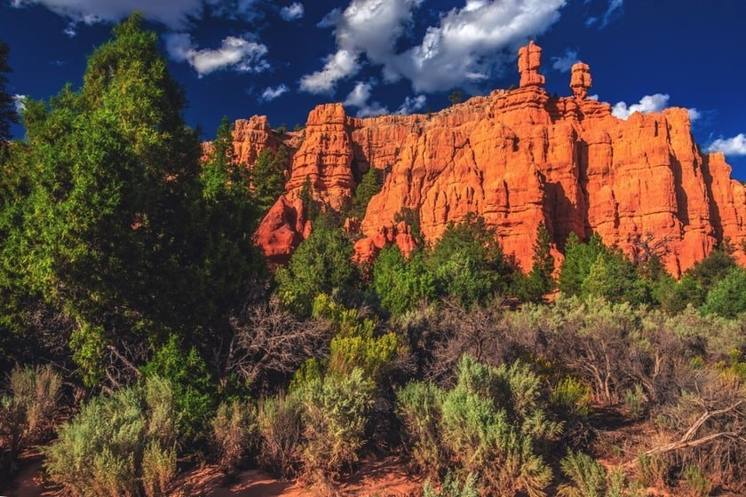
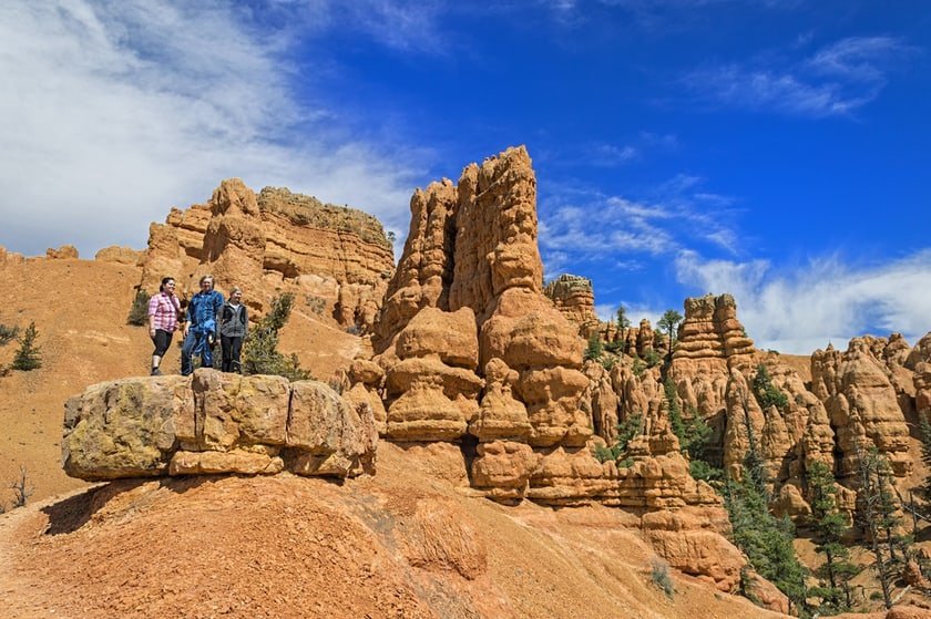
Red Canyon, which should not be confused with the Red Rock Canyon (near Las Vegas) or with Red Rock Canyon State Park in California, is a kind of miniature Bryce Canyon in Dixie National Forest. As you may have guessed by now, anyone who wants to reach Bryce Canyon from the west must pass through Red Canyon.
As I mentioned earlier, the road through the heart of the Red Canyon is 4 miles long, and most people keep driving without ever stopping, settling for what they can see along the way. For this reason, the clearings on the sides of the road are often deserted or almost deserted, but you can also take advantage of them, in case you want to take some pictures or head on a trail to reach a better vista point.
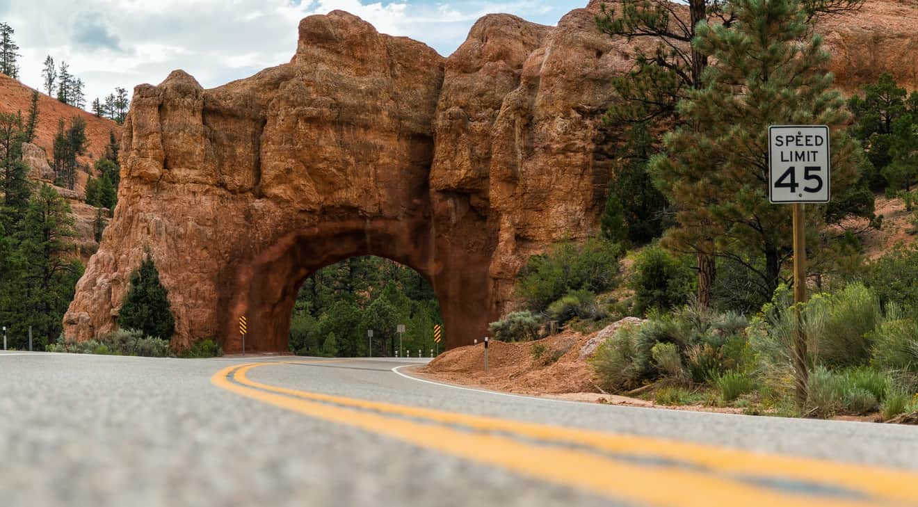
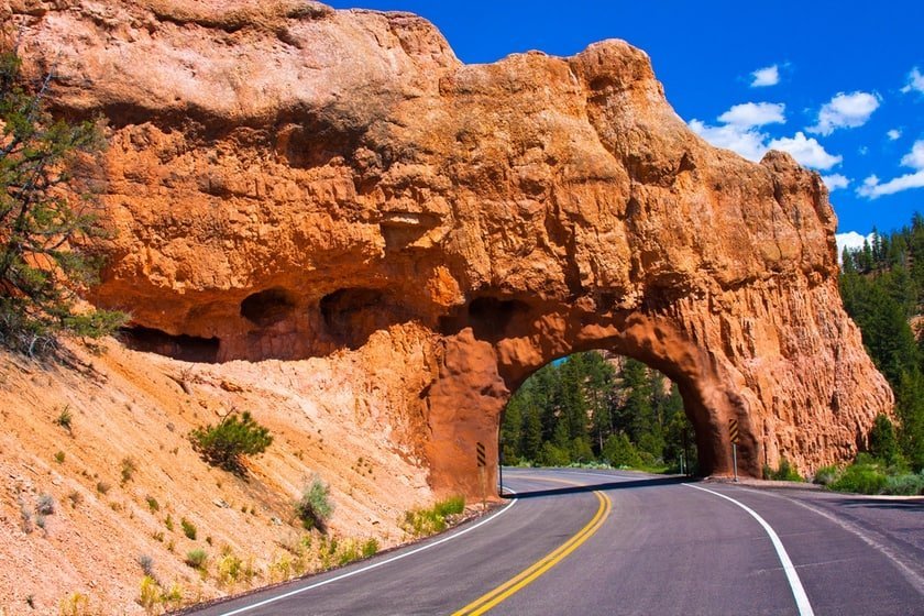
One of the most characteristic and unforgettable moments of this short scenic road inside the Red Canyon is when you drive under the two red rock tunnels. There could not be a more appropriate entrance to the landscape of pinnacles and rocks with bizarre shapes in Bryce Canyon than this canyon.
Red Canyon Map
Red Canyon Utah Hiking Trails
The Red Canyon is very popular among cyclists, who often come to the area to ride the 24-mile Red Canyon Bicycle Trail. However, if you haven’t brought your bike and are fascinated by the charm of Red Canyon, you can park your car and venture along one of these canyon trails:
- Pink Ledges Trail: This is the most popular trail in the Red Canyon, being the one that allows you to enjoy the best view of the area with minimum effort. You will reach the foot of cliffs and red hoodos, under the shade of the green forest. It is a loop that starts from the Visitor center, where you can conveniently find a place to park. The length of the trail, which is an “interpretive trail”, is a total of 0.7 miles with an elevation gain of just 151 ft.
- Red Canyon Tunnel Trail: From this point, you can start the Tunnel Trail, a simple trail that offers a beautiful view of the valley and especially of the two famous tunnels/arches mentioned above. The hike will take no more than half an hour. The length of the trail is 0.8 miles with minor elevation gain of about 246 ft.
- Golden Wall Trail: Those who have more time at their disposal can walk this loop that is 4.2 miles, that reaches 1040 ft, which is a significant altitude. The effort will be rewarded by the view of some of the most interesting rock formations in Red Canyon that border the sides of the trail like a compact wall of warm colors and show you the way. The trailhead is located across the street from the visitor center. These are the coordinates. The final part of the trail takes place on Buckhorn Trail and ends at the campsite.
- Cassidy Trail: Legend has it that the notorious outlaw Butch Cassidy hid out in Red Canyon after killing a man in Panguitch during a fight over a woman. The trail that the outlaw walked is now called Cassidy Trail in his honor. The trail begins 1 mile from the Visitor center at the Red Canyon Trailhead. As you walk, you will see beautiful views of the red rocks of Red Canyon and Losee Canyon. The trail can be combined with the Losee Canyon Trail. The length of the trail is 4.3 miles and the elevation gain is 623 ft.
Casto Canyon and Losee Canyon
Red Canyon is the most famous area of a plateau called Sunset Cliffs, which includes Casto Canyon and Losee Canyon, two other far more remote canyons. Furthermore, both canyons (especially the Casto Canyon) are far more beautiful than Red Canyon, especially because of the variety of colors and shapes of the rocks. How do you reach the canyons and explore them on foot? The quickest way is to drive to their respective trailheads on Casto Canyon Road, a dirt road that branches off from UT-12 just before entering the Red Canyon.
The exact point where you take Casto Canyon Road in your 4×4 or SUV is here. From here you have to drive 2 miles to get to Losee Canyon. If you keep going straight ahead for another mile, you will reach the Casto Canyon. Each of the two trailheads is well-marked and near both of them, there is space where you can leave your car before you start walking. You proceed inside a striking red gorge where the hoodoos and the vermilion, orange and pinkish rock faces rise on both sides of the trail beautifully and contrast the evergreen trees of the forest and the blue sky. Be careful when you visit Casto Canyon! The trail is often used by ATV and UTV vehicles.
Where to Stay Near Red Canyon
Here you will find the Red Canyon Campground, but if you need another place to stay in the area, please read our article on accommodations near Bryce Canyon. Click below to read the article.