Especially in the case of those coming from Bryce Canyon and heading to the Moab area, Scenic Byway UT-24 (also named Capitol Reef Country Scenic Byway) is the natural continuation of the equally scenic and incredible UT-12. The road is longer than the section we are focusing on in the article, but we are particularly interested in the stretch that goes from Torrey to the entrance of the I-70, which will then take us to Green River and then towards Moab.
Contents
Utah Highway 24 Scenic Byway: Length and Travel Time
The length of the route shown on the map is 81 miles to drive it takes 90 minutes without stopping. On the other hand, the segment to the west, which joins Torrey to Salina, is less traveled and you will not likely go that way, if not to reach a remote section of Capitol Reef (Cathedral Valley) or Fish Lake.
Utah Highway 24 Map
Here is a map of the route:
So let’s start with Capitol Reef, the first stop on this route, which is also the most important. It is right along the UT-24 Scenic Byway and it will be followed by the other stops on the itinerary.
Capitol Reef
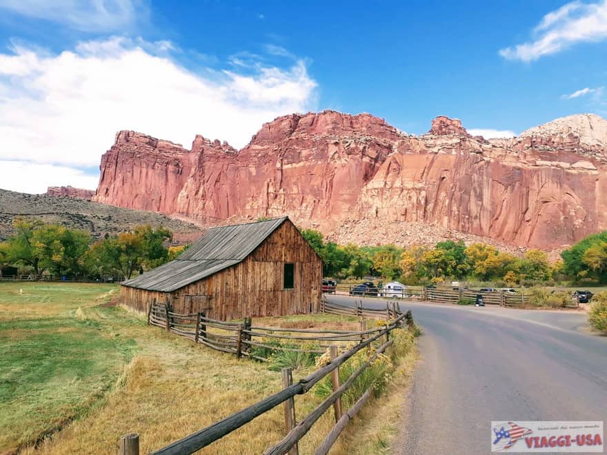 Capitol Reef, one of the most underrated parks in the Utah Mighty Five, is the triumphant opening of this first stretch of the route. The most striking feature of this beautiful national park is Fruita, a Mormon settlement with an orchard with the backdrop of red rock canyons, which are what distinguishes this area of the United States. There are numerous trails, off-road trails and viewpoints that can be reached. To visit some of these points of interest require a lot of time and energy, so I suggest you familiarize yourself with our in-depth article on the things to do at Capitol Reef.
Find accommodations in Capitol Reef
Waterpocket Fold to Caineville
 After visiting Fruita, head northeast and you’ll be amazed by what you will see. You’ll literally pass through the towering red wall of Waterpocket Fold, which is the backbone of Capitol Reef, which will surely make an already impressive visit… unforgettable.
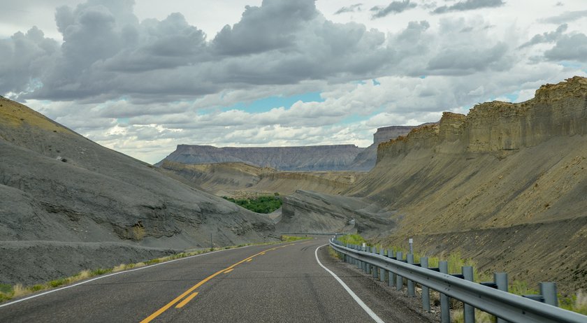
After a few miles, especially once you get to Caineville and beyond, the landscape around UT-24 transforms and suddenly becomes an arid and inhospitable alien territory with a variety of colors, including grey, pale yellow, purple and above all blue. Already at Caineville, you’ll find yourself driving through an endless desert expanse of multicolored rock (slickrock). You will be surrounded by rare mesas with bizarre shapes, called Upper Blue Hills and framed to the south by the Henry Mountains and San Rafael Swell to the north.
All available accommodations in Caineville
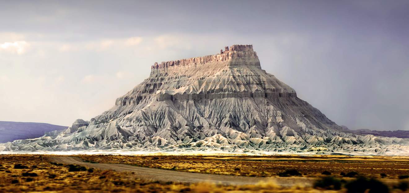
Factory Butte Recreational Area
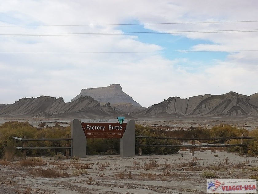
Factory Butte is perhaps the most iconic “natural monument” of this portion of the road. You will see it from afar along UT-24 and you will be amazed by its grandeur and the kaleidoscope of cold colors that are concentrated at the top and then streak down to the ravines at its base.
Recently, a recreational area called Factory Butte Special Recreation Management Area has been opened to the public, mainly intended for off-road vehicles (4×4, dune buggies, motocross bikes) but it is open to all vehicles. The easiest area to reach is called Swing Arm City, right along UT-24, more precisely here, 6 miles from Caineville. You’ll notice on the left a sign with the name of the area written on it (Factory Butte SRMA). All you have to do is to turn left and enter the dirt road.
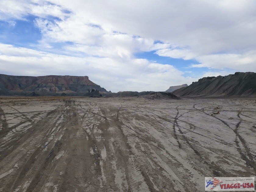
I absolutely recommend you to spend some time here, because you will have the opportunity to drive for a few hundred feet (or as far as you wish to drive, since there is no road marked) into an absolutely surreal, almost lunar landscape, with the Factory Butte and the North Caineville Mesa standing out on the horizon. If you don’t have a 4×4 car, drive carefully as long as you feel safe and then turn around. If the ground is dry there should be no problem, but you can never be too careful.
If you want to get closer to Factory Butte, you will not be able to access it here. Instead, turn left on Coal Mine Road (click here to see the location on Google Maps), a road that can be covered by any vehicle for the first 6-9 miles. Coal Mine Road runs parallel to Factory Butte on the eastern side and there are no secondary roads to reach it. Unless you are an off-road expert and have a suitable vehicle, I advise you not to wander off of the main road.
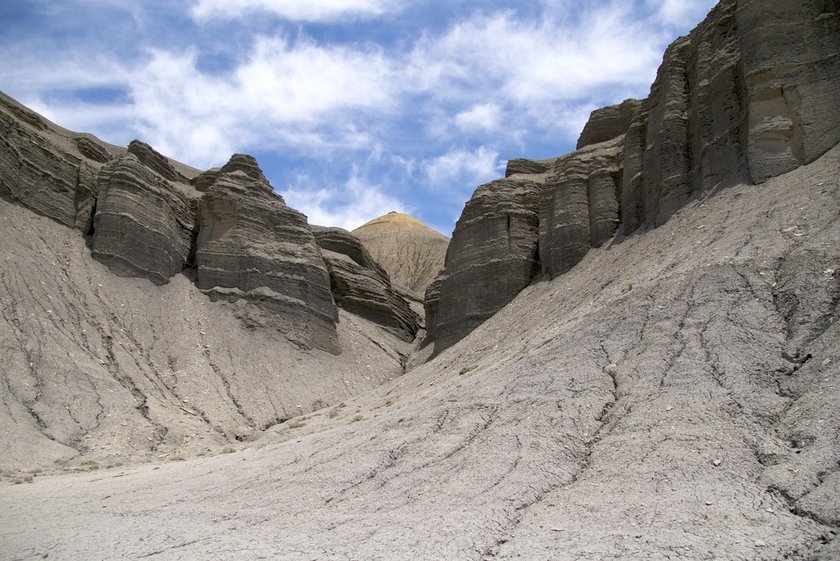
Moonscape Overlook
 Another reason to take Coal Mine Road is the Moonscape Overlook, where you will see a less-known alien landscape. If you want to go, turn right after about 6 miles (leaving Factory Butte behind you) at this point. Follow the road for 1 mile to the ridge and enjoy the view (you will see the best view in the late afternoon when the sun is behind you).
The Mars Desert Research Station
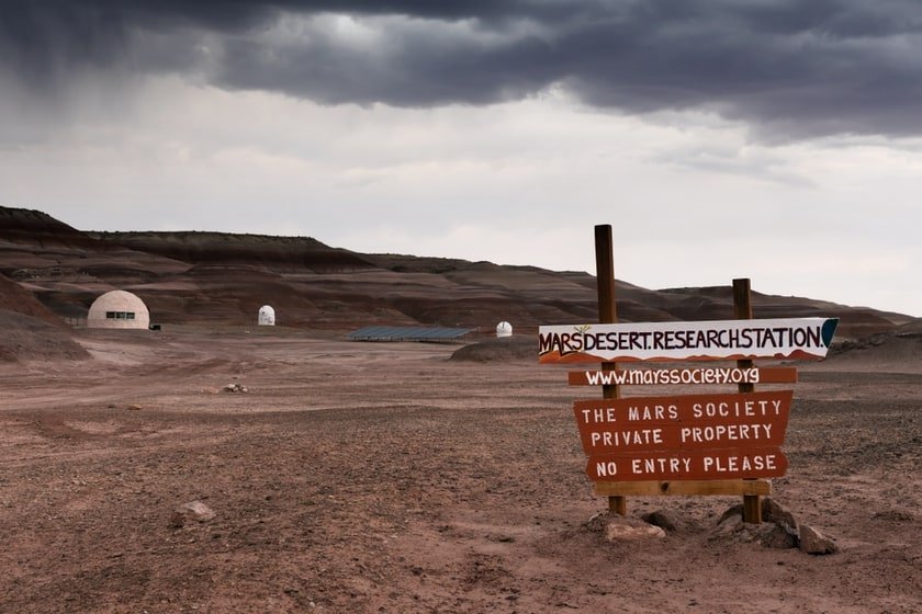 You are probably wondering why the landscape looks like it could be from another planet. And speaking of planets, did you know that not far from UT-24 is a replica of the planet Mars? Just 17 miles from Caineville, you can make another interesting detour to a peculiar “space station”. The Mars Desert Research Station in Utah was built by the Mars Society in this particular desert scenario in order to simulate the possible habitability of the Mars surface… well, we’ve said it all! You will drive 15 minutes on a dirt road to reach the research area, which includes an observatory, a greenhouse and other scientific instruments.
Hanksville
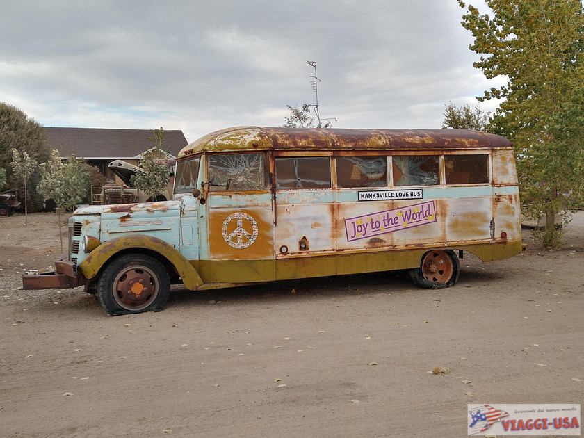 Next, after leaving the Factory Butte area, you will arrive in Hanksville, a small remote town with a hippie soul that serves as an important crossroads. To the south, along UT-95 S you can go towards the northern section of Lake Powell (Bullfrog), while to the north, UT-24 continues towards Green River. When you are in Hanksville, I recommend two pit stops:
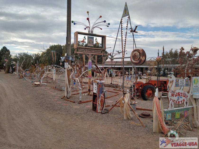
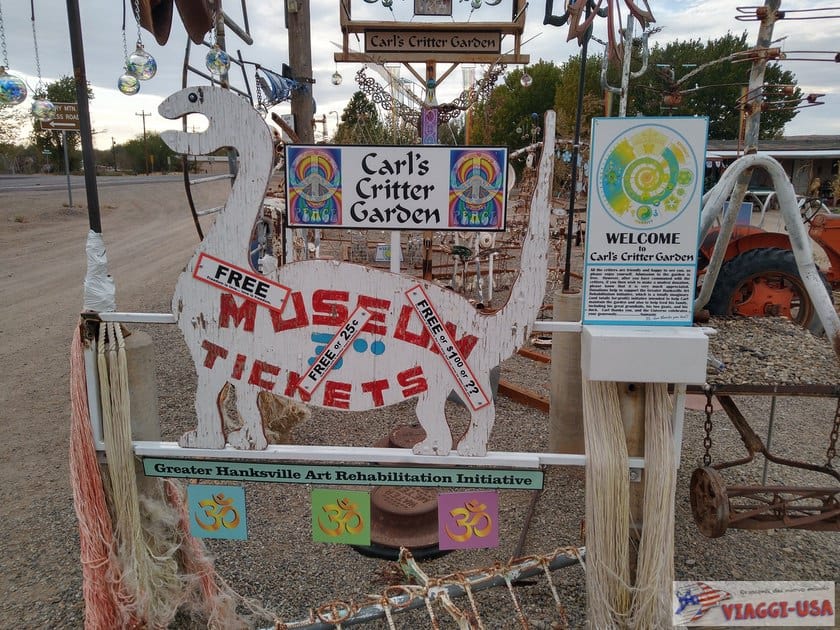
- Carl’s Critter Garden: On UT-24, at address number 864, there is an exhibition of memorabilia, old cars and unusual outdoor metal sculptures where a motel once stood. Stop by to take a few pictures of these funny and bizarre hippie rusty creations.
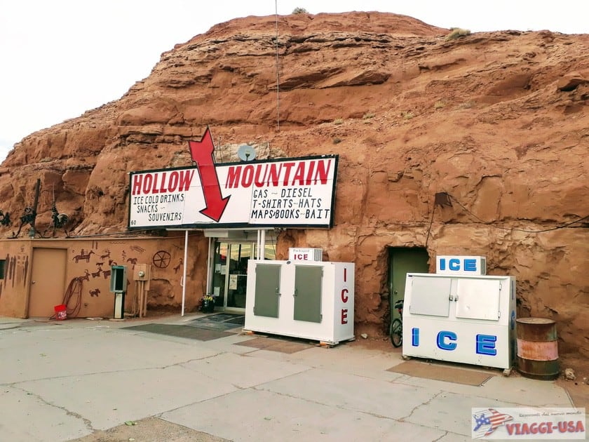
- Hollow Mountain: At 40 N UT-95 in Hanksville, near a Sinclair gas station, you’ll find Hollow Mountain, which turns out to be a gift shop and grocery store carved into the rock. Given its proportions, it may remind you of Hole ‘N’ the Rock in Moab, also because of tacky objects outside, such as fake petroglyphs and vintage vehicles.
Goblin Valley
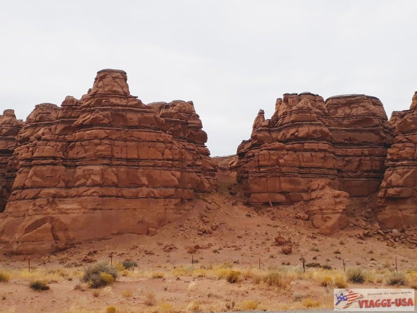
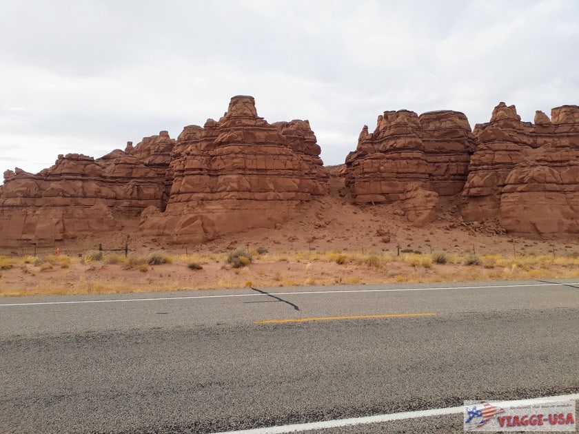
 You are only a few miles away from Goblin Valley, the last stop of our road trip on the UT-24 Scenic Byway! Right after passing Hanksville, along the road, you will also see some incredible rock formations on the sides of the road, where you will definitely want to stop to take some pictures, for example at this point.
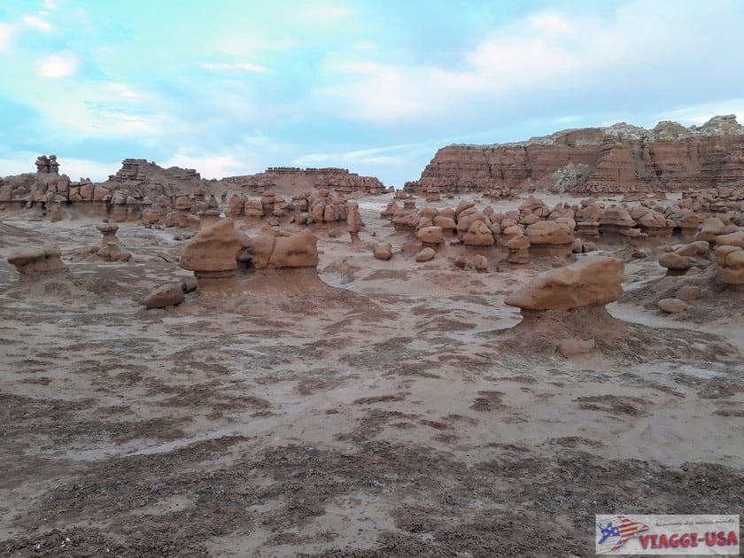
Goblin Valley is a beautiful state park that is home to some of the strangest rock formations in the area. You’ll be amazed at Molly’s Castle, the Three Sisters and above all the army of rock goblins lined up in the Valley of the Goblins. We talked about this park in the article about the points of interest in Goblin Valley.
Our road trip along UT-24 ends at the intersection with I-70 W, a road – which is not as scenic – that takes you to Moab (by turning onto US-191 N from I-70 W) in about 1 hour and 40 minutes. If you are heading north (Salt Lake City), you will take US-6 E after a few miles.
Where to Stay
Compared to UT-12, there are not as many towns along UT-24 where you can find accommodations. My advice is to look for a hotel, depending on your itinerary, in Torrey or Green River. The former is closer to Capitol Reef, while the latter is more convenient for those who want to stay overnight closer to Goblin Valley and Moab.