I have always said that Zion National Park is one of those American national parks that shuns being labeled as a “quick getaway”. There are no easily accessible overlooks, and to enjoy the best views, you have to put in some effort to get there. Well, at an altitude of 6500 ft, Zion Observation Point offers one of the most incredible views of Zion Canyon. However, it is also one of the toughest to reach from the bottom of the canyon, perhaps even more so than the notorious Angels Landing, which is a trail generally considered “dangerous”, but not so arduous.
In this article, I want to give some information about the East Rim Trail, which departs from Zion Canyon. But it doesn’t end here. I’ll also give advice on how to get to the viewpoint via a trail that is a little out of the way, but much less tiring than the East Rim Trail, called the East Mesa Trail.
Contents
Zion Observation Point via the East Rim Trail

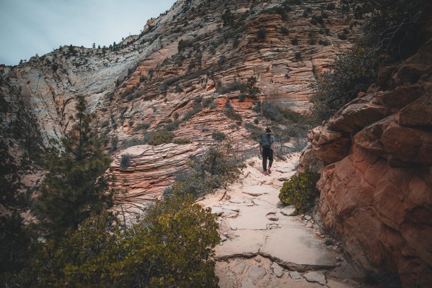
If you are in Zion Canyon and want to reach the plateau (East Mesa) where this overlook is located, you will have to hike the East Rim Trail, a grueling 7-mile (round trip) trail that climbs up the ridge for a total elevation gain of 2800 ft. Plan well the time you have available, because this hike will require at least half a day and probably not allow you to go on other hikes that require the same amount of physical exertion.
The trail starts at the parking lot behind the Weeping Rock shuttle stop. After 2625 ft, you will find a deviation to the Weeping Rock Trail, a very easy and popular hike that gives its name to the area. If you keep climbing, you’ll soon realize that for much of the ascent of the East Rim Trail there is a series of hairpin turns.
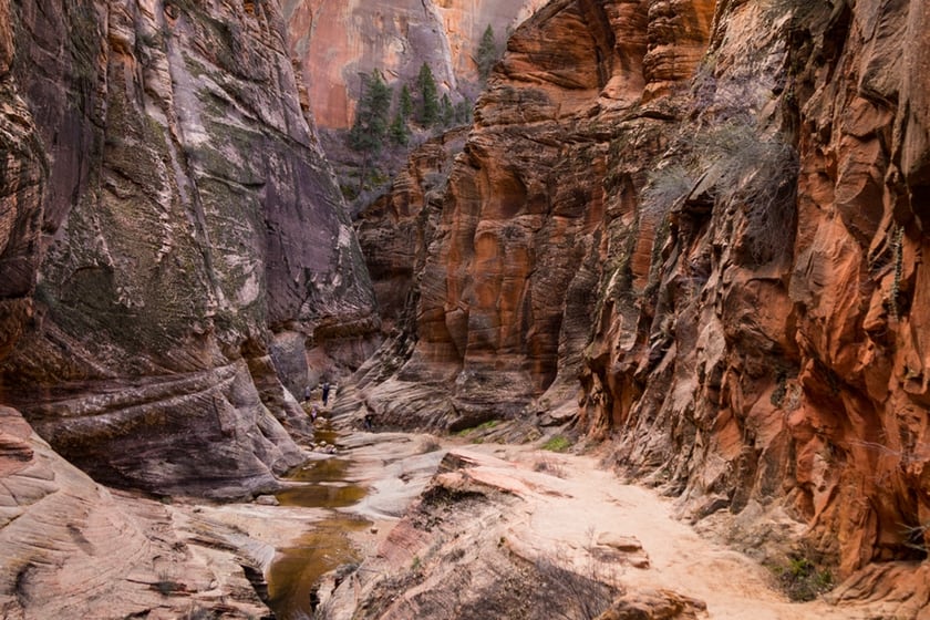
After 10 hairpin turns in the trail, you will find yourself in the middle of a beautiful slot canyon called Echo Canyon. You will walk through this rift between the rocks with your heart in your throat, because in front of you you will see the tall wall of the mesa emerge. After Echo Canyon, another ascent awaits you with a dozen or so hairpin turns to the top of the plateau. Here you will encounter the East Mesa Trail, which will take you straight to Zion Observation Point.
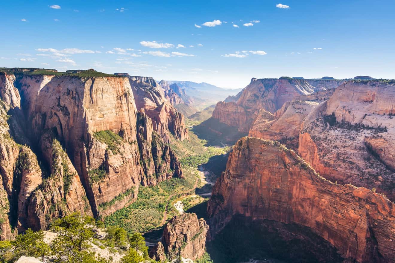
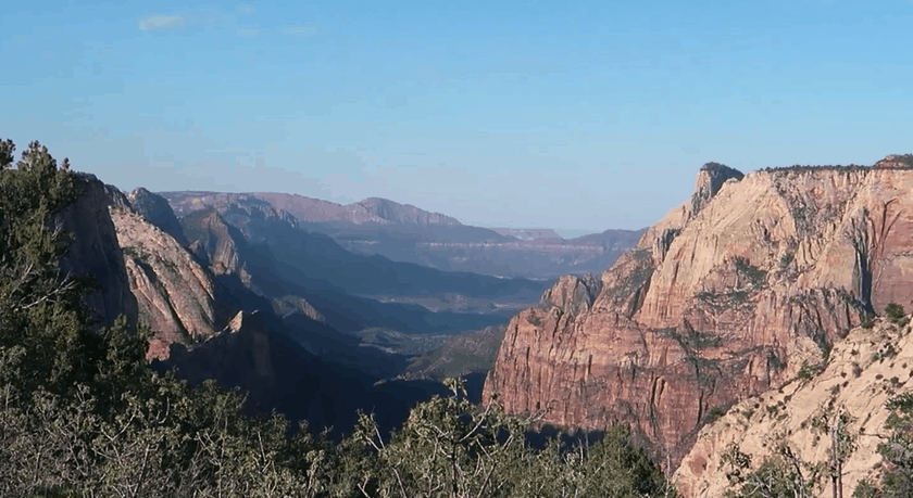
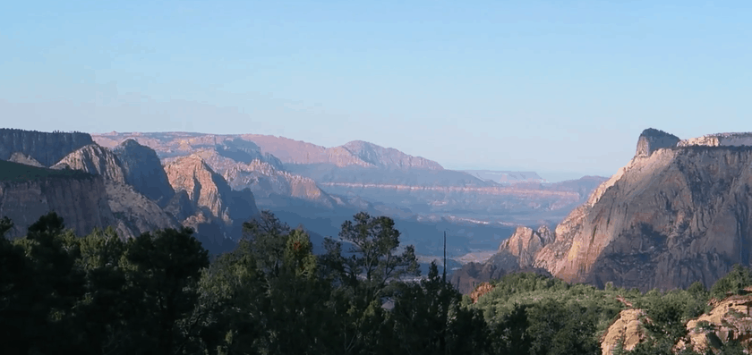
Once there, the view ahead of you is incredible. If you were impressed by the view of Zion Canyon from the top of Angels Landing, consider that from Zion Observation Point you’ll see the unmistakable Angels Landing below you and the panorama of the entire canyon all the way to the valley where Springdale is located.
How to Get to the East Rim Trailhead
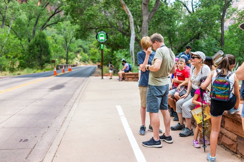
The trail is located at the Weeping Rock shuttle stop, which is stop number 7 on the route. As soon as you get off the shuttle, you will find yourself in front of a parking lot. Take the trail on the right which has the classic information signs.
Map
Alternate Route: Zion Observation Point via East Mesa Trail
What I have just described is definitely the most tiring and fascinating way to get to Zion Observation Point. However, not everyone knows that there is a less scenic but much easier trail, known as the East Mesa Trail. Yes, it’s the same trail you briefly encountered at the top of the plateau after climbing all the hairpin turns of the East Rim Trail.
The East Mesa Trail is almost all flat, because it takes place entirely on the East Mesa plateau. Easy, you say! The problem is that the trailhead is not inside Zion Canyon. Instead, the trail starts somewhere else, practically on the eastern edge of the park. Therefore, you must plan well, because you won’t have a lot of time left to explore other trails inside the canyon, especially if you are only spending one day visiting Zion Canyon.
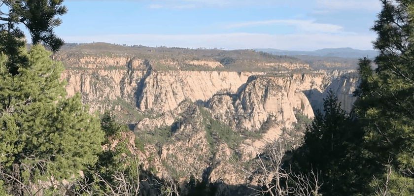
This trail, which remained fairly unknown until the East Rim Trail closed, is long but simple. It is 6.7 miles long (round trip) for an elevation of 695 ft and is a quiet walk in the forest that is mostly shaded with some points under the sun (especially in the final part). The route does not have striking views, especially when compared with the East Rim Trail and the Echo Canyon, but in the final part there are excellent views of remote areas of the park (such as Mystery Canyon or the Narrows). After crossing the East Rim Trail (wave to all those who have braved the hairpin turns!), you will be very close to the Zion Observation Point, where you will see the exceptional view.

How to Get to the East Mesa Trailhead
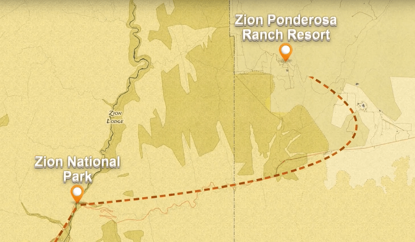
The trailhead is not in Zion Canyon, but in a remote area east of the park. To reach it, you need to drive on SR-9 and you will turn and enter the Zion Ponderosa Ranch Resort.
There are two ways to get to the point where the East Mesa Trail begins.
By Shuttle
Coming from Springdale, drive east on the Zion-Mt Carmel Highway, leave the East Entrance behind and reach the junction with the North Fork Country Road (there are signs for Zion Ponderosa Ranch). Turn and drive on North Fork Country Road to the junction with Twin Knolls Road, turn left and enter the ranch. From Springdale, it takes about 45 minutes to get to the ranch.
At the ranch you will find a convenient shuttle service run by Zion Adventures, a Springdale-based tour agency. Departures are every hour until 2 p.m. Shuttles travel along a short dirt road up to the trailhead. Shuttles depart from the trailhead every hour starting at 8:30 am until the end of service. The cost is $7 per person for round-trip transportation.
By car
Some people drive their car directly to the trailhead, but remember that the final part of the road after the ranch is unpaved and there are only a few parking lots. Leaving your car outside of the official parking lots is prohibited. If you want to drive to the trailhead, read the box below.
Map
Zion Observation Point Trail Map
Here is a satellite map that gives an idea of the routes of the two different trails.

Where to Stay
For advice on accommodations, you can read our in-depth guide on where to stay in Zion Canyon, which will be important, especially if you’re planning on hiking the East Rim Trail.
If you want to be in close proximity to the trailhead of the East Mesa Trail, you can find accommodations at the Zion-Ponderosa Ranch, a beautiful peaceful resort surrounded by the mountains of Zion. One option is to stay overnight at the ranch, leave very early for the Zion Observation Point, pick up your car after the hike and reach Zion Canyon via SR-9, which will certainly be faster than an overnight stay in Springdale.