There’s no doubt about it. There are so many natural wonders to see around Page that it would take more than a week to see them all. If you’re planning your road trip to Arizona, draw a nice red circle on the map around Page. Here you will find some of the most fascinating slot canyons in Arizona, such as Antelope Canyon and Water Holes Canyon), the mesmerizing Lake Powell with its many bends, the Lone Rock and Rainbow Bridge National Monument, then also Marble Canyon (which is the very beginning of the Grand Canyon) and the thousand other wonders in Glen Canyon.
In addition to all these points of interest, there is a natural masterpiece that until a few years ago was ignored by most travelers. I am talking about Horseshoe Bend, certainly one of the most spectacular landscapes in Arizona, which has quickly become so popular that it has secured its spot among the top things to do in Page and throughout the Southwest.
Contents
Where is Horseshoe Bend? Directions from Page
 The parking lot for Horseshoe Bend is located about 4 miles south of Page heading towards Bitter Springs. You must turn right off of Highway 89 and follow the signs.
From Monument Valley to Horseshoe Bend
If you are traveling to Page after visiting Monument Valley, you have to take AZ-98 W at Shonto and drive up to Page, passing Antelope Canyon. At the intersection with Highway 89, turn left and drive 2 miles and you will arrive at the Horseshoe Bend parking lot.
From Grand Canyon to Horseshoe Bend
If you arrive at Page from the south (e.g. after visiting the Grand Canyon), you will clearly see Horseshoe Bend on your left. As you drive along Highway 89, you will see the signs for Horseshoe Bend (Overlook Trail). Take the exit indicated and you will immediately see the parking lot.
From Las Vegas to Horseshoe Bend
Of course, if your previous stop was further west (e.g. Las Vegas or simply Kanab), you’ll already be on Hwy 89. When you’ve passed Glen Canyon Dam, continue south for 5 miles and stay on the main road without entering Page.
Horseshoe Bend Hike: Plan Your Visit
Once you’ve parked your car and read the signs, you’ll understand that you’ll have put in some effort to get to Horseshoe Bend.
Horseshoe Bend Trail
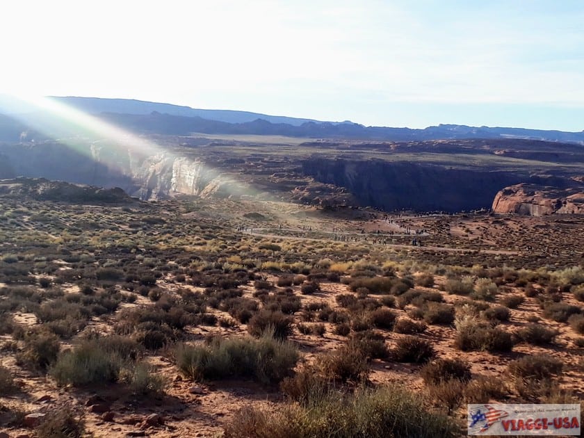 From the parking lot, you can take a 1.5-mile round trip trail that leads to the cliff where this magnificent natural masterpiece. The hike is short but in the summer months the heat is grueling and the uphill climbs can be difficult, so it is a good idea to bring lots of water.
After climbing up the 984 ft gentle ascent, you will find yourself in an area with a small rest area with a shady gazebo, where you can catch your breath and read the panels that will tell you the geological history of the Horseshoe Bend, providing a brief description of what you will see.
From this point, the second part of the short hike resumes and is all downhill and easy to walk. The return trip will be hard – uphill and with the sun beating down, which is why you may consider hiking at a time of day when temperatures are lower – but at least you will still have had the great satisfaction of having seen Horseshoe Bend.
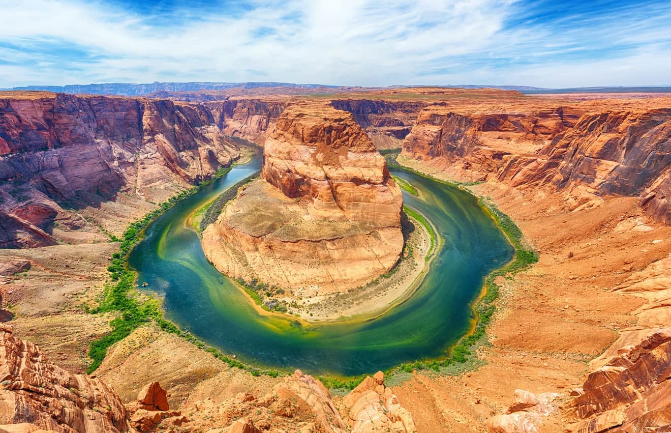
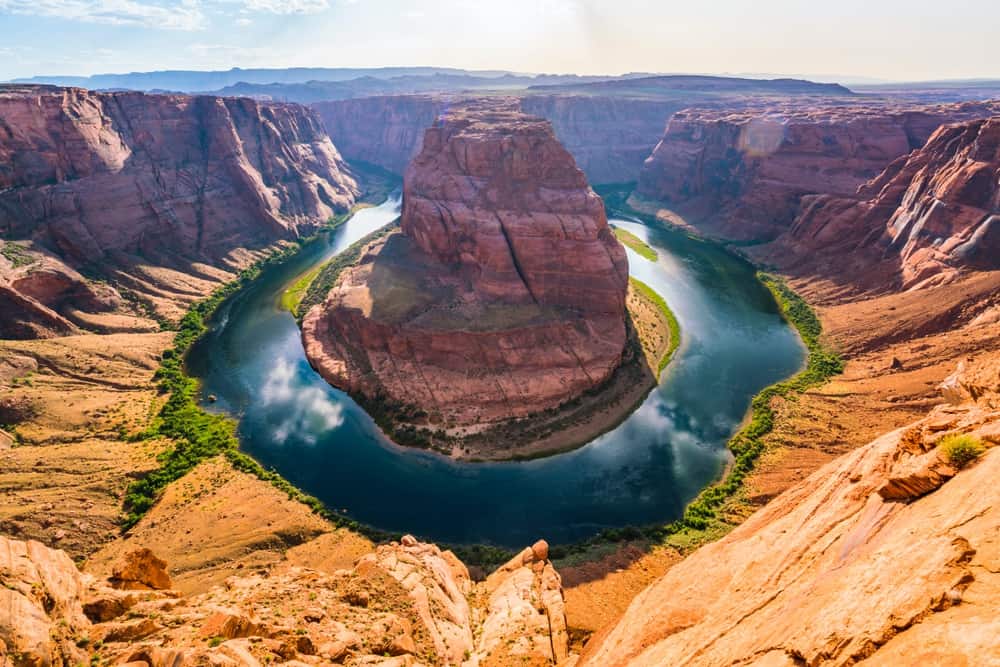
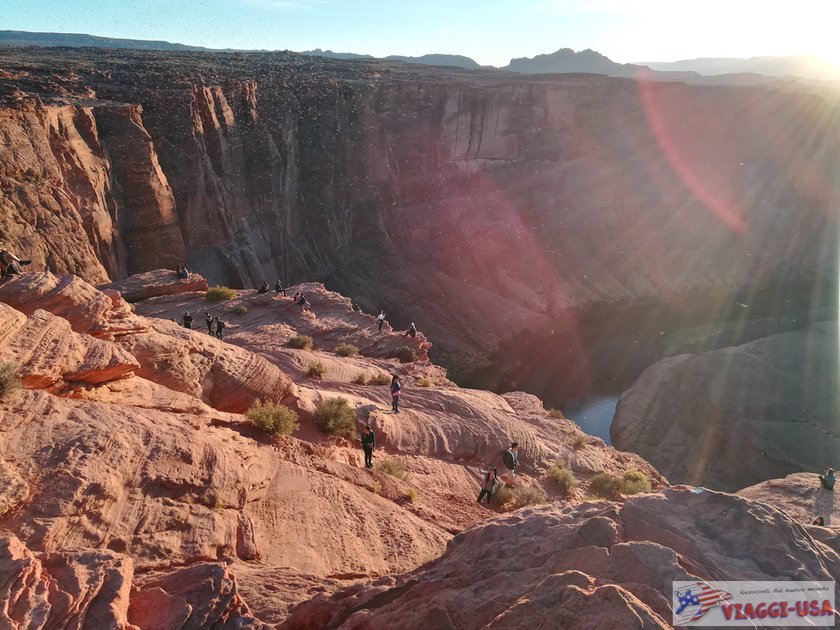
Horseshoe Bend Overlook: What Can You See?
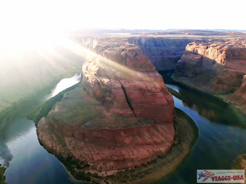
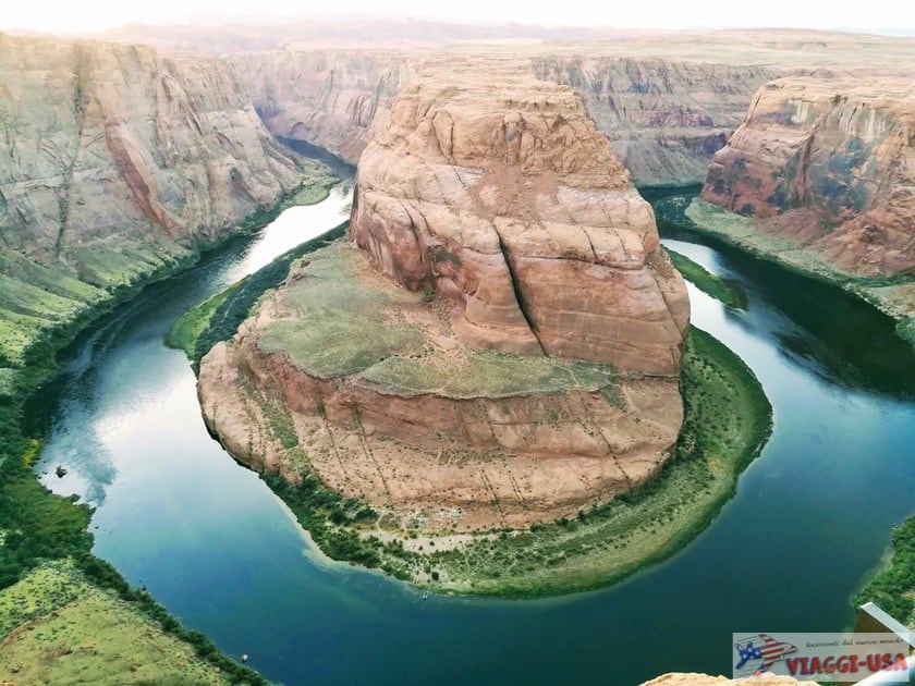
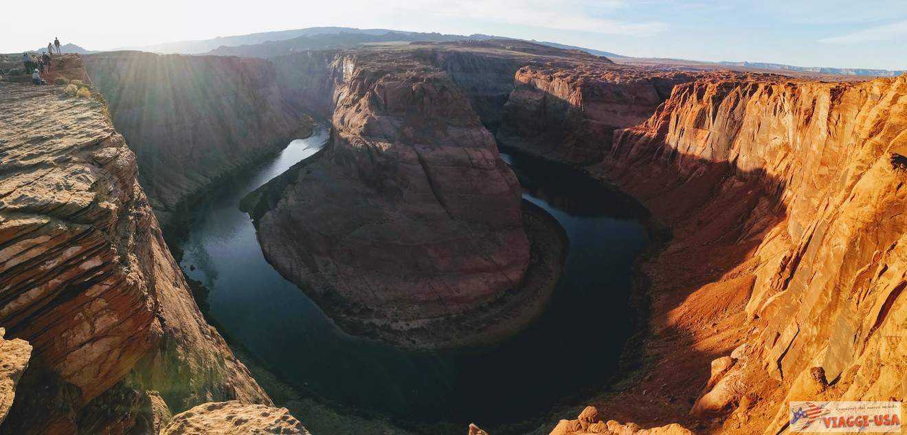 You will see the river bend that looks just like a horseshoe that has been molded by the Colorado River. The overlook allows you to see Horseshoe Bend from above, and you will be awestruck by the beauty of the view and, above all, by the astounding height of the viewpoint. In 2018, railings were installed along the central part of the cliff, because many people leaned a little too close to the edge to take the perfect selfie, often defying the rules of common sense, and in some cases, it proved fatal.
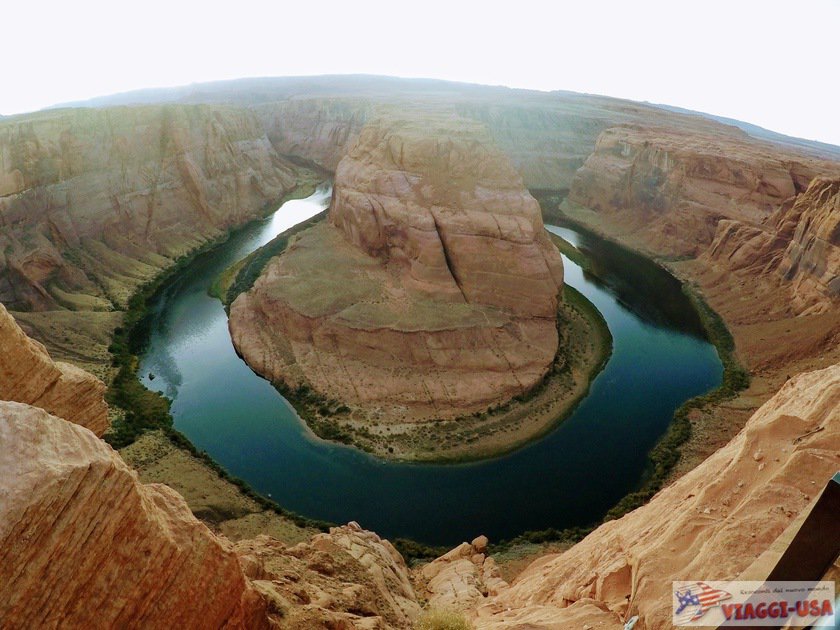
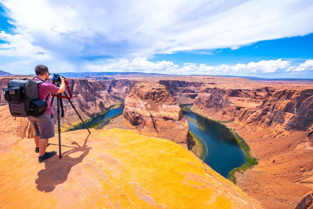
If you want to observe and photograph the view in complete safety, stay close to the railing, which is the best place to see and take a picture of yourself with the “classic view” of Horseshoe Bend. However, when you’re there, you won’t be able to resist the temptation to look at this natural wonder from multiple angles.
Bear in mind that there is only a barrier present in the central section of the overlook and that the rest of the ridge is not protected. We don’t know if the authorities will decide to build a railing around the entire overlook in the next few years, but for the time being, we suggest that you be extremely careful.
Horseshoe Bend: Best Time to Photograph
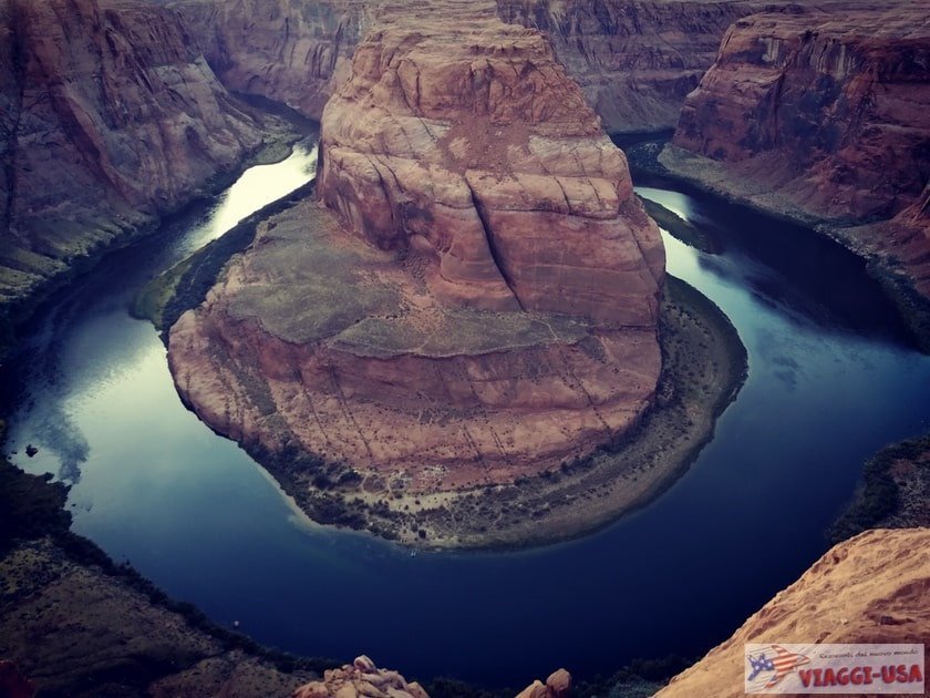
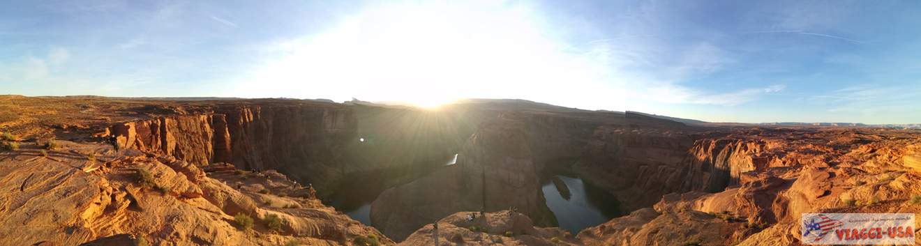
 The best time to photograph Horseshoe Bend is from late morning to early afternoon, because the sun is high and illuminates both the river and the rock. However, it is very hot at that time, not only in summer. If you are concerned about the heat, go there at dawn or before 9 o’clock or you can also go in the evening at sunset when the sun is behind Horseshoe Bend, which means that the sun will be in your eyes and it will “burn” the photos a little bit, but already a few minutes after sunset you can see beautiful colors.
Horseshoe Bend Map
Horseshoe Bend Entrance Fee
 Until a few years ago, Horseshoe Bend was virtually untouched. There was no charge for parking or admission. Since 2014, the place’s popularity grew so much that – due to the huge crowds and the resulting risks I mentioned above – it became necessary to impose safety measures, expand the parking lot, build a Visitor Center and pave the trail that connects the parking lot to the edge of the canyon.
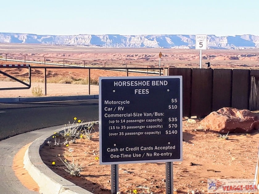
Admission to the park is free, but you pay for parking (managed by the town of Page), which is mandatory, unless you have the crazy idea to walk about 6 miles from Page along the road! 🙂
Here are the entry fees:
- Car and RV: $10
- Motorcycle: $5
Horseshoe Bend Tours
 There are very adventurous ways to visit Horseshoe Bend. When you’re on the overlook looking down, you’ll see small boats along the Colorado River bend. If you would like to ride the boat too, just jump in your car and turn around and head to the aforementioned Glen Canyon Dam a few miles away. From there, after visiting the dam, you will descend to the water level and you can embark on rafts. A guide will take you along the river and tell you about the geological evolution of this wonderful place.
If, on the other hand, you love to look down on things from above and the cliff was not high enough for you, you can look over Horseshoe Bend in a helicopter or small plane. At the link below you’ll find an overview of all the air tours available departing from Page.
In addition, there is an interesting package deal that includes a one-day visit to Antelope Canyon and Horseshoe Bend. We talked about it in this article.
Is There an Alternative That is Less Crowded?

Given its growing fame, seeing Horseshoe Bend alone or almost alone is now virtually impossible. But is there really an alternative? It’s hard to find a landscape like this, with such a perfectly shaped rock formation. In Utah and Arizona there are a few different but equally breathtaking viewpoints: Dead Horse Point State Park, Goosenecks State Park and other “bends” or “goosenecks” (there’s one in Capitol Reef too).
But would you believe me if I told you that a few miles from Horseshoe Bend there is another bend that is quite similar, not so beautiful perhaps, but totally untouched and unknown? At the point where the Colorado River meets the mouth of Waterholes Canyon, there is a curve in the river quite similar to Horseshoe Bend, but it is less “curvy”. It’s called Waterholes Bend, which you can locate it here. How do you get there? It’s not easy at all, because there is no road that is commonly traveled and the hike is much longer and harder than Horseshoe Bend. The point where the hike starts is here, and the trail will run all the way along the south side of Waterholes Canyon to the precipice.
Since I have not personally gone on this hike, I recommend that you only do it if you have adequate experience hiking and a good sense of direction. In any case, check with the Waterholes Canyon tourist agency before embarking on this hike.
Hotels Near Horseshoe Bend: Where to Stay in Page?
If you want to spend the night near Horseshoe Bend, the closest place is undoubtedly Page, which is full of quality motels and hotels, but we also want to remind you that not far away from Page, you will find the Lake Powell Resort (100 Lake Shore Drive), located on the banks of the charming Lake Powell.
Photo Gallery