Also known as Route 1 or Highway 1, the Pacific Coast Highway is the road of the American Dream, a U.S. route that offers beautiful views of the coast along the 620-mile road from Orange County (near Dana Point, south of Los Angeles) to Mendocino County (just above San Francisco, in Leggett), that covers almost the entire California coast.
A Pacific Coast Highway road trip passes through desolate moors and viewpoints that allow you to enjoy the rare and amazing natural beauty of the coast. The possibilities are endless but a common route is to take the coastal scenic route from Los Angeles to San Francisco (or vice versa), and often people extend the journey and continue south to San Diego, a city with beautiful beaches and pleasant temperatures.
But a road trip on Highway 1 doesn’t only offer unforgettable scenic views. Even history buffs will find something of interest. Along the Pacific Coast you will find the many Franciscan missions that were built in California starting the eighteenth century, all included in the historical itinerary El Camino Real. We start our Pacific Coast Highway itinerary from the south, from the beaches of Orange County, and will head north towards San Francisco Bay and beyond.
Contents
Pacific Coast Highway Map
Orange County, Located South of Los Angeles
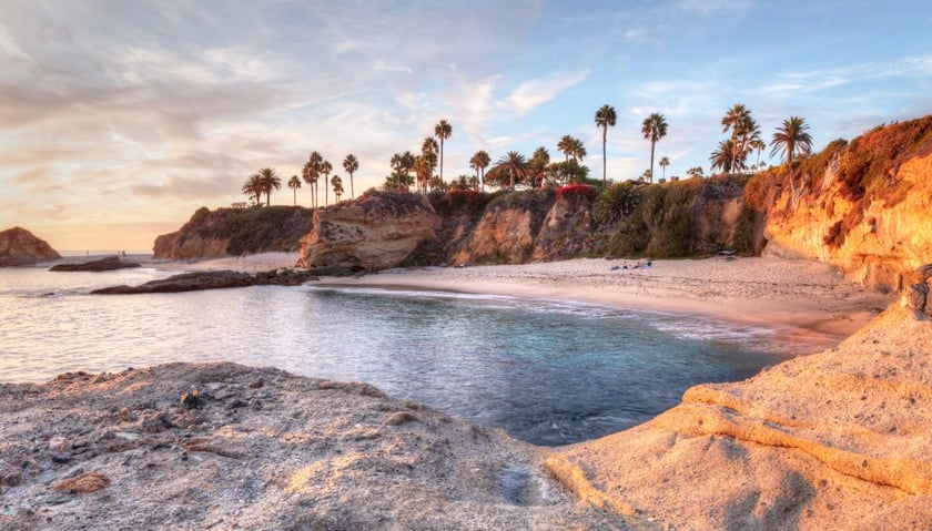
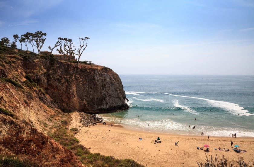
Usually, the last stretch of the Pacific Coast Highway, which crosses Orange County, is traveled on the way from Los Angeles to San Diego. Best known for Disneyland, Orange County is a region that can boast many incredible attractions, including the beautiful beaches and charming hidden coves that characterize Laguna Beach, the area’s most popular beach destination, but also interesting historical places, such as San Juan Capistrano, 11 miles south of Laguna Beach, which, in addition to its historic district, has one of the most fascinating missions on the entire California coast.
If you love surfing, there are a few places where you can go in search of the perfect wave, starting with Huntington Beach. Many consider it the surf capital of the United States (not surprisingly it was renamed “Surf City USA”). There are also Newport Beach and The Wedge, on the southern end of the Balboa Peninsula.
This section of Highway 1 is not particularly impressive to drive along, but it can be very rewarding if you decide to stop in the various coves and inlets that the Laguna Beach area offers along the way (e.g. the cliffs of Treasure Island Park). For a list of recommended stops, please refer to our guide of Laguna Beach.
From Los Angeles to Santa Barbara
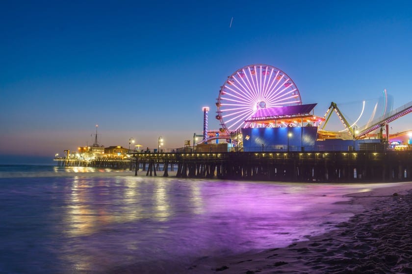
Continuing north, pass through Long Beach and plan to stop next in Santa Monica, one of the most famous destinations in the Greater Los Angeles area, known throughout the world for its amusement park on the pier (Santa Monica Pier) and for being the end of Route 66. Next, head to Malibu, a stretch of the coast that was renamed “27 miles of great views”, and then on to Santa Barbara, at the foot of the Santa Ynez Mountains, a green valley full of vineyards and farms that you can also cross via Highway 101, an alternative and faster road that goes from Los Angeles to San Francisco.
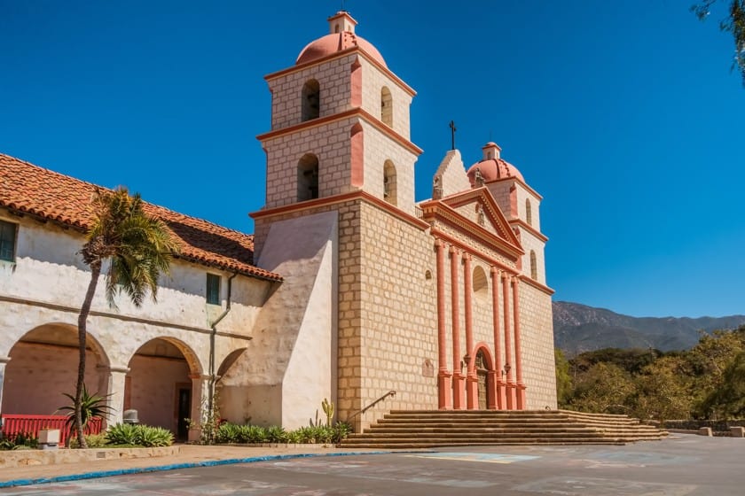
Santa Barbara is a destination that really deserves an extended visit, especially because of the multiple pieces of history and the many Spanish Colonial buildings. Since you are here, take the opportunity to make a detour in a very unusual town, Solvang, a Danish town in the USA.
Hearst Castle and Big Sur
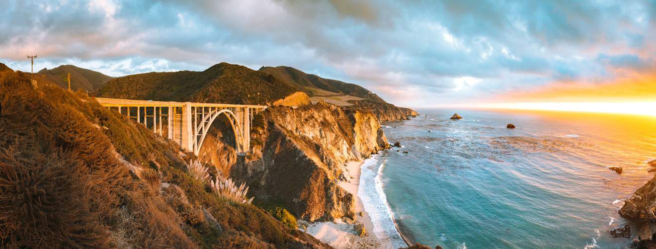
Further north, the Pacific Coast Highway begins to show its most majestic and impressive scenery, rising 1640 to 3280 ft above the roaring waves of the Pacific. Considered by many as America’s most fascinating scenic road, the rugged and wild 90-mile drive that stretches from Hearst Castle, just past the interesting towns of Morro Bay and San Luis Obispo, is bound to win the hearts of road trip enthusiasts.
Big Sur, which is bordered by the rugged mountains of Saint Lucia to the east and the Pacific to the west, is certainly the most fascinating section of the coast, “A place of greatness and eloquent silence”, as described by Henry Miller, the author of the novel Tropic of Cancer.
It was practically inaccessible before the Pacific Coast Highway was built. Thanks to the work of prisoners and New Deal funds, Big Sur was completed in 1937 and began to attract tourists. Its beauty has inspired artists and writers like Miller, whose books and photographs can be found at the Henry Miller Memorial Library, and alternative thinkers, some of whom helped found the Esalen Institute.
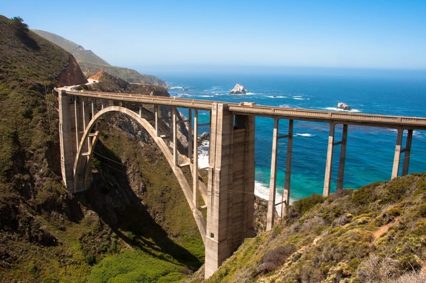
Proudly protected by its 1,500 inhabitants, Big Sur offers landscapes that seem to be taken from a Romantic painting. The land is splashed by the impetuous waves of the ocean and circumscribed by curved and narrow roads that wind along the edge of the sheer mountains. You will definitely want to take pictures at Bixby Bridge, the famous symbol of this road.
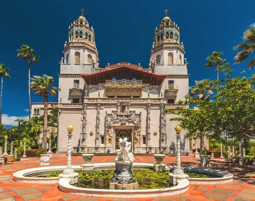
Hearst Castle, located near Pfeiffer State Beach, a beach with violet sand and picturesque sea stacks, is another unforgettable place, and if you are looking for somewhere to take a break and relax, stop by Nepenthe for a drink, a restaurant with an outdoor patio 2,625 ft above the sea.
For more details about things to do in the area, check out our guide on how to visit Big Sur.
The Monterey Peninsula
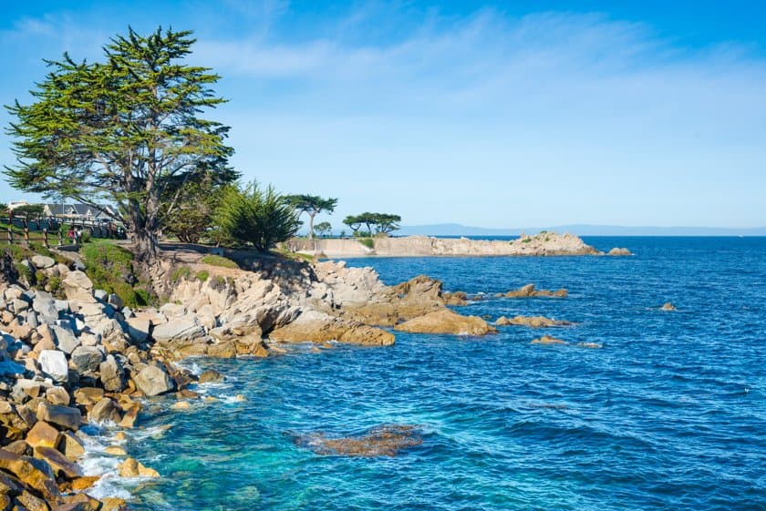
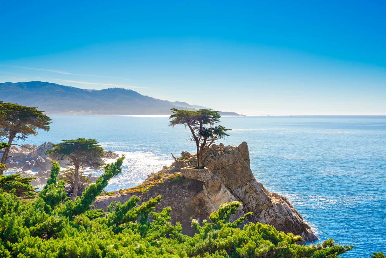
The most spectacular section of Highway 1 is behind us, but this road still has a lot of surprises for us. The Monterey Peninsula is a treasure trove with many places to discover, starting with Carmel By the Sea, a charming town with a beautiful mission, then Monterey, famous for its large aquarium and many well-preserved historic buildings, the 17-mile Drive, a winding scenic road that runs along the ocean around Carmel Point, and Pebble Beach, an area frequented by wealthy people that has golf courses, luxurious villas, as well as charming views of the sea and trees with unusual shapes.
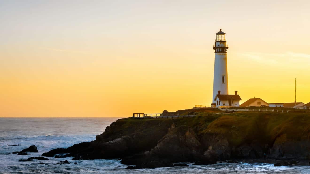
In addition, there is also Pacific Grove, which has a rugged coastline dotted with pink flowers and embellished with the striking lighthouse of Point Pinos, and Point Lobos, a beautiful protected area where you can go and view the perfect inlet.
For a complete recap of everything that awaits you on this stretch of the Pacific Coast Highway, please read our Monterey Peninsula guide.
San Francisco Bay Area and Marin County
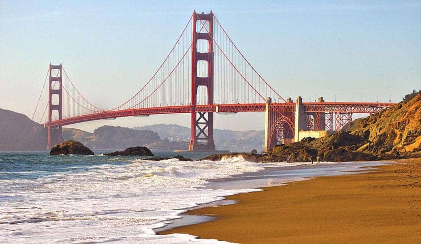
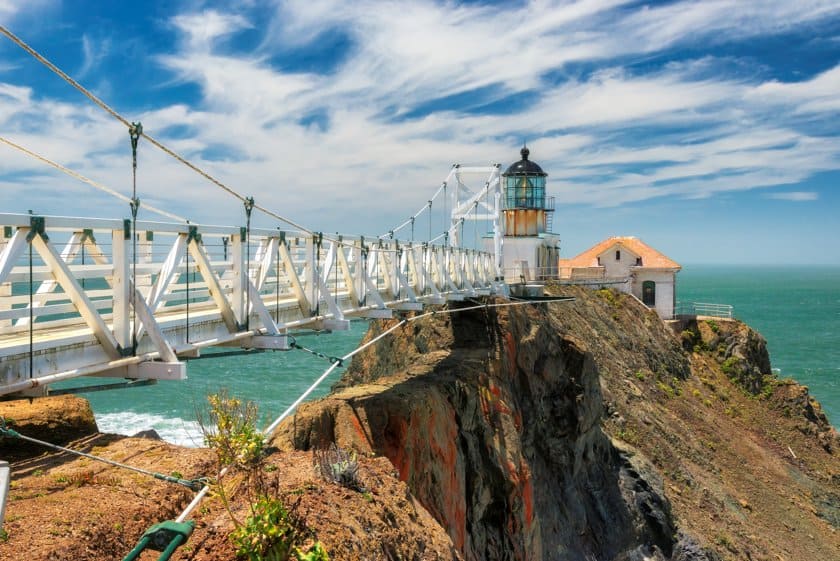
You’ve arrived in San Francisco and most people decide to conclude the trip on America’s most scenic road here, yet this fascinating itinerary still has so much to offer. Highway 1 continues along one of the most famous bridges in the world, I’m not talking about the aforementioned Bixby Bridge but the famous red bridge that crosses San Francisco Bay (read our tips for driving across the Golden Gate Bridge) and will take you to the giant redwood forest of Muir Woods, but before you get there, I recommend a small detour from the main road to visit Point Bonita Lighthouse, one of the most scenic lighthouses on the West Coast.
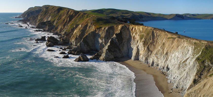
Continuing further north, the coast of Marin County has stunning views of cliffs and sea stacks; it is an area known as the Gulf of the Stacks and part of the Greater Farallones National Marine Sanctuary. Those who love lighthouses will enjoy visiting Point Reyes Lighthouse, one of California’s most scenic and well-known lighthouses.
North of San Francisco: the last stretch of Highway 1
After crossing Marin County, the lesser-known and less touristy part of the coast awaits us. Highway 1 continues along the ocean and still offers some breathtaking views of the cliffs overlooking the sea. The first interesting stop is Bodega Bay, which Hitchcock used as the set for the movie The Birds. If you go on Westshore Road, you can visit Bodega Head, where you can enjoy one of the best views of Highway 1 (the area is also recommended for whale watching).
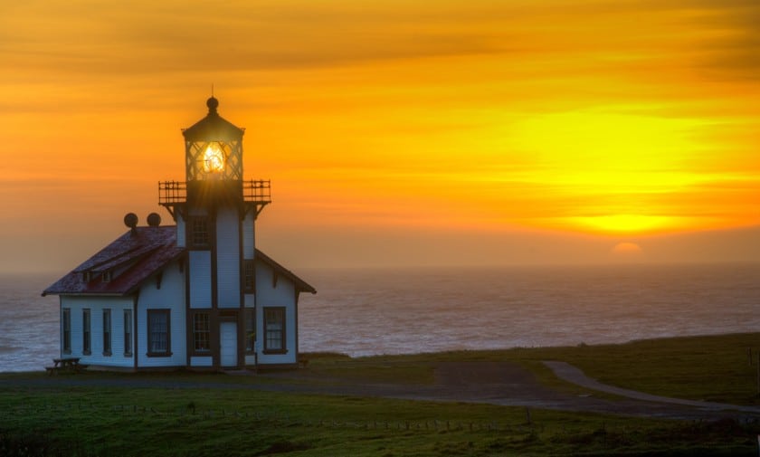
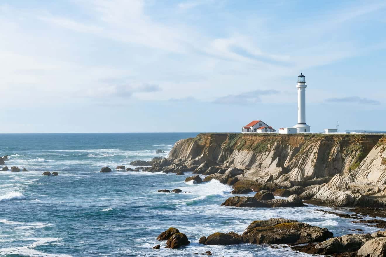
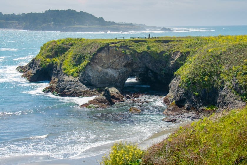
Mendocino, famous for being used as a set for Jessica Fletcher’s Cabot Cove, is certainly the most picturesque area of this stretch of the road because of the sea stacks and cliffs of Headlands State Park. Those who love lighthouses will still find points of interest, namely Point Arena Lighthouse and Point Cabrillo Lighthouse, both built after the devastating earthquake in San Francisco in 1906. The lighthouses can be visited by taking a short detour from Highway 1. Also worth mentioning is the very special Bowling Ball Beach: the name says it all!
The Pacific Coast Highway officially ends in Leggett, 53 miles north of Mendocino, where it connects to Highway 101, which leads to the area with the world’s tallest redwoods (Redwood National Park) and then to more spectacular views on the coast of Oregon.
How Long is the Pacific Coast Highway?
The travel time is not to be underestimated. If you are in a hurry, this is not the right road for you. There are several alternative roads further inland that allow you to travel more quickly (but alas what you will see will be less rewarding). To travel the main stretch of Highway 1, the one between Los Angeles and San Francisco, I suggest you plan 1 or 2 stops (for directions on how to break the journey, you can read my guide on where to stay between Los Angeles and San Francisco). Here are some guides to the most important destinations you will find along the way:
If you want to continue to the end of the Pacific Coast Highway, keep in mind that from San Francisco Bay to Mendocino the drive is slow and depending on the length of the stops, you may need another stop to break up the journey, for example, in Gualala. Before Leggett, the best stop is Mendocino (about 90 minutes away). We also have an article in which you can read our advice on what to do and where to stay in Mendocino.
For more detailed information about finding accommodations in Los Angeles and San Francisco, read our in-depth articles:
- Where to stay in San Francisco: Recommended areas and neighborhoods
- Where to sleep in Los Angeles: Staying in the city and the surrounding area
The Pacific Coast Highway is the ideal route for those who dream of going on a road trip and gives you the chance to admire the natural wonders of California’s coast. It is one of the most popular routes traveled by those who love to take road trips around the USA and who love adventure.