Along with Moab and Sedona, in my opinion, Page (Arizona) is the most naturally beautiful town in the Southwest. Change my mind! Not only will you see Antelope Canyon and Horseshoe Bend, Lake Powell, and Lees Ferry, the place where the Grand Canyon begins, but so much more. In our article dedicated to the attractions of Page, you can see how there are also hidden gems and pristine nature, such as the New Wave or the Water Holes Canyon.
Today I would like to tell you about yet another attraction, recommended especially for those who have a spirit of adventure (and above all, to those who have a rental car suitable for the excursion) a place off the beaten track known as Stud Horse Point. This viewpoint is located in a large and unspoiled area called Ferry Swale, close to the Glen Canyon National Recreation Area, not far from Page on the Utah–Arizona border. If you have some time after visiting Page’s main attractions, consider coming here. Unforgettable sunsets and sunrises await you.
Contents
How to get to Stud Horse Point?
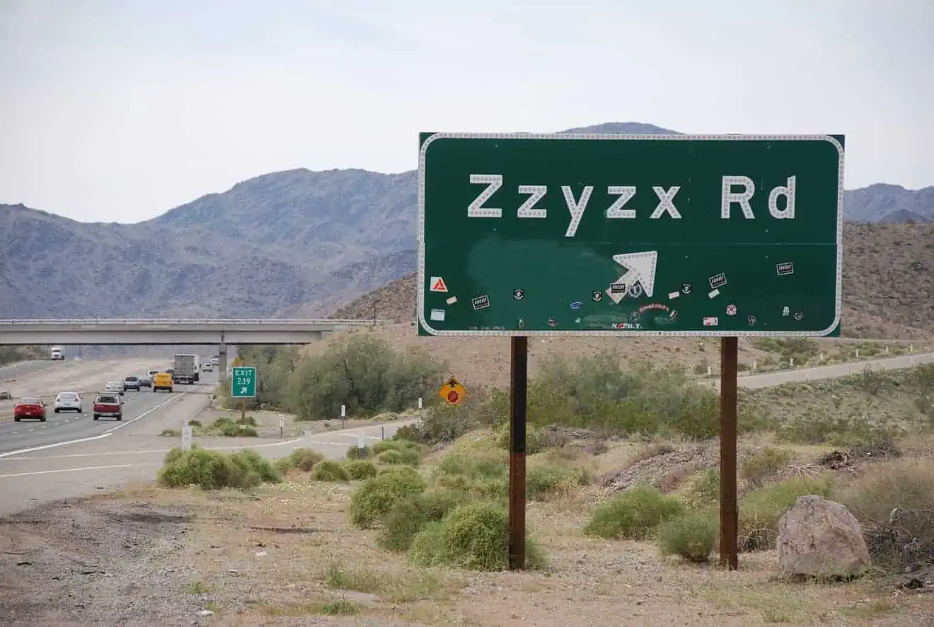
Whether you’re coming from the south (Page) or the north (Kanab) you’ll have to take a secondary dirt road that branches off US-89. This is the point you’ll have to reach. Put it in your GPS and you won’t go wrong.
- If you are coming from Kanab, it will take a little over an hour to cover 65 miles. To get to the point indicated, you will have to turn right as soon as you see the sign on US-89 indicating the entrance to Arizona. Here is the exact point where you should turn.
- If you are coming from Page, you will have to drive on US-89 N for 8 miles (about 10 minutes) to this point. Then turn left and follow the road to the point indicated above.
From this point on, the road to get to Stud Horse Point is not easy to follow, so learn the following directions carefully and look at the map below:
- After 1.5 miles, you will come to this point. Turn left.
- After another 0.4 miles you will find a fork. Continue straight on. From this point on, driving a 4×4 is highly recommended. If you don’t have one, park your car and continue on foot for about 1.7 miles.
- 0.25 miles after the fork, at this point, turn right.
- Walk for another .75 miles until this point, where you will find a gate, which you can open and you will have to close after passing. From here on it becomes necessary to have a 4×4 because the road becomes narrow, sandy, and difficult to drive on because of the rough terrain, especially if it has recently rained. If you don’t have the right car, continue on foot for the remaining 0.5 miles.
- If you are driving your 4×4, you can arrive here and park. Go down the hill and you will have arrived at Stud Horse Point
Video of the Route (Final Part)
Watching the video below from minute 3 will give you an overview of the kind of driving experience you will have from the gate to Stud Horse Point, all on the ridge of the headland (in the video the route is in the opposite direction).
Things to See and Do
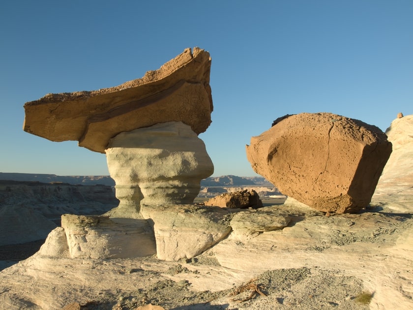
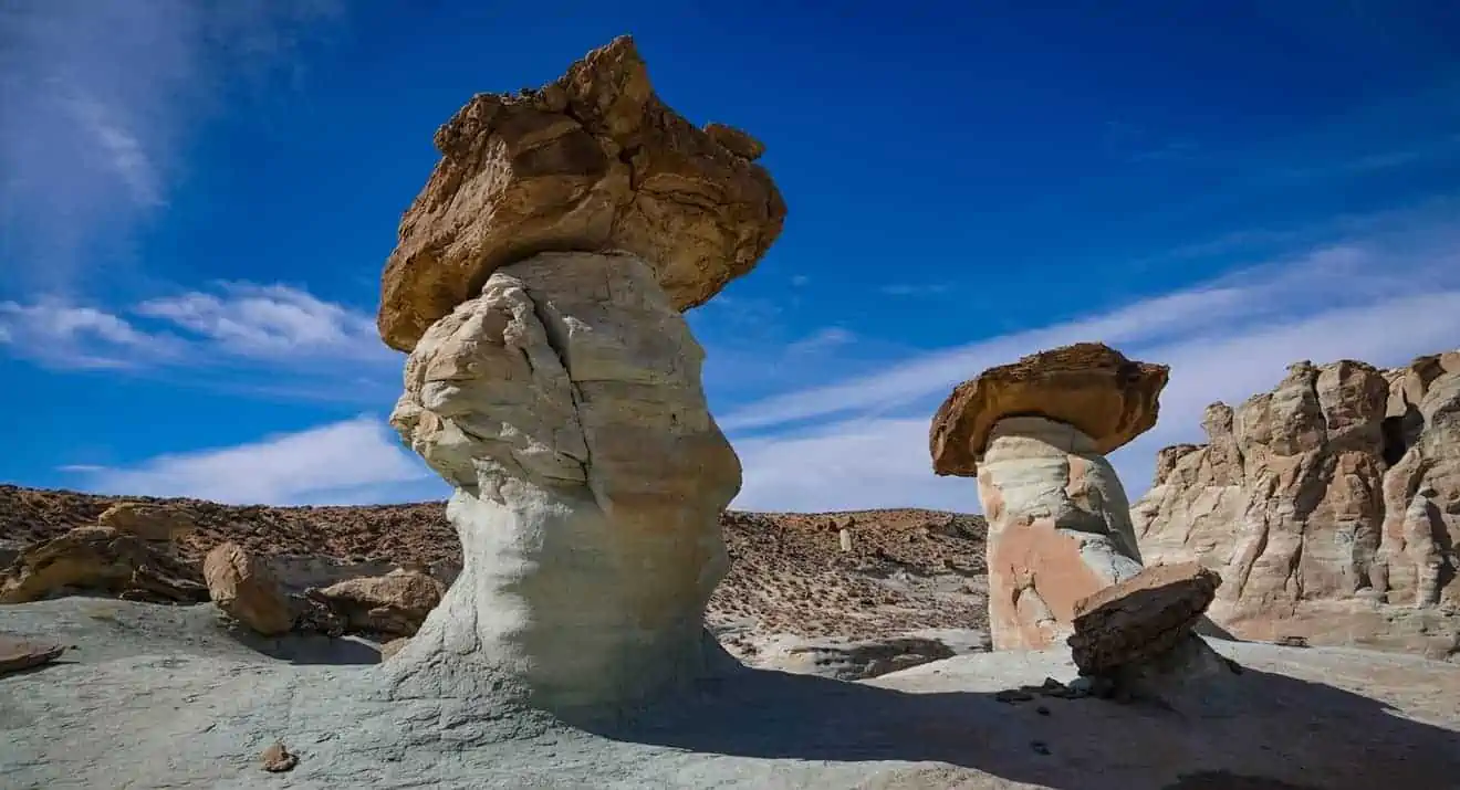
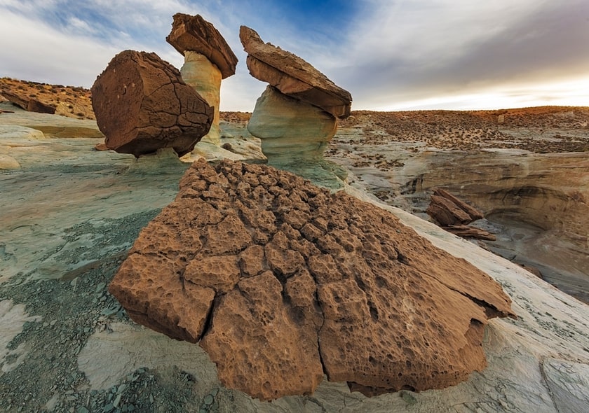
As soon as you reach the ridge of the mesa, look around and you’ll realize that there’s not much to do except observe the view and explore the area. Of course, be very careful not to get too close to the edge. Against the backdrop of the surrounding endless rocky desert, you’ll see before you an isolated butte and a dozen or so large balanced rocks and hoodoos, or large mushroom-shaped pinnacles of various colors (from white to green to red to gray to pink) topped by broad brown rocks.
In the distance, you’ll also get an unusual perspective of the monumental Lone Rock emerging from the bottom of Lake Powell. The natural scenery that awaits you can be likened to a smaller version of another Arizona hidden gem such as the Coal Mine Canyon, but the geologic features are quite similar to those of the Wahweap area and, more specifically, the Toadstool Hoodoos, a crown jewel of the Grand Staircase-Escalante National Monument. If you are a photographer or are attracted to the colors of the rocks in this area, the ideal way to enjoy the best light is to arrive on the edge of the mesa no later than an hour after sunrise, or at sunset.
And after that?
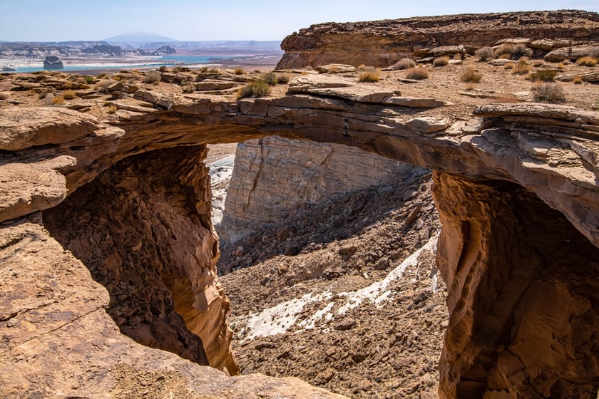
If you are satisfied with your visit or do not have more time, go back on the same road and go to enjoy the other beautiful places in the area. If, on the other hand, you are an unconquerable adventurer and have driven here in a 4×4, you could continue along the edge of the mesa north for another 2 miles and reach the Skylight Arch Trailhead, the beginning of a very fascinating trail that crosses the Arizona-Utah border and leads to a scenic arch at the top of the plateau, just above US-89, with a view of Lake Powell (see photo).
If you came on foot from the gate parking lot or if you parked the car even further, think twice before embarking on this additional trail because, in addition to the 1.86 miles from Stud Horse Point to the trailhead, you will have to walk another 2 miles to get to the arch (plus all the way back of course), and there are no rest areas, bathrooms, or shady spots where you can take a break. We talked about this trail in our article on the Skylight Arch in Utah.
Where to Stay
The lavish Amangiri Resort, located practically underneath the Studhorse Mesa on the Utah border, is a luxury property that blends perfectly into the surrounding desert. Check out our article (linked above) to see what to expect if you decide to have such an exclusive experience. If Page is your next stop, read our tips on where to stay in Page; if you’re heading to Kanab, find more recommendations for an overnight stay here.