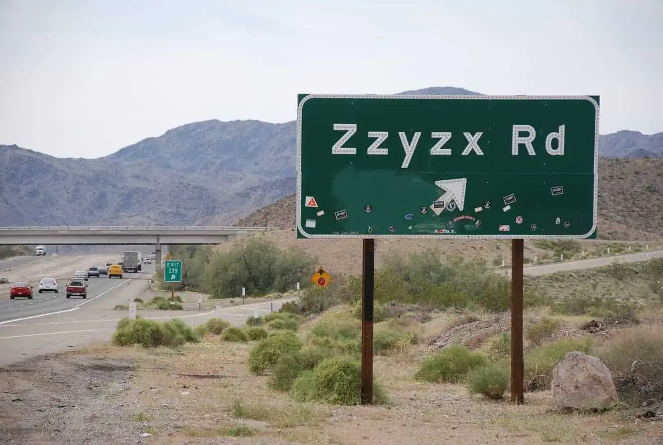
Many travelers return from their road trip in the Southwest with a wealth of memories and adventures, but the one big regret they may have is not visiting The Wave in Arizona. We have talked many times about this geological wonder located in the Vermilion Cliffs National Monument and about how difficult it is to visit it. The length of the trail, the bumpy road to the trailhead, and the rather prohibitive weather conditions in summer are not the only obstacles that stand between you and The Wave.
To complicate matters, there is a lottery reservation system for a very small number of daily visitors because otherwise, the mass tourism attracted by the beauty of the Wave could jeopardize the delicate rock formations of the area. The fact is that very few people can say they’ve seen The Wave, although, ironically it is located not far from the busy US-89, which many people take to get from Kanab to Page. It would just require a short detour… unfortunately, over 90% of travelers have to give up. What can travelers do when faced with this challenge? Are there alternatives to The Wave? Can similar rock formations be found? The answer is yes, although the beauty of the Wave is unparalleled.
Among the various options that don’t require permits (the White Pocket in Vermilion itself, the Valley of Fire’s Fire Wave, etc.), there is a very similar and virtually unknown rock formation just a stone’s throw from Page and Lake Powell. It’s significantly called The New Wave, and today I’m going to give you some information on how to get there.
Contents
Where is it? How do you get there?

As mentioned above, the New Wave is located near Page, Arizona. To get there from Page, drive northwest on US-89 N towards Kanab, past the Glen Canyon Dam. Just a mile past the dam, at this point on US-89 N, turn left. Make no mistake! If you take a right, you will be heading towards Lake Powell. Take the dirt road and you’ll find yourself at a fork in the road. Then turn right and after a few feet, you’ll find a clearing at the Beehive Campground. Park your car there and start your visit. And what’s also great about it is that it’s free!
The New Wave and Radio Tower Rock

Once you park the car, if you look north you will see Lake Powell in the distance. If you turn around, you’ll see some rocky knolls. That’s the direction you need to go. Don’t follow the most visible trail, because that leads towards the Ropes Trail, a fascinating trail that I will talk about in the next paragraph. Walk toward the two rocky knolls you see in front of you.
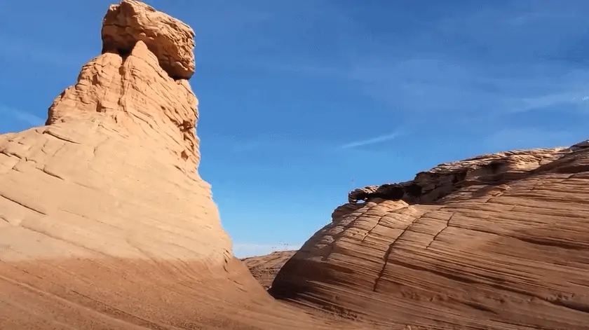
First, follow the trail between two rows of rocks. You will find a viewpoint and a fork in the road. Keep walking and climb up to this point, where there is a rock formation that has been renamed Radio Tower Rock, perhaps because it is in the same direction as the antenna that is on the adjacent hill towards the road.
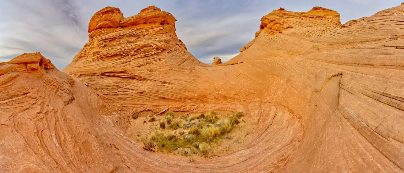
Already from this location, you can see the characteristic red-striped, wavy rocks that you are hoping to see. Indeed, Radio Tower Rock may offer an even more striking backdrop than New Wave.

Walk down the small hill, retrace your steps and climb the other hill. This is where the actual New Wave is located. It will not be very difficult to reach it. Walk carefully on the sandstone slabs that resemble stairs. Once there, you’ll find yourself surrounded by a fascinating labyrinth of smooth curving rock walls. Wander through the rocky waves where you can take unforgettable photos and see the best views of the surrounding area with Lake Powell in the distance. You’ll probably find very few people here, so enjoy the view in absolute silence!
Best Time of the Day to Visit the New Wave
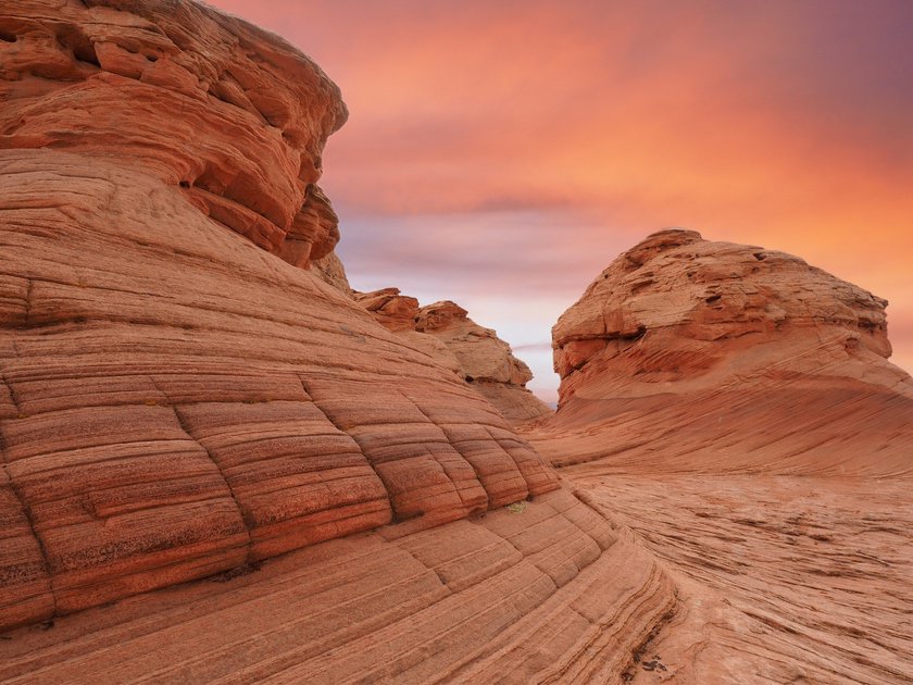
As you can probably tell from the photo above, the best time to see the colors of the New Wave is from late afternoon until sunset.
Ropes Trail: Down to the Colorado River!

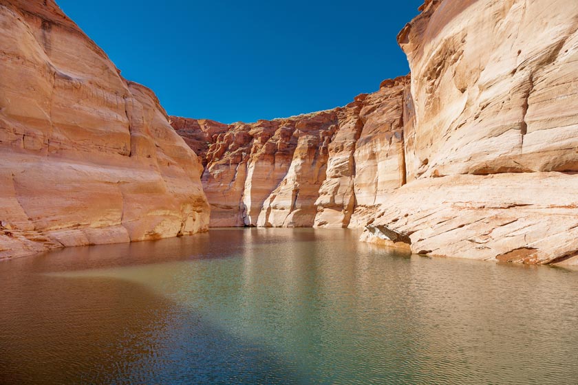
There is another trail, which I mentioned earlier, that also starts at the parking lot. The Ropes Trail is recommended only for trained hikers. What makes this trail so special is that it will allow you to descend down the Glen Canyon to the banks of the Colorado River! Following the trail I pointed out just above the trailhead, you will have to walk between the Radio Tower Rock hill and the hill with the actual antenna (Radio Tower Hill) for about a mile southeast.
Eventually, when you reach a small depression, you will find yourself at the point of the escarpment where the descent to the river begins. It is steep and exposed, especially in the final part (total elevation gain of 700 ft). Metal stakes between the rocks will indicate the path to follow inside a crack, and in the final part of the descent, you will have to get through with the help of some ropes already prepared (hence the name of the path), which will be very useful especially for climbing up. At the end, you will arrive at this point, where the Ropes Campsite is located. Not bad!
Map of the Trails
Things to See in the Surroundings
We’re really just a stone’s throw from Page, which has an impressive number of sights to explore, starting with the must-see Antelope Canyon, Horseshoe Bend, and Lake Powell. In our article on the attractions in Page, we gave you quite a few suggestions on what to see in addition to these must-see attractions. But it doesn’t end there! If you keep driving on US-89 north, doing a little bit of off-road driving, you can also find the trail to the Skylight Arch and, just before, Stud Horse Point. Also worth mentioning are the remote Wahweap Hoodoos, Utah’s Toadstool Hoodoos, and all the other attractions around Kanab.
Where to Stay
If you are in Page and have decided to stay a while in these parts to explore the myriad of natural beauty in the surrounding area, read our focus on where to stay in Page to find the best lodging. Remember that the New Wave is right on the doorstep of the famous Lake Powell Resort, right on the shores of the lake!